Geological and Geographical Survey of the Territories (U.S.)
Published / Created:
1873.
Call Number:
WA Photos Folio 53
Container / Volume:
Volume (copy 1)
Image Count:
93
Abstract:
Two versions of a viewbook distributed by the United States Geological and Geographical Survey of the Territories in 1873 with mounted photographic prints created by William Henry Jackson of camps, geothermal features, and landscape primarily in Yello...
Description:
Each photograph is accompanied by a guard sheet with descriptive letter-press captions.
Publisher:
Government Printing Office
Subject (Geographic):
Yellowstone National Park., Blackmore, Mount (Mont.), Bridger Canyon (Mont.), Firehole River (Wyo.), Fort Hall (Idaho : Fort), Gallatin Canyon (Mont.), Gallatin River (Wyo. and Mont.), Grand Teton (Wyo.), Grand Teton National Park (Wyo.), Idaho, Lower Falls of the Yellowstone River (Wyo.), Mammoth Hot Springs (Wyo.), Montana, Teton Range (Wyo. and Idaho), Tower Creek (Wyo.), Upper Falls of the Yellowstone River (Wyo.), Upper Geyser Basin (Wyo.), Utah, Wasatch Range (Utah and Idaho), Wyoming, Yellowstone National Park, Yellowstone River, and Yellowstone River Valley
Subject (Name):
Jackson, William Henry, 1843-1942. and Geological and Geographical Survey of the Territories (U.S.)
Subject (Topic):
Discoveries in geography, American, Rock formations, United States, Discovery and exploration, and Surveys
Geological and Geographical Survey of the Territories (U.S.)
Published / Created:
1873.
Call Number:
WA Photos Folio 53
Container / Volume:
Volume (copy 2)
Image Count:
94
Abstract:
Two versions of a viewbook distributed by the United States Geological and Geographical Survey of the Territories in 1873 with mounted photographic prints created by William Henry Jackson of camps, geothermal features, and landscape primarily in Yello...
Description:
Each photograph is accompanied by a guard sheet with descriptive letter-press captions.
Publisher:
Government Printing Office
Subject (Geographic):
Yellowstone National Park., Blackmore, Mount (Mont.), Bridger Canyon (Mont.), Firehole River (Wyo.), Fort Hall (Idaho : Fort), Gallatin Canyon (Mont.), Gallatin River (Wyo. and Mont.), Grand Teton (Wyo.), Grand Teton National Park (Wyo.), Idaho, Lower Falls of the Yellowstone River (Wyo.), Mammoth Hot Springs (Wyo.), Montana, Teton Range (Wyo. and Idaho), Tower Creek (Wyo.), Upper Falls of the Yellowstone River (Wyo.), Upper Geyser Basin (Wyo.), Utah, Wasatch Range (Utah and Idaho), Wyoming, Yellowstone National Park, Yellowstone River, and Yellowstone River Valley
Subject (Name):
Jackson, William Henry, 1843-1942. and Geological and Geographical Survey of the Territories (U.S.)
Subject (Topic):
Discoveries in geography, American, Rock formations, United States, Discovery and exploration, and Surveys
Mellen, Geo. E. (George Egbert), 1854- , photographer
Published / Created:
[circa 1880]
Call Number:
WA Photos 316
Image Count:
20
Resource Type:
still image
Abstract:
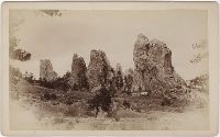
Photographs of locations in El Paso County, Colorado, taken by George Egbert Mellen and published by Rocky Mountain View Company showing landscapes, including Pikes Peak, the Garden of the Gods, and Ute Pass, in addition to town views of Colorado Spri...
Description:
Captions in English.
Publisher:
Rocky Mountain View Company
Subject (Geographic):
Colorado, Colorado Springs (Colo.), El Paso County (Colo.), Garden of the Gods (Colorado Springs, Colo.), Manitou Springs (Colo.), Pikes Peak (Colo.), and Ute Pass
Subject (Name):
Mellen, Geo. E. 1854- (George Egbert), and Rocky Mountain View Company.