Search
You Searched For
Search Results
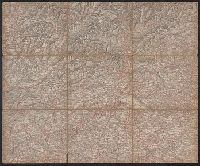
- Creator:
- Ordnance Survey of Great Britain and Ireland
Royal Geographical Society (Great Britain). Geographical Section
- Published / Created:
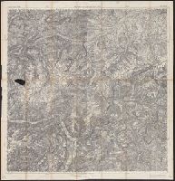
- 1915
- Call Number:
- 11hcf 1919E-5
- Container / Volume:
- BRBL_00010ZA
- Image Count:
- 1
- Resource Type:
- Maps, Atlases & Globes
- Subject (Geographic):
- Austria--Maps
- Found in:
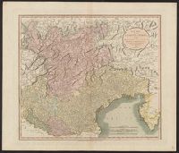
- Beinecke Rare Book and Manuscript Library > (Vienna) Wien : North M 33. / compiled at the Royal Geographical Society under the direction of the Geographical Section ; drawn and printed by Ordnance Survey.
- Published / Created:
- 1816
- Call Number:
- 41 1816
- Container / Volume:
- BRBL_00241
- Image Count:
- 1
- Resource Type:
- Maps, Atlases & Globes
- Subject (Geographic):
- Austria--Maps
- Found in:
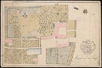
- Beinecke Rare Book and Manuscript Library > Austrian dominions / Neele, sculp.
- Published / Created:
- 1835
- Call Number:
- 427 K66 1835
- Container / Volume:
- BRBL_00246
- Image Count:
- 1
- Resource Type:
- Maps, Atlases & Globes
- Subject (Geographic):
- Carinthia (Austria)--Maps
- Found in:
- Beinecke Rare Book and Manuscript Library > Carte vom Kreise Klagenfurth im Herzogthume Kaernthen ... / in Stein gravirt von Friedrich Rivier.
- Creator:
- Herder, Bartholomä, 1774-1839, lithographer
Woerl, Joseph Edmund
Woerl, Joseph Edmund. Atlas von Central-Europa
- Call Number:
- 30 1840B
- Container / Volume:
- BRBL_00031
- Image Count:
- 1
- Resource Type:
- Maps, Atlases & Globes
- Subject (Geographic):
- Tyrol (Austria)--Maps
- Found in:
- Beinecke Rare Book and Manuscript Library > Constanz.
- Creator:
- Swetz, Wenzel
- Published / Created:
- [1810?]
- Call Number:
- BrSides Folio 2018 144
- Image Count:
- 1
- Resource Type:
- Maps, Atlases & Globes
- Subject (Geographic):
- Bruck an der Leitha (Austria)--Maps.
- Found in:
- Beinecke Rare Book and Manuscript Library > Plan von den hochfreyherrlich Sardagnaschen Obst-Zier- und Kuchelgarten zu Leopoldsdorf / aufgenommen und gezeichnet von Wenzel Swetz, geprüfter Geometer.
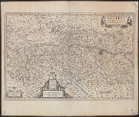
- Creator:
- Lazius, Wolfgang, 1514-1565
- Published / Created:
- [1635]
- Call Number:
- 42 1630
- Container / Volume:
- BRBL_00244
- Image Count:
- 2
- Resource Type:
- Maps, Atlases & Globes
- Subject (Geographic):
- Austria--Maps--Early works to 1800
- Found in:
- Beinecke Rare Book and Manuscript Library > Austria archiducatus / auctore Wolfgango Lazio.
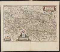
- Creator:
- Lazius, Wolfgang, 1514-1565
- Published / Created:
- [1641?]
- Call Number:
- 42 1640
- Container / Volume:
- BRBL_00244
- Image Count:
- 2
- Resource Type:
- Maps, Atlases & Globes
- Subject (Geographic):
- Austria--Maps--Early works to 1800
- Found in:
- Beinecke Rare Book and Manuscript Library > Austria archiducatus / [cartographic material] / auctore Wolfgango Lazio.
- Published / Created:
- 1896
- Call Number:
- 41hc 1896
- Container / Volume:
- BRBL_00243
- Image Count:
- 1
- Resource Type:
- Maps, Atlases & Globes
- Subject (Geographic):
- Austria--Maps
- Found in:
- Beinecke Rare Book and Manuscript Library > The Austro-Hungarian Maneuvers : September, 1896 / C.H. Ourand.
- Creator:
- Visscher, Nicolaes, 1649-1702, cartographer
- Published / Created:
- [ca. 1700?]
- Call Number:
- 41 AU79 1700
- Container / Volume:
- BRBL_00242
- Image Count:
- 1
- Resource Type:
- Maps, Atlases & Globes
- Subject (Geographic):
- Austria--Maps--Early works to 1800
- Found in:
- Beinecke Rare Book and Manuscript Library > Austriae archiducatus pars superior in omnes ejusdem quadrantes ditiones accuratissime et distincte delineata [cartographic material] / per Nic. Visscher.
- Creator:
- Danckerts, Cornelis, ca. 1603-1656
Lazius, Wolfgang, 1514-1565
- Published / Created:
- [ca. 1631]
- Call Number:
- 1983 Folio 19
- Collection Title:
- [Atlas factice of 96 maps by Blaeu, Visscher, Jansson, Hondius and others]
- Image Count:
- 1
- Subject (Geographic):
- Austria --Maps --Early works to 1800
- Found in:
- Beinecke Rare Book and Manuscript Library > Austria archiducatus / auctore Wolfgango Lazio
- Creator:
- Homann, Johann Baptist, 1663-1724
- Published / Created:
- [ca. 1710]
- Call Number:
- 1983 Folio 23
- Collection Title:
- [Atlas factice of 50 maps, primarily by Johann Baptist Homann and/or issued by the Homann Erben
- Image Count:
- 1
- Subject (Geographic):
- Austria --Maps --Early works to 1800
- Found in:
- Beinecke Rare Book and Manuscript Library > Archiducatus Austriae [cartographic material] : inferioris in omnes suas quadrantes ditiones divisi nova et exacta tabula / e conatibus Io. Baptistae Homanni
- Creator:
- Homann, Johann Baptist, 1663-1724
Vischer, Georg Matthaeus, 1628-1695
- Published / Created:
- [ca. 1710]
- Call Number:
- 1983 Folio 23
- Collection Title:
- [Atlas factice of 50 maps, primarily by Johann Baptist Homann and/or issued by the Homann Erben
- Image Count:
- 1
- Subject (Geographic):
- Austria --Maps --Early works to 1800
- Found in:
- Beinecke Rare Book and Manuscript Library > Archiducatus Austriae superioris in suas quadrantes ditiones exacte divisi accuratissima tabula [cartographic material] / ex amplissima Rev. Dn. Georg Matth. Vischer Sac. Caes. Mai. (Leopoldi Glor.mae Mem.) Geogra. ; desumta et exhibita a Ioh. Baptista Ho
- Creator:
- Berry, William, fl. 1669-1708, creator
Sanson, Nicolas, 1600-1667
- Published / Created:
- [ca. 1686]
- Call Number:
- 1973 Folio 10
- Image Count:
- 1
- Resource Type:
- Maps, Atlases & Globes
- Subject (Geographic):
- Austria --Maps --Early works to 1800
- Found in:
- Beinecke Rare Book and Manuscript Library > Part of the circle of Austria viz the Archdukedom of Austria, divided into the higher and lower
- Creator:
- Berry, William, fl. 1669-1708, creator
Sanson, Nicolas, 1600-1667
- Published / Created:
- 1688
- Call Number:
- 1973 Folio 10
- Image Count:
- 1
- Resource Type:
- Maps, Atlases & Globes
- Subject (Geographic):
- Austria --Maps --Early works to 1800
- Found in:
- Beinecke Rare Book and Manuscript Library > Part of the circle of Austria in which are the Dukedomes of Stiria, and Carinthia, of Carniola, and other heriditary countrys of the house of Austria
- Creator:
- Homann, Johann Baptist, 1663-1724
Vischer, Georg Matthaeus, 1628-1695
- Published / Created:
- [ca. 1710]
- Call Number:
- 1983 Folio 23
- Collection Title:
- [Atlas factice of 50 maps, primarily by Johann Baptist Homann and/or issued by the Homann Erben
- Image Count:
- 1
- Subject (Geographic):
- Graz (Austria) --Maps, Pictorial
- Found in:
- Beinecke Rare Book and Manuscript Library > Ducatus Stiriae novissima tabula [cartographic material] / ex ampliore mappa olim R. Dni. Georgii Matth. Vischer S.C.M., Leopoldi I. Glorssae. Memae. Geographi deducta ; et in hac utiliore forma curiosorum oculis exhibita a Ioh. Bapti. Homanno
- Creator:
- Homann, Johann Baptist, 1663-1724
- Published / Created:
- [ca. 1715]
- Call Number:
- 1983 Folio 23
- Collection Title:
- [Atlas factice of 50 maps, primarily by Johann Baptist Homann and/or issued by the Homann Erben
- Image Count:
- 1
- Subject (Geographic):
- Carinthia (Austria) --Maps --Early
- Found in:
- Beinecke Rare Book and Manuscript Library > Nova et accurata Carinthiae Ducatus tabula geographica [cartographic material] : in superiorem et inferiorem divisa, cum insertis partibus, Archiepiscopatui Salisburgensi propriis nec non dynastiis aliquot, quae tempore S. Henrici Imperiatoris circa A. 10
- Published / Created:
- [1760?]
- Call Number:
- 428 1760
- Container / Volume:
- BRBL_00247
- Image Count:
- 5
- Resource Type:
- Maps, Atlases & Globes
- Subject (Geographic):
- Tyrol (Austria)--Maps--Early works to
- Found in:
- Beinecke Rare Book and Manuscript Library > Atlas Tyrolensis.
- Creator:
- Homann, Johann Baptist, 1663-1724
- Published / Created:
- [before 1724?]
- Call Number:
- BrSides Double Folio 2019 42
- Image Count:
- 1
- Resource Type:
- Maps, Atlases & Globes
- Subject (Geographic):
- Tyrol (Austria)--Maps--Early works to
- Found in:
- Beinecke Rare Book and Manuscript Library > Comitatus principalis Tirolis : in quo Episc. Tridentin[us] et Brixensis, Comitatus Brigantinus, Feldkirchiae Sonnebergae et Pludentii accuratè exhibentur / editore Ioh. Baptista Homanno, Sacrae Caes. Majestatis Geographo.
- Creator:
- Merian, Matthaeus, 1593-1650, creator.
- Published / Created:
- [1644?]
- Call Number:
- BrSides Folio 2017 27
- Image Count:
- 1
- Resource Type:
- Maps, Atlases & Globes
- Subject (Geographic):
- Salzburg (Austria)--Maps--Early works
- Found in:
- Beinecke Rare Book and Manuscript Library > Saltzburg.
- Creator:
- Merian, Matthaeus, 1593-1650, creator.
- Published / Created:
- [1644?]
- Call Number:
- BrSides Folio 2017 28
- Image Count:
- 1
- Resource Type:
- Maps, Atlases & Globes
- Subject (Geographic):
- Salzburg (Austria)--Maps--Early works
- Found in:
- Beinecke Rare Book and Manuscript Library > Saltzburg.
- Published / Created:
- 1625?]
- Call Number:
- 426 1625
- Container / Volume:
- BRBL_00246
- Image Count:
- 2
- Resource Type:
- Maps, Atlases & Globes
- Subject (Geographic):
- Styria (Austria)--Maps--Early works to
- Found in:
- Beinecke Rare Book and Manuscript Library > Stiria / per Gerardum Mercatorem ...
- Creator:
- Longmans, Green, and Co
- Published / Created:
- [191-?]
- Call Number:
- 11hcf 1919A-18
- Container / Volume:
- BRBL_00010M
- Image Count:
- 2
- Resource Type:
- Maps, Atlases & Globes
- Subject (Geographic):
- Austria--Maps
- Found in:
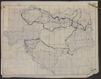
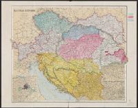
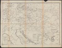
- Beinecke Rare Book and Manuscript Library > Austria-Hungary.
- Creator:
- Longmans, Green, and Co
- Published / Created:
- [191-?]
- Call Number:
- 11hcf 1919A-21
- Container / Volume:
- BRBL_00010M
- Image Count:
- 2
- Resource Type:
- Maps, Atlases & Globes
- Subject (Geographic):
- Austria--Maps
- Found in:
- Beinecke Rare Book and Manuscript Library > Austria-Hungary.
- Creator:
- Longmans, Green, and Co
- Published / Created:
- [191-?]
- Call Number:
- 11hcf 1919A-19
- Container / Volume:
- BRBL_00010M
- Image Count:
- 2
- Resource Type:
- Maps, Atlases & Globes
- Subject (Geographic):
- Austria--Maps
- Found in:
- Beinecke Rare Book and Manuscript Library > Austria-Hungary.
- Creator:
- Longmans, Green, and Co
- Published / Created:
- [191-?]
- Call Number:
- 11hcf 1919A-22
- Container / Volume:
- BRBL_00010M
- Image Count:
- 2
- Resource Type:
- Maps, Atlases & Globes
- Subject (Geographic):
- Austria--Maps
- Found in:
- Beinecke Rare Book and Manuscript Library > Austria-Hungary.
- Published / Created:
- 1910?]
- Call Number:
- 41 1910
- Container / Volume:
- BRBL_00241
- Image Count:
- 1
- Resource Type:
- Maps, Atlases & Globes
- Subject (Geographic):
- Austria--Maps
- Found in:
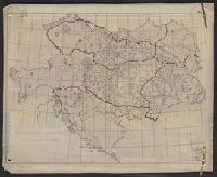
- Beinecke Rare Book and Manuscript Library > [Austrian Empire].
- Published / Created:
- 1910?]
- Call Number:
- 41 1910A
- Container / Volume:
- BRBL_00241
- Image Count:
- 1
- Resource Type:
- Maps, Atlases & Globes
- Subject (Geographic):
- Austria--Maps
- Found in:
- Beinecke Rare Book and Manuscript Library > Austria-Hungary.
- Creator:
- Atkins, Paul M. (Paul Moody), 1892-
- Published / Created:
- 1910]
- Call Number:
- 41gc 1910
- Container / Volume:
- BRBL_00243
- Image Count:
- 1
- Resource Type:
- Maps, Atlases & Globes
- Subject (Geographic):
- Austria--Maps
- Found in:
- Beinecke Rare Book and Manuscript Library > Austria-Hungary : Population actively engaged in Agriculture Paul M. Atkins.
- Creator:
- Atkins, Paul M. (Paul Moody), 1892-
- Published / Created:
- 1910]
- Call Number:
- 41gf 1910
- Container / Volume:
- BRBL_00243
- Image Count:
- 1
- Resource Type:
- Maps, Atlases & Globes
- Subject (Geographic):
- Austria--Maps
- Found in:
- Beinecke Rare Book and Manuscript Library > Austria-Hungary : Population actively engaged in Industry Paul M. Atkins.
- Published / Created:
- [1912]
- Call Number:
- 41 1912
- Container / Volume:
- BRBL_00241
- Image Count:
- 1
- Resource Type:
- Maps, Atlases & Globes
- Subject (Geographic):
- Austria--Maps
- Found in:
- Beinecke Rare Book and Manuscript Library > Austria-Hungary / The London Geographical Institute.
- Creator:
- Longmans, Green, and Co
- Published / Created:
- [191-?]
- Call Number:
- 11hcf 1919A-20
- Container / Volume:
- BRBL_00010M
- Image Count:
- 2
- Resource Type:
- Maps, Atlases & Globes
- Subject (Geographic):
- Austria--Maps
- Found in:
- Beinecke Rare Book and Manuscript Library > Austria-Hungary.
- Published / Created:
- 1783
- Call Number:
- 429 1783
- Container / Volume:
- BRBL_00249
- Image Count:
- 3
- Resource Type:
- Maps, Atlases & Globes
- Subject (Geographic):
- Vorarlberg (Austria)--Maps--Early works
- Found in:
- Beinecke Rare Book and Manuscript Library > Provincia Arlbergica ... / per Joannem Antonium Pfaundler.
- Published / Created:
- [191-?]
- Call Number:
- 11hcf 1919A-23
- Container / Volume:
- BRBL_00010M
- Image Count:
- 1
- Resource Type:
- Maps, Atlases & Globes
- Subject (Geographic):
- Austria--Maps
- Found in:
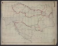
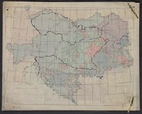
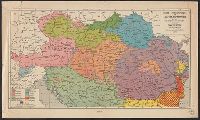
- Beinecke Rare Book and Manuscript Library > Austria-Hungary : Czecho-Slovak claims.
- Published / Created:
- 1910?]
- Call Number:
- 11hcf 1919C-14
- Image Count:
- 1
- Resource Type:
- Maps, Atlases & Globes
- Subject (Geographic):
- Austria--Maps.
- Found in:
- Beinecke Rare Book and Manuscript Library > Austria-Hungary.
- Published / Created:
- 1811
- Call Number:
- 40 1811
- Container / Volume:
- BRBL_00199
- Image Count:
- 1
- Resource Type:
- Maps, Atlases & Globes
- Subject (Geographic):
- Tyrol (Austria)--Maps
- Found in:
- Beinecke Rare Book and Manuscript Library > A new map of the county of Tyrol, and the republic of Venice ... / by John Cary, engraver.
- Published / Created:
- [1740?]
- Call Number:
- 42 V67 1740
- Container / Volume:
- BRBL_00244
- Image Count:
- 1
- Resource Type:
- Maps, Atlases & Globes
- Subject (Geographic):
- Vienna (Austria)--Maps--Early works to
- Found in:
- Beinecke Rare Book and Manuscript Library > Wien, die welt-berühmte kayserl. resid. Stadt ... / Matth. Seutter ...
- Published / Created:
- 1874
- Call Number:
- 41GMD 1874
- Container / Volume:
- BRBL_00243
- Image Count:
- 1
- Resource Type:
- Maps, Atlases & Globes
- Subject (Geographic):
- Austria--Maps
- Found in:
- Beinecke Rare Book and Manuscript Library > Eisenbahn und Post-Routen-Karte der Osterreichisch-Ungarischen Monarchie.
- Creator:
- Sanson, Nicolas, 1600-1667
- Published / Created:
- 1692
- Call Number:
- 42 V67 1692
- Container / Volume:
- BRBL_00244
- Image Count:
- 1
- Resource Type:
- Maps, Atlases & Globes
- Subject (Geographic):
- Vienna (Austria)--Maps--Early works to
- Found in:
- Beinecke Rare Book and Manuscript Library > Plan de la ville de Vienne en Austriche et ses environs [cartographic material].
- Published / Created:
- 1858
- Call Number:
- 41EF 1858
- Container / Volume:
- BRBL_00243
- Image Count:
- 1
- Resource Type:
- Maps, Atlases & Globes
- Subject (Geographic):
- Austria--Maps
- Found in:
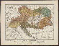
- Beinecke Rare Book and Manuscript Library > Völker-Karte der Oesterreichischen Monarchie / Gest. v. D. Biller.
- Published / Created:
- 1868
- Call Number:
- 41ED 1868
- Container / Volume:
- BRBL_00243
- Image Count:
- 1
- Resource Type:
- Maps, Atlases & Globes
- Subject (Geographic):
- Austria--Maps
- Found in:
- Beinecke Rare Book and Manuscript Library > Ethnographische Karte Österreich-Ungarischen Monarchie / von Carl Freiherrn von Czoernig.
- Published / Created:
- 1783
- Call Number:
- 42 V67 1783
- Container / Volume:
- BRBL_00244
- Image Count:
- 1
- Resource Type:
- Maps, Atlases & Globes
- Subject (Geographic):
- Vienna (Austria)--Maps--Early works to
- Found in:
- Beinecke Rare Book and Manuscript Library > Grundriss der Residenzstadt Wien ...
- Published / Created:
- 1791
- Call Number:
- 427 V71 1791
- Container / Volume:
- BRBL_00246
- Image Count:
- 1
- Resource Type:
- Maps, Atlases & Globes
- Subject (Geographic):
- Carinthia (Austria)--Maps--Early works
- Found in:
- Beinecke Rare Book and Manuscript Library > Oberkaernten, oder der Villacher Kreis / entworfen und gezeichnet von Joseph Karl Kindermann ; gestochen zu Wien von Christoph Junker.
- Published / Created:
- 1790
- Call Number:
- 427 K66 1790
- Container / Volume:
- BRBL_00246
- Image Count:
- 1
- Resource Type:
- Maps, Atlases & Globes
- Subject (Geographic):
- Carinthia (Austria)--Maps--Early works
- Found in:
- Beinecke Rare Book and Manuscript Library > Unterkaernten, oder der Klagenfurter Kreis / entworfen und gezeichnet von Joseph Karl Kindermann ; gestochen zu Wien von Christoph Junker.
- Creator:
- Homann, Johann Baptist, 1663-1724
- Published / Created:
- [after 1724]
- Call Number:
- 428 1720
- Container / Volume:
- BRBL_00247
- Image Count:
- 1
- Resource Type:
- Maps, Atlases & Globes
- Subject (Geographic):
- Tyrol (Austria)--Maps--Early works to
- Found in:
- Beinecke Rare Book and Manuscript Library > Comitatus principalis Tirolis : in quo Episc. Tridentin[us] et Brixensis, Comitatus Brigantinus, Feldkirchiae Sonnebergae et Pludentii accuratè exhibentur / editore Ioh. Baptista Homanno, Sacrae Caes. Majestatis Geographo.
- Published / Created:
- [1674?]
- Call Number:
- 428 1674
- Container / Volume:
- BRBL_00247
- Image Count:
- 1
- Resource Type:
- Maps, Atlases & Globes
- Subject (Geographic):
- Tyrol (Austria)--Maps--Early works to
- Found in:
- Beinecke Rare Book and Manuscript Library > Tyrolis comitatus / Marthinus Gumpp.
- Published / Created:
- 1778?]
- Call Number:
- 428 1778
- Container / Volume:
- BRBL_00247
- Image Count:
- 1
- Resource Type:
- Maps, Atlases & Globes
- Subject (Geographic):
- Tyrol (Austria)--Maps--Early works to
- Found in:
- Beinecke Rare Book and Manuscript Library > Le Tyrol sous le nom duquel l'on comprend le comté de Tyrol ... / par le Sr. Robert, geographe ; gravé par Delahaye l'ainé.
- Creator:
- Deyerlsperg, Georg Jacob von.
- Published / Created:
- [1740]
- Call Number:
- Italian Festivals Folio 4
- Image Count:
- 110
- Resource Type:
- Books, Journals & Pamphlets
- Subject (Geographic):
- Graz (Austria)--Maps--Early works to
- Found in:
- Beinecke Rare Book and Manuscript Library > Erb-Huldigung : welche dem Allerdurchsleuchtigist- Grossmächtigsten und Unüberwindlichsten Römischen Kayser, Carolo dem Sechsten, zu Spanien, Hungarn, und Böheim König &c. &c. als Hertzogen in Steyer, von denen gesamten steyrischen Land-Ständen den sechsten Julii 1728 : in allerunterthänigster Submission abgeleget, und auf Hochderenselben Verordnung zusammen getragen worden / durch Dero Landschaftlichen Syndicum und Ober Secretarium Georg Jacob Edlen von Deyerlsperg ...
- Creator:
- Homann, Johann Baptist, 1663-1724
- Published / Created:
- [after 1724]
- Call Number:
- 1983 Folio 23
- Collection Title:
- [Atlas factice of 50 maps, primarily by Johann Baptist Homann and/or issued by the Homann Erben
- Image Count:
- 1
- Subject (Geographic):
- Tyrol (Austria)--Maps--Early works to
- Found in:
- Beinecke Rare Book and Manuscript Library > Comitatus principalis Tirolis : in quo Episc. Tridentin[us] et Brixensis, Comitatus Brigantinus, Feldkirchiae Sonnebergae et Pludentii accuratè exhibentur / editore Ioh. Baptista Homanno, Sacrae Caes. Majestatis Geographo.
- Published / Created:
- [1700?]
- Call Number:
- 428 In7 1700
- Container / Volume:
- BRBL_00706
- Image Count:
- 1
- Resource Type:
- Maps, Atlases & Globes
- Subject (Geographic):
- Tyrol (Austria)--Maps, Manuscript
- Found in:
- Beinecke Rare Book and Manuscript Library > [Manuscript map of Environs North & West of Insprugg].
- Published / Created:
- [1790?]
- Call Number:
- 426 1790
- Container / Volume:
- BRBL_00706
- Image Count:
- 1
- Resource Type:
- Maps, Atlases & Globes
- Subject (Geographic):
- Styria (Austria)--Maps, Manuscript
- Found in:
- Beinecke Rare Book and Manuscript Library > Ducato di Stiria.
- Call Number:
- 4035 1830
- Container / Volume:
- BRBL_00234
- Image Count:
- 1
- Resource Type:
- Maps, Atlases & Globes
- Subject (Geographic):
- Tyrol (Austria)--Maps
- Found in:
- Beinecke Rare Book and Manuscript Library > Karte von der gefürsteten Grafschaft Tyrol : nach der neuesten und bewaehrtesten Hülfsmitteln entworfen.
- Published / Created:
- [1880?]
- Call Number:
- 428 1880
- Container / Volume:
- BRBL_00248
- Image Count:
- 2
- Resource Type:
- Maps, Atlases & Globes
- Subject (Geographic):
- Tyrol (Austria)--Maps
- Found in:
- Beinecke Rare Book and Manuscript Library > G.D. Reymann's Specialkarte von Tyrol.
- Published / Created:
- 1878
- Call Number:
- 11hcf 1919-40
- Container / Volume:
- BRBL_00010L
- Image Count:
- 1
- Resource Type:
- Maps, Atlases & Globes
- Subject (Geographic):
- Austria--Maps
- Found in:
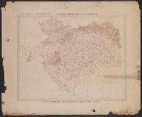
- Beinecke Rare Book and Manuscript Library > Carte ethnographique de l'Autriche-Hongrie et des régions habitées par les Roumains / aprés H. Kiepert. Epoque du Congrés de Berlin, 1878.
- Published / Created:
- 191-.
- Call Number:
- 11hcf 1919-39
- Container / Volume:
- BRBL_00010L
- Image Count:
- 1
- Resource Type:
- Maps, Atlases & Globes
- Subject (Geographic):
- Austria--Maps
- Found in:
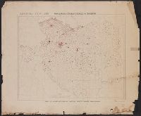
- Beinecke Rare Book and Manuscript Library > Linguistic map of the Austro-Hungarian Monarchy.
- Creator:
- Woerl, Joseph Edmund
- Call Number:
- 41 1830
- Container / Volume:
- BRBL_00241
- Image Count:
- 1
- Resource Type:
- Maps, Atlases & Globes
- Subject (Geographic):
- Styria (Austria)--Maps
- Found in:
- Beinecke Rare Book and Manuscript Library > Grätz.
- Published / Created:
- 1803
- Call Number:
- 42 SA39 1803
- Container / Volume:
- BRBL_00244
- Image Count:
- 1
- Resource Type:
- Maps, Atlases & Globes
- Subject (Geographic):
- Salzburg (Austria : Land)--Maps
- Found in:
- Beinecke Rare Book and Manuscript Library > Das Chur-Fürstenthum Salzburgh ... / entworfen von I.N. Diewald.
- Published / Created:
- 1913
- Call Number:
- 428 Ot9 1913
- Container / Volume:
- BRBL_00249
- Image Count:
- 4
- Resource Type:
- Maps, Atlases & Globes
- Subject (Geographic):
- Stubay Alps (Austria)--Maps
- Found in:
- Beinecke Rare Book and Manuscript Library > Oetzthal & Stubai.
- Creator:
- Danckerts, Justus, 1635-1701.
- Published / Created:
- after 1696]
- Call Number:
- 1973 Folio 18
- Image Count:
- 1
- Resource Type:
- Maps, Atlases & Globes
- Subject (Geographic):
- Austria--Maps--Early works to 1800.
- Found in:
- Beinecke Rare Book and Manuscript Library > Circuli Austriaci in quo sunt archiducatus Austriae ducatus Stiriae Carintiae Carniolae Comitatus Tirolis et episcopatus Tridentini novissima deschriptio [cartographic material] / per Iustinum Danckerts.
- Published / Created:
- [1653?]
- Call Number:
- 41 1653
- Container / Volume:
- BRBL_00241
- Image Count:
- 2
- Resource Type:
- Maps, Atlases & Globes
- Subject (Geographic):
- Austria--Maps--Early works to 1800
- Found in:
- Beinecke Rare Book and Manuscript Library > Rhetiæ alpestris descriptio, in qua hodie Tirolis comitatus ... ex tabula Wolfgangi Lazij ... / Joan Maior Viennensis edidit.
- Published / Created:
- 1627
- Call Number:
- 41 AU79 1627
- Container / Volume:
- BRBL_00242
- Image Count:
- 2
- Resource Type:
- Maps, Atlases & Globes
- Subject (Geographic):
- Austria--Maps--Early works to 1800
- Found in:
- Beinecke Rare Book and Manuscript Library > Austria archiducatus / per Gerardum Mercatorem ...
- Published / Created:
- [1680?]
- Call Number:
- 41 1680
- Container / Volume:
- BRBL_00241
- Image Count:
- 2
- Resource Type:
- Maps, Atlases & Globes
- Subject (Geographic):
- Austria--Maps--Early works to 1800
- Found in:
- Beinecke Rare Book and Manuscript Library > Carinthiae ducatus, et Goritiae palatinatus / Wolf. Lazio auctore.
- Published / Created:
- [1575?]
- Call Number:
- 41 1575
- Container / Volume:
- BRBL_00240
- Image Count:
- 1
- Resource Type:
- Maps, Atlases & Globes
- Subject (Geographic):
- Austria--Maps--Early works to 1800
- Found in:
- Beinecke Rare Book and Manuscript Library > Austriæ ducatus seu Pannoniæ superioris chorographia ... / a Wolfgango Lazio.
- Published / Created:
- 1750?]
- Call Number:
- 41 1750
- Container / Volume:
- BRBL_00241
- Image Count:
- 1
- Resource Type:
- Maps, Atlases & Globes
- Subject (Geographic):
- Austria--Maps--Early works to 1800
- Found in:
- Beinecke Rare Book and Manuscript Library > Partie meridionale du cercle d'Autriche ... / par le Sr. Robert de Vaugondy fils ; gravé par Delahaye l'ainé.
- Published / Created:
- 1795
- Call Number:
- 41 AD34 1795
- Container / Volume:
- BRBL_00242
- Image Count:
- 1
- Resource Type:
- Maps, Atlases & Globes
- Subject (Geographic):
- Austria--Maps--Early works to 1800
- Found in:
- Beinecke Rare Book and Manuscript Library > Innerkrain oder der Adelsberger Kreis / entworfen und gezeichnet von Joseph Karl Kindermann ; gestochen zu Wien von Christoph Junker.
- Published / Created:
- 1663
- Call Number:
- 41 1663
- Container / Volume:
- BRBL_00241
- Image Count:
- 1
- Resource Type:
- Maps, Atlases & Globes
- Subject (Geographic):
- Austria--Maps--Early works to 1800
- Found in:
- Beinecke Rare Book and Manuscript Library > Les confins des Chrestiens et des Turcs en terre ferme, c'est a dire la Hongrie, l'Esclavonie, la Croatie et la Dalmatie / par P. Du Val ...
- Published / Created:
- 1744?]
- Call Number:
- 41 1744
- Container / Volume:
- BRBL_00241
- Image Count:
- 1
- Resource Type:
- Maps, Atlases & Globes
- Subject (Geographic):
- Austria--Maps--Early works to 1800
- Found in:
- Beinecke Rare Book and Manuscript Library > Le royaume de Boheme, le duché de Silisie et les marquisats de Moravie et Lusace ... / par le Sr. Robert ...
- Creator:
- Schenk, Peter, 1660-1718 or 1719.
- Published / Created:
- ca. 1700?]
- Call Number:
- 1973 Folio 18
- Image Count:
- 1
- Resource Type:
- Maps, Atlases & Globes
- Subject (Geographic):
- Austria--Maps--Early works to 1800.
- Found in:
- Beinecke Rare Book and Manuscript Library > Imperii circulus Bavaria titulô Electoratus insignis [cartographic material] : ea pro ut in ducatum, ac palatinatum, aliosque eorundem status hîc politicè divisa / denuò nunc exhibetur â Petro Schenk, cum privilegio.
- Creator:
- Homann Erben (Firm)
Mayer, Tobias, 1723-1762
- Published / Created:
- 1747
- Call Number:
- 1983 Folio 23
- Collection Title:
- [Atlas factice of 50 maps, primarily by Johann Baptist Homann and/or issued by the Homann Erben
- Image Count:
- 1
- Subject (Geographic):
- Austria --Maps --Early works to 1800
- Found in:
- Beinecke Rare Book and Manuscript Library > S.R.I. circulus Austriacus [cartographic material] : quem componunt archid. Austriae, ducatus Stiriae, Carinthiae, Carnioliae, comit. Tyrolensis, ditionesque Sueviae austriacae, cum suis confiniis / a Tobia Majero ; curantibus Homannianis Heridibus = Le C
- Creator:
- Homann Erben (Firm)
Mayer, Tobias, 1723-1762
- Published / Created:
- 1747
- Call Number:
- 1975 Folio 31
- Collection Title:
- [Atlas factice of 42 maps, produced by the Homann Erben firm]
- Image Count:
- 1
- Subject (Geographic):
- Austria --Maps --Early works to 1800
- Found in:
- Beinecke Rare Book and Manuscript Library > S.R.I. circulus Austriacus [cartographic material] : quem componunt archid. Austriae, ducatus Stiriae, Carinthiae, Carnioliae, comit. Tyrolensis, ditionesque Sueviae austriacae, cum suis confiniis / a Tobia Majero ; curantibus Homannianis Heridibus, C.P.S
- Published / Created:
- Undated
- Call Number:
- 1976 1233
- Collection Title:
- Twenty four new and accurate maps of the several parts of Europe ... : all (except the last) new
- Image Count:
- 1
- Subject (Geographic):
- Austria --Maps --Early works to 1800
- Found in:
- Beinecke Rare Book and Manuscript Library > The south east part of Germany containing ye dominions of ye dutchy & elec. of Bavaria, the dutchy of Newburg, archbishop: of Saltzburg, and ye estates of Austria, viz Bohemia, Moravia, Austria, Styria, Carinthia, Carniola, the bishopricks of Brixen, Tren
- Published / Created:
- 1799
- Call Number:
- 40 1799B
- Container / Volume:
- BRBL_00198
- Image Count:
- 1
- Resource Type:
- Maps, Atlases & Globes
- Subject (Geographic):
- Tyrol (Austria)--Maps--Early works to
- Found in:
- Beinecke Rare Book and Manuscript Library > A new map of the county of Tyrol, and the republic of Venice ... / by John Cary, engraver.
- Creator:
- Blaeu, Willem Janszoon, 1571-1638
- Published / Created:
- [ca. 1634]
- Call Number:
- 1983 Folio 19
- Collection Title:
- [Atlas factice of 96 maps by Blaeu, Visscher, Jansson, Hondius and others]
- Image Count:
- 1
- Subject (Geographic):
- Styria (Austria) --Maps --Early works
- Found in:
- Beinecke Rare Book and Manuscript Library > Stiria = Steyrmarck
- Creator:
- Sperges, Joseph, Freiherr von, 1725-1791
- Published / Created:
- [ca. 1762?]
- Call Number:
- 4035 1762
- Container / Volume:
- BRBL_00234
- Image Count:
- 1
- Resource Type:
- Maps, Atlases & Globes
- Subject (Geographic):
- Tyrol (Austria)--Maps--Early works to
- Found in:
- Beinecke Rare Book and Manuscript Library > Tyrolis pars meridionalis cum Espicopatu Tridentino finitimisque vallibus et limitibus Venetis / accurate descripta a Iosepho de Spergs in Palenz et Reisdorf.
- Creator:
- Jaillot, Alexis Hubert, 1632?-1712
- Published / Created:
- 1707
- Call Number:
- 428 1707
- Container / Volume:
- BRBL_00247
- Image Count:
- 1
- Resource Type:
- Maps, Atlases & Globes
- Subject (Geographic):
- Tyrol (Austria)--Maps--Early works to
- Found in:
- Beinecke Rare Book and Manuscript Library > Le comté de Tirol, les eveschés de Trente et de Brixen, &c [cartographic material] / dedié au Roy ... A. Hubert Iaillot ... ; Cordier, sculpsit.
- Creator:
- Jansson, Jan, 1588-1664
- Published / Created:
- [ca. 1680]
- Call Number:
- 1983 Folio 19
- Collection Title:
- [Atlas factice of 96 maps by Blaeu, Visscher, Jansson, Hondius and others]
- Image Count:
- 1
- Subject (Geographic):
- Tyrol (Austria) --Maps --Early works to
- Found in:
- Beinecke Rare Book and Manuscript Library > Comitatus Tirolensis
- Creator:
- Homann Erben (Firm)
Sperges, Joseph, Freiherr von, 1725-1791
- Published / Created:
- [ca. 1762?]
- Call Number:
- 1983 Folio 23
- Collection Title:
- [Atlas factice of 50 maps, primarily by Johann Baptist Homann and/or issued by the Homann Erben
- Image Count:
- 1
- Subject (Geographic):
- Tyrol (Austria) --Maps --Early works to
- Found in:
- Beinecke Rare Book and Manuscript Library > Tyrolis pars meridionalis cum Espicopatu Tridentino finitimisque vallibus et limitibus Venetis [cartographic material] / accurate descripta a Iosepho de Spergs in Palenz et Reisdorf
- Creator:
- Willmer & Rogers News Company
- Published / Created:
- [1854]
- Call Number:
- 491 1853A
- Container / Volume:
- BRBL_00269
- Image Count:
- 2
- Resource Type:
- Maps, Atlases & Globes
- Subject (Geographic):
- Austria--Maps
- Found in:
- Beinecke Rare Book and Manuscript Library > Map of the frontier provinces of Turkey, Russia & Austria, the Black Sea, & c [cartographic material] / Lith. by Bevan & Boell, 163 Broadway N.Y.
- Creator:
- Willmer & Rogers News Company
- Published / Created:
- [1854]
- Call Number:
- 53hc 1878
- Container / Volume:
- BRBL_00287
- Image Count:
- 1
- Resource Type:
- Maps, Atlases & Globes
- Subject (Geographic):
- Austria--Maps
- Found in:
- Beinecke Rare Book and Manuscript Library > Map of the frontier provinces of Turkey, Russia & Austria, the Black Sea, & c [cartographic material] / Lith. by Bevan & Boell, 163 Broadway N.Y.
- Creator:
- Mercator, Gerhard, 1512-1594
- Published / Created:
- [1635]
- Call Number:
- 425 1640A
- Container / Volume:
- BRBL_00246
- Image Count:
- 2
- Resource Type:
- Maps, Atlases & Globes
- Subject (Geographic):
- Salzburg (Austria : Land)--Maps--Early
- Found in:
- Beinecke Rare Book and Manuscript Library > Saltzburg archiepiscopatus, et Carinthia ducatus / [cartographic material] / auctore Ger. Mercatore.
- Creator:
- Mercator, Gerhard, 1512-1594
- Published / Created:
- [ca. 1652?]
- Call Number:
- 425 1640
- Container / Volume:
- BRBL_00246
- Image Count:
- 2
- Resource Type:
- Maps, Atlases & Globes
- Subject (Geographic):
- Salzburg (Austria : Land)--Maps--Early
- Found in:
- Beinecke Rare Book and Manuscript Library > Saltzburg archiepiscopatus et Carinthia ducatus / auctore Ger. Mercatore.
- Creator:
- Mercator, Gerhard, 1512-1594
- Published / Created:
- 1627 [i.e. 1636]
- Call Number:
- 425 1627
- Container / Volume:
- BRBL_00246
- Image Count:
- 2
- Resource Type:
- Maps, Atlases & Globes
- Subject (Geographic):
- Salzburg (Austria : Land)--Maps--Early
- Found in:
- Beinecke Rare Book and Manuscript Library > Saltzburg archiepiscopatus cum ducatu Carinthiae / [cartographic material] / per Gerardum Mercatorem ...
- Published / Created:
- [1724?]
- Call Number:
- 425 1724
- Container / Volume:
- BRBL_00246
- Image Count:
- 1
- Resource Type:
- Maps, Atlases & Globes
- Subject (Geographic):
- Salzburg (Austria : Land)--Maps--Early
- Found in:
- Beinecke Rare Book and Manuscript Library > S.R.I principatus archiepiscopatus Salisburgensis ... / Ioh. Bapt. Homann.
- Creator:
- Mercator, Gerhard, 1512-1594
- Published / Created:
- [ca. 1634]
- Call Number:
- 1983 Folio 19
- Collection Title:
- [Atlas factice of 96 maps by Blaeu, Visscher, Jansson, Hondius and others]
- Image Count:
- 2
- Subject (Geographic):
- Salzburg (Austria : Land) --Maps
- Found in:
- Beinecke Rare Book and Manuscript Library > Saltzburg archiepiscopatus et Carinthia ducatus / auct. Ger. Mercatore
- Creator:
- Sanson, Guillaume
- Published / Created:
- 1709
- Call Number:
- 41 1709
- Container / Volume:
- BRBL_00241
- Image Count:
- 1
- Resource Type:
- Maps, Atlases & Globes
- Subject (Geographic):
- Austria--Maps--Early works to 1800
- Found in:
- Beinecke Rare Book and Manuscript Library > Partie du cercle d'Austriche, ou sont les duchés de Stirie, de Carinthie, de Carniole, et autres estats hereditaires à la Maison d'Austriche [cartographic material] / par le Sr. Sanson ... ; Cordier, sculpsit.
- Creator:
- Delarochette, L. (Louis), 1731-1802
Kitchin, Thomas, 1718-1784. New universal atlas. 1804
Laurie & Whittle
- Call Number:
- 36 1794B
- Container / Volume:
- BRBL_00119
- Image Count:
- 2
- Resource Type:
- Maps, Atlases & Globes
- Subject (Geographic):
- Austria--Maps--Early works to 1800
- Found in:
- Beinecke Rare Book and Manuscript Library > Map of the Empire of Germany : including all the states comprehended under that name: with the Kingdom of Prussia, &c. / by L. Delarochette ; T. Kitchin sculpt.
- Published / Created:
- Undated
- Call Number:
- 1983 Folio 19
- Collection Title:
- [Atlas factice of 96 maps by Blaeu, Visscher, Jansson, Hondius and others]
- Image Count:
- 2
- Subject (Geographic):
- Austria --Maps --Early works to 1800
- Found in:
- Beinecke Rare Book and Manuscript Library > Bohemia
- Creator:
- Held, F
- Published / Created:
- 1887
- Call Number:
- 41EF 1887
- Container / Volume:
- BRBL_00243
- Image Count:
- 1
- Resource Type:
- Maps, Atlases & Globes
- Subject (Geographic):
- Austria--Languages--Maps
- Found in:
- Beinecke Rare Book and Manuscript Library > Sprachen-Karte der westlichen Kronländer von Oesterreich [cartographic material] : nach dem Zensus von 1880 / entworfen von F. Held.
- Creator:
- Kartographische Anstalt Freytag und Berndt
- Published / Created:
- [1920?]
- Call Number:
- 304 1920
- Container / Volume:
- BRBL_00034
- Image Count:
- 1
- Resource Type:
- Maps, Atlases & Globes
- Subject (Geographic):
- Austria--Boundaries--Maps
- Found in:
- Beinecke Rare Book and Manuscript Library > G. Freytag's & Berndt's Karte von Mittel-Europa / Druck und Verlag der Kartogr. Anstalt G. Freytag & Berndt.
- Creator:
- Homann Erben (Firm)
Homann, Johann Baptist, 1663-1724
- Published / Created:
- [1741?]
- Call Number:
- 1983 Folio 23
- Collection Title:
- [Atlas factice of 50 maps, primarily by Johann Baptist Homann and/or issued by the Homann Erben
- Image Count:
- 1
- Subject (Geographic):
- Austria --Maps --Early works to 1800
- Found in:
- Beinecke Rare Book and Manuscript Library > Imperii Romano Germanici in svos statvs et circvlos divisi tabvla generalis in ufus iuventutis erundiendae accommodata
- Creator:
- Homann Erben (Firm)
Homann, Johann Baptist, 1663-1724
- Published / Created:
- ca. 1741
- Call Number:
- 1975 Folio 31
- Collection Title:
- [Atlas factice of 42 maps, produced by the Homann Erben firm]
- Image Count:
- 2
- Subject (Geographic):
- Austria --Maps --Early works to 1800
- Found in:
- Beinecke Rare Book and Manuscript Library > Imperii Romano Germanici in svos statvs et circvlos divisi tabvla generalis in ufus iuventutis erundiendae accommodata / a Ioh Bapt Homanno, S.C.M. Geographo, Reg. Boruss. Societ. Scient. Sodali
- Creator:
- Homann Erben (Firm)
Homann, Johann Baptist, 1663-1724
- Published / Created:
- [1746?]
- Call Number:
- 1973 Folio 30
- Collection Title:
- [Atlas factice of 32 maps and 1 distance table, produced by the Homann Erben firm]
- Image Count:
- 2
- Subject (Geographic):
- Austria --Maps --Early works to 1800
- Found in:
- Beinecke Rare Book and Manuscript Library > Imperii Romano Germanici in svos statvs et circvlos divisi tabvla generalis in ufus iuventutis erundiendae accommodata / [cartographic material] / a Ioh Bapt Homanno, S.C.M. Geographo, Reg. Boruss. Societ. Scient. Sodali