Skip to search
Skip to main content
Skip to first result
Search
You Searched For
"Africa--Maps--Early works to 1800"
New Search
Search Results
Creator:
Published / Created:
1766]
Call Number:
654 1766
Container / Volume:
BRBL_00344
Image Count:
1
Resource Type:
Maps, Atlases & Globes
Subject (Geographic):
Africa , West--Maps --Early works to 1800
Subject (Topic):
Coasts--Africa , West--Maps --Early works
Found in:
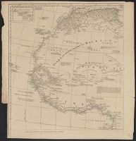
Beinecke Rare Book and Manuscript Library > A new and correct map of the coast of Africa, from Cape Blanco (lat. 20⁰40Ń) to the coast of Angola (lat. 11⁰S) : with explanatory notes of all the forts and settlements belonging to the several European powers / R.W. Seale, sculp.
Creator:
Published / Created:
1677
Call Number:
655 1677
Container / Volume:
BRBL_00345
Image Count:
1
Resource Type:
Maps, Atlases & Globes
Subject (Geographic):
Africa , West--Maps --Early works to 1800
Subject (Topic):
Coasts--Africa , West--Maps --Early works
Found in:
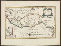
Beinecke Rare Book and Manuscript Library > Costes de Guińee avec les royaumes qui y sont connus des Européens, au dedans des terres : selon les relations les plus nouvelles / par P. Duval.
Creator:
Published / Created:
1st January 1789.
Call Number:
655 1789
Container / Volume:
BRBL_00345
Image Count:
1
Resource Type:
Maps, Atlases & Globes
Subject (Geographic):
Africa , West--Maps --Early works to 1800
Subject (Topic):
Coasts--Africa , West--Maps --Early works
Found in:
Beinecke Rare Book and Manuscript Library > The western coast of Africa, from Cape Blanco to Cape Virga, exhibiting Senegambia proper / by T. Jefferys.
Creator:
Published / Created:
1789 January 1
Call Number:
1982 Folio 10
Image Count:
1
Subject (Geographic):
Africa , West --Maps --Early works to
Subject (Topic):
Coasts --Africa , West --Maps --Early
Found in:
Beinecke Rare Book and Manuscript Library > The western coast of Africa, from Cape Blanco to Cape Virga, exhibiting Senegambia proper
Creator:
Published / Created:
1720?]
Call Number:
49 1740
Container / Volume:
BRBL_00684
Image Count:
1
Resource Type:
Maps, Atlases & Globes
Subject (Topic):
--Maps --Early works to 1800
Found in:
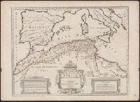
Beinecke Rare Book and Manuscript Library > In notitiam ecclesiasticam Africae tabula geographica / auctore G. De L'Isle ...
Creator:
Published / Created:
1780
Call Number:
49 1780
Container / Volume:
BRBL_00267
Image Count:
1
Resource Type:
Maps, Atlases & Globes
Subject (Topic):
--Maps --Early works to 1800
Found in:
Beinecke Rare Book and Manuscript Library > In notitiam ecclesiasticam Africæ tabula geographica [cartographic material] / Auctore G. de l'Isle ; Joan. Bap. Liébaux inv. et sculp.
Creator:
Published / Created:
[1748]
Call Number:
BrSides Folio 2017 11
Image Count:
1
Resource Type:
Maps, Atlases & Globes
Subject (Geographic):
Africa --Maps --Early works to 1800 .
Found in:
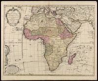
Beinecke Rare Book and Manuscript Library > Africa [cartographic material] / drawn from the best maps by T. Jefferys, Geographer to his Royal Highness the Prince of Wales.
Creator:
Published / Created:
1730
Call Number:
60 1730
Image Count:
1
Resource Type:
Maps, Atlases & Globes
Subject (Geographic):
Africa --Maps --Early works to 1800 .
Found in:
Beinecke Rare Book and Manuscript Library > Carte d'Afrique / dressée pour l'usage du Roy par Guillaume Delisle, premier geographe de sa Majesté, de l'aacademie [sic] royale des sciences.
Creator:
Published / Created:
[1688?]
Call Number:
BrSides Double Folio 2019 114
Image Count:
1
Resource Type:
Maps, Atlases & Globes
Subject (Geographic):
Africa --Maps --Early works to 1800 .
Found in:
Beinecke Rare Book and Manuscript Library > Totius Africae accuratissima tabula [cartographic material] : denuo correcte revisa multis locis aucta, in partes tam maiores quam minores divisa / per F. de Witt.
Creator:
Published / Created:
1766?]
Call Number:
60 1766
Container / Volume:
BRBL_00323
Image Count:
4
Resource Type:
Maps, Atlases & Globes
Subject (Geographic):
Africa --Maps --Early works to 1800
Found in:
Beinecke Rare Book and Manuscript Library > Africa / performed by the Sr. Danville under the patronage of the Duke of Orleans ; revised and improved by Mr. Bolton ; E. Bowen sculpt.
Branch:v1.60.98 ,Deployed:2024-04-17T09:54:31-04:00