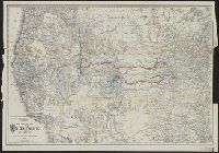
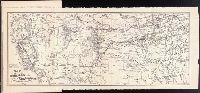
Relief shown by hachures. and Shows "Chicago, Rock Island & Pacific Railway & proprietary lines," "El Paso & Northeastern System," and "St. Louis & San Francisco System."
Publisher:
Rand, McNally & Co.,
Subject (Name):
Chicago, Rock Island and Pacific Railway Company--Maps, El Paso and Northeastern Railroad Company--Maps, and St. Louis-San Francisco Railway Company--Maps
"Copyright, 1902.", In issue of the ABC Pathfinder R'way Guide of July 1903., and Inset maps: Alaska -- Yellowstone Park -- Philippine Islands -- Guam -- Hawaiian Islands.
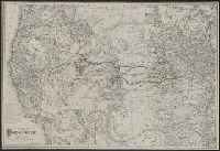
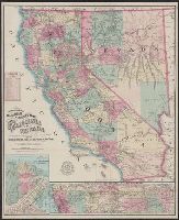
Map of the city of San Francisco, California., Map of the Great National Pacific Railroads., and Topographical railroad and county map of the states of California and Nevada
Description:
"Entered according to act of Congress A.D. 1868 by Frey & Nell in the clerks office of the district court of the United States for the southern district of New York." and Includes insets of "Map of the city of San Francisco, California" and "Map of the Great National Pacific Railroads," distance list, and difference of time chart.
Publisher:
A.C. Frey & Co. ; and General agents for California, A. Roman & Co.,
Subject (Geographic):
California--Maps, Nevada--Maps, and San Francisco (Calif.)--Maps
Subject (Name):
A. Roman & Co, A.C. Frey & Co, and Ferd. Mayer & Co
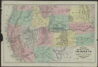
New trans-continental map of the Pacific R.R. and routes of overland travel to Colorado, Nebraska, the Black Hills, Utah, Idaho, Nevada, Montana, California and the Pacific coast
Description:
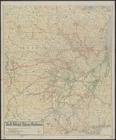
"Entered according to act of Congress in the year 1876 by H.T. Williams ...", Advertisements and text on verso., In lower margin: Am. Photo-Lithographic Co. N.Y. (Osborne's Process)., Relief shown by, and Shows completed and projected railroads and stage routes.
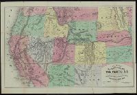
New trans-continental map of the Pacific R.R. and routes of overland travel to Colorado, Nebraska, the Black Hills, Utah, Idaho, Nevada, Montana, California, and the Pacific coast
Description:
"Entered according to act of Congress in the year 1877 by H.T. Williams ...", Advertisements, time tables, fare schedules, and text on verso., and Relief shown by hachures.
Idaho --Description and travel, Montana --Description and travel, Utah --Description and travel, West (U.S.)--Description and travel, and West (U.S.)--Maps
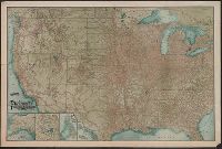
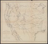
"This map is a hurried compilation of all the authentic surveys and is designed to exhibit the relations of the different routes to each other.", Appears in 33d Cong., 1st Sess., House Ex. Doc. 129, Serial 736., and Relief shown by hachures and spot heights.