Search
You Searched For
Search Results
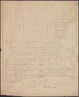
- Creator:
- Nicholson, Walter L
- Published / Created:
- 19--?].
- Call Number:
- 76GMD 1866
- Container / Volume:
- BRBL_00446A
- Image Count:
- 1
- Resource Type:
- Maps, Atlases & Globes
- Subject (Geographic):
- New England--Maps
- Subject (Topic):
- Postal service--New England--Maps
- Found in:
- Beinecke Rare Book and Manuscript Library > Post route map [of the states of] New Hampshire, Vermont, Massachusetts, Rhode Island, Connecticut, and parts of New York and Maine / designed and constructed under the orders of Postmaster General Wm. Dennison and Second Ass't Postmaster Gen'l Geo. Wm. M
- Call Number:
- 1978 Folio 10
- Collection Title:
- ... : also a new description of Newfound-Land, New-England, New-York, east and west New-Jerzey, Dellewar-Bay
- Image Count:
- 1
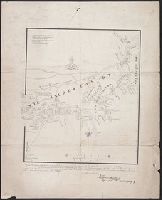
- Subject (Geographic):
- New England --Maps --Early works to
- Found in:
- Beinecke Rare Book and Manuscript Library > A chart of the sea coast of New Found Land, New Scotland, New England, New York, New Jersey, with Virginia and Maryland
- Published / Created:
- 1841
- Call Number:
- 76 1614A
- Container / Volume:
- BRBL_00443
- Image Count:
- 1
- Resource Type:
- Maps, Atlases & Globes
- Subject (Geographic):
- New England--Maps
- Found in:
- Beinecke Rare Book and Manuscript Library > The original Carte Figurative, of wich the above is an accurate Fac-Simile was found ... 1841 in ... the Royal Archives at the Hague ... 1614, and is referred to in the Memorial as showing the extent of the discoveries [in New England] made by ... Hendric
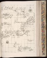
- Creator:
- Russell, John, fl. 1733-1795
- Published / Created:
- 1795 February 7
- Call Number:
- 1986 102
- Collection Title:
- An historical, geographical, commercial, and philosophical view of the American United States, and
- Image Count:
- 1
- Subject (Geographic):
- New England --Maps --Early works to
- Found in:
- Beinecke Rare Book and Manuscript Library > Map of the northern, or, New England states of America. Comprehending Vermont, New Hampshire, District of Main, Massachusetts, Rhode-Island, and Connecticut
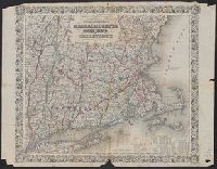
- Published / Created:
- 1819
- Call Number:
- 76 1819
- Container / Volume:
- BRBL_00443
- Image Count:
- 1
- Resource Type:
- Maps, Atlases & Globes
- Subject (Geographic):
- New England--Maps
- Found in:
- Beinecke Rare Book and Manuscript Library > A map of Massachusetts, Connecticut, and Rhodeisland humbly sumitted to the Citizens thereof by ... E. Ruggles.
- Published / Created:
- 1780
- Call Number:
- 76hc 1777
- Container / Volume:
- BRBL_00446A
- Image Count:
- 1
- Resource Type:
- Maps, Atlases & Globes
- Subject (Geographic):
- New England--Maps
- Found in:
- Beinecke Rare Book and Manuscript Library > A map of the country in wich the army under Lt. General Burgoyne acted in the campaing of 1777, shewing the marches of the army & the places of the principal actions.
- Published / Created:
- 1661
- Call Number:
- 1976 Folio 152
- Collection Title:
- Arcano del mare di D. Rvberto Dvdleo dvca di Nortvmbria, e conte di VVarvich. Diviso in libri sei ...
- Container / Volume:
- Volume 2
- Image Count:
- 1
- Subject (Geographic):
- New England
- Found in:
- Beinecke Rare Book and Manuscript Library > Carta particolare della nuova Belgia e parte della nuova Anglia
- Creator:
- J.H. Colton & Co
- Published / Created:
- 1853
- Call Number:
- 76gme 1853
- Container / Volume:
- BRBL_00446A
- Image Count:
- 1
- Resource Type:
- Maps, Atlases & Globes
- Subject (Geographic):
- New England--Maps
- Found in:
- Beinecke Rare Book and Manuscript Library > Colton's railroad and township map of Massachusetts, Rhode Island, and Connecticut. / published by J.H. Colton, no. 86 Cedar St. New York. 1853.
- Published / Created:
- 1828
- Call Number:
- 76gma 1828
- Container / Volume:
- BRBL_00446
- Image Count:
- 1
- Resource Type:
- Maps, Atlases & Globes
- Subject (Geographic):
- New England--Maps
- Found in:
- Beinecke Rare Book and Manuscript Library > Map exhibiting the Farmington & Hampshire Canals, together with the line of their proposed continuatonthrough the valley of the Connecticut River, to Canada.