Search
You Searched For
Search Results
- Creator:
- Great Britain. War Office. General Staff. Geographical Section
- Published / Created:
- 1943
- Call Number:
- 40 Ao75 1943
- Container / Volume:
- BRBL_00204
- Image Count:
- 1
- Resource Type:
- Maps, Atlases & Globes
- Subject (Name):
- United States. Army Map Service
- Found in:
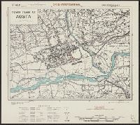
- Beinecke Rare Book and Manuscript Library > Town plan of Aosta [cartographic material].
- Creator:
- Great Britain. War Office. General Staff. Geographical Section
- Published / Created:
- 1943
- Call Number:
- 40 B45 1943
- Container / Volume:
- BRBL_00205
- Image Count:
- 1
- Resource Type:
- Maps, Atlases & Globes
- Subject (Name):
- United States. Army Map Service
- Found in:
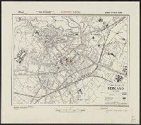
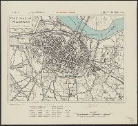
- Beinecke Rare Book and Manuscript Library > Town plan of Bergamo [cartographic material].
- Creator:
- Great Britain. War Office. General Staff. Geographical Section
- Published / Created:
- 1943
- Call Number:
- 408 C27 1943
- Container / Volume:
- BRBL_00239
- Image Count:
- 1
- Resource Type:
- Maps, Atlases & Globes
- Subject (Name):
- United States. Army Map Service
- Found in:
- Beinecke Rare Book and Manuscript Library > Town plan of Castelvetrano [cartographic material] / drawn and photolithographed by War Office, 1943.
- Creator:
- Great Britain. War Office. General Staff. Geographical Section
- Published / Created:
- 1943. and Army Map Service, U. S. Army,
- Call Number:
- 675 C33 1943
- Container / Volume:
- BRBL_00349
- Image Count:
- 1
- Resource Type:
- Maps, Atlases & Globes
- Subject (Name):
- United States. Army Map Service
- Found in:
- Beinecke Rare Book and Manuscript Library > Town plan of Ceuta.
- Creator:
- Great Britain. War Office. General Staff. Geographical Section
- Published / Created:
- 1943
- Call Number:
- 408 En61 1943
- Container / Volume:
- BRBL_00239
- Image Count:
- 1
- Resource Type:
- Maps, Atlases & Globes
- Subject (Name):
- United States. Army Map Service
- Found in:
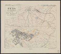
- Beinecke Rare Book and Manuscript Library > Town plan of Enna [cartographic material] / drawn and photolithographed by War Office, 1943.
- Creator:
- Great Britain. War Office. General Staff. Geographical Section
- Published / Created:
- 1943
- Call Number:
- 408 L61 1943
- Container / Volume:
- BRBL_00239
- Image Count:
- 1
- Resource Type:
- Maps, Atlases & Globes
- Subject (Name):
- United States. Army Map Service
- Found in:
- Beinecke Rare Book and Manuscript Library > Town plan of Licata [cartographic material] / drawn and photolithographed by War Office, 1943.
- Creator:
- Great Britain. War Office. General Staff. Geographical Section
- Published / Created:
- 1943
- Call Number:
- 408 M56 1943
- Container / Volume:
- BRBL_00239
- Image Count:
- 1
- Resource Type:
- Maps, Atlases & Globes
- Subject (Name):
- United States. Army Map Service
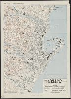
- Found in:
- Beinecke Rare Book and Manuscript Library > Town plan of Messina [cartographic material] / photolithographed by the Ordnance Survey, 1943.
- Creator:
- Great Britain. War Office. General Staff. Geographical Section
- Published / Created:
- 1943
- Call Number:
- 408 N84 1943
- Container / Volume:
- BRBL_00239
- Image Count:
- 1
- Resource Type:
- Maps, Atlases & Globes
- Subject (Name):
- United States. Army Map Service
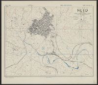
- Found in:
- Beinecke Rare Book and Manuscript Library > Town plan of Noto [cartographic material] / drawn and lithographed by War Office, 1943.
- Creator:
- Great Britain. War Office. General Staff. Geographical Section
- Published / Created:
- 1943
- Call Number:
- 40 P13 1943
- Container / Volume:
- BRBL_00213
- Image Count:
- 1
- Resource Type:
- Maps, Atlases & Globes
- Subject (Name):
- United States. Army Map Service
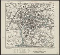
- Found in:
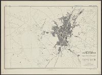
- Beinecke Rare Book and Manuscript Library > Town plan of Padua (Padova) [cartographic material].
- Creator:
- Great Britain. War Office. General Staff. Geographical Section
- Published / Created:
- 1943
- Call Number:
- 408 P17 1943
- Container / Volume:
- BRBL_00239
- Image Count:
- 1
- Resource Type:
- Maps, Atlases & Globes
- Subject (Name):
- United States. Army Map Service
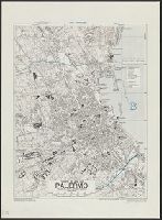
- Found in:
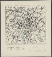
- Beinecke Rare Book and Manuscript Library > Town plan of Palermo [cartographic material].
- Creator:
- Great Britain. War Office. General Staff. Geographical Section
- Published / Created:
- 1943
- Call Number:
- 40 P24 1943
- Container / Volume:
- BRBL_00213
- Image Count:
- 1
- Resource Type:
- Maps, Atlases & Globes
- Subject (Name):
- United States. Army Map Service
- Found in:
- Beinecke Rare Book and Manuscript Library > Town plan of Parma [cartographic material].
- Creator:
- Great Britain. War Office. General Staff. Geographical Section
- Published / Created:
- 1943
- Call Number:
- 40 P57 1943
- Container / Volume:
- BRBL_00214
- Image Count:
- 1
- Resource Type:
- Maps, Atlases & Globes
- Subject (Name):
- United States. Army Map Service
- Found in:
- Beinecke Rare Book and Manuscript Library > Town plan of Piacenza [cartographic material].
- Creator:
- Great Britain. War Office. General Staff. Geographical Section
- Published / Created:
- 1943
- Call Number:
- 40 P67 1943
- Container / Volume:
- BRBL_00214
- Image Count:
- 1
- Resource Type:
- Maps, Atlases & Globes
- Subject (Name):
- United States. Army Map Service
- Found in:
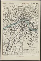
- Beinecke Rare Book and Manuscript Library > Town plan of Pisa [cartographic material].
- Creator:
- Great Britain. War Office. General Staff. Geographical Section
- Published / Created:
- 1943
- Call Number:
- 40 R19 1943
- Container / Volume:
- BRBL_00215
- Image Count:
- 1
- Resource Type:
- Maps, Atlases & Globes
- Subject (Name):
- United States. Army Map Service
- Found in:
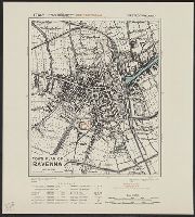
- Beinecke Rare Book and Manuscript Library > Town plan of Ravenna [cartographic material].
- Creator:
- Great Britain. War Office. General Staff. Geographical Section
- Published / Created:
- 1943
- Call Number:
- 408 Sy76 1943
- Container / Volume:
- BRBL_00239
- Image Count:
- 1
- Resource Type:
- Maps, Atlases & Globes
- Subject (Name):
- United States. Army Map Service
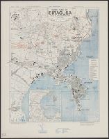
- Found in:
- Beinecke Rare Book and Manuscript Library > Town plan of Siracusa [cartographic material] / photolithographed by the Ordnance Survey, 1943.
- Creator:
- Great Britain. War Office. General Staff. Geographical Section
- Published / Created:
- 1943
- Call Number:
- 679 T15 1943
- Container / Volume:
- BRBL_00349
- Image Count:
- 1
- Resource Type:
- Maps, Atlases & Globes
- Subject (Name):
- United States. Army Map Service
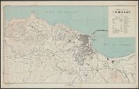
- Found in:
- Beinecke Rare Book and Manuscript Library > Town plan of Tangier.
- Published / Created:
- [1942?]
- Call Number:
- 679 T15 1942
- Container / Volume:
- BRBL_00349
- Image Count:
- 1
- Resource Type:
- Maps, Atlases & Globes
- Subject (Name):
- United States. Army Map Service
- Found in:
- Beinecke Rare Book and Manuscript Library > Town plan of Tangier.
- Creator:
- Great Britain. Army. Royal Engineers. Fd. Survey Coy., 512
- Published / Created:
- 1943
- Call Number:
- 40 T17 1943
- Image Count:
- 1
- Resource Type:
- Maps, Atlases & Globes
- Subject (Name):
- United States. Army Map Service
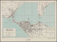
- Found in:
- Beinecke Rare Book and Manuscript Library > Town plan of Taranto [cartographic material] / reproduced by 512 Fd. Survey Coy., R.E., June, 1943, from W.O. pulls 1st edition, 1942, with revision from air photographs, dated 1943.
- Creator:
- Great Britain. War Office. General Staff. Geographical Section
- Published / Created:
- 1943
- Call Number:
- 40 T729 1943
- Image Count:
- 1
- Resource Type:
- Maps, Atlases & Globes
- Subject (Name):
- United States. Army Map Service
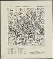
- Found in:
- Beinecke Rare Book and Manuscript Library > Town plan of Treviso [cartographic material].
- Creator:
- Great Britain. War Office. General Staff. Geographical Section
- Published / Created:
- 1943
- Call Number:
- 40 Ud5 1943
- Image Count:
- 1
- Resource Type:
- Maps, Atlases & Globes
- Subject (Name):
- United States. Army Map Service
- Found in:
- Beinecke Rare Book and Manuscript Library > Town plan of Udine [cartographic material].
- Creator:
- Great Britain. Inter-service Topographical Dept
- Published / Created:
- 1943
- Call Number:
- 40 V652 1943
- Image Count:
- 1
- Resource Type:
- Maps, Atlases & Globes
- Subject (Name):
- United States. Army Map Service
- Found in:
- Beinecke Rare Book and Manuscript Library > Town plan of Vibo Valentia Marina [cartographic material] / compiled and drawn by Inter-Service Topographical Department ; produced under the Superintendence of Vice-Admiral John Edgell, hydrographer.
- Creator:
- Great Britain. War Office. General Staff. Geographical Section
- Published / Created:
- 1943
- Call Number:
- 40 V66 1943
- Image Count:
- 1
- Resource Type:
- Maps, Atlases & Globes
- Subject (Name):
- United States. Army Map Service
- Found in:
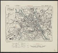
- Beinecke Rare Book and Manuscript Library > Town plan of Vicenza [cartographic material].
- Creator:
- Great Britain. War Office. General Staff. Geographical Section
- Published / Created:
- 1943
- Call Number:
- 408 V83 1943
- Container / Volume:
- BRBL_00239
- Image Count:
- 1
- Resource Type:
- Maps, Atlases & Globes
- Subject (Name):
- United States. Army Map Service
- Found in:
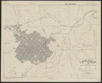
- Beinecke Rare Book and Manuscript Library > Town plan of Vittoria [cartographic material] / drawn and photolithographed by War Office, 1943.
- Creator:
- Great Britain. War Office. General Staff. Geographical Section
- Published / Created:
- 1945
- Call Number:
- 56 T83 1945
- Container / Volume:
- BRBL_00297
- Image Count:
- 1
- Resource Type:
- Maps, Atlases & Globes
- Subject (Name):
- United States. Army Map Service
- Found in:
- Beinecke Rare Book and Manuscript Library > Tungchow [cartographic material] / Geographical Section, General Staff.
- Creator:
- Great Britain. War Office. General Staff. Geographical Section
- Published / Created:
- 1943
- Call Number:
- 501 1943
- Container / Volume:
- BRBL_00276
- Image Count:
- 1
- Resource Type:
- Maps, Atlases & Globes
- Subject (Name):
- United States. Army Map Service
- Found in:
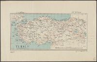
- Beinecke Rare Book and Manuscript Library > Turkey [cartographic material].
- Creator:
- Great Britain. Inter-service Topographical Dept
- Published / Created:
- 1943
- Call Number:
- 40 V715 1943
- Image Count:
- 1
- Resource Type:
- Maps, Atlases & Globes
- Subject (Name):
- United States. Army Map Service
- Found in:
- Beinecke Rare Book and Manuscript Library > Villa San Giovanni [cartographic material] / compiled and drawn by Inter-Service Topographical Department ; produced under the Superintendence of Vice-Admiral John Edgell, hydrographer.
- Creator:
- J.H. Colton & Co.
- Published / Created:
- 1858
- Call Number:
- 754gme 1858
- Container / Volume:
- BRBL_00420
- Image Count:
- 1
- Resource Type:
- Maps, Atlases & Globes
- Subject (Geographic):
- United States--Maps
- Subject (Topic):
- Railroads--United States--Maps
- Found in:
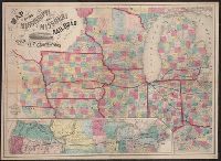
- Beinecke Rare Book and Manuscript Library > Map of the Mississippi and Missouri Railroad : and its connections.
- Creator:
- Steiger, W. T
- Published / Created:
- 1854
- Call Number:
- 75gme 1854
- Container / Volume:
- BRBL_00411
- Image Count:
- 2
- Resource Type:
- Maps, Atlases & Globes
- Subject (Topic):
- Railroads--United States--Maps
- Found in:
- Beinecke Rare Book and Manuscript Library > Diagram of the United States of America, Mexico, the West India Islands and Isthmus of Darien : showing proposed routes of the Pacific Rail Road ... / by W. T. Steiger, General Land Office ; Lith. by A. Hoen & Co. Baltimore.
- Creator:
- Rand McNally and Company
- Published / Created:
- [1912]
- Call Number:
- 80gme 1912B
- Container / Volume:
- BRBL_00540
- Image Count:
- 1
- Resource Type:
- Maps, Atlases & Globes
- Subject (Topic):
- Railroads--United States--Maps
- Found in:
- Beinecke Rare Book and Manuscript Library > Outline map of the lines of the Chicago, Milwaukee & St. Paul Railway Company, Chicago, Milwaukee & Puget Sound Railway Company, and Tacoma Eastern Railway Company : June 30, 1912.
- Creator:
- Rand McNally and Company
- Published / Created:
- [1924]
- Call Number:
- 832gmb 1923
- Container / Volume:
- BRBL_00583
- Image Count:
- 2
- Resource Type:
- Maps, Atlases & Globes
- Description:
- the United States" and "Map of Yellowstone
- Subject (Topic):
- Express highways--United States--Maps
- Found in:
- Beinecke Rare Book and Manuscript Library > Rand McNally official 1924 auto trails map, Idaho.
- Published / Created:
- 1909
- Call Number:
- 75ak 1909
- Container / Volume:
- BRBL_00407A
- Image Count:
- 1
- Resource Type:
- Maps, Atlases & Globes
- Subject (Geographic):
- United States--Maps
- Found in:
- Beinecke Rare Book and Manuscript Library > United States Base Map / engraved by U.S.G.S.
- Creator:
- Rand McNally and Company
- Published / Created:
- [1882?]
- Call Number:
- 75gme 1882A
- Container / Volume:
- BRBL_00413
- Image Count:
- 1
- Resource Type:
- Maps, Atlases & Globes
- Subject (Topic):
- Railroads--United States--Maps
- Found in:
- Beinecke Rare Book and Manuscript Library > New map of the United States showing the complete railway system of the trans-Missouri country / prepared expressly for Crofutt's New overland tourist and Pacific coast guide, 1882, the Overland Publishing Company, Omaha, Neb., and Denver, Colo.
- Creator:
- United States. General Land Office
- Published / Created:
- 1864
- Call Number:
- 75fcm 1864
- Container / Volume:
- BRBL_00410
- Image Count:
- 1
- Resource Type:
- Maps, Atlases & Globes
- Subject (Geographic):
- Canada--Boundaries--United States--Maps
- Subject (Topic):
- Public lands--United States--Maps.
- Found in:
- Beinecke Rare Book and Manuscript Library > Map of the Public Land States and territories [cartographic material] / constructed from the Public Surveys and other official sources in the General Land Office ; drawn by J.H. Hawes, principal draughtsman [and] T. Franks, assistant.
- Creator:
- H.M. Gousha Company
- Published / Created:
- [1934]
- Call Number:
- 841gmb 1934
- Container / Volume:
- BRBL_00597
- Image Count:
- 2
- Resource Type:
- Maps, Atlases & Globes
- Alternative Title:
- 1934 official road map, United States.
- Description:
- ," and "1934 official road map, United States
- Subject (Topic):
- Express highways--United States--Maps
- Found in:
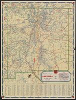
- Beinecke Rare Book and Manuscript Library > 1934 official road map, New Mexico / [prepared for] Phillips Petroleum Company.
- Creator:
- H.M. Gousha Company
- Published / Created:
- [1938]
- Call Number:
- 841gmb 1938
- Container / Volume:
- BRBL_00597
- Image Count:
- 2
- Resource Type:
- Maps, Atlases & Globes
- Alternative Title:
- 1938 road map, United States.
- Description:
- , and "1938 road map, United States" (scale
- Subject (Topic):
- Express highways--United States--Maps
- Found in:
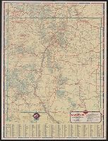
- Beinecke Rare Book and Manuscript Library > 1938 road map, New Mexico / prepared exclusively for Standard Oil Company of Texas.
- Creator:
- Rand McNally and Company
- Published / Created:
- [1924]
- Call Number:
- 841gmb 1924
- Container / Volume:
- BRBL_00597
- Image Count:
- 2
- Resource Type:
- Maps, Atlases & Globes
- Subject (Topic):
- Express highways--United States--Maps
- Found in:
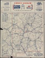
- Beinecke Rare Book and Manuscript Library > Rand McNally official 1924 auto trails map, New Mexico.
- Creator:
- Germany. Publikationsstelle Berlin-Dahlem
- Published / Created:
- 1941
- Call Number:
- 352eb 1941A
- Container / Volume:
- BRBL_00109
- Image Count:
- 1
- Resource Type:
- Maps, Atlases & Globes
- Subject (Name):
- United States. Army Map Service
- Found in:
- Beinecke Rare Book and Manuscript Library > Die Bevölkerungsdichte des Europäischen Russland innerhalb der Grenzen der Sowjetunion von 1941. I. Die ländliche Bevölkerungsdichte / Reichsministerium des Innern.
- Creator:
- Germany. Publikationsstelle Berlin-Dahlem
- Published / Created:
- 1941
- Call Number:
- 352eb 1941B
- Container / Volume:
- BRBL_00109
- Image Count:
- 1
- Resource Type:
- Maps, Atlases & Globes
- Subject (Name):
- United States. Army Map Service
- Found in:
- Beinecke Rare Book and Manuscript Library > Die Bevölkerungsdichte des Europäischen Russland innerhalb der Grenzen der Sowjetunion von 1941. II. Die städtischen Siedlungen / Reichsministerium des Innern.
- Creator:
- Germany. Heer. Abteilung für Kriegskarten- und Vermessungswesen II
- Published / Created:
- 1942
- Call Number:
- 352 B634 1942
- Container / Volume:
- BRBL_00107
- Image Count:
- 2
- Resource Type:
- Maps, Atlases & Globes
- Subject (Name):
- United States. Army Map Service Stamp
- Found in:
- Beinecke Rare Book and Manuscript Library > Russland 1:50 000. M-37-82-A-B. Bogutschar / Gen. St. d. H. Abt. f. Kart. u. Verm. Wes. (II).
- Published / Created:
- 1943
- Call Number:
- 507 N159 1943
- Container / Volume:
- BRBL_00277
- Image Count:
- 1
- Resource Type:
- Maps, Atlases & Globes
- Subject (Name):
- United States. Army Map Service Stamp
- Found in:
- Beinecke Rare Book and Manuscript Library > South Levant 1:50,000. Naoua.
- Creator:
- Geological Survey (U.S.)
- Published / Created:
- 1910
- Call Number:
- 75cbf 1910
- Container / Volume:
- BRBL_00408
- Image Count:
- 1
- Resource Type:
- Maps, Atlases & Globes
- Subject (Geographic):
- United States--Maps
- Found in:
- Beinecke Rare Book and Manuscript Library > United States relief map / compiled by Henry Gannett.
- Creator:
- Hartley, W. M. B
- Published / Created:
- [1870?]
- Call Number:
- Zc39 870ha
- Image Count:
- 7
- Subject (Geographic):
- United States--Maps
- Subject (Topic):
- Railroads--United States--Maps
- Found in:
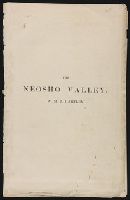
- Beinecke Rare Book and Manuscript Library > The Neosho Valley ...
- Published / Created:
- [1874?]
- Call Number:
- 796gme 1874
- Container / Volume:
- BRBL_00531
- Image Count:
- 2
- Resource Type:
- Maps, Atlases & Globes
- Subject (Topic):
- Railroads--United States--Maps
- Found in:
- Beinecke Rare Book and Manuscript Library > "Texas New Yorker's" railroad map of Texas : showing all completed and proposed routes, with principal rivers, county boundaries and county-seats, railroad stations and distances, congressional districts, United States military telegraph line, and frontie
- Creator:
- Rand McNally and Company
- Published / Created:
- 1931
- Call Number:
- 844gmb 1931
- Container / Volume:
- BRBL_00615
- Image Count:
- 2
- Resource Type:
- Maps, Atlases & Globes
- Alternative Title:
- Texaco road map, 1931, United States.
- Description:
- Index, ill., and road maps of United
- Subject (Topic):
- Roads--United States--Maps
- Found in:
- Beinecke Rare Book and Manuscript Library > Texaco road map, California, Nevada.
- Creator:
- United States. Army Map Service
- Published / Created:
- 1944
- Call Number:
- 50 1945K
- Container / Volume:
- BRBL_00273
- Image Count:
- 2
- Resource Type:
- Maps, Atlases & Globes
- Subject (Name):
- United States. Army Map Service
- Found in:
- Beinecke Rare Book and Manuscript Library > Harbin / prepared under the direction of the Chief of Engineers, U.S. Army, by the Army Map Service.
- Creator:
- United States. Army Map Service
- Published / Created:
- 1944
- Call Number:
- 556 1943
- Container / Volume:
- BRBL_00293
- Image Count:
- 2
- Resource Type:
- Maps, Atlases & Globes
- Subject (Name):
- United States. Army Map Service
- Found in:
- Beinecke Rare Book and Manuscript Library > Harbin [cartographic material] / prepared under the direction of the Chief of Engineers, U.S. Army, by the Army Map Service.
- Creator:
- United States. Office of Indian Affairs
- Published / Created:
- 1909
- Call Number:
- 75ed 1909
- Container / Volume:
- BRBL_00410
- Image Count:
- 1
- Resource Type:
- Maps, Atlases & Globes
- Subject (Topic):
- Indian reservations--United States
- Found in:
- Beinecke Rare Book and Manuscript Library > Map showing Indian reservations within the limits of the United States, 1909 / [Department of the Interior, Office of Indian Affairs] ; compiled under the direction of R. G. Valentine.
- Creator:
- United States. Army Map Service
- Published / Created:
- 1944
- Call Number:
- 50 1945O
- Container / Volume:
- BRBL_00273
- Image Count:
- 2
- Resource Type:
- Maps, Atlases & Globes
- Found in:
- Beinecke Rare Book and Manuscript Library > AAF cloth chart [cartographic material] : Eastern Asia / Army Map Service.
- Creator:
- United States. Army Map Service
- Published / Created:
- 1944
- Call Number:
- 56gms 1944
- Container / Volume:
- BRBL_00299
- Image Count:
- 2
- Resource Type:
- Maps, Atlases & Globes
- Found in:
- Beinecke Rare Book and Manuscript Library > AAF cloth map [cartographic material] / prepared under the direction of the Commanding General, Army Air Forces, by the Aeronautical Chart Service.
- Creator:
- United States. Army Map Service
- Published / Created:
- 1944
- Call Number:
- 50 1945E
- Container / Volume:
- BRBL_00273
- Image Count:
- 2
- Resource Type:
- Maps, Atlases & Globes
- Found in:
- Beinecke Rare Book and Manuscript Library > AAF cloth map [cartographic material] / prepared under the direction of the Commanding General, Army Air Forces, by the Aeronautical Chart Service.