Skip to search
Skip to main content
Skip to first result
Search
You Searched For
"Europe, Eastern--Maps"
New Search
Search Results
Published / Created:
191-.
Call Number:
11hcf 1919D-19
Container / Volume:
BRBL_00010W
Image Count:
1
Resource Type:
Maps, Atlases & Globes
Description:
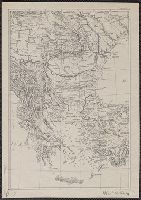
"Inquiry-626" outside upper right margin. and Shows Bulgaria, Greece, Roumania (sic), and parts of Turkey, Serbia, and Hungary.
Publisher:
s.n.,
Subject (Geographic):
Europe , Eastern --Maps
Found in:
Beinecke Rare Book and Manuscript Library > [Bulgaria and surrounding areas].
Creator:
Published / Created:
[1918?-1943?]
Call Number:
304 1886A
Container / Volume:
BRBL_00740
Image Count:
9
Resource Type:
Maps, Atlases & Globes
Description:
BEIN Series 304 1886A: Imperfect: all sheets but C2-4, D2-4, E2-4 wanting., In upper margin of some maps: Domborzati áttekintés., Maps individually numbered and subtitled in upper margin, e.g.: B.4. Pola, Zara, Comacchio -- C2. Brno -- D.2. Kassa és Kraków -- E3. Koloszvár -- F.3. Bielcy, Kisziniew, Jassi., Publisher's name in lower margin differs: M. Kir. Térképészeti Intézet -- M. Kir. Állami Térképészeti Intézet -- M. Kir. Állami Térképészet -- M.kir. állami térképészet nyomása., Subtitles for the same map may differ according to ed., Title devised by cataloger., and Various eds. of some maps.
Publisher:
M. Kir. Térképészeti Intézet,
Subject (Geographic):
Europe , Eastern --Maps
Found in:
Beinecke Rare Book and Manuscript Library > [Kelet-Európa térképe] [cartographic material].
Published / Created:
[1940?]
Call Number:
308fab 1940
Container / Volume:
BRBL_00037
Image Count:
3
Resource Type:
Maps, Atlases & Globes
Description:
Library has 3 sheets only. Wanting northwest quadrant.
Publisher:
Eckert Lith. Co.,
Subject (Geographic):
Europe , Eastern --Maps
Found in:
Beinecke Rare Book and Manuscript Library > [Map of Eastern Europe - showing political boundaries, railroads, military facilities].
Published / Created:
1919?]
Call Number:
11hcf 1919B-31
Container / Volume:
BRBL_00010Q
Image Count:
1
Resource Type:
Maps, Atlases & Globes
Publisher:
s.n.,
Subject (Geographic):
Europe , Eastern --Maps
Found in:
Beinecke Rare Book and Manuscript Library > [Map of Eastern Europe].
Creator:
Published / Created:
1915
Call Number:
11hcf 1919E-5
Container / Volume:
BRBL_00010ZA
Image Count:
1
Resource Type:
Maps, Atlases & Globes
Alternative Title:
Europe 1:1,000,000, G.S.G.S. ; no. 2758, and G.S.G.S. ; no. 2758.
Description:
Copy 2 ms. notes, hand col. spots on map. and Includes index to adjoining sheets, index to boundaries, and pronunciation glossary.
Publisher:
Ordnance Survey,
Subject (Geographic):
Europe , Eastern --Maps
Found in:
Beinecke Rare Book and Manuscript Library > (Vienna) Wien : North M 33. / compiled at the Royal Geographical Society under the direction of the Geographical Section ; drawn and printed by Ordnance Survey.
Creator:
Published / Created:
1918
Call Number:
11hcf 1919E-6
Container / Volume:
BRBL_00010ZA
Image Count:
1
Resource Type:
Maps, Atlases & Globes
Alternative Title:
Europe 1:1,000,000, G.S.G.S. ; no. 2758, and G.S.G.S. ; no. 2758.
Description:
"Minor corrections December 1918." and Includes index to adjoining sheets, index to boundaries, and pronunciation glossary.
Publisher:
Ordnance Survey,
Subject (Geographic):
Europe , Eastern --Maps
Found in:
Beinecke Rare Book and Manuscript Library > (Vienna) Wien : North M 33. / compiled at the Royal Geographical Society under the direction of the Geographical Section ; drawn and printed by Ordnance Survey.
Creator:
Published / Created:
1915
Call Number:
11hcf 1919E-5
Container / Volume:
BRBL_00010ZA
Image Count:
1
Resource Type:
Maps, Atlases & Globes
Alternative Title:
Europe 1:1,000,000, G.S.G.S. ; no. 2758, and G.S.G.S. ; no. 2758.
Description:
Includes index to adjoining sheets, index to boundaries, and pronunciation glossary.
Publisher:
Ordnance Survey,
Subject (Geographic):
Europe , Eastern --Maps
Found in:
Beinecke Rare Book and Manuscript Library > (Vienna) Wien : North M 33. / compiled at the Royal Geographical Society under the direction of the Geographical Section ; drawn and printed by Ordnance Survey.
Creator:
Published / Created:
[1914?]
Call Number:
11hcf 1919B-13
Container / Volume:
BRBL_00010O
Image Count:
3
Resource Type:
Maps, Atlases & Globes
Description:
Sheet 2 fragile, in 3 fragments.
Publisher:
American Geographical Society,
Subject (Geographic):
Europe , Eastern --Maps
Found in:
Beinecke Rare Book and Manuscript Library > Austria-Hungary [cartographic material].
Published / Created:
1816
Call Number:
41 1816
Container / Volume:
BRBL_00241
Image Count:
1
Resource Type:
Maps, Atlases & Globes
Description:
Drawn and engraved for Thompson's New General Atlas, 1816.
Subject (Geographic):
Europe , Eastern --Maps
Found in:
Beinecke Rare Book and Manuscript Library > Austrian dominions / Neele, sculp.
Published / Created:
191-.
Call Number:
11hcf 1919-27
Image Count:
1
Resource Type:
Maps, Atlases & Globes
Description:
Shows Persia and adjoining countries, from Bulgaria to Chinese Turkestan; scale given in miles, kilometers, and versts.
Publisher:
s.n.,
Subject (Geographic):
Europe , Eastern --Maps
Found in:
Beinecke Rare Book and Manuscript Library > Danube to India.
Branch:v1.61.6 ,Deployed:2024-06-12T09:55:37-04:00