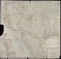
Copyright: Southern Pacific Co., Covers states west of the Mississippi River and area in Mexico north of Mexico City., Insets: Portland and vicinity -- San Francisco and vicinity -- Los Angeles and vicinity., and Library's copy imperfect: Part of Portland inset torn away.
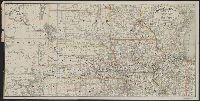
Covers area from Colorado to Lake Michigan, through South Dakota, Minnesota, Wisconsin, Nebraska, Iowa, Illinois, and northern Kansas and Missouri. and Relief shown by hachures.
Publisher:
Rand McNally & Co.,
Subject (Name):
Chicago, Burlington & Quincy Railroad Company and Chicago, Burlington & Quincy Railroad Company--Maps
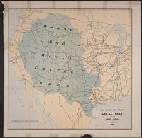
"No I.", "To accompany a report in reply to a resolution of the House of Representatives dated Feb 16th, 1885"., and Shows cattle trails, quarantine lines, "assumed northern limit of Texas fever district", railroads, cities and towns, Indian reservations, rivers, and isotherms.
Publisher:
Julius Bien & Co.,
Subject (Name):
Julius Bien & Co, Nimmo, Joseph, 1837-1909, and United States. Dept. of the Treasury. Report on the internal commerce of the United States
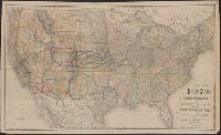
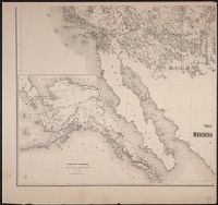
Map of the states and territories from the Mississippi River to the Pacific Ocean
Description:
"Entered according to act of Congress in the year 1867 by G.W. & C.B. Colton ... ", Also shows locations of Indian tribes., Includes text., Prime meridians: Greenwich and Washington., and Relief shown by hachures and spot heights.
Map of the states and territories from the Mississippi River to the Pacific Ocean
Description:
"Entered according to act of Congress in the year 1874 by G.W. & C.B. Colton ... ", Also shows locations of Indian tribes., Includes text., Prime meridians: Greenwich and Washington., and Relief shown by hachures and spot heights.
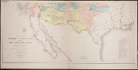
Includes "Note" and "Authorities.", Incorporates note and surveys added after Jan. 8, 1858., Relief shown by hachures and spot heights., and Shows Indian tribal locations, military posts, routes and dates of expeditions and surveys.
Includes list of "Authorities" and inset "Territory of Alaska" (scale 1:9,000,000)., Relief shown by hachures and spot heights., and Shows routes and dates of expeditions and surveys.
Publisher:
War Dept.,
Subject (Geographic):
West (U.S.)--Maps
Subject (Name):
United States. War Dept and Warren, Gouverneur Kemble, 1830-1882
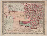
Johnson's new railroad and county copper plate map of Kansas gold region and the Great West, from the latest and best authorities, New, and New rail road and county copper plate map of Kansas gold region and the Great West, from the latest and best authorities
Description:
"Entered according to act of Congress in the year 1859 by A.J. Johnson in the clerks office of the district court of the United States for the southern district of New, Includes notes., Prime meridian: Washington., and Relief shown by hachures and spot heights.