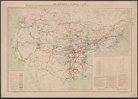
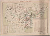
Depicts area from central Florida to Quebec and from Delaware to Iowa., Insets: Cal[ifornia] -- Texas., and Shows track gauge guages indicated by color.
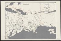
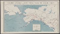
Shows proposed railroads primarily in the North Central United States and Canada; bullseye centering on Mackinaw City and the Great Lakes region and the Straits of Mackinaw connecting Lake Michigan and Lake Huron; Michigan counties, major cities and towns
Publisher:
Middleton, Strobridge & Co.,
Subject (Geographic):
Canada--Maps
Subject (Name):
Canadian Pacific Railway Company--Maps and Northern Pacific Railroad Company--Maps
Part of imprint is faintly visible in bottom margin: [?]acKen[?] No. 38 No[?]folk Street Strand., Relief shown by hachures., and Rivers and lakes in the Pacific Northwest and British Columbia are in manuscript, pen-and-ink.
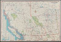
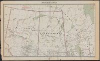
Alberta, British Columbia, Manitoba, Saskatchewan, Provinces of British Columbia and Alberta ; Provinces of Manitoba and Saskatchewan, and Provinces of Manitoba and Saskatchewan.
Description:
Includes mileage tables, indexes, text, and advertisements. and Insets: Map showing continuation of roads from Prince George to Prince Rupert -- Map showing continuation of roads from Edmonton to Peace River District.
"100 M.84.", Includes indexes, mileage chart, col. ill., and 8 inset maps: Vancouver -- Edmonton -- Calgary -- Winnipeg -- Regina -- Saskatoon -- Alaska Highway -- Victoria., and Road map of Saskatchewan and Manitoba -- Road map of British Columbia and Alberta.
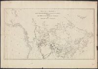
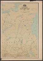
"Accompanying the Report of the Senate Committee appointed to inquire into the, Date inferred from Manitoba's northern boundary which is shown before its northern extension of 1912., and Shows natural resources, and developed and undeveloped agricultural areas.
Publisher:
Railway Lands Branch, Dept. of the Interior,
Subject (Geographic):
Canada, Western--Maps
Subject (Name):
Canada. Dept. of the Interior. Railway Lands Branch