Skip to search
Skip to main content
Skip to first result
Search
You Searched For
"Europe, Eastern--Maps"
New Search
Search Results
Published / Created:
1918?]
Call Number:
11hc 1918Z-1
Container / Volume:
BRBL_00010F
Image Count:
1
Resource Type:
Maps, Atlases & Globes
Publisher:
s.n.,
Subject (Geographic):
Europe , Eastern --Maps
Found in:
Beinecke Rare Book and Manuscript Library > Linea d'Armistizio : Villa Giusti - 3 Novembre 1918.
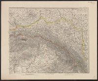
Published / Created:
1890-1891.
Call Number:
41 1891
Container / Volume:
BRBL_00241
Image Count:
2
Resource Type:
Maps, Atlases & Globes
Description:
Insets: [1.] Budapest und weitere Umgegend, 1:150,000 -- [2.] Südspitze von Dalmatien.
Publisher:
Justus Perthes,
Subject (Geographic):
Europe , Eastern --Maps
Found in:
Beinecke Rare Book and Manuscript Library > Österreich-Ungarn in 4 Blättern / von C. Vogel.
Creator:
Published / Created:
[1910?]
Call Number:
352 1910
Container / Volume:
BRBL_00105
Image Count:
1
Resource Type:
Maps, Atlases & Globes
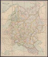
Description:
In lower left corner of margin: George Philip & Son. Ltd., In lower right corner of margin: The London Geographical Institute., Incl. identical panel title., Map shows railways, submarine cables, steamer routes., and Relief shown by hachures, spot heights.
Publisher:
George Philip & Son,
Subject (Geographic):
Europe , Eastern --Maps
Subject (Name):
London Geographical Institute
Subject (Topic):
Cables, Submarine--Russia--Maps and Railroads--Russia--Maps
Found in:
Beinecke Rare Book and Manuscript Library > Russia in Europe / George Philip & Son.
Creator:
Published / Created:
[1872?]
Call Number:
352 1872
Image Count:
1
Resource Type:
Maps, Atlases & Globes
Description:
From A. Fullarton & Co.'s Royal illustrated atlas of modern geography. London; Edinburgh: A. Fullarton and Co., [1872?]., Imperfect: brittle and chipped. Sheet measures 59 x 46 cm. Manuscript annotations on verso. Cross Collection no. 83., and Relief shown by hachures.
Publisher:
A. Fullarton & Co.,
Subject (Geographic):
Europe , Eastern --Maps .
Subject (Name):
A. Fullarton & Co. Royal illustrated atlas of modern geography.
Found in:
Beinecke Rare Book and Manuscript Library > Russia in Europe [cartographic material] / by G.H. Swanston.
Published / Created:
1918?]
Call Number:
11hc 1918Z-2
Container / Volume:
BRBL_00010G
Image Count:
1
Resource Type:
Maps, Atlases & Globes
Description:
Legend shows the "Linea d'armistizio" and "Vecchio confine di Stato." and Title supplied by cataloger.
Publisher:
s.n.,
Subject (Geographic):
Europe , Eastern --Maps
Found in:
Beinecke Rare Book and Manuscript Library > [Linea d'Armistizio : Villa Giusti, 3 Novembre 1918].
Published / Created:
1919?]
Call Number:
11hcf 1919C-3-17
Container / Volume:
BRBL_00010U
Image Count:
1
Resource Type:
Maps, Atlases & Globes
Description:
In upper right and bottom left: 610.
Publisher:
s.n.,
Subject (Geographic):
Europe , Eastern --Maps
Found in:
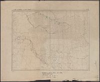
Beinecke Rare Book and Manuscript Library > Austria-Hungary.
Published / Created:
1919?]
Call Number:
11hcf 1919C-3-8
Container / Volume:
BRBL_00010U
Image Count:
1
Resource Type:
Maps, Atlases & Globes
Description:
Hand colored regions and borders.
Publisher:
s.n.,
Subject (Geographic):
Europe , Eastern --Maps
Found in:
Beinecke Rare Book and Manuscript Library > Austria-Hungary.
Published / Created:
1944
Call Number:
47 1944B
Container / Volume:
BRBL_00261
Image Count:
1
Resource Type:
Maps, Atlases & Globes
Description:
"Lage im Blattschnitt der Weltkarte 1:1,000,000". and "VI.44. (D 80)".
Publisher:
Publikationsstelle Wien,
Subject (Geographic):
Europe , Eastern --Maps
Found in:
Beinecke Rare Book and Manuscript Library > Bulgarien mit Albanien und Europ. Türkei.
Creator:
Published / Created:
[1941]
Call Number:
53f 1941
Container / Volume:
BRBL_00287
Image Count:
1
Resource Type:
Maps, Atlases & Globes
Alternative Title:
Europe Sud-est, Permanent atlas., and Südost-Europa
Description:
"20/12/41.", "No. 14.", "Permanent atlas, Geneva; Atlas permanent, Genève; Permanenter Atlas, Gene.", and In English, French, and German.
Publisher:
Vallier & Blanc,
Subject (Geographic):
Europe , Eastern --Maps
Found in:
Beinecke Rare Book and Manuscript Library > South-eastern Europe [cartographic material] = Europe Sud-est = Südost-Europa.
Published / Created:
1878?]
Call Number:
11hcf 1919C-1-1
Container / Volume:
BRBL_00010S
Image Count:
1
Resource Type:
Maps, Atlases & Globes
Description:
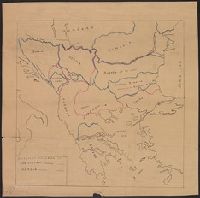
Legend indicates boundaries according to San Stefano in pink crayon, and boundaries according to Berlin in blue crayon. and Title supplied by cataloger.
Publisher:
s.n.,
Subject (Geographic):
Europe , Eastern --Maps
Subject (Topic):
Boundaries--Balkan Peninsula--Russo-Turkish War, 1877-1878 and Boundaries--Europe, Eastern--Russo-Turkish War, 1877-1878
Found in:
Beinecke Rare Book and Manuscript Library > [Manuscript Map showing boundaries according to the Treaty of Berlin and the Treaty of San Stefano].
Branch:v1.61.6 ,Deployed:2024-06-12T09:55:31-04:00