Skip to search
Skip to main content
Skip to first result
Search
You Searched For
"New York (N.Y.)--Maps"
New Search
Search Results
Creator:
Published / Created:
1868
Call Number:
771 N49 1868D
Container / Volume:
BRBL_00487
Image Count:
21
Resource Type:
Maps, Atlases & Globes
Description:
Imperfect, wanting sheet 2., Includes "Distances between The Avenues"., and Ms. notes on title sheet, individual map sheets in mylar sleeves.
Publisher:
Mathew Dripps,
Subject (Geographic):
New York (N.Y .)--Maps
Subject (Name):
Harrison, John F
Subject (Topic):
Landowners--New York (State)--New York--Maps and Real property--New York (State)--New York--Maps
Found in:
Beinecke Rare Book and Manuscript Library > Plan of New York City from the Battery to Spuyten Duyvil Creek : showing every lot and building thereon; old farm lines, street numbers at the corners of blocks, railroads, steamboat landings, bulkhead and pier lines, etc., etc., etc. / based on the surve
Published / Created:
1872?]
Call Number:
771 N49 1868C
Container / Volume:
BRBL_00487
Image Count:
1
Resource Type:
Maps, Atlases & Globes
Description:
Removed from a duplicate copy of Beers, J.B., & Co. County atlas of Westchester, New York ... New York 1872, to which it may not have belonged. Copy discarded as duplicate per D.G.W. 6/10/42.
Subject (Geographic):
New York (N.Y .)--Maps
Found in:
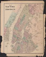
Beinecke Rare Book and Manuscript Library > Plan of New York and Brooklyn.
Published / Created:
[1838?]
Call Number:
771 N49 1838
Container / Volume:
BRBL_00485
Image Count:
1
Resource Type:
Maps, Atlases & Globes
Description:
Printed on silk.
Subject (Geographic):
New York (N.Y .)--Maps
Found in:
Beinecke Rare Book and Manuscript Library > Plan of New York.
Published / Created:
[1838?]
Call Number:
771 N49 1838A
Container / Volume:
BRBL_00485
Image Count:
2
Resource Type:
Maps, Atlases & Globes
Description:
Map shows Manhattan Island south to 40th St. List all public buildings in columns at either side.
Subject (Geographic):
New York (N.Y .)--Maps
Found in:
Beinecke Rare Book and Manuscript Library > Plan of the city of New York for the use of strangers.
Published / Created:
[1817?]
Call Number:
771 N49 1817A
Container / Volume:
BRBL_00485
Image Count:
1
Resource Type:
Maps, Atlases & Globes
Description:
Engraved from the original map by G. Hayward for Haswell's Reminiscences.
Subject (Geographic):
New York (N.Y .)--Maps
Found in:
Beinecke Rare Book and Manuscript Library > Plan of the city of New York the greater part from actual survey ... by Thos, Poppleton, City Surveyor, 1817.
Creator:
Call Number:
771 N49 1829
Container / Volume:
BRBL_00485
Image Count:
1
Resource Type:
Maps, Atlases & Globes
Description:
"Additions to 1829.", Coordinates not present on map and are approximated., Imperfect: hole in lower right, with some loss of text., Relief shown by hachures., and Shows wards, ferry lines, house numbers, selected places of interest, and houses with family names
Publisher:
J. Langdon,
Subject (Geographic):
New York (N.Y .)--Maps
Subject (Name):
Hooker, William, 1782-1856., Maverick, Peter, 1780-1831, and Prior & Bowne
Found in:
Beinecke Rare Book and Manuscript Library > Plan of the city of New-York : the greater part from actual survey made expressly for the purpose (the rest from authentic documents) / by Thos. H. Poppleton, city surveyor ; revised & corrected by Wm. Hooker ; P. Maverick sc. Newark.
Published / Created:
1921
Call Number:
771g N49 1921
Container / Volume:
BRBL_00493
Image Count:
1
Resource Type:
Maps, Atlases & Globes
Subject (Geographic):
New York (N.Y .)--Maps
Found in:
Beinecke Rare Book and Manuscript Library > Port of New York Authority / projected public improvements and their relation to the comprehensive plan.
Creator:
Published / Created:
1910
Call Number:
771 N49 1910B
Image Count:
2
Resource Type:
Maps, Atlases & Globes
Alternative Title:
New handy map of New York City
Description:
Includes lists of transportation services and points of interest., Inset of greater New York in upper left., and Shows ferry routes, subways and surface railroads.
Publisher:
Rand, McNally & Co.,
Subject (Geographic):
New York (N.Y .)--Maps
Found in:
Beinecke Rare Book and Manuscript Library > Rand McNally & Co.'s new handy map of New York City / Rand McNally & Co.
Published / Created:
1817
Call Number:
771 N49 1817
Container / Volume:
BRBL_00485
Image Count:
1
Resource Type:
Maps, Atlases & Globes
Description:
Index and guide., Inset: New York in 1729., and Valuable map of the city of New York. Plan of 1729, Plan of 1817. Formerly owned by Hon. J. Deming Perkins of Litchfield. Given to Mary Perkins Quincy (his niece) by Mrs. J. Deming Perkins. 1911.
Subject (Geographic):
New York (N.Y .)--Maps
Found in:
Beinecke Rare Book and Manuscript Library > This actual map and comparative pland showing 88 years growth of the city ... David Longworth 1817.
Published / Created:
[1905?].
Call Number:
771cea N49 1905G
Image Count:
1
Resource Type:
Maps, Atlases & Globes
Description:
"Copy of the United States Coast and Geodetic Survey Chart No. 120, with colored additions made by the Dept. of Docks and Ferries."
Publisher:
U.S.C. & G.S.,
Subject (Geographic):
New York (N.Y .)--Maps
Found in:
Beinecke Rare Book and Manuscript Library > Waterfront and Harbor of the City of New York.
Branch:v1.61.6 ,Deployed:2024-06-12T09:55:36-04:00