Great Britain. War Office. General Staff. Geographical Section
Published / Created:
1918
Call Number:
36ed 1918
Container / Volume:
BRBL_00127
Image Count:
2
Resource Type:
Maps, Atlases & Globes
Alternative Title:
GSGS (Series) ; 3703a. and GSGS ; 3703a
Description:
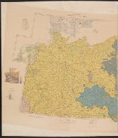
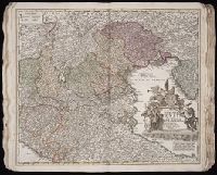
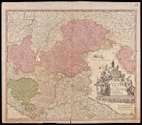
Germany -- Poland -- Northern Italy -- South east Europe., Imperfect: sheets northern Italy and southeast Europe wanting. Ms. annotations on map., and Insets: Density of population.
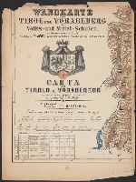
From Woerl's Atlas von Central-Europa, 1830., Imperfect: trimmed along neat line, with loss of marginal data. Dissected and mounted on cloth., Relief shown by hachures., and Title from label on verso.
Subject (Geographic):
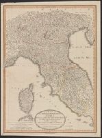
Italy, Northern--Maps
Subject (Name):
Herder, Bartholomä, 1774-1839, lithographer and Woerl, Joseph Edmund. Atlas von Central-Europa
"Cum privilegio Sac. Caes. Majestatis.", Bar scales given in "milliaria Germanica," "milliaria Gallica," and ""milliaria Italica.", Manuscript number in upper right corner: 43. From the Karpinski-von Wieser Map Collection., and Relief shown pictorially.
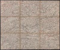
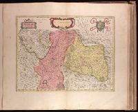
Backed with paper. Ms. no. "69" in upper right corner. Sheet measures 53.5 x 62.5 cm. No. 64 of 87 maps bound together., Bar scale given in "miglia cinque.", and Relief shown pictorially.