Search
You Searched For
Search Results
- Creator:
- Blake, Jacob Edmund, 1811 or 12-1846
- Published / Created:
- 1842?]
- Call Number:
- 796fab Sa13 1842E
- Container / Volume:
- BRBL_00530
- Image Count:
- 1
- Resource Type:
- Maps, Atlases & Globes
- Subject (Geographic):
- Texas--Boundaries--United States--Maps
- Found in:
- Beinecke Rare Book and Manuscript Library > Part of the boundary between the United States and Texas, north of Sabine River from the 39th [i.e. 36th] to the 72nd mile mound / drawn from the notes of survey and copied for the use of the commissioners under the Convention of 25th April 1838 by J. Edm
- Creator:
- Blake, Jacob Edmund, 1811 or 12-1846
- Published / Created:
- 1842?]
- Call Number:
- 796fab Sa13 1842F
- Container / Volume:
- BRBL_00530
- Image Count:
- 1
- Resource Type:
- Maps, Atlases & Globes
- Subject (Geographic):
- Texas--Boundaries--United States--Maps
- Found in:
- Beinecke Rare Book and Manuscript Library > Part of the boundary between the United States and Texas, north of the Sabine River from the 72nd mile mound to Red River / drawn from the notes of survey and copied for the use of the commissioners under the Convention of 25th April, 1838 by J. Edm.d Bla
- Creator:
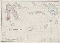
- United States. Army Map Service
United States. Office of Strategic Services. Research and Analysis Branch
- Published / Created:
- 1945
- Call Number:
- 27 1945A
- Container / Volume:
- BRBL_00023B
- Image Count:
- 1
- Resource Type:
- Maps, Atlases & Globes
- Found in:
- Beinecke Rare Book and Manuscript Library > Arafura, Banda, and Ceram seas / R & A, OSS.
- Call Number:
- Zc20 697heg
- Collection Title:
- A new discovery of a vast country in America : extending above four thousand miles, between New
- Image Count:
- 1
- Subject (Geographic):
- United States --Maps --Early works to
- Found in:
- Beinecke Rare Book and Manuscript Library > A map of a large country newly discovered in the northern America situated between New Mexico and the frozen sea, together with the course of the Great River Meschasipi. Dedicated to His Ma.ty William III King of Great Britain. By Father Lewis Hennepin, m
- Call Number:
- Zc20 697heg
- Collection Title:
- A new discovery of a vast country in America : extending above four thousand miles, between New
- Image Count:
- 1
- Subject (Geographic):
- United States --Maps --Early works to
- Found in:
- Beinecke Rare Book and Manuscript Library > A map of a new world between New Mexico and the frozen sea newly discovered by Father Lewis Hennepin, missionary recollect and native of Aht in Hainault. Dedicated to his majesty of Great Britain William III
- Call Number:
- Zc20 697heg
- Collection Title:
- A new discovery of a vast country in America : extending above four thousand miles, between New
- Image Count:
- 1
- Subject (Geographic):
- United States --Maps --Early works to
- Found in:
- Beinecke Rare Book and Manuscript Library > A new discovery of a vast country in America ...
- Creator:
- Barber, Bissell B
- Published / Created:
- 1835
- Call Number:
- 75 1835A
- Container / Volume:
- BRBL_00398
- Image Count:
- 1
- Resource Type:
- Maps, Atlases & Globes
- Subject (Geographic):
- United States--Maps
- Found in:
- Beinecke Rare Book and Manuscript Library > Map of the United States of America with its territories and districts : including also a part of upper & lower Canada and Mexico.
- Creator:
- Taylor, David, R.N.
- Published / Created:
- [1834?]
- Call Number:
- 755 1834
- Container / Volume:
- BRBL_00440
- Image Count:
- 1
- Resource Type:
- Maps, Atlases & Globes
- Subject (Geographic):
- United States--Maps
- Found in:
- Beinecke Rare Book and Manuscript Library > New travelling and commercial map of the Canadas [cartographic material] : from the Sault of St. Marie to the river Saguenay, and a large section of the United States of America / compiled from the latest surveys and most approved authorities ... by his o
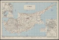
- Creator:
- Cyprus. Ktēmatologiko kai Chōrometriko Tmēma
- Published / Created:
- 1950
- Call Number:
- 509 1942
- Container / Volume:
- BRBL_00277
- Image Count:
- 1
- Resource Type:
- Maps, Atlases & Globes
- Alternative Title:
- AMS series (United States. Army Map
- Found in:
- Beinecke Rare Book and Manuscript Library > Cyprus [cartographic material] / compiled by land Registration and Surveys, Cyprus.
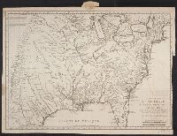
- Creator:
- Bellin, Jacques Nicolas, 1703-1772
- Published / Created:
- 1744]
- Call Number:
- 755 1744
- Container / Volume:
- BRBL_00426
- Image Count:
- 1
- Resource Type:
- Maps, Atlases & Globes
- Subject (Geographic):
- United States--Maps--Early works to
- Found in:
- Beinecke Rare Book and Manuscript Library > Carte de la Louisiane cours du Mississipi [i.e. Mississippi] et pais voisins : dediée à M. le Comte de Maurepas, ministre et secretaire d'etat commandeur des ordres du roy / par N. Bellin ingenieur de la marine, 1744 ; Dheulland sculp.