Search
You Searched For
Search Results
- Creator:
- Sotzmann, D. F
- Call Number:
- Zm Sp79
- Collection Title:
- Allgemeines historisches Taschenbuch, oder, Abriss der merkwurdigsten neuen Welt-Begebenheiten
- Image Count:
- 1
- Subject (Geographic):
- United States --Maps --Early works to
- Found in:
- Beinecke Rare Book and Manuscript Library > Die Vereinigten Staaten von Nord America. nach der von Wm Faden 1783
- Creator:
- Glümer, J. v
- Published / Created:
- 1883?]
- Call Number:
- 847 1883
- Container / Volume:
- BRBL_00625
- Image Count:
- 1
- Resource Type:
- Maps, Atlases & Globes
- Subject (Geographic):
- Canada--Boundaries--United States--Maps
- Found in:
- Beinecke Rare Book and Manuscript Library > Map of the n.w. boundaries of the United States / compiled in 1883 under the direction of Bvt. Brig. Gen'l. O.M. Poe, U.S. Army Lt. Col. of Engineers, Col. & A.D.C. ; compiled & drawn by J. von Glümer.
- Creator:
- Anville, Jean Baptiste Bourguignon d', 1697-1782
Pownall, Thomas, 1722-1805
Sayer, Robert, 1725-1794, creator
- Published / Created:
- 1786
- Call Number:
- 1982 Folio 10
- Image Count:
- 2
- Subject (Geographic):
- United States --Maps --Early works to
- Found in:
- Beinecke Rare Book and Manuscript Library > A new map of the whole continent of America : divided into North and South and West Indies wherein are exactly described the United States of North America as well as the several European possessions according to the preliminaries of peace signed at Versa
- Creator:
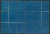
- International Boundary Commission
- Published / Created:
- 1952]
- Call Number:
- 848fab 1951
- Container / Volume:
- BRBL_00635
- Image Count:
- 15
- Resource Type:
- Maps, Atlases & Globes
- Subject (Geographic):
- Canada--Boundaries--United States--Maps
- Found in:
- Beinecke Rare Book and Manuscript Library > Joint maps of the international boundary between United States and Canada from Cape Muzon to Mount St. Elias.
- Creator:
- Monk, Jacob
- Published / Created:
- 1854
- Call Number:
- 71 1854
- Container / Volume:
- BRBL_00371
- Image Count:
- 4
- Resource Type:
- Maps, Atlases & Globes
- Subject (Geographic):
- United States--Maps
- Found in:
- Beinecke Rare Book and Manuscript Library > New map of that portion of North America, exhibiting the United States and territories, the Canadas, New Brunswick, Nova Scotia, and Mexico, also Central America, and the West India Islands : compiled from the most recent surveys, and other authentic sour
- Creator:
- Disturnell, John, 1801-1877
- Published / Created:
- [1949]
- Call Number:
- 88 1847I
- Container / Volume:
- BRBL_00645
- Image Count:
- 1
- Resource Type:
- Maps, Atlases & Globes
- Subject (Geographic):
- Mexico--Boundaries--United States--Maps
- Found in:
- Beinecke Rare Book and Manuscript Library > Mapa de los Estados Unidos de Méjico / segun lo organizado y definido por las varias actas del Congreso de dicha República, y construido por las mejores autoridades.
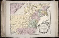
- Creator:
- Haussard, C
Robert de Vaugondy, Gilles, 1688-1766, creator
- Published / Created:
- 1755
- Call Number:
- 2003 Folio 85
- Image Count:
- 1
- Subject (Geographic):
- United States -- Maps -- Early works to
- Found in:
- Beinecke Rare Book and Manuscript Library > Partie de l'Amerique septentrionale: qui comprend le cours de l'Ohio, la Nlle. Angleterre, la Nlle York, le New Jersey, la Pensylvanie, le Maryland, la Virginie, la Caroline
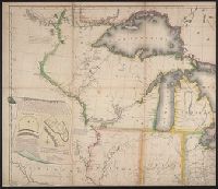
- Creator:
- Bowen, Emanuel, d. 1767
- Published / Created:
- 1754
- Call Number:
- 75 1720
- Container / Volume:
- BRBL_00689
- Image Count:
- 1
- Resource Type:
- Maps, Atlases & Globes
- Subject (Geographic):
- United States--Maps--Early works to
- Found in:
- Beinecke Rare Book and Manuscript Library > A map of the British American plantations [cartographic material] : extending from Boston in New England to Georgia, including all the back settlements in the respective provinces, as far as the Mississippi / by Eman. Bowen Geogr. to His Majesty ; Tho. Bo
- Creator:
- Shelton & Kensett
- Published / Created:
- [1816]
- Call Number:
- 75 1816
- Container / Volume:
- BRBL_00397
- Image Count:
- 4
- Resource Type:
- Maps, Atlases & Globes
- Subject (Geographic):
- United States--Maps
- Found in:
- Beinecke Rare Book and Manuscript Library > A map of the United States and British provinces of Upper and Lower Canada with other parts adjacent [cartographic material] / by Shelton & Kensett.
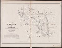
- Creator:
- Gray, A. B. (Andrew Belcher), 1820-1862
- Published / Created:
- 1842?]
- Call Number:
- 796fab Sa13 1842I
- Container / Volume:
- BRBL_00530
- Image Count:
- 1
- Resource Type:
- Maps, Atlases & Globes
- Subject (Geographic):
- Texas--Boundaries--United States--Maps
- Found in:
- Beinecke Rare Book and Manuscript Library > Map of the river Sabine from Logan's Ferry to 32nd degree of north latitude : shewing the boundary between the United States of America and the Republic of Texas between said points, as marked and laid down by survey in 1841, under the direction of the Jo