Search
You Searched For
Search Results
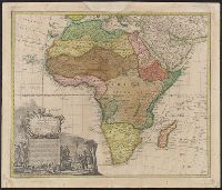
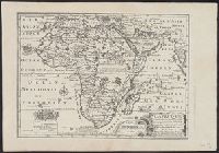
- Creator:
- Hase, Johann Matthias, 1684-1742
- Published / Created:
- 1737
- Call Number:
- 60 1737
- Container / Volume:
- BRBL_00323
- Image Count:
- 1
- Resource Type:
- Maps, Atlases & Globes
- Subject (Geographic):
- Africa--Maps--Early works to 1800
- Found in:
- Beinecke Rare Book and Manuscript Library > Africa secundum legitimas projectionis stereographicae regulas et juxta recentissimas relationes et observationes in subsidium vocatis quoque veterum Leonis Africani Nubiensis Geographi et aliorum monumentis et eleminatis fabulosis aliorum designationibus
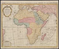
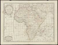
- Creator:
- L'Isle, Guillaume de, 1675-1726
- Published / Created:
- [ca. 1774?]
- Call Number:
- 60 1774A
- Container / Volume:
- BRBL_00323
- Image Count:
- 1
- Resource Type:
- Maps, Atlases & Globes
- Subject (Geographic):
- Africa--Maps--Early works to 1800
- Found in:
- Beinecke Rare Book and Manuscript Library > Carte d'Afrique, dressée pour l'usage du Roy / par Guillaume Delisle, Premier Geographe de sa Majesté de l'Academie Royale de Sciences ; J. Kondet, schulpsit.
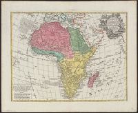
- Creator:
- L'Isle, Guillaume de, 1675-1726
- Published / Created:
- [ca. 1760]
- Call Number:
- 60 1760B
- Container / Volume:
- BRBL_00323
- Image Count:
- 1
- Resource Type:
- Maps, Atlases & Globes
- Subject (Geographic):
- Africa--Maps--Early works to 1800
- Found in:
- Beinecke Rare Book and Manuscript Library > Africa : concinnata secundum observationes membror. acad. regal. scientiarum et non nullorum aliorum, et juxta recentissimas annotationes / per G. de l'Isle, geographum.
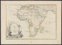
- Published / Created:
- 1700?]
- Call Number:
- 60 1700
- Container / Volume:
- BRBL_00322
- Image Count:
- 1
- Resource Type:
- Maps, Atlases & Globes
- Subject (Geographic):
- Africa--Maps--Early works to 1800
- Found in:
- Beinecke Rare Book and Manuscript Library > A new map of Africk : shewing its present general divisions, cheif cities or towns, rivers, mountains &c.
- Creator:
- Payne, John, fl. 1800
- Published / Created:
- 1792?]
- Call Number:
- 60 1792
- Container / Volume:
- BRBL_00324
- Image Count:
- 1
- Resource Type:
- Maps, Atlases & Globes
- Subject (Geographic):
- Africa--Maps--Early works to 1800
- Found in:
- Beinecke Rare Book and Manuscript Library > Africa, 1792 / Ferguson sculpsit.
- Creator:
- Janvier, Jean
- Published / Created:
- 1789
- Call Number:
- 60 1782
- Container / Volume:
- BRBL_00324
- Image Count:
- 1
- Resource Type:
- Maps, Atlases & Globes
- Subject (Geographic):
- Africa--Maps--Early works to 1800
- Found in:
- Beinecke Rare Book and Manuscript Library > L'Afrique, divisée en ses principaux etats / par le Sr. Janvier, geographe.
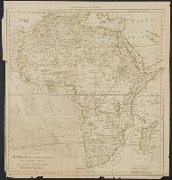
- Published / Created:
- [1968]
- Call Number:
- 60 1710
- Container / Volume:
- BRBL_00322
- Image Count:
- 1
- Resource Type:
- Maps, Atlases & Globes
- Subject (Geographic):
- Africa--Maps--Early works to 1800
- Found in:
- Beinecke Rare Book and Manuscript Library > Africa according to H. Moll 1710.
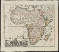
- Creator:
- Fer, Nicolas de, 1646-1720
- Published / Created:
- 1705
- Call Number:
- 60 1705
- Container / Volume:
- BRBL_00322
- Image Count:
- 1
- Resource Type:
- Maps, Atlases & Globes
- Subject (Geographic):
- Africa--Maps--Early works to 1800
- Found in:
- Beinecke Rare Book and Manuscript Library > L'Afrique : dressée selon les dernieres relat. et suivant les nouvelles decouvertes dont les points principaux sont placez sur les observations de Mrs. de l'Academie Royale des Sciences / par N. de Fer.
- Creator:
- Sandrart, Jakob von, 1630-1708
- Published / Created:
- 1700]
- Call Number:
- 60 1700A
- Container / Volume:
- BRBL_00322
- Image Count:
- 1
- Resource Type:
- Maps, Atlases & Globes
- Subject (Geographic):
- Africa--Maps--Early works to 1800
- Found in:
- Beinecke Rare Book and Manuscript Library > Accuratissima totius Africae tabula / in lucem producta per Iacobum de Sandrart ; Joann. Bapt. Homann, sculpsit.
- Creator:
- L'Isle, Guillaume de, 1675-1726
- Published / Created:
- [1797?]
- Call Number:
- 60 1797
- Container / Volume:
- BRBL_00324
- Image Count:
- 1
- Resource Type:
- Maps, Atlases & Globes
- Subject (Geographic):
- Africa--Maps--Early works to 1800
- Found in:
- Beinecke Rare Book and Manuscript Library > Carte d'Afrique : dressée pour l'instruction / par Guillaume de L'Isle, premier géographe de l'Académie des sciences ; revue et augmentée par Dezauche, successeur des srs. Delisle et Phil. Buache.