Search
You Searched For
Search Results
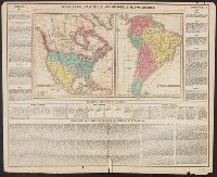
- Creator:
- Carey, Henry Charles, 1793-1879
- Published / Created:
- 1822]
- Call Number:
- 70 1822C
- Container / Volume:
- BRBL_00358
- Image Count:
- 1
- Resource Type:
- Maps, Atlases & Globes
- Subject (Geographic):
- North America--Maps
- Found in:
- Beinecke Rare Book and Manuscript Library > Geographical, statistical and historical map of America / Young & Delleker sc.
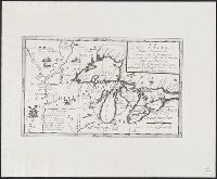
- Creator:
- Coronelli, Vincenzo, 1650-1718
- Published / Created:
- 19--?]
- Call Number:
- 71 1680A
- Container / Volume:
- BRBL_00360
- Image Count:
- 1
- Resource Type:
- Maps, Atlases & Globes
- Subject (Geographic):
- Great Lakes Region (North America
- Found in:
- Beinecke Rare Book and Manuscript Library > La Louisiana, parte settentrionalle : scoperta sotta la protettione di Luigi XIV, Ré di Francia, etc. / descritta, e dedicata, dal P. Cosmografo Coronelli.
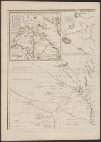
- Creator:
- Reichard, C. G. (Christian Gottlieb), 1758-1837
- Published / Created:
- 1802
- Call Number:
- 71 1802B
- Container / Volume:
- BRBL_00367
- Image Count:
- 1
- Resource Type:
- Maps, Atlases & Globes
- Subject (Geographic):
- North America--Maps
- Found in:
- Beinecke Rare Book and Manuscript Library > Charte von Nordamerica : nach den neuesten Bestimmungen und Entdeckungen / von C.G. Reichard.
- Creator:
- Middleton, Strobridge & Co
- Published / Created:
- [1857].
- Call Number:
- 753gme 1858
- Container / Volume:
- BRBL_00415
- Image Count:
- 1
- Resource Type:
- Maps, Atlases & Globes
- Subject (Geographic):
- Great Lakes (North America)--Maps
- Subject (Topic):
- Railroads--Great Lakes (North America
- Found in:
- Beinecke Rare Book and Manuscript Library > Map illustrating the Canada Pacific and Northern Pacific and other proposed Railroads, connecting at Straits of Mackinaw : Also showing the position of Mackinaw City.
- Creator:
- Lotter, Matthäus Albrecht, 1741-1810
- Published / Created:
- 1784
- Call Number:
- 71 1784L
- Container / Volume:
- BRBL_00726
- Image Count:
- 4
- Resource Type:
- Maps, Atlases & Globes
- Subject (Geographic):
- North America--Maps--Early works to
- Found in:
- Beinecke Rare Book and Manuscript Library > A new and correct map of North America with the West India Islands : divided according to the last Treaty of Peace, concluded at Paris the 20th of Jan. 1783, wherein are particularly distinguished the Thirteen Provinces wich [sic] compose the United State
- Creator:
- Mitchell, John, 1711-1768
- Published / Created:
- 1776]
- Call Number:
- 71 1776D
- Container / Volume:
- BRBL_00365
- Image Count:
- 8
- Resource Type:
- Maps, Atlases & Globes
- Subject (Geographic):
- North America--Maps--Early works to
- Found in:
- Beinecke Rare Book and Manuscript Library > Amérique septentrionale avec les routes : distances en miles, villages, et etablissements françois et anglois / par le docteur Mitchel ; traduit de l'Anglois à Paris par Le Rouge, ingr. géographe du roy, Rue des Grands Augustins 1756.
- Published / Created:
- 1756
- Call Number:
- 70 1756
- Container / Volume:
- BRBL_00724
- Image Count:
- 8
- Resource Type:
- Maps, Atlases & Globes
- Subject (Geographic):
- North America--Maps--Early works to
- Found in:
- Beinecke Rare Book and Manuscript Library > Amerique Septentrionale avec les routes, distances en miles, villages et etablissements francois et anglois / par le docteur Mitchel.
- Creator:
- Mitchell, John, 1711-1768
- Published / Created:
- [1755]
- Call Number:
- 71 1755D
- Container / Volume:
- BRBL_00363
- Image Count:
- 8
- Resource Type:
- Maps, Atlases & Globes
- Subject (Geographic):
- North America--Maps--Early works to
- Found in:
- Beinecke Rare Book and Manuscript Library > A map of the British and French dominions in North America : with the roads, distances, limits, and extent of the settlements, humbly inscribed to the Right Honourable the Earl of Halifax, and the other Right Honourable the Lords Commissioners for Trade &
- Creator:
- Mitchell, John, 1711-1768
- Published / Created:
- [1775?]
- Call Number:
- 71 1755A
- Container / Volume:
- BRBL_00363
- Image Count:
- 8
- Resource Type:
- Maps, Atlases & Globes
- Subject (Geographic):
- North America--Maps--Early works to
- Found in:
- Beinecke Rare Book and Manuscript Library > A map of the British colonies in North America : with the roads, distances, limits, and extent of the settlements, humbly inscribed to the Right Honourable the Earl of Halifax, and the other Right Honourable the Lords Commissioners for Trade & Plantations
- Creator:
- Rhode, Johann Christoph, cartographer
- Call Number:
- 755 1755AA
- Container / Volume:
- BRBL_00427
- Image Count:
- 1
- Resource Type:
- Maps, Atlases & Globes
- Subject (Geographic):
- North America--Maps--Early works to
- Found in:
- Beinecke Rare Book and Manuscript Library > Theatrum belli in America Septentrionali / II. foliis comprehensum jussu Acad. Reg. Scient. et Eleg. Litt. exhibet I. C. Rhode Ac: Geogr. ; Berger, sculpsit berol.