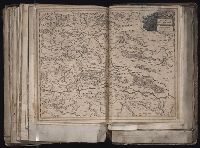
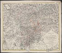
Search
You Searched For
Search Results
- Published / Created:
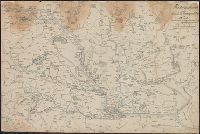
- [1940?-1941]
- Call Number:
- 42 1940
- Container / Volume:
- BRBL_00244
- Image Count:
- 13
- Resource Type:
- Maps, Atlases & Globes
- Subject (Geographic):
- Austria--Maps, Topographic
- Found in:
- Beinecke Rare Book and Manuscript Library > [Topographical map of Austria. 1: 25,000].
- Published / Created:
- 1876
- Call Number:
- 425 H676 1876
- Container / Volume:
- BRBL_00246
- Image Count:
- 2
- Resource Type:
- Maps, Atlases & Globes
- Subject (Geographic):
- Austria--Maps
- Found in:
- Beinecke Rare Book and Manuscript Library > [Specialkarte des österr. Alpengebietes 1:75.000.] Zone 17 Col. VIII, Hof-Gastein.
- Published / Created:
- 1877
- Call Number:
- 425 R119 1877
- Container / Volume:
- BRBL_00246
- Image Count:
- 2
- Resource Type:
- Maps, Atlases & Globes
- Subject (Geographic):
- Austria--Maps
- Found in:
- Beinecke Rare Book and Manuscript Library > [Specialkarte des österr. Alpengebietes 1:75.000.] Zone 16 Col. IX, Radstadt.
- Published / Created:
- [1830]
- Call Number:
- 42 Sa39 1830
- Container / Volume:
- BRBL_00706
- Image Count:
- 1
- Resource Type:
- Maps, Atlases & Globes
- Subject (Geographic):
- Salzburg (Austria)--Maps, Manuscript
- Found in:
- Beinecke Rare Book and Manuscript Library > [Manuscript map showing part of the province of Salzburg]. Gezeichnet Franz Weys.
- Published / Created:
- [1700?]
- Call Number:
- 428 In7 1700
- Container / Volume:
- BRBL_00706
- Image Count:
- 1
- Resource Type:
- Maps, Atlases & Globes
- Subject (Geographic):
- Tyrol (Austria)--Maps, Manuscript
- Found in:
- Beinecke Rare Book and Manuscript Library > [Manuscript map of Environs North & West of Insprugg].
- Published / Created:
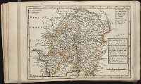
- [1890?]
- Call Number:
- 423 K88 1890
- Container / Volume:
- BRBL_00245
- Image Count:
- 1
- Resource Type:
- Maps, Atlases & Globes
- Subject (Geographic):
- Lower Austria (Austria)--Maps
- Found in:
- Beinecke Rare Book and Manuscript Library > [Krems and Environs].
- Published / Created:
- [1878?]
- Call Number:
- 428 IN7 1878
- Container / Volume:
- BRBL_00248
- Image Count:
- 1
- Resource Type:
- Maps, Atlases & Globes
- Subject (Geographic):
- Innsbruck (Austria)--Maps
- Found in:
- Beinecke Rare Book and Manuscript Library > [Innsbruck].
- Published / Created:
- 1875?]
- Call Number:
- 428 IN7 1875
- Container / Volume:
- BRBL_00248
- Image Count:
- 1
- Resource Type:
- Maps, Atlases & Globes
- Subject (Geographic):
- Tyrol (Austria)--Maps
- Found in:
- Beinecke Rare Book and Manuscript Library > [Innsbruck and Environs].
- Published / Created:
- [1915?]
- Call Number:
- 427gmb 1915
- Container / Volume:
- BRBL_00247
- Image Count:
- 2
- Resource Type:
- Maps, Atlases & Globes
- Subject (Geographic):
- Carinthia (Austria)--Maps
- Found in:
- Beinecke Rare Book and Manuscript Library > [Hözels Automobilkarten]. Blatt XVII - Klagenfurt-Hofgastein.
- Creator:
- Löwe, Cornelius
Pharus-Verlag
United States. Office of Strategic Services. Geography Division. Map Information Section
- Published / Created:
- ca. 1942]
- Call Number:
- 36 L65 1942
- Container / Volume:
- BRBL_00125
- Image Count:
- 2
- Resource Type:
- Maps, Atlases & Globes
- Subject (Geographic):
- Linz (Austria)--Maps
- Found in:
- Beinecke Rare Book and Manuscript Library > [Facsimile map of Linz, Austria].
- Published / Created:
- 1910?]
- Call Number:
- 41 1910
- Container / Volume:
- BRBL_00241
- Image Count:
- 1
- Resource Type:
- Maps, Atlases & Globes
- Subject (Geographic):
- Austria--Maps
- Found in:
- Beinecke Rare Book and Manuscript Library > [Austrian Empire].
- Published / Created:
- [1740?]
- Call Number:
- 42 V67 1740
- Container / Volume:
- BRBL_00244
- Image Count:
- 1
- Resource Type:
- Maps, Atlases & Globes
- Subject (Geographic):
- Vienna (Austria)--Maps--Early works to
- Found in:
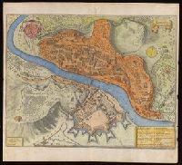
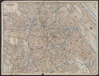
- Beinecke Rare Book and Manuscript Library > Wien, die welt-berühmte kayserl. resid. Stadt ... / Matth. Seutter ...
- Published / Created:
- 1848
- Call Number:
- 42 V67 1848
- Container / Volume:
- BRBL_00245
- Image Count:
- 1
- Resource Type:
- Maps, Atlases & Globes
- Subject (Geographic):
- Vienna (Austria)--Maps
- Found in:
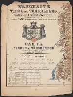
- Beinecke Rare Book and Manuscript Library > Wien und seine Umgebung / J. P. Segesser, autographiert.
- Published / Created:
- [ca. 1870]
- Call Number:
- 428 1870
- Container / Volume:
- BRBL_00248
- Image Count:
- 6
- Resource Type:
- Maps, Atlases & Globes
- Subject (Geographic):
- Tyrol (Austria)--Maps
- Found in:
- Beinecke Rare Book and Manuscript Library > Wandkarte von Tirol und Vorarlberg für Volks-und Mittel-Schulen = Carta del Tirolo e Vorarlberg ad uso di scuole popolari e medie / Gezeichnet von G.v. Kaler.
- Published / Created:
- 191-.
- Call Number:
- 11hcf 1919D-62
- Image Count:
- 1
- Resource Type:
- Maps, Atlases & Globes
- Subject (Geographic):
- Austria--Maps
- Found in:
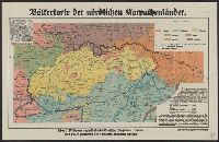
- Beinecke Rare Book and Manuscript Library > Völkerkarte der nördlichen karpathenländer.
- Published / Created:
- 1858
- Call Number:
- 41EF 1858
- Container / Volume:
- BRBL_00243
- Image Count:
- 1
- Resource Type:
- Maps, Atlases & Globes
- Subject (Geographic):
- Austria--Maps
- Found in:
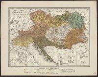
- Beinecke Rare Book and Manuscript Library > Völker-Karte der Oesterreichischen Monarchie / Gest. v. D. Biller.
- Creator:
- Kiepert, Heinrich, 1818-1899
- Published / Created:
- 1869
- Call Number:
- 41EF 1869
- Container / Volume:
- BRBL_00243
- Image Count:
- 1
- Resource Type:
- Maps, Atlases & Globes
- Subject (Geographic):
- Austria--Languages--Maps
- Subject (Topic):
- Ethnology--Austria--Maps
- Found in:
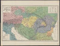
- Beinecke Rare Book and Manuscript Library > Völker- und Sprachen-Karte von Österreich und den Unter-Donau-Ländern [cartographic material] / zusammengestellt von H. Kiepert.
- Published / Created:
- 191-.
- Call Number:
- 11hcf 1919D-61
- Image Count:
- 1
- Resource Type:
- Maps, Atlases & Globes
- Subject (Geographic):
- Austria--Maps
- Found in:
- Beinecke Rare Book and Manuscript Library > Verteilung der Bevölkerung der Kärntens nach der Umgangssprache auf Grund der Volkszählung von 1910 (Ohne Militär) : Nach den Ortsgemeinden entworfen von Dr. Martin Wutte / Verlag des Geschichtsvereins für Kärnten.
- Published / Created:
- 1790
- Call Number:
- 427 K66 1790
- Container / Volume:
- BRBL_00246
- Image Count:
- 1
- Resource Type:
- Maps, Atlases & Globes
- Subject (Geographic):
- Carinthia (Austria)--Maps--Early works
- Found in:
- Beinecke Rare Book and Manuscript Library > Unterkaernten, oder der Klagenfurter Kreis / entworfen und gezeichnet von Joseph Karl Kindermann ; gestochen zu Wien von Christoph Junker.
- Published / Created:
- [1885]
- Call Number:
- 428 IN7 1885A
- Container / Volume:
- BRBL_00248
- Image Count:
- 2
- Resource Type:
- Maps, Atlases & Globes
- Subject (Geographic):
- Tyrol (Austria)--Maps
- Found in:
- Beinecke Rare Book and Manuscript Library > Umgebungskarte von Innsbruck.
- Published / Created:
- [1870?]
- Call Number:
- 424 L65 1872
- Container / Volume:
- BRBL_00245
- Image Count:
- 1
- Resource Type:
- Maps, Atlases & Globes
- Subject (Geographic):
- Upper Austria (Austria)--Maps
- Found in:
- Beinecke Rare Book and Manuscript Library > Umgebung von Linz : Nach einem von der Generalstabs-Abtheilung der k. k. III. Truppen-Division erhaltenen Originale, im k. k. militärisch geografischen Institut photolithographirt.
- Published / Created:
- [1915?]
- Call Number:
- 428 In7 1915
- Container / Volume:
- BRBL_00248
- Image Count:
- 1
- Resource Type:
- Maps, Atlases & Globes
- Subject (Geographic):
- Tyrol (Austria)--Maps
- Found in:
- Beinecke Rare Book and Manuscript Library > Umgebung von Innsbruck.
- Published / Created:
- [1885?]
- Call Number:
- 428 IN7 1885
- Container / Volume:
- BRBL_00248
- Image Count:
- 2
- Resource Type:
- Maps, Atlases & Globes
- Subject (Geographic):
- Tyrol (Austria)--Maps
- Found in:
- Beinecke Rare Book and Manuscript Library > Umgebung von Innsbruck, der Achen-See, das Ziller-thal und der Venediger Blatt VII / Rud. Maschek sen.
- Published / Created:
- [1887?]
- Call Number:
- 3627 1887
- Container / Volume:
- BRBL_00139
- Image Count:
- 2
- Resource Type:
- Maps, Atlases & Globes
- Subject (Geographic):
- Austria--Maps
- Found in:
- Beinecke Rare Book and Manuscript Library > Uebersichtskarte für kombinirbare Rundreisebillete / (zu J. Chr. Hacker's Fahrplan).
- Published / Created:
- [1875?]
- Call Number:
- 428 ST93 1895
- Container / Volume:
- BRBL_00249
- Image Count:
- 1
- Resource Type:
- Maps, Atlases & Globes
- Subject (Geographic):
- Stubay Alps (Austria)--Maps
- Found in:
- Beinecke Rare Book and Manuscript Library > Uebersichts-Karte Stubaier Gebirgs-Gruppe nach den neuesten Aufnahmen / gezeichnet von Leop. Pfaundler.
- Creator:
- Sonklar, Karl Albrecht Edler von Innstädten, 1816-1885
- Published / Created:
- 1861
- Call Number:
- 428 OT9 1861
- Container / Volume:
- BRBL_00249
- Image Count:
- 1
- Resource Type:
- Maps, Atlases & Globes
- Subject (Topic):
- Mountains--Austria--Maps
- Found in:
- Beinecke Rare Book and Manuscript Library > Uebersichts Karte des Oetzthaler Gletsher-Gebietes / von Karl Sonklar Edl. von Innstäden.
- Published / Created:
- 1892
- Call Number:
- 42 V67 1892
- Container / Volume:
- BRBL_00245
- Image Count:
- 1
- Resource Type:
- Maps, Atlases & Globes
- Subject (Geographic):
- Vienna (Austria)--Maps
- Found in:
- Beinecke Rare Book and Manuscript Library > Ubersichts-Plan der k.k. Reichshaupt und Residenzstadt Wien.
- Creator:
- Homann Erben (Firm)
Sperges, Joseph, Freiherr von, 1725-1791
- Published / Created:
- [ca. 1762?]
- Call Number:
- 1983 Folio 23
- Collection Title:
- [Atlas factice of 50 maps, primarily by Johann Baptist Homann and/or issued by the Homann Erben
- Image Count:
- 1
- Subject (Geographic):
- Tyrol (Austria) --Maps --Early works to
- Found in:
- Beinecke Rare Book and Manuscript Library > Tyrolis pars meridionalis cum Espicopatu Tridentino finitimisque vallibus et limitibus Venetis [cartographic material] / accurate descripta a Iosepho de Spergs in Palenz et Reisdorf
- Creator:
- Sperges, Joseph, Freiherr von, 1725-1791
- Published / Created:
- [ca. 1762?]
- Call Number:
- 4035 1762
- Container / Volume:
- BRBL_00234
- Image Count:
- 1
- Resource Type:
- Maps, Atlases & Globes
- Subject (Geographic):
- Tyrol (Austria)--Maps--Early works to
- Found in:
- Beinecke Rare Book and Manuscript Library > Tyrolis pars meridionalis cum Espicopatu Tridentino finitimisque vallibus et limitibus Venetis / accurate descripta a Iosepho de Spergs in Palenz et Reisdorf.
- Published / Created:
- [1674?]
- Call Number:
- 428 1674
- Container / Volume:
- BRBL_00247
- Image Count:
- 1
- Resource Type:
- Maps, Atlases & Globes
- Subject (Geographic):
- Tyrol (Austria)--Maps--Early works to
- Found in:
- Beinecke Rare Book and Manuscript Library > Tyrolis comitatus / Marthinus Gumpp.
- Published / Created:
- 191-.
- Call Number:
- 11hcf 1919D-23
- Container / Volume:
- BRBL_00010W
- Image Count:
- 1
- Resource Type:
- Maps, Atlases & Globes
- Subject (Geographic):
- Tyrol (Austria)--Maps
- Found in:
- Beinecke Rare Book and Manuscript Library > Tyrol.
- Published / Created:
- 191-.
- Call Number:
- 11hcf 1919D-2
- Container / Volume:
- BRBL_00010W
- Image Count:
- 1
- Resource Type:
- Maps, Atlases & Globes
- Subject (Geographic):
- Tyrol (Austria)--Maps
- Found in:
- Beinecke Rare Book and Manuscript Library > Tyrol.
- Published / Created:
- [1900?]
- Call Number:
- 3627 1900
- Image Count:
- 1
- Resource Type:
- Maps, Atlases & Globes
- Subject (Geographic):
- Salzburg (Austria)--Maps
- Found in:
- Beinecke Rare Book and Manuscript Library > Touristenkarte der Bayerischen Alpen mit Nordtyrol u. Salzburg.
- Published / Created:
- 1808
- Call Number:
- 42 V67 1808
- Container / Volume:
- BRBL_00244
- Image Count:
- 1
- Resource Type:
- Maps, Atlases & Globes
- Subject (Geographic):
- Vienna (Austria)--Maps
- Found in:
- Beinecke Rare Book and Manuscript Library > Topographische Karte der Gegenden um Wien ... / von Ludwig Schmidt ; gestochen von Joseph Gareis.
- Published / Created:
- [1840?]
- Call Number:
- 41hc 1840
- Container / Volume:
- BRBL_00706
- Image Count:
- 1
- Resource Type:
- Maps, Atlases & Globes
- Subject (Geographic):
- Austria--Maps, Manuscript
- Found in:
- Beinecke Rare Book and Manuscript Library > Théatre de la Guerre Dédié A.S.A.R. Monseigneule Duc D'Aoste. Par son tris humble tris obeissantet tris fidelle Servilees Lelhevgure Victor De Roubin, Italie.
- Published / Created:
- Undated
- Call Number:
- 1976 1233
- Collection Title:
- Twenty four new and accurate maps of the several parts of Europe ... : all (except the last) new
- Image Count:
- 1
- Subject (Geographic):
- Austria --Maps --Early works to 1800
- Found in:
- Beinecke Rare Book and Manuscript Library > The south east part of Germany containing ye dominions of ye dutchy & elec. of Bavaria, the dutchy of Newburg, archbishop: of Saltzburg, and ye estates of Austria, viz Bohemia, Moravia, Austria, Styria, Carinthia, Carniola, the bishopricks of Brixen, Tren
- Creator:
- United States. Office of Strategic Services. Research and Analysis Branch
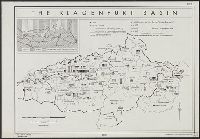
- Published / Created:
- 1944
- Call Number:
- 42ed K66 1944
- Container / Volume:
- BRBL_00245
- Image Count:
- 1
- Resource Type:
- Maps, Atlases & Globes
- Subject (Geographic):
- Carinthia (Austria)--Languages--Maps
- Subject (Topic):
- Slovenes--Austria--Carinthia--Maps
- Found in:
- Beinecke Rare Book and Manuscript Library > The Klagenfurt Basin [cartographic material].
- Published / Created:
- 1896
- Call Number:
- 41hc 1896
- Container / Volume:
- BRBL_00243
- Image Count:
- 1
- Resource Type:
- Maps, Atlases & Globes
- Subject (Geographic):
- Austria--Maps
- Found in:
- Beinecke Rare Book and Manuscript Library > The Austro-Hungarian Maneuvers : September, 1896 / C.H. Ourand.
- Creator:
- Blaeu, Willem Janszoon, 1571-1638
- Published / Created:
- [ca. 1634]
- Call Number:
- 1983 Folio 19
- Collection Title:
- [Atlas factice of 96 maps by Blaeu, Visscher, Jansson, Hondius and others]
- Image Count:
- 1
- Subject (Geographic):
- Styria (Austria) --Maps --Early works
- Found in:
- Beinecke Rare Book and Manuscript Library > Stiria = Steyrmarck
- Published / Created:
- 1625?]
- Call Number:
- 426 1625
- Container / Volume:
- BRBL_00246
- Image Count:
- 2
- Resource Type:
- Maps, Atlases & Globes
- Subject (Geographic):
- Styria (Austria)--Maps--Early works to
- Found in:
- Beinecke Rare Book and Manuscript Library > Stiria / per Gerardum Mercatorem ...
- Creator:
- Held, F
- Published / Created:
- 1887
- Call Number:
- 41EF 1887
- Container / Volume:
- BRBL_00243
- Image Count:
- 1
- Resource Type:
- Maps, Atlases & Globes
- Subject (Geographic):
- Austria--Languages--Maps
- Found in:
- Beinecke Rare Book and Manuscript Library > Sprachen-Karte der westlichen Kronländer von Oesterreich [cartographic material] : nach dem Zensus von 1880 / entworfen von F. Held.
- Published / Created:
- 1883
- Call Number:
- 425 V55 1883
- Container / Volume:
- BRBL_00246
- Image Count:
- 1
- Resource Type:
- Maps, Atlases & Globes
- Subject (Geographic):
- Venediger Mountains (Austria)--Maps
- Found in:
- Beinecke Rare Book and Manuscript Library > Special-Karte der Venediger-Gruppe.
- Published / Created:
- 1890
- Call Number:
- 41 G51 1890
- Container / Volume:
- BRBL_00242
- Image Count:
- 1
- Resource Type:
- Maps, Atlases & Globes
- Subject (Geographic):
- Alps, Austrian (Austria)--Maps
- Found in:
- Beinecke Rare Book and Manuscript Library > Special Karte der Gross-Glockner-Gruppe.
- Published / Created:
- 1913
- Call Number:
- 11hcf 1919-17
- Container / Volume:
- BRBL_00010J
- Image Count:
- 1
- Resource Type:
- Maps, Atlases & Globes
- Subject (Geographic):
- Austria--Maps
- Found in:
- Beinecke Rare Book and Manuscript Library > Schulhandkarte des Herzogtums Steiermark / Berbeitet von Hans Trunk.
- Published / Created:
- 1913
- Call Number:
- 11hcf 1919-16
- Container / Volume:
- BRBL_00010J
- Image Count:
- 1
- Resource Type:
- Maps, Atlases & Globes
- Subject (Geographic):
- Austria--Maps
- Found in:
- Beinecke Rare Book and Manuscript Library > Schulhandkarte des Herzogtums Steiermark / Berbeitet von Hans Trunk.
- Published / Created:
- 1915
- Call Number:
- 11hcf 1919A-17
- Container / Volume:
- BRBL_00010M
- Image Count:
- 1
- Resource Type:
- Maps, Atlases & Globes
- Subject (Geographic):
- Austria--Maps
- Found in:
- Beinecke Rare Book and Manuscript Library > Schulhandkarte des Herzogtums Kärnten / Berbeitet von Franz P.E.H.R.
- Published / Created:
- 1915
- Call Number:
- 11hcf 1919-5
- Container / Volume:
- BRBL_00010L
- Image Count:
- 1
- Resource Type:
- Maps, Atlases & Globes
- Subject (Geographic):
- Austria--Maps
- Found in:
- Beinecke Rare Book and Manuscript Library > Schulhandkarte des Herzogtums Kärnten / Berbeitet von Franz P.E.H.R.
- Creator:
- Woerl, Joseph Edmund
- Call Number:
- 42 1830
- Container / Volume:
- BRBL_00244
- Image Count:
- 1
- Resource Type:
- Maps, Atlases & Globes
- Subject (Geographic):
- Carinthia (Austria)--Maps
- Found in:
- Beinecke Rare Book and Manuscript Library > Salzburg.
- Creator:
- Merian, Matthaeus, 1593-1650, creator.
- Published / Created:
- [1644?]
- Call Number:
- BrSides Folio 2017 28
- Image Count:
- 1
- Resource Type:
- Maps, Atlases & Globes
- Subject (Geographic):
- Salzburg (Austria)--Maps--Early works
- Found in:
- Beinecke Rare Book and Manuscript Library > Saltzburg.
- Creator:
- Merian, Matthaeus, 1593-1650, creator.
- Published / Created:
- [1644?]
- Call Number:
- BrSides Folio 2017 27
- Image Count:
- 1
- Resource Type:
- Maps, Atlases & Globes
- Subject (Geographic):
- Salzburg (Austria)--Maps--Early works
- Found in:
- Beinecke Rare Book and Manuscript Library > Saltzburg.
- Creator:
- Mercator, Gerhard, 1512-1594
- Published / Created:
- [1635]
- Call Number:
- 425 1640A
- Container / Volume:
- BRBL_00246
- Image Count:
- 2
- Resource Type:
- Maps, Atlases & Globes
- Subject (Geographic):
- Salzburg (Austria : Land)--Maps--Early
- Found in:
- Beinecke Rare Book and Manuscript Library > Saltzburg archiepiscopatus, et Carinthia ducatus / [cartographic material] / auctore Ger. Mercatore.
- Creator:
- Mercator, Gerhard, 1512-1594
- Published / Created:
- [ca. 1652?]
- Call Number:
- 425 1640
- Container / Volume:
- BRBL_00246
- Image Count:
- 2
- Resource Type:
- Maps, Atlases & Globes
- Subject (Geographic):
- Salzburg (Austria : Land)--Maps--Early
- Found in:
- Beinecke Rare Book and Manuscript Library > Saltzburg archiepiscopatus et Carinthia ducatus / auctore Ger. Mercatore.
- Creator:
- Mercator, Gerhard, 1512-1594
- Published / Created:
- [ca. 1634]
- Call Number:
- 1983 Folio 19
- Collection Title:
- [Atlas factice of 96 maps by Blaeu, Visscher, Jansson, Hondius and others]
- Image Count:
- 2
- Subject (Geographic):
- Salzburg (Austria : Land) --Maps
- Found in:
- Beinecke Rare Book and Manuscript Library > Saltzburg archiepiscopatus et Carinthia ducatus / auct. Ger. Mercatore
- Creator:
- Mercator, Gerhard, 1512-1594
- Published / Created:
- 1627 [i.e. 1636]
- Call Number:
- 425 1627
- Container / Volume:
- BRBL_00246
- Image Count:
- 2
- Resource Type:
- Maps, Atlases & Globes
- Subject (Geographic):
- Salzburg (Austria : Land)--Maps--Early
- Found in:
- Beinecke Rare Book and Manuscript Library > Saltzburg archiepiscopatus cum ducatu Carinthiae / [cartographic material] / per Gerardum Mercatorem ...
- Creator:
- Homann Erben (Firm)
Mayer, Tobias, 1723-1762
- Published / Created:
- 1747
- Call Number:
- 1975 Folio 31
- Collection Title:
- [Atlas factice of 42 maps, produced by the Homann Erben firm]
- Image Count:
- 1
- Subject (Geographic):
- Austria --Maps --Early works to 1800
- Found in:
- Beinecke Rare Book and Manuscript Library > S.R.I. circulus Austriacus [cartographic material] : quem componunt archid. Austriae, ducatus Stiriae, Carinthiae, Carnioliae, comit. Tyrolensis, ditionesque Sueviae austriacae, cum suis confiniis / a Tobia Majero ; curantibus Homannianis Heridibus, C.P.S
- Creator:
- Homann Erben (Firm)
Mayer, Tobias, 1723-1762
- Published / Created:
- 1747
- Call Number:
- 1983 Folio 23
- Collection Title:
- [Atlas factice of 50 maps, primarily by Johann Baptist Homann and/or issued by the Homann Erben
- Image Count:
- 1
- Subject (Geographic):
- Austria --Maps --Early works to 1800
- Found in:
- Beinecke Rare Book and Manuscript Library > S.R.I. circulus Austriacus [cartographic material] : quem componunt archid. Austriae, ducatus Stiriae, Carinthiae, Carnioliae, comit. Tyrolensis, ditionesque Sueviae austriacae, cum suis confiniis / a Tobia Majero ; curantibus Homannianis Heridibus = Le C
- Published / Created:
- [1724?]
- Call Number:
- 425 1724
- Container / Volume:
- BRBL_00246
- Image Count:
- 1
- Resource Type:
- Maps, Atlases & Globes
- Subject (Geographic):
- Salzburg (Austria : Land)--Maps--Early
- Found in:
- Beinecke Rare Book and Manuscript Library > S.R.I principatus archiepiscopatus Salisburgensis ... / Ioh. Bapt. Homann.
- Published / Created:
- 1918
- Call Number:
- 428gm 1918
- Container / Volume:
- BRBL_00249
- Image Count:
- 1
- Resource Type:
- Maps, Atlases & Globes
- Subject (Geographic):
- Tyrol (Austria)--Maps
- Found in:
- Beinecke Rare Book and Manuscript Library > Route map of Tirol, Vorarlberg and Liechtenstein giving distances.
- Published / Created:
- [1653?]
- Call Number:
- 41 1653
- Container / Volume:
- BRBL_00241
- Image Count:
- 2
- Resource Type:
- Maps, Atlases & Globes
- Subject (Geographic):
- Austria--Maps--Early works to 1800
- Found in:
- Beinecke Rare Book and Manuscript Library > Rhetiæ alpestris descriptio, in qua hodie Tirolis comitatus ... ex tabula Wolfgangi Lazij ... / Joan Maior Viennensis edidit.
- Published / Created:
- [1890?]
- Call Number:
- 425 1890
- Container / Volume:
- BRBL_00246
- Image Count:
- 1
- Resource Type:
- Maps, Atlases & Globes
- Subject (Geographic):
- Austria--Maps
- Found in:
- Beinecke Rare Book and Manuscript Library > Reise und Wanderkarte fürdas Salzkammergut, Salzburg u. Ost-Tirol, mit Angabe der Hauptanstiegsrichtungen aller häufig bestiegenen Bergspitzen / G. Freytag & H. Hess.
- Published / Created:
- 1783
- Call Number:
- 429 1783
- Container / Volume:
- BRBL_00249
- Image Count:
- 3
- Resource Type:
- Maps, Atlases & Globes
- Subject (Geographic):
- Vorarlberg (Austria)--Maps--Early works
- Found in:
- Beinecke Rare Book and Manuscript Library > Provincia Arlbergica ... / per Joannem Antonium Pfaundler.
- Published / Created:
- [1915?]
- Call Number:
- 428cbf 1915
- Container / Volume:
- BRBL_00249
- Image Count:
- 1
- Resource Type:
- Maps, Atlases & Globes
- Subject (Geographic):
- Tyrol (Austria)--Maps
- Found in:
- Beinecke Rare Book and Manuscript Library > Plastische Karte des Alpenland Tirol nebst angrenzenden Gebieten als Beilage zum "Tiroler Verkehrs- u. Hotelbuche" des Dr. v. Zimmeter in Innsbruck.
- Creator:
- Swetz, Wenzel
- Published / Created:
- [1810?]
- Call Number:
- BrSides Folio 2018 144
- Image Count:
- 1
- Resource Type:
- Maps, Atlases & Globes
- Subject (Geographic):
- Bruck an der Leitha (Austria)--Maps.
- Found in:
- Beinecke Rare Book and Manuscript Library > Plan von den hochfreyherrlich Sardagnaschen Obst-Zier- und Kuchelgarten zu Leopoldsdorf / aufgenommen und gezeichnet von Wenzel Swetz, geprüfter Geometer.
- Published / Created:
- [1910?]
- Call Number:
- 42 V67 1910B
- Container / Volume:
- BRBL_00245
- Image Count:
- 1
- Resource Type:
- Maps, Atlases & Globes
- Subject (Geographic):
- Vienna (Austria)--Maps
- Found in:
- Beinecke Rare Book and Manuscript Library > Plan of Vienna.
- Published / Created:
- [1930?]
- Call Number:
- 42 Sa39 1900
- Container / Volume:
- BRBL_00244
- Image Count:
- 1
- Resource Type:
- Maps, Atlases & Globes
- Subject (Geographic):
- Salzburg (Austria)--Maps
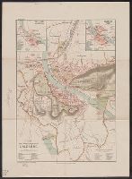
- Found in:
- Beinecke Rare Book and Manuscript Library > Plan der Landeshauptstadt Salzburg / Bearbeitet von K. Adrian u. J.G. Rothaug.
- Published / Created:
- 1802
- Call Number:
- 42 V67 1802
- Container / Volume:
- BRBL_00244
- Image Count:
- 1
- Resource Type:
- Maps, Atlases & Globes
- Subject (Geographic):
- Vienna (Austria)--Maps
- Found in:
- Beinecke Rare Book and Manuscript Library > Plan der K.K. Haupt u. Residenz Stadt Wien, mit allen Vorstadten / gezeichnet von Max V. Grim in Kupfer ; gestochen von L. Renard.
- Published / Created:
- [ca. 1900]
- Call Number:
- 42 V67 1900
- Container / Volume:
- BRBL_00245
- Image Count:
- 1
- Resource Type:
- Maps, Atlases & Globes
- Subject (Geographic):
- Vienna (Austria)--Maps
- Found in:
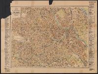
- Beinecke Rare Book and Manuscript Library > Plan der Bundeshauptstadt Wien : nach den besten verlässlichsten Quellen bearbeitet.
- Creator:
- Sanson, Nicolas, 1600-1667
- Published / Created:
- 1692
- Call Number:
- 42 V67 1692
- Container / Volume:
- BRBL_00244
- Image Count:
- 1
- Resource Type:
- Maps, Atlases & Globes
- Subject (Geographic):
- Vienna (Austria)--Maps--Early works to
- Found in:
- Beinecke Rare Book and Manuscript Library > Plan de la ville de Vienne en Austriche et ses environs [cartographic material].
- Published / Created:
- 1750?]
- Call Number:
- 41 1750
- Container / Volume:
- BRBL_00241
- Image Count:
- 1
- Resource Type:
- Maps, Atlases & Globes
- Subject (Geographic):
- Austria--Maps--Early works to 1800
- Found in:
- Beinecke Rare Book and Manuscript Library > Partie meridionale du cercle d'Autriche ... / par le Sr. Robert de Vaugondy fils ; gravé par Delahaye l'ainé.
- Creator:
- Sanson, Guillaume
- Published / Created:
- 1709
- Call Number:
- 41 1709
- Container / Volume:
- BRBL_00241
- Image Count:
- 1
- Resource Type:
- Maps, Atlases & Globes
- Subject (Geographic):
- Austria--Maps--Early works to 1800
- Found in:
- Beinecke Rare Book and Manuscript Library > Partie du cercle d'Austriche, ou sont les duchés de Stirie, de Carinthie, de Carniole, et autres estats hereditaires à la Maison d'Austriche [cartographic material] / par le Sr. Sanson ... ; Cordier, sculpsit.
- Creator:
- Berry, William, fl. 1669-1708, creator
Sanson, Nicolas, 1600-1667
- Published / Created:
- [ca. 1686]
- Call Number:
- 1973 Folio 10
- Image Count:
- 1
- Resource Type:
- Maps, Atlases & Globes
- Subject (Geographic):
- Austria --Maps --Early works to 1800
- Found in:
- Beinecke Rare Book and Manuscript Library > Part of the circle of Austria viz the Archdukedom of Austria, divided into the higher and lower
- Creator:
- Berry, William, fl. 1669-1708, creator
Sanson, Nicolas, 1600-1667
- Published / Created:
- 1688
- Call Number:
- 1973 Folio 10
- Image Count:
- 1
- Resource Type:
- Maps, Atlases & Globes
- Subject (Geographic):
- Austria --Maps --Early works to 1800
- Found in:
- Beinecke Rare Book and Manuscript Library > Part of the circle of Austria in which are the Dukedomes of Stiria, and Carinthia, of Carniola, and other heriditary countrys of the house of Austria
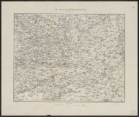
- Creator:
- United States. Office of Strategic Services. Research and Analysis Branch
- Published / Created:
- 1945
- Call Number:
- 36hc 1945
- Container / Volume:
- BRBL_00134
- Image Count:
- 1
- Resource Type:
- Maps, Atlases & Globes
- Subject (Topic):
- Prisoners of war--Austria--Maps
- Found in:
- Beinecke Rare Book and Manuscript Library > P.W. installations in Germany and Austria : prisoners from the armies of the United States, France, Great Britain and the dominions (February 1, 1945).
- Published / Created:
- [1890?]
- Call Number:
- 41 AL74 1890
- Container / Volume:
- BRBL_00242
- Image Count:
- 1
- Resource Type:
- Maps, Atlases & Globes
- Subject (Geographic):
- Alps, Austrian (Austria)--Maps
- Found in:
- Beinecke Rare Book and Manuscript Library > Österreichische Alpenländer.
- Published / Created:
- 1890-1891.
- Call Number:
- 41 1891
- Container / Volume:
- BRBL_00241
- Image Count:
- 2
- Resource Type:
- Maps, Atlases & Globes
- Subject (Geographic):
- Austria--Maps
- Found in:
- Beinecke Rare Book and Manuscript Library > Österreich-Ungarn in 4 Blättern / von C. Vogel.
- Published / Created:
- 1913
- Call Number:
- 428 Ot9 1913
- Container / Volume:
- BRBL_00249
- Image Count:
- 4
- Resource Type:
- Maps, Atlases & Globes
- Subject (Geographic):
- Stubay Alps (Austria)--Maps
- Found in:
- Beinecke Rare Book and Manuscript Library > Oetzthal & Stubai.
- Creator:
- Freytag, Gustav, 1816-1895
- Published / Created:
- 1892
- Call Number:
- 41FCB 1892
- Container / Volume:
- BRBL_00243
- Image Count:
- 2
- Resource Type:
- Maps, Atlases & Globes
- Subject (Geographic):
- Austria--Maps
- Found in:
- Beinecke Rare Book and Manuscript Library > Oesterreichisch-ungarische Reichsraths-Wahlkarte mit den Reichsraths-Wahlen Oesterreichs für die Jahre 1885-1891 und Ungarns für die Jahre 1887-1892 / Entworfen von Béla Grafen Kreith.
- Published / Created:
- 1791
- Call Number:
- 427 V71 1791
- Container / Volume:
- BRBL_00246
- Image Count:
- 1
- Resource Type:
- Maps, Atlases & Globes
- Subject (Geographic):
- Carinthia (Austria)--Maps--Early works
- Found in:
- Beinecke Rare Book and Manuscript Library > Oberkaernten, oder der Villacher Kreis / entworfen und gezeichnet von Joseph Karl Kindermann ; gestochen zu Wien von Christoph Junker.
- Creator:
- Homann, Johann Baptist, 1663-1724
- Published / Created:
- [ca. 1715]
- Call Number:
- 1983 Folio 23
- Collection Title:
- [Atlas factice of 50 maps, primarily by Johann Baptist Homann and/or issued by the Homann Erben
- Image Count:
- 1
- Subject (Geographic):
- Carinthia (Austria) --Maps --Early
- Found in:
- Beinecke Rare Book and Manuscript Library > Nova et accurata Carinthiae Ducatus tabula geographica [cartographic material] : in superiorem et inferiorem divisa, cum insertis partibus, Archiepiscopatui Salisburgensi propriis nec non dynastiis aliquot, quae tempore S. Henrici Imperiatoris circa A. 10
- Published / Created:
- 1914
- Call Number:
- 428cbf 1914
- Container / Volume:
- BRBL_00249
- Image Count:
- 2
- Resource Type:
- Maps, Atlases & Globes
- Subject (Geographic):
- Tyrol (Austria)--Maps
- Found in:
- Beinecke Rare Book and Manuscript Library > Nordosttirol / Geograph. artist. Anst. Kümmerly & Frey, Bern.
- Published / Created:
- [1910?]
- Call Number:
- 3627 1910
- Container / Volume:
- BRBL_00139
- Image Count:
- 1
- Resource Type:
- Maps, Atlases & Globes
- Subject (Geographic):
- Tyrol (Austria)--Maps
- Found in:
- Beinecke Rare Book and Manuscript Library > No. 1 Strassen-Karte München-Bozen mit Strassen-Profil : Gratisgabgabe des Deutschen Touring-Club, München, a. V. seine Mitglieder / Entwurf & Ausführung de Lithogr.-karthogr. Anstalt v. Hubert Köhler, München.
- Published / Created:
- [1865?]
- Call Number:
- 423 1865
- Container / Volume:
- BRBL_00245
- Image Count:
- 1
- Resource Type:
- Maps, Atlases & Globes
- Subject (Geographic):
- Austria--Maps
- Found in:
- Beinecke Rare Book and Manuscript Library > Nieder und Ober-Oesterreich oder das Erzherzogthum Oesterreich unter & ob der Enns und das Herzogthum Salzburg / Bearbeitet von C. Gräf.
- Published / Created:
- 1852
- Call Number:
- 42 V67 1852
- Container / Volume:
- BRBL_00245
- Image Count:
- 1
- Resource Type:
- Maps, Atlases & Globes
- Subject (Geographic):
- Vienna (Austria)--Maps
- Found in:
- Beinecke Rare Book and Manuscript Library > Neuester Plan von Wien und seinen Vorstädten / gestochen v. Domik. Biller.
- Published / Created:
- 1872
- Call Number:
- 42 V67 1872
- Container / Volume:
- BRBL_00245
- Image Count:
- 2
- Resource Type:
- Maps, Atlases & Globes
- Subject (Geographic):
- Vienna (Austria)--Maps
- Found in:
- Beinecke Rare Book and Manuscript Library > Neuester Plan von Wien nach der neuen Bezirkseintheilung und neuen Benennung des Strassen und Plätze.
- Published / Created:
- [1884?]
- Call Number:
- 42 G79 1884
- Container / Volume:
- BRBL_00244
- Image Count:
- 1
- Resource Type:
- Maps, Atlases & Globes
- Subject (Geographic):
- Graz (Austria)--Maps
- Found in:
- Beinecke Rare Book and Manuscript Library > Neuester Plan von Graz / Lith von Albert Fraiss.
- Published / Created:
- 1849
- Call Number:
- 41EF 1849
- Container / Volume:
- BRBL_00243
- Image Count:
- 1
- Resource Type:
- Maps, Atlases & Globes
- Subject (Geographic):
- Austria--Maps
- Found in:
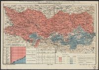
- Beinecke Rare Book and Manuscript Library > Neueste National und Sprachenkarte des oesterreichischen Kaiserstaates und der angrenzenden Theile ... / gest. von Fr. Reisser.
- Published / Created:
- 1805
- Call Number:
- 41 1805
- Container / Volume:
- BRBL_00241
- Image Count:
- 4
- Resource Type:
- Maps, Atlases & Globes
- Subject (Geographic):
- Austria--Maps
- Found in:
- Beinecke Rare Book and Manuscript Library > Mappa novissima regnorum Hungariae, Croatiae, Sclavoniae ... / F. Muller, sculpsit.
- Creator:
- Pope-Hennessy, Una, 1876-1949
- Published / Created:
- [1917]
- Call Number:
- 11hc 1919Y
- Image Count:
- 2
- Resource Type:
- Maps, Atlases & Globes
- Subject (Geographic):
- Austria--Maps
- Found in:
- Beinecke Rare Book and Manuscript Library > Map of the main prison camps in Germany and Austria / by Mrs Pope-Hennessy.
- Creator:
- Willmer & Rogers News Company
- Published / Created:
- [1854]
- Call Number:
- 53hc 1878
- Container / Volume:
- BRBL_00287
- Image Count:
- 1
- Resource Type:
- Maps, Atlases & Globes
- Subject (Geographic):
- Austria--Maps
- Found in:
- Beinecke Rare Book and Manuscript Library > Map of the frontier provinces of Turkey, Russia & Austria, the Black Sea, & c [cartographic material] / Lith. by Bevan & Boell, 163 Broadway N.Y.
- Creator:
- Willmer & Rogers News Company
- Published / Created:
- [1854]
- Call Number:
- 491 1853A
- Container / Volume:
- BRBL_00269
- Image Count:
- 2
- Resource Type:
- Maps, Atlases & Globes
- Subject (Geographic):
- Austria--Maps
- Found in:
- Beinecke Rare Book and Manuscript Library > Map of the frontier provinces of Turkey, Russia & Austria, the Black Sea, & c [cartographic material] / Lith. by Bevan & Boell, 163 Broadway N.Y.
- Creator:
- Delarochette, L. (Louis), 1731-1802
Kitchin, Thomas, 1718-1784. New universal atlas. 1804
Laurie & Whittle
- Call Number:
- 36 1794B
- Container / Volume:
- BRBL_00119
- Image Count:
- 2
- Resource Type:
- Maps, Atlases & Globes
- Subject (Geographic):
- Austria--Maps--Early works to 1800
- Found in:
- Beinecke Rare Book and Manuscript Library > Map of the Empire of Germany : including all the states comprehended under that name: with the Kingdom of Prussia, &c. / by L. Delarochette ; T. Kitchin sculpt.
- Published / Created:
- 191-.
- Call Number:
- 11hcf 1919-39
- Container / Volume:
- BRBL_00010L
- Image Count:
- 1
- Resource Type:
- Maps, Atlases & Globes
- Subject (Geographic):
- Austria--Maps
- Found in:
- Beinecke Rare Book and Manuscript Library > Linguistic map of the Austro-Hungarian Monarchy.
- Published / Created:
- 1919
- Call Number:
- 11hcf 1919-38
- Container / Volume:
- BRBL_00010L
- Image Count:
- 1
- Resource Type:
- Maps, Atlases & Globes
- Subject (Geographic):
- Austria--Maps
- Found in:
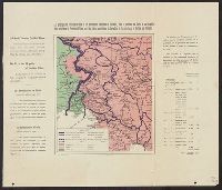
- Beinecke Rare Book and Manuscript Library > Les principes du président Wilson et les aspirations Italiennes en Carinthie, dans la province de Goritz et en Carniole = The principles of president Wilson and the Italian aspirations in Carinthia, in the provinces of Gorice and Carniola / Lith. L. Wuhr
- Published / Created:
- 1919
- Call Number:
- 11hc 1920Z
- Container / Volume:
- BRBL_00010I
- Image Count:
- 1
- Resource Type:
- Maps, Atlases & Globes
- Subject (Geographic):
- Austria--Maps
- Found in:
- Beinecke Rare Book and Manuscript Library > Les principes du président Wilson et les aspirations Italiennes en Carinthie, dans la province de Goritz et en Carniole = The principles of president Wilson and the Italian aspirations in Carinthia, in the provinces of Gorice and Carniola / Lith. L. Wuhr
- Published / Created:
- 1663
- Call Number:
- 41 1663
- Container / Volume:
- BRBL_00241
- Image Count:
- 1
- Resource Type:
- Maps, Atlases & Globes
- Subject (Geographic):
- Austria--Maps--Early works to 1800
- Found in:
- Beinecke Rare Book and Manuscript Library > Les confins des Chrestiens et des Turcs en terre ferme, c'est a dire la Hongrie, l'Esclavonie, la Croatie et la Dalmatie / par P. Du Val ...
- Published / Created:
- 1744?]
- Call Number:
- 41 1744
- Container / Volume:
- BRBL_00241
- Image Count:
- 1
- Resource Type:
- Maps, Atlases & Globes
- Subject (Geographic):
- Austria--Maps--Early works to 1800
- Found in:
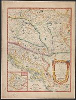
- Beinecke Rare Book and Manuscript Library > Le royaume de Boheme, le duché de Silisie et les marquisats de Moravie et Lusace ... / par le Sr. Robert ...
- Creator:
- Jaillot, Alexis Hubert, 1632?-1712
- Published / Created:
- 1707
- Call Number:
- 428 1707
- Container / Volume:
- BRBL_00247
- Image Count:
- 1
- Resource Type:
- Maps, Atlases & Globes
- Subject (Geographic):
- Tyrol (Austria)--Maps--Early works to
- Found in:
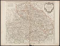
- Beinecke Rare Book and Manuscript Library > Le comté de Tirol, les eveschés de Trente et de Brixen, &c [cartographic material] / dedié au Roy ... A. Hubert Iaillot ... ; Cordier, sculpsit.
- Published / Created:
- 1778?]
- Call Number:
- 428 1778
- Container / Volume:
- BRBL_00247
- Image Count:
- 1
- Resource Type:
- Maps, Atlases & Globes
- Subject (Geographic):
- Tyrol (Austria)--Maps--Early works to
- Found in:
- Beinecke Rare Book and Manuscript Library > Le Tyrol sous le nom duquel l'on comprend le comté de Tyrol ... / par le Sr. Robert, geographe ; gravé par Delahaye l'ainé.
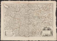
- Call Number:
- 4035 1830
- Container / Volume:
- BRBL_00234
- Image Count:
- 1
- Resource Type:
- Maps, Atlases & Globes
- Subject (Geographic):
- Tyrol (Austria)--Maps
- Found in:
- Beinecke Rare Book and Manuscript Library > Karte von der gefürsteten Grafschaft Tyrol : nach der neuesten und bewaehrtesten Hülfsmitteln entworfen.