Skip to search
Skip to main content
Skip to first result
Yale University Library
Ask Yale Library
Reserve Rooms
Places to Study
Research
Quicksearch
Search Library Catalog (Orbis)
Search Law Library Catalog (MORRIS)
Search Borrow Direct
Search WorldCat
Search Articles+
Search Digital Collections
Search Archives at Yale
Research Guides
Find Databases by Title
Find eJournals by Title
Guide to Using Special Collections
Services
Your Personal Librarian
Subject Specialists
Research Support and Workshops
Citation Tools
OverDrive: Popular Audio and eBooks
Get It @ Yale (Borrow Direct, Interlibrary Loan, Scan & Deliver)
Course Reserves
Off-Campus Access
EliScholar
OverDrive: Popular Audio and eBooks
Bass Media Equipment
Libraries & Collections
Arts Library
Bass Library
Beinecke Library
Classics Library
Divinity Library
Film Study Center
Fortunoff Archive
Humanities Collections
International Collections
Law Library
Lewis Walpole Library
Library Collection Services
Manuscripts & Archives
Map Collection
Marx Science & Social Science Library
Medical Library
Music Library
Sterling Library
Yale Center for British Art
Information & Policies
Library Hours
Departments & Staff
Borrowing & Circulation
Services for Persons with Disabilities
Copyright Basics
Scanning, Printing & Copying
Computers & Wireless
Library Policies
About the Library
Giving to the Library
Purchase Request
Working at the Library
Terms Governing Use of Materials
Search in
All Fields
Creator
Title
Call Number
Date
Subject
Orbis ID
Full Text
Description
Full text
search for
Search
Search
Advanced Search
Digital Collections
Search
You Searched For
"North America--Maps"
New Search
« Previous
|
1
-
100
of
409
|
Next »
Sort
by relevance
relevance
Creator (A --> Z)
Creator (Z --> A)
Title (A --> Z)
Title (Z --> A)
Year (ascending)
Year (descending)
Number of results to display per page
100
per page
9
per page
30
per page
60
per page
99
per page
View results as:
List
List
Gallery
Gallery
Search Results
Map of America / by A. Arrowsmith ; engraved by W. West, the hills by H. Wilson.
Carte géologique de l'Amérique du nord / dressée d'apres les sources officielles des Etats Unis
North America / engraved by Sidney Hall.
Indian territory with part of the adjoining state of Kansas &c. / Engineer Bureau War Dept
Map of the Indian tribes of North America, about 1600 A.D. along the Atlantic, & about 1800 A.D
The Southwest / produced by the Cartographic Division, National Geographic Society ; John B. Garver
[Map of Indian tribes of North America].
Linguistic stocks of American Indians north of Mexico / by J.W. Powell.
Carte des possessions Françoises et Angloises dans le Canada, et partie de la Louisiane / L
Carte des possessions angloises & françoises du continent de l'Amérique septentrionale / par I
Carte du Canada et de la Louisiane qui forment la Nouvelle France et des colonies Angloises ou sont
The British & French dominions in North America : particularly shewing the French encroachments
A map exhibiting all the new discoveries in the interior parts of North America : inscribed by
America septentrionalis : concinnata juxta observationes D[omi]n[o] n[ostro] Academiae Regalis
Carte de l'Amerique Septentrionale / par Delamarche.
Carte de la Nouvelle France : et de la Louisiane nouvellement decouverte dediee au roy l'an 1683
Carte encyprotype de l'Amerique Septentrionale : dediée et preśentée à Monsieur- / par H. Brué
Carte physique et politique de L'Amerique Septentrionale / par L. Dussieux, 1865.
Carte physique et politique de l'Amérique Septentrionale / par A.H. Brué, géographe du Roi.
Carte physique et politique de l'Amérique septentrionale / par A.H. Brué, géographe de S.A.R
Charte von NordAmerica / entworfen und gezeichnet von C.G. Reichard.
Charte von Nordamerica : nach den neuesten Entdeckungen und zuverläfsigsten astronomischen
Johnson's North America / by Johnson and Ward.
Map
of
North
America
/ by J. Calvin Smith.
Map
of
North
America
/ by J. Calvin Smith.
Map
of
North
America
/ by J. Calvin Smith.
Map
of
North
America
: exhibiting the recent discoveries, geographical & nautical / by James Wyld
Map
of
North
America
: exhibiting the recent discoveries, geographical and nautical; drawn chiefly
Map
of
North
America
: exhibiting the recent discoveries, geographical and nautical; drawn chiefly
Map
of
North
America
: reduced from map on scale of 1:5,000,000 / compiled by the U.S. Geological
Map of the Northern Pacific Railway and tributary country.
Map of the United States of America, the British provinces, Mexico, the West Indies, and Central
Map of the United States, Canada, Mexico, Central America, and the West India Islands : with a
Nord America / entworfen u. gezeichnet von F. v. St. 1832 ; L. Thiel sc.
Nord America / entworfen und gezeichnet von C.F. Weiland ; Gest. v. C. Jungmann, W. 30.
North America / E. Bourne sculp.
North America / N.R. Hewitt, sc.
North America.
North American atlas
Nouvelle carte illustrée de l'Amérique du nord : indiquant les grandes divisions physiques, la
Oro-und hydrographische Karte v. Nordamerica.
The British possessions in North America and the United States with the Hudson's Bay territories
["The Ambassadors" globe]
[
Map
of
North
America
]
Partie occidentale du Canada, ou de la Nouvelle France : ou sont les nations des Ilinois, de Tracy
A new and accurate map of the British dominions in America, according to the Treaty of 1763
Intercontinental railway map : prepared under the direction of the permanent Pan American Railway
Diagram of the United States of America, Mexico, the West India Islands and Isthmus of Darien
British dominions in America : drawn from the latest and best authorities / by Thos. Kitchin
[Map of Louisiana and the western parts of Virginia and Carolina] / [cartographic material] / J
Colton's map of the states and territories west of the Mississippi River to the Pacific Ocean
Map showing Indian reservations within the limits of the United States, 1909 / [Department of the
[An untitled manuscript map in French depicting the Mississippi River valley from the Gulf of
A
Map
of
North
America
, Constructed According to the Latest Information by H. S. Tanner
A map exhibiting all the new discoveries in the interior parts of North America [cartographic
Index chart of the northern and northwestern lakes : compiled from the data of the U.S. Survey and
Map showing the several lines of R.R. : leading from the Lakes to the MIssissippi River together
Nouvelle carte de l'Amérique septentrionale, du Groënland et des îles qui en dépendent / par
The Rand McNally new commercial atlas map of Mexico.
The coasts of California, Oregon, &c.
[Railroads of the Lake States, from Great Lakes to Ohio River]
Map of the Colony of Rhode Island : giving the Indian names of locations and the locations of great
Map showing Indian reservations within the limits of the United States / compiled under the
A
map
of
North
America
: constructed according to the latest information / engraved & published by
Charte von Nordamerica : nach den neuesten Bestimmungen und Entdeckungen / von C.G. Reichard.
Charte von der nordwestküste America's nach Vancouver.
Colton's map of the United States of America, the British provinces, Mexico and the West Indies
Geographical, statistical and historical map of America / Young & Delleker sc.
La Louisiana, parte settentrionalle : scoperta sotta la protettione di Luigi XIV, Ré di Francia
The American continent : topographical and railroad map of the United States, British possessions
Map illustrating the Canada Pacific and Northern Pacific and other proposed Railroads, connecting
A general
map
of
North
America
: drawn from the best surveys, 1795 / Scoles sc.
A general
map
of
North
America
; from the latest observations / engrav'd by Jno. Lodge from the
A
map
of
North
America
A
map
of
North
America
/ by J. Palairet, with considerable alterations & improvements from
A
map
of
North
America
: from D'Anville, 1769.
A
map
of
North
America
: published under the patronage of the Duke of Orleans by d'Anville / drawn
A
map
of
North
America
: with the European settlements & whatever else is remarkable in ye West
A
map
of
North
America
and the West Indies / by L.S. de la Rochette.
A
map
of
North
America
, from the latest surveys and maps / by John Blair as a supplement to his
A map of the British Empire in America, with the French, Spanish and Hollandish settlements
A map of the British Empire, in North America / by Samuel Dunn, mathematician, improved from the
A map of the British and French dominions in North America : with the roads, distances, limits, and
A map of the British colonies in North America : with the roads, distances, limits, and extent of
A map of the British empire in North America / by Samuel Dunn, mathematician ; improved from the
A map of the British empire in North America / by Samuel Dunn, mathematician.
A new and accurate map of the English empire in North America : representing their rightful claim
A new and correct
map
of
North
America
with the West India Islands : divided according to the last
A new and correct
map
of
North
America
, with the West India Islands : divided according to the last
A new and correct
map
of
North
America
, with the West India Islands : divided according to the
PREVIOUS
«
1
2
3
4
5
»
NEXT
Limit your search
Extent of Digitization
Completely digitized
334
Unspecified
68
Partially digitized
7
Access
Public
409
Repository
Beinecke Rare Book and Manuscript Library
409
Format
cartographic
405
mixed material
2
still image
2
Genre
Maps
380
Maps in books
68
Engravings
57
Maps.
21
Hand coloring
17
Annotations (Provenance)--18th century
9
Illustrations
9
Intaglio prints
9
Facsimiles (Reproductions)
6
Marginalia
5
more
Genre
»
Resource Type
Maps, Atlases & Globes
334
Books, Journals & Pamphlets
3
Archives or Manuscripts
1
Language
English
197
French
121
Latin
58
German
23
Italian
10
Dutch; Flemish
7
Spanish; Castilian
4
Creator
L'Isle, Guillaume de, 1675-1726
14
Pownall, Thomas, 1722-1805
11
Gibson, J. (John)
10
Homann Erben (Firm)
7
Homann, Johann Baptist, 1663-1724
7
Jansson, Jan, 1588-1664
7
Mitchell, John, 1711-1768
7
Popple, Henry, -1743
7
Sanson, Nicolas, 1600-1667
7
Chatelain, Henri Abraham
6
more
Creator
»
Subject (Topic)
Pilot guides --Caribbean Area --Early works to 1800
40
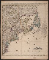
Harbors --Atlantic Coast (North America) --Maps --Early works to 1800
27
Nautical charts --Atlantic Coast (North America) --Early works to 1800
27
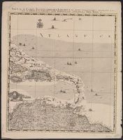
Nautical charts --Caribbean Area --Early works to 1800
27
Nautical charts --West Indies --Early works to 1800
27
Pilot guides --Atlantic Coast (North America) --Early works to 1800
27
Pilot guides --West Indies --Early works to 1800
27
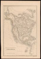
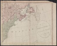
British--America--Maps--Early works to 1800
19
Coasts--North America--Maps--Early works to 1800
15
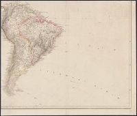
Coasts--South America--Maps--Early works to 1800
15
more
Subject (Topic)
»
Subject (Name)
Anville, Jean Baptiste Bourguignon d', 1697-1782
12
Homann Erben (Firm)
11
Cóvens et Mortier
9
Chatelain, Henri Abraham. Atlas historique
7
Lahontan, Louis Armand de Lom d'Arce, baron de, 1666-1715?
7
Condet, Johannes, 1711-1781, engraver
6
L'Isle, Guillaume de, 1675-1726. Atlas nouveau
6
Lotter, Tobias Conrad, 1717-1777
6
Homann Erben (Firm). Atlas geographicus maior
5
Robert Sayer and John Bennett (Firm)
5
more
Subject (Name)
»
Publication Place
London :
32
[London] :
20
Paris :
18
A Paris :
15
[Amsterdam :
15
[S.l. :
14
New York :
12
Noribergae :
11
[London :
11
[London? :
11
more
Publication Place
»
Date Created
View distribution
Current results range from
1565
to
1999
Date Created range begin
Date Created range end
View larger »
[Missing]
58