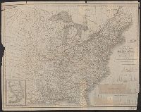
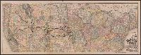
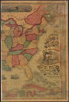
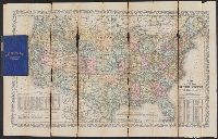
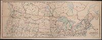
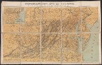
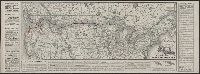
Search
You Searched For
Search Results
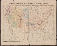
- Published / Created:
- 1874]
- Call Number:
- 75eha 1873
- Image Count:
- 1
- Resource Type:
- Maps, Atlases & Globes
- Subject (Geographic):
- United States--Maps
- Subject (Name):
- States--Maps
- Subject (Topic):
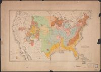
- Missions--United States--Maps
- Found in:
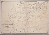
- Beinecke Rare Book and Manuscript Library > Domestic missionary map, Protestant Episcopal Church.
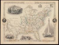
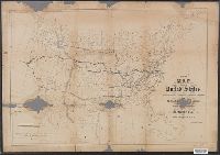
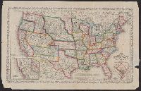
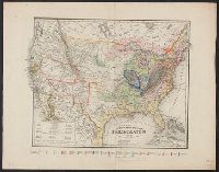
- Creator:
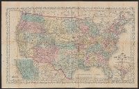
- Rapkin, J
- Published / Created:
- [1857]
- Call Number:
- BrSides 2017 60
- Image Count:
- 1
- Resource Type:
- Maps, Atlases & Globes
- Subject (Geographic):
- United States--Maps.
- Found in:
- Beinecke Rare Book and Manuscript Library > United States / map drawn & engraved by J. Rapkin.
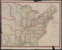
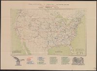
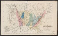
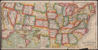
- Creator:
- Waddell, J. H. (John Hunter)
- Published / Created:
- 1868
- Call Number:
- 75GBC 1868
- Container / Volume:
- BRBL_00410
- Image Count:
- 1
- Resource Type:
- Maps, Atlases & Globes
- Subject (Geographic):
- United States--Maps
- Subject (Topic):
- Railroads--United States--Maps
- Found in:
- Beinecke Rare Book and Manuscript Library > Map of the United States / constructed on the rectangular tangential projection by J.H. Waddell ... ; prepared under the instructions M. F. Maury ...
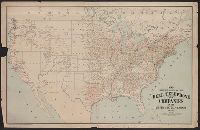
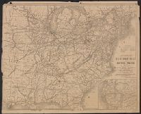
- Creator:
- Tanner, Henry Schenck, 1786-1858
- Published / Created:
- 1840
- Call Number:
- 75gm 1840C
- Container / Volume:
- BRBL_00410
- Image Count:
- 1
- Resource Type:
- Maps, Atlases & Globes
- Subject (Geographic):
- United States--Maps.
- Subject (Topic):
- Canals--United States--Maps.
- Found in:
- Beinecke Rare Book and Manuscript Library > Map of the canals & rail roads of the United States / reduced from the large map of the U.S. by H.S. Tanner ; engraved by J. Knight.
- Creator:
- Tanner, Henry Schenck, 1786-1858
- Published / Created:
- 1840
- Call Number:
- 75gm 1840B
- Container / Volume:
- BRBL_00410
- Image Count:
- 1
- Resource Type:
- Maps, Atlases & Globes
- Subject (Geographic):
- United States--Maps.
- Subject (Topic):
- Canals--United States--Maps.
- Found in:
- Beinecke Rare Book and Manuscript Library > Map of the canals & rail roads of the United States / reduced from the large map of the U.S. by H.S. Tanner ; engraved by J. Knight.
- Creator:
- Waddell, J. H
- Published / Created:
- 1868?]
- Call Number:
- 75 1868
- Container / Volume:
- BRBL_00404
- Image Count:
- 1
- Resource Type:
- Maps, Atlases & Globes
- Subject (Geographic):
- United States--Maps
- Subject (Topic):
- Railroads--United States--Maps
- Found in:
- Beinecke Rare Book and Manuscript Library > Map of the United States / constructed on the rectangular tangential projection by J.H. Waddell ... ; prepared under the instructions M.F. Maury ...
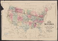
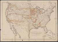
- Creator:
- United States. General Land Office
- Published / Created:
- 1876
- Call Number:
- 75 1876
- Container / Volume:
- BRBL_00405
- Image Count:
- 6
- Resource Type:
- Maps, Atlases & Globes
- Subject (Topic):
- Canals--United States--Maps
- Found in:
- Beinecke Rare Book and Manuscript Library > Map of the United States and territories, showing the extent of public surveys, Indian and military reservations, land grant R.R., rail roads, canals, and other details / compiled from the official surveys of the General Land Office, and other authentic s
- Creator:
- G.W. & C.B. Colton & Co
- Published / Created:
- 1864
- Call Number:
- 75 1864
- Container / Volume:
- BRBL_00403
- Image Count:
- 1
- Resource Type:
- Maps, Atlases & Globes
- Subject (Geographic):
- United States--Maps
- Subject (Topic):
- Military bases--United States--Maps
- Found in:
- Beinecke Rare Book and Manuscript Library > Coltons' rail-road and military map of the United States, Mexico, the West Indies &c.
- Creator:
- National Highways Association
- Published / Created:
- 1913
- Call Number:
- 75gmb 1915B
- Container / Volume:
- BRBL_00411
- Image Count:
- 1
- Resource Type:
- Maps, Atlases & Globes
- Subject (Topic):
- Highway planning--United States--Maps
- Found in:
- Beinecke Rare Book and Manuscript Library > National highways system -- fifty thousand miles -- main trunk and link lines proposed by the National Highways Association / National Highways Association.
- Creator:
- American Telephone and Telegraph Company
- Published / Created:
- 1904
- Call Number:
- 75gmk 1904
- Container / Volume:
- BRBL_00414A
- Image Count:
- 1
- Resource Type:
- Maps, Atlases & Globes
- Subject (Topic):
- Telephone lines--United States--Maps
- Found in:
- Beinecke Rare Book and Manuscript Library > Map showing lines of the Bell telephone companies in the United States and Canada : July 1st, 1904 / American Telephone & Telegraph Company.
- Creator:
- Brayer, Garnet M
- Published / Created:
- 1949 [i.e. 1950]
- Call Number:
- 75gmb 1895
- Container / Volume:
- BRBL_00411
- Image Count:
- 1
- Resource Type:
- Maps, Atlases & Globes
- Subject (Topic):
- Cattle trade--United States--Maps
- Found in:
- Beinecke Rare Book and Manuscript Library > America's cattle trails. Compiled from contemporary sources by Garnet M. Brayer and Herbert O. Brayer; Hugh T. Glen, cartographer; C.O. Froid, illustrator.
- Published / Created:
- 1909
- Call Number:
- 75cfe 1909
- Container / Volume:
- BRBL_00409
- Image Count:
- 1
- Resource Type:
- Maps, Atlases & Globes
- Subject (Geographic):
- United States--Maps
- Found in:
- Beinecke Rare Book and Manuscript Library > United States, Contour Map.
- Creator:
- From the Collection: Steinberg, Saul, 1914-1999
- Published / Created:
- undated
- Call Number:
- YCAL MSS 1053
- Container / Volume:
- Box 423, folder 5730
- Image Count:
- 3
- Found in:
- Beinecke Rare Book and Manuscript Library > Saul Steinberg papers (YCAL MSS 1053) > Series II: Artwork > Drawings, paintings, and collage > Untitled [Map series: United States Map superimposed on map of Europe]
- Creator:
- Rand McNally and Company
- Call Number:
- 75gme 1872
- Container / Volume:
- BRBL_00412
- Image Count:
- 1
- Resource Type:
- Maps, Atlases & Globes
- Subject (Geographic):
- United States--Maps.
- Subject (Topic):
- Railroads--United States--Maps.
- Found in:
- Beinecke Rare Book and Manuscript Library > Railway and distance map accompanying Rand, McNally & Co.'s Railway Guide.
- Published / Created:
- 1853
- Call Number:
- 754gme 1853
- Container / Volume:
- BRBL_00419
- Image Count:
- 1
- Resource Type:
- Maps, Atlases & Globes
- Subject (Geographic):
- United States--Maps
- Subject (Topic):
- Railroads--United States--Maps
- Found in:
- Beinecke Rare Book and Manuscript Library > Map of the Delaware, Lackawanna & Western railroad : with its principal connections.
- Published / Created:
- [1857?]
- Call Number:
- 754gme 1857
- Container / Volume:
- BRBL_00419
- Image Count:
- 1
- Resource Type:
- Maps, Atlases & Globes
- Subject (Geographic):
- United States--Maps
- Subject (Topic):
- Railroads--United States--Maps
- Found in:
- Beinecke Rare Book and Manuscript Library > Map showing position of the Lake Erie and Pacific rail road : and its connections / [by] Chas. E. Hore, mechanical and topographical draftsman, 308 Broadway, N.Y.
- Creator:
- Young, J. H. (James Hamilton)
- Published / Created:
- 1857
- Call Number:
- 75 1857
- Container / Volume:
- BRBL_00401
- Image Count:
- 1
- Resource Type:
- Maps, Atlases & Globes
- Subject (Geographic):
- United States--Maps
- Subject (Topic):
- Railroads--United States--Maps
- Found in:
- Beinecke Rare Book and Manuscript Library > A new map of the United States of America / by J.H. Young ; engraved by J.L. Hazzard & E. Yeager.
- Creator:
- Young, J. H. (James Hamilton)
- Published / Created:
- [1864]
- Call Number:
- 75 1864B
- Container / Volume:
- BRBL_00403
- Image Count:
- 1
- Resource Type:
- Maps, Atlases & Globes
- Subject (Geographic):
- United States--Maps
- Subject (Topic):
- Railroads--United States--Maps
- Found in:
- Beinecke Rare Book and Manuscript Library > A new map of the United States of America [cartographic material] / by J.H. Young ; engraved by J.L. Hazzard & E. Yeager.
- Published / Created:
- 186-]
- Call Number:
- 754gme 1860B
- Container / Volume:
- BRBL_00420
- Image Count:
- 1
- Resource Type:
- Maps, Atlases & Globes
- Subject (Geographic):
- United States--Maps
- Subject (Topic):
- Railroads--United States--Maps
- Found in:
- Beinecke Rare Book and Manuscript Library > [Railroads of the Northern United States from Iowa to Boston, Massachusetts]
- Creator:
- McGee, W. J., 1853-1912
- Published / Created:
- 1884
- Call Number:
- 75CA 1884
- Container / Volume:
- BRBL_00407A
- Image Count:
- 1
- Resource Type:
- Maps, Atlases & Globes
- Subject (Geographic):
- United States--Maps
- Subject (Topic):
- Geology--United States--Maps
- Found in:
- Beinecke Rare Book and Manuscript Library > Map of the United States exhibiting the present status of knowledge relating to the areal distribution of geologic groups : (preliminary compilation) / compiled by W.J. McGee.
- Creator:
- Young, J. H. (James Hamilton)
- Published / Created:
- 1860, c1859.
- Call Number:
- 75 1859D
- Container / Volume:
- BRBL_00401
- Image Count:
- 1
- Resource Type:
- Maps, Atlases & Globes
- Subject (Geographic):
- United States--Maps
- Subject (Topic):
- Railroads--United States--Maps
- Found in:
- Beinecke Rare Book and Manuscript Library > A new map of the United States of America / by J.H. Young ; engraved by J.L. Hazzard & E. Yeager.
- Published / Created:
- March 15, 1832
- Call Number:
- 75 1850
- Container / Volume:
- BRBL_00689
- Image Count:
- 2
- Resource Type:
- Maps, Atlases & Globes
- Subject (Geographic):
- United States--Maps
- Subject (Topic):
- Geology--United States--Maps
- Found in:
- Beinecke Rare Book and Manuscript Library > A geological map of the United States [cartographic material].
- Creator:
- Goldthwait, J. H.
- Published / Created:
- [1843]
- Call Number:
- BrSides 2019 109
- Image Count:
- 2
- Resource Type:
- Maps, Atlases & Globes
- Subject (Geographic):
- United States--Maps.
- Subject (Topic):
- Counties--United States--Maps.
- Found in:
- Beinecke Rare Book and Manuscript Library > Goodyear's miniature county map of the United States / engraved by J.H. Goldthwait.
- Published / Created:
- c1883.
- Call Number:
- 75gme 1883C
- Container / Volume:
- BRBL_00413
- Image Count:
- 2
- Resource Type:
- Maps, Atlases & Globes
- Subject (Geographic):
- United States--Maps
- Subject (Topic):
- Railroads--United States--Maps
- Found in:
- Beinecke Rare Book and Manuscript Library > Official map of the Union Pacific Railway : through Kansas & Nebraska and from Colorado, Wyoming, Montana, Utah, Nevada, Idaho, Washington, Oregon & California.
- Creator:
- George F. Cram Company
- Published / Created:
- 1873
- Call Number:
- 75 1873
- Container / Volume:
- BRBL_00405
- Image Count:
- 2
- Resource Type:
- Maps, Atlases & Globes
- Subject (Geographic):
- United States--Maps
- Subject (Topic):
- Railroads--United States--Maps
- Found in:
- Beinecke Rare Book and Manuscript Library > The Improved American Union Railroad map of the United States, British provinces, West Indies, Mexico and Central America.
- Creator:
- Young, J. H. (James Hamilton)
- Published / Created:
- [1864]
- Call Number:
- 75 1864B
- Container / Volume:
- BRBL_00403
- Image Count:
- 2
- Resource Type:
- Maps, Atlases & Globes
- Subject (Geographic):
- United States--Maps
- Subject (Topic):
- Railroads--United States--Maps
- Found in:
- Beinecke Rare Book and Manuscript Library > A new map of the United States of America [cartographic material] / by J.H. Young ; engraved by J.L. Hazzard & E. Yeager.
- Published / Created:
- 1870
- Call Number:
- 80 1870B
- Container / Volume:
- BRBL_00535
- Image Count:
- 1
- Resource Type:
- Maps, Atlases & Globes
- Subject (Geographic):
- United States--Maps
- Subject (Topic):
- Railroads--United States--Maps
- Found in:
- Beinecke Rare Book and Manuscript Library > Map of the North West : from explorations by the United States Engineers & Royal Engineers of England and Union & Northern Pacific R.R. surveys.
- Creator:
- Burr, Henry A
- Published / Created:
- 1850
- Call Number:
- 75 1850
- Container / Volume:
- BRBL_00400
- Image Count:
- 2
- Resource Type:
- Maps, Atlases & Globes
- Subject (Geographic):
- United States--Maps
- Subject (Topic):
- Railroads--United States--Maps
- Found in:
- Beinecke Rare Book and Manuscript Library > Disturnell's new map of the United States and Canada : showing all the canals, rail roads, telegraph lines and principal stage routes / drawn by Henry A. Burr, topographer to the Post Office Dep't., Washington, D.C. ; engraved by J.M. Atwood, N.Y.
- Creator:
- Berthrong, I. P
- Published / Created:
- 1908
- Call Number:
- 75j 1908
- Container / Volume:
- BRBL_00414A
- Image Count:
- 1
- Resource Type:
- Maps, Atlases & Globes
- Subject (Geographic):
- United States--Maps
- Subject (Topic):
- Explorers--United States--Maps
- Found in:
- Beinecke Rare Book and Manuscript Library > United States showing routes of principal explorers and early roads and highways [map] / from data prepared by Frank Bond ; by I. B. Berthrong.
- Creator:
- Berthrong, I. P
- Published / Created:
- 1908
- Call Number:
- 75gmb 1908
- Container / Volume:
- BRBL_00411
- Image Count:
- 1
- Resource Type:
- Maps, Atlases & Globes
- Subject (Geographic):
- United States--Maps
- Subject (Topic):
- Explorers--United States--Maps
- Found in:
- Beinecke Rare Book and Manuscript Library > United States showing routes of principal explorers and early roads and highways [map] / from data prepared by Frank Bond ; by I. B. Berthrong.
- Creator:
- Berthrong, I. P
- Published / Created:
- 1908
- Call Number:
- 75j 1908
- Container / Volume:
- BRBL_00414A
- Image Count:
- 1
- Resource Type:
- Maps, Atlases & Globes
- Subject (Geographic):
- United States--Maps
- Subject (Topic):
- Explorers--United States--Maps
- Found in:
- Beinecke Rare Book and Manuscript Library > United States showing routes of principal explorers and early roads and highways [map] / from data prepared by Frank Bond ; by I. B. Berthrong.
- Creator:
- United States. Office of Farm Management
- Published / Created:
- 1915
- Call Number:
- 75gce 1915
- Container / Volume:
- BRBL_00410
- Image Count:
- 1
- Resource Type:
- Maps, Atlases & Globes
- Subject (Geographic):
- United States--Maps
- Subject (Topic):
- Irrigation--United States--Maps
- Found in:
- Beinecke Rare Book and Manuscript Library > Irrigation map of the United States / engraved and printed by the U.S. Geological Survey ; outline of irrigated areas based upon data collected by the Bureau of the Census, 1910 ; revised by Irrigation Division, Office of Experimental Stations, and by the
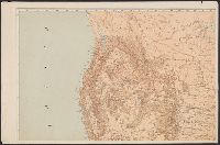
- Creator:
- McGee, W. J., 1853-1912
- Published / Created:
- [1893?]
- Call Number:
- 75CA 1893
- Container / Volume:
- BRBL_00408
- Image Count:
- 10
- Resource Type:
- Maps, Atlases & Globes
- Subject (Topic):
- Geology--United States--Maps
- Found in:
- Beinecke Rare Book and Manuscript Library > Reconnoissance map of the United States showing the distribution of the geologic system so far as known / compiled from data in possession of the U.S. Geological Survey by W.J. McGee, 1893.
- Published / Created:
- 1919
- Call Number:
- 75gmb AL14 1919
- Container / Volume:
- BRBL_00411
- Image Count:
- 1
- Resource Type:
- Maps, Atlases & Globes
- Subject (Topic):
- Roads--United States--Maps
- Found in:
- Beinecke Rare Book and Manuscript Library > Map of the Albert Pike Highway : showing every city, town, village and hamlet throughout its entire length / proposed by the Albert Pike Highway Association.
- Creator:
- National Highways Association
- Published / Created:
- c1914.
- Call Number:
- 75gmb 1915A
- Container / Volume:
- BRBL_00411
- Image Count:
- 1
- Resource Type:
- Maps, Atlases & Globes
- Subject (Topic):
- Roads--United States--Maps
- Found in:
- Beinecke Rare Book and Manuscript Library > Fifty thousand miles of national highways proposed by the National Highways Association / published under direction of the National Highways Association ; John C. Mulford, cartographer.
- Published / Created:
- 1915
- Call Number:
- 75gmb 1915
- Container / Volume:
- BRBL_00411
- Image Count:
- 1
- Resource Type:
- Maps, Atlases & Globes
- Subject (Topic):
- Roads--United States--Maps
- Found in:
- Beinecke Rare Book and Manuscript Library > National highways map of the United States showing one hundred thousand miles of national highways proposed by the National Highways Association / John C. Mulford, chief cartographer ; published under direction of the National Highways Association.
- Creator:
- Ellet, Charles, 1810-1862
- Published / Created:
- 1851
- Call Number:
- 75gme 1851
- Container / Volume:
- BRBL_00411
- Image Count:
- 1
- Resource Type:
- Maps, Atlases & Globes
- Subject (Topic):
- Railroads--United States--Maps
- Found in:
- Beinecke Rare Book and Manuscript Library > Map of the Western Railroads tributary to Philadelphia with their rival lines / prepared under the direction of Charles Ellet Jr., civil engineer ; by W. Williams, map engraver.
- Published / Created:
- 1869
- Call Number:
- 75gme 1869
- Container / Volume:
- BRBL_00412
- Image Count:
- 1
- Resource Type:
- Maps, Atlases & Globes
- Subject (Topic):
- Railroads--United States--Maps
- Found in:
- Beinecke Rare Book and Manuscript Library > The great railroad routes to the Pacific, and their connections : 1869 / [by Joseph Gorlinski, Draughtsman].
- Creator:
- Latrobe, Benj. H. (Benjamin Henry), 1807-1878
- Published / Created:
- 1850?]
- Call Number:
- 75gme 1850B
- Container / Volume:
- BRBL_00411
- Image Count:
- 1
- Resource Type:
- Maps, Atlases & Globes
- Subject (Topic):
- Railroads--United States--Maps
- Found in:
- Beinecke Rare Book and Manuscript Library > Map, exhibiting the railway route between Baltimore & St. Louis, together with the other principal lines in the Eastern, Middle & Western states / prepared under the direction of B.H. Latrobe, Ch. Engr. B. & O.R.R. ; Lith. by A. Hoen & Co.
- Published / Created:
- [1885?]
- Call Number:
- 754 1885
- Container / Volume:
- BRBL_00417
- Image Count:
- 1
- Resource Type:
- Maps, Atlases & Globes
- Subject (Topic):
- Railroads--United States--Maps
- Found in:
- Beinecke Rare Book and Manuscript Library > Topographical map of Virginia : also showing the states of Maryland and Delaware.
- Published / Created:
- 1853
- Call Number:
- 75CA 1853
- Container / Volume:
- BRBL_00407A
- Image Count:
- 1
- Resource Type:
- Maps, Atlases & Globes
- Subject (Topic):
- Geology--United States--Maps
- Found in:
- Beinecke Rare Book and Manuscript Library > Geognostische Karte der Nord-Americanischen Freistaaten.
- Creator:
- Rand McNally and Company
- Published / Created:
- [1882]
- Call Number:
- 75gme 1882B
- Container / Volume:
- BRBL_00413
- Image Count:
- 2
- Resource Type:
- Maps, Atlases & Globes
- Subject (Topic):
- Railroads--United States--Maps
- Found in:
- Beinecke Rare Book and Manuscript Library > A correct map of the United States of America showing the Atchison, Topeka and Santa Fe R.R. and connections.
- Creator:
- Allen, Lane & Scott
- Published / Created:
- 1880
- Call Number:
- 75gme 1880B
- Container / Volume:
- BRBL_00413
- Image Count:
- 2
- Resource Type:
- Maps, Atlases & Globes
- Subject (Topic):
- Railroads--United States--Maps
- Found in:
- Beinecke Rare Book and Manuscript Library > Pennsylvania Railroad : Great Trunk Line and U.S. Mail Route.
- Creator:
- Thomas, G. F
- Published / Created:
- [1864]
- Call Number:
- 75gme 1864
- Container / Volume:
- BRBL_00412
- Image Count:
- 2
- Resource Type:
- Maps, Atlases & Globes
- Subject (Topic):
- Railroads--United States--Maps
- Found in:
- Beinecke Rare Book and Manuscript Library > Appletons' railway map of the United States and the Canadas : representing railways in actual operation, and those in course of construction, also map of the territories, showing the Pacific Railroad, gold regions, &c. / carefully compiled by G. F. Thomas
- Creator:
- Rand McNally and Company
- Published / Created:
- 1883
- Call Number:
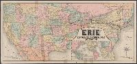
- 75gme 1883
- Container / Volume:
- BRBL_00413
- Image Count:
- 2
- Resource Type:
- Maps, Atlases & Globes
- Subject (Topic):
- Railroads--United States--Maps
- Found in:
- Beinecke Rare Book and Manuscript Library > Map of the "Erie" : New-York, Lake Erie and Western Rail Road and connections.
- Creator:
- Northern Pacific Railroad Company
- Published / Created:
- 1883
- Call Number:
- 75gme 1883E
- Container / Volume:
- BRBL_00413
- Image Count:
- 2
- Resource Type:
- Maps, Atlases & Globes
- Subject (Topic):
- Railroads--United States--Maps
- Found in:
- Beinecke Rare Book and Manuscript Library > New and correct map of the lines of the Northern Pacific Railroad and Oregon Railway & Navigation Co.
- Creator:
- Thomas, G. F
- Published / Created:
- [1876]
- Call Number:
- 754gme 1876
- Container / Volume:
- BRBL_00420
- Image Count:
- 2
- Resource Type:
- Maps, Atlases & Globes
- Subject (Topic):
- Railroads--United States--Maps
- Found in:
- Beinecke Rare Book and Manuscript Library > Appletons' railway map of the United States and the Canadas : representing railways in actual operation, and those in course of construction, also map of the territories, showing the Pacific Railroad, gold regions, &c. / carefully compiled by G. F. Thomas
- Creator:
- Allen, Lane & Scott
- Published / Created:
- 1884
- Call Number:
- 75gme 1884
- Container / Volume:
- BRBL_00414
- Image Count:
- 2
- Resource Type:
- Maps, Atlases & Globes
- Subject (Topic):
- Railroads--United States--Maps
- Found in:
- Beinecke Rare Book and Manuscript Library > Pennsylvania Railroad : Great Trunk Line of the United States / Chas. E. Pugh, General Manager ; J.R. Wood, General Passenger Agent.
- Creator:
- Northern Pacific Railroad Company
- Published / Created:
- 1883
- Call Number:
- 75gme 1883D
- Container / Volume:
- BRBL_00413
- Image Count:
- 2
- Resource Type:
- Maps, Atlases & Globes
- Subject (Topic):
- Railroads--United States--Maps
- Found in:
- Beinecke Rare Book and Manuscript Library > New and correct map of the lines of the Northern Pacific Railroad and Oregon Railway & Navigation Co.
- Creator:
- H.M. Gousha Company
- Published / Created:
- [1928]
- Call Number:
- 842gmb 1928
- Container / Volume:
- BRBL_00600
- Image Count:
- 2
- Resource Type:
- Maps, Atlases & Globes
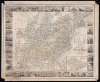
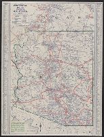
- Description:
- United States," map of "Grand Canyon National
- Subject (Topic):
- Express highways--United States--Maps
- Found in:
- Beinecke Rare Book and Manuscript Library > Continental Oil Co. official road map, Arizona.
- Published / Created:
- 1878
- Call Number:
- 75GM 1878
- Container / Volume:
- BRBL_00410
- Image Count:
- 1
- Resource Type:
- Maps, Atlases & Globes
- Subject (Geographic):
- United States--Maps
- Subject (Topic):
- Land grants--United States--Maps
- Found in:
- Beinecke Rare Book and Manuscript Library > Map of the United States : exhibiting the grants of lands made by the General government to aid the construction of railroads and wagon roads / Dept. of the Interior. U.S. Geographical and Geological Survey of the Rocky Mountain Region J.W. Powell, in Cha
- Published / Created:
- 1878
- Call Number:
- 75gme 1878
- Container / Volume:
- BRBL_00412
- Image Count:
- 1
- Resource Type:
- Maps, Atlases & Globes
- Subject (Geographic):
- United States--Maps
- Subject (Topic):
- Land grants--United States--Maps
- Found in:
- Beinecke Rare Book and Manuscript Library > Map of the United States : exhibiting the grants of lands made by the General government to aid the construction of railroads and wagon roads / Dept. of the Interior. U.S. Geographical and Geological Survey of the Rocky Mountain Region J.W. Powell, in Cha
- Creator:
- Freyhold, Edward
- Published / Created:
- 1870
- Call Number:
- 75 1870A
- Container / Volume:
- BRBL_00404
- Image Count:
- 4
- Resource Type:
- Maps, Atlases & Globes
- Subject (Geographic):
- United States--Maps
- Subject (Topic):
- Military bases--United States--Maps
- Found in:
- Beinecke Rare Book and Manuscript Library > Military map of the United States / compiled and drawn by E. Freyhold.
- Creator:
- Winship, W. W
- Published / Created:
- 1889
- Call Number:
- 75 1889
- Container / Volume:
- BRBL_00407
- Image Count:
- 4
- Resource Type:
- Maps, Atlases & Globes
- Subject (Geographic):
- United States--Maps
- Subject (Topic):
- Military bases--United States--Maps
- Found in:
- Beinecke Rare Book and Manuscript Library > Map of the United States / prepared in the Office of the Chief of Engineers, U.S.A., by W.W. Winship, under the direction of Brig. Gen. John Newton, Chief of Eng., Bvt. Major General, U.S.A.
- Creator:
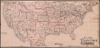
- Perkins, Frederic B. (Frederic Beecher), 1828-1899
- Published / Created:
- 1880
- Call Number:
- 75FCB 1880G
- Container / Volume:
- BRBL_00410
- Image Count:
- 1
- Resource Type:
- Maps, Atlases & Globes
- Subject (Topic):
- Political parties--United States--Maps
- Found in:
- Beinecke Rare Book and Manuscript Library > Congressional district vote map of the United States / designed by Fred B. Perkins ; drawn by Whitman & Breck.
- Creator:
- Hutawa, Julius
- Published / Created:
- 1854?]
- Call Number:
- 75 1854A
- Container / Volume:
- BRBL_00401
- Image Count:
- 1
- Resource Type:
- Maps, Atlases & Globes
- Subject (Topic):
- Inland navigation--United States--Maps
- Found in:
- Beinecke Rare Book and Manuscript Library > Map of the United States, shewing the principal steamboat routes and projected railroads connecting with St. Louis / Juls. Hutawa, lithr.
- Creator:
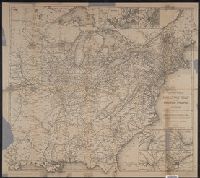
- Geological Survey (U.S.)
- Published / Created:
- [1897]
- Call Number:
- 75BH 1897
- Container / Volume:
- BRBL_00407A
- Image Count:
- 1
- Resource Type:
- Maps, Atlases & Globes
- Subject (Geographic):
- United States--Surveys--Maps
- Subject (Topic):
- Stream-gaging stations--United States
- Found in:
- Beinecke Rare Book and Manuscript Library > Map showing condition and progress of topographic surveys and location of gaging stations for the fiscal year 1896-1897.
- Creator:
- H.M. Gousha Company
- Published / Created:
- [1935].
- Call Number:
- 834gmb 1935
- Container / Volume:
- BRBL_00591
- Image Count:
- 2
- Resource Type:
- Maps, Atlases & Globes
- Description:
- "Official road map, United States," map
- Subject (Topic):
- Roads--United States--Maps
- Found in:
- Beinecke Rare Book and Manuscript Library > Official road map, Colorado / Conoco Travel Bureau.
- Creator:
- Rand McNally and Company
- Published / Created:
- 1888
- Call Number:
- 75gme 1888
- Container / Volume:
- BRBL_00414
- Image Count:
- 1
- Resource Type:
- Maps, Atlases & Globes
- Subject (Geographic):
- United States--Maps
- Subject (Topic):
- Railroads--United States--Maps
- Found in:
- Beinecke Rare Book and Manuscript Library > The Duluth daily news map of the Duluth railway system : Showing lines completed, under construction, and projected, Jan. 1st, 1888.
- Creator:
- Burr, Henry A
- Published / Created:
- 1853
- Call Number:
- 75GM 1853
- Container / Volume:
- BRBL_00410
- Image Count:
- 1
- Resource Type:
- Maps, Atlases & Globes
- Subject (Geographic):
- United States--Maps
- Subject (Topic):
- Railroads--United States--Maps
- Found in:
- Beinecke Rare Book and Manuscript Library > Disturnell's new map of the United States and Canada : showing all the canals, rail roads, telegraph lines and principal stage routes / Drawn by Henry A. Burr.
- Creator:
- Poole Brothers
- Published / Created:
- [1901?], c1893.
- Call Number:
- 73eu 1901
- Container / Volume:
- BRBL_00375B
- Image Count:
- 1
- Resource Type:
- Maps, Atlases & Globes
- Subject (Geographic):
- United States--Maps
- Subject (Topic):
- Railroads--United States--Maps
- Found in:
- Beinecke Rare Book and Manuscript Library > Map of the Canadian Pacific Railway, the Minneapolis, St. Paul and Sault Ste. Marie Railway, the Duluth, South Shore and Atlantic Railway and connections / Poole Bros, engravers.
- Creator:
- Poole Brothers
- Published / Created:
- [1927], c1911.
- Call Number:
- 73gme 1927
- Container / Volume:
- BRBL_00376
- Image Count:
- 1
- Resource Type:
- Maps, Atlases & Globes
- Subject (Geographic):
- United States--Maps
- Subject (Topic):
- Railroads--United States--Maps
- Found in:
- Beinecke Rare Book and Manuscript Library > Map of the Canadian Pacific Railway, the Minneapolis, St. Paul & Sault Ste. Marie Railway, the Duluth, South Shore & Atlantic Railway, the Spokane International Railway and connections / Poole Bros, Chicago.
- Creator:
- United States. General Land Office
- Published / Created:
- 1866
- Call Number:
- 75 1866
- Container / Volume:
- BRBL_00403
- Image Count:
- 1
- Resource Type:
- Maps, Atlases & Globes
- Subject (Geographic):
- United States--Surveys--Maps
- Subject (Topic):
- States--Maps
- Found in:
- Beinecke Rare Book and Manuscript Library > Map of the United States and territories : shewing the extent of public surveys and other details / constructed from the plats and official sources of the General Land Office, under the direction of Hon. Jos. S. Wilson, Commissioner, by Theodore Franks, d
- Creator:
- United States. General Land Office
- Published / Created:
- [1868]
- Call Number:
- 75 1868C
- Container / Volume:
- BRBL_00404
- Image Count:
- 2
- Resource Type:
- Maps, Atlases & Globes
- Subject (Geographic):
- United States--Surveys--Maps
- Subject (Topic):
- States--Maps
- Found in:
- Beinecke Rare Book and Manuscript Library > Map of the United States and territories, showing the extent of public surveys and other details / constructed from the plats and official sources of the General Land Office, under the direction of the Hon. Jos. S. Wilson, commissioner, by Joseph Gorlinsk
- Creator:
- Spencer Trask & Co
- Published / Created:
- c1906.
- Call Number:
- 75gme 1906A
- Container / Volume:
- BRBL_00414
- Image Count:
- 1
- Resource Type:
- Maps, Atlases & Globes
- Subject (Topic):
- Railroads--United States--Maps
- Found in:
- Beinecke Rare Book and Manuscript Library > Trans-continental map : showing the main lines and proposed extentions of the various Trans-continental railroad systems of the Unites States and Canada, and some of the important connecting lines / Spencer Trask & Co. ; railroads drawn by Edward Aberle.
- Published / Created:
- 1875
- Call Number:
- 753CA 1875
- Container / Volume:
- BRBL_00415
- Image Count:
- 1
- Resource Type:
- Maps, Atlases & Globes
- Subject (Topic):
- Geology--United States--Maps
- Found in:
- Beinecke Rare Book and Manuscript Library > Geological chart of the United States, east of the Rocky Mountains, and of Canada / compiled by Frank H. Bradley, Prof. Geol., East Tennessee University.
- Published / Created:
- [1870?]
- Call Number:
- 75gme 1870
- Container / Volume:
- BRBL_00412
- Image Count:
- 1
- Resource Type:
- Maps, Atlases & Globes
- Subject (Topic):
- Railroads--United States--Maps
- Found in:
- Beinecke Rare Book and Manuscript Library > Map showing the location of the Northern Pacific Rail Road.
- Creator:
- National Railway Publication Company
- Call Number:
- BrSides Zc19 N82h 870na
- Image Count:
- 1
- Resource Type:
- Maps, Atlases & Globes
- Subject (Topic):
- Railroads--United States--Maps.
- Found in:
- Beinecke Rare Book and Manuscript Library > Map of the Northern Pacific Railway and tributary country.
- Creator:
- H.M. Gousha Company
- Published / Created:
- [1938]
- Call Number:
- 818gmb 1938
- Container / Volume:
- BRBL_00565
- Image Count:
- 2
- Resource Type:
- Maps, Atlases & Globes
- Alternative Title:
- Official road map, United States.
- Description:
- "Official road map, United States
- Subject (Topic):
- Roads--United States--Maps
- Found in:
- Beinecke Rare Book and Manuscript Library > 1938 official road map, Arkansas / [prepared for] Phillips Petroleum Company.
- Creator:
- Rand McNally and Company
- Published / Created:
- [1932]
- Call Number:
- 824gmb 1932
- Container / Volume:
- BRBL_00572
- Image Count:
- 2
- Resource Type:
- Maps, Atlases & Globes
- Alternative Title:
- United States.
- Description:
- United States" (scale [ca. 1:11,000,000
- Subject (Topic):
- Roads--United States--Maps
- Found in:
- Beinecke Rare Book and Manuscript Library > Rand McNally senior 1932 auto road map of Nebraska / [prepared for] Producers and Refiners Corporation, Independence-Kansas.
- Creator:
- Rand McNally and Company
- Published / Created:
- [1932]
- Call Number:
- 827gmb 1932
- Container / Volume:
- BRBL_00578
- Image Count:
- 2
- Resource Type:
- Maps, Atlases & Globes
- Alternative Title:
- United States.
- Description:
- United States" (scale [ca. 1:11,000,000]) and
- Subject (Topic):
- Roads--United States--Maps
- Found in:
- Beinecke Rare Book and Manuscript Library > Rand McNally senior 1932 auto road map of Oklahoma / [prepared for] PARCO.
- Creator:
- Rand McNally and Company
- Published / Created:
- [1951?]
- Call Number:
- 844gmb 1951
- Container / Volume:
- BRBL_00616
- Image Count:
- 2
- Resource Type:
- Maps, Atlases & Globes
- Description:
- "Rand McNally road map, United States
- Subject (Topic):
- Roads--United States--Maps
- Found in:
- Beinecke Rare Book and Manuscript Library > Rand McNally road map, California / issued by Randall Motor Club, Inc., affiliated with E. Broox Randall & Sons, Inc.
- Creator:
- Rand McNally and Company
- Published / Created:
- (Chicago : and [1886], c1883
- Call Number:
- 75gme 1883B
- Container / Volume:
- BRBL_00413
- Image Count:
- 2
- Resource Type:
- Maps, Atlases & Globes
- Subject (Topic):
- Railroads--United States--Maps
- Found in:
- Beinecke Rare Book and Manuscript Library > Map of the South West railway system : Missouri Pacific Ry., Central Branch U.P.R.R., Missouri, Kansas & Texas Ry., Texas and Pacific Ry., St. Louis, Iron Mountn. and Southern Ry., International and Great Northern Ry. and their connections / Rand McNally
- Creator:
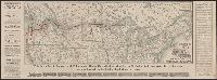
- Taylor, George Rogers, 1895-1983
- Published / Created:
- c1956.
- Call Number:
- 753gme 1861
- Container / Volume:
- BRBL_00415
- Image Count:
- 3
- Resource Type:
- Maps, Atlases & Globes
- Subject (Topic):
- Railroads--United States--Maps
- Found in:
- Beinecke Rare Book and Manuscript Library > United States and Canadian railways, April 1, 1861 / compiled by George Rogers Taylor ; Robert L. Williams, map maker.
- Creator:
- National Railway Publication Company
- Published / Created:
- [187-?]
- Call Number:
- 71gme 1875
- Container / Volume:
- BRBL_00372
- Image Count:
- 1
- Resource Type:
- Maps, Atlases & Globes
- Subject (Topic):
- Railroads--United States--Maps
- Found in:
- Beinecke Rare Book and Manuscript Library > Map of the Northern Pacific R.R., its connections and tributary country.
- Published / Created:
- [1870?]
- Call Number:
- 75gme 1870
- Container / Volume:
- BRBL_00372
- Image Count:
- 1
- Resource Type:
- Maps, Atlases & Globes
- Subject (Topic):
- Railroads--United States--Maps
- Found in:
- Beinecke Rare Book and Manuscript Library > Map showing the location of the Northern Pacific Rail Road.
- Creator:
- National Railway Publication Company
- Call Number:
- 71gme 1870
- Container / Volume:
- BRBL_00372
- Image Count:
- 1
- Resource Type:
- Maps, Atlases & Globes
- Subject (Topic):
- Railroads--United States--Maps
- Found in:
- Beinecke Rare Book and Manuscript Library > Map of the Northern Pacific Railway and tributary country.
- Creator:
- National Railway Publication Company
- Published / Created:
- [1872?]
- Call Number:
- 71gme 1872
- Container / Volume:
- BRBL_00372
- Image Count:
- 1
- Resource Type:
- Maps, Atlases & Globes
- Subject (Topic):
- Railroads--United States--Maps
- Found in:
- Beinecke Rare Book and Manuscript Library > Map of the Northern Pacific Railroad and tributary country.
- Creator:
- George F. Cram Company
- Published / Created:
- [1930]
- Call Number:
- 827 1930
- Container / Volume:
- BRBL_00577
- Image Count:
- 2
- Resource Type:
- Maps, Atlases & Globes
- Alternative Title:
- United States.
- Description:
- and topographical map of United States
- Subject (Topic):
- Airways--United States--Maps
- Found in:
- Beinecke Rare Book and Manuscript Library > 1930 census map of Oklahoma / George F. Cram Company, engravers and publishers.
- Creator:
- H.M. Gousha Company
- Published / Created:
- [1939]
- Call Number:
- 836gmb 1939
- Container / Volume:
- BRBL_00593
- Image Count:
- 2
- Resource Type:
- Maps, Atlases & Globes
- Alternative Title:
- Official road map, United States.
- Description:
- , United States" on verso.
- Subject (Topic):
- Roads--United States--Maps
- Found in:
- Beinecke Rare Book and Manuscript Library > 1939 official road map, Utah / [prepared for] Phillips Petroleum Company.
- Creator:
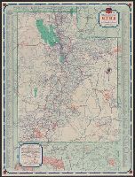
- Allen, W. F
- Published / Created:
- 1883
- Call Number:
- 75bk 1883A
- Container / Volume:
- BRBL_00407A
- Image Count:
- 1
- Resource Type:
- Maps, Atlases & Globes
- Subject (Topic):
- States--Maps
- Found in:
- Beinecke Rare Book and Manuscript Library > Map illustrating the proposed system of standard time as reported to the General and Southern Railway Time conventions : at their meetings held on April 11th and 18th, 1883, and unanimously recommended by the conventions for adoption by the railway lines
- Creator:
- United States. Army Map Service
- Published / Created:
- 1944
- Call Number:
- 50 1945M
- Container / Volume:
- BRBL_00273
- Image Count:
- 1
- Resource Type:
- Maps, Atlases & Globes
- Subject (Name):
- United States. Army Map Service
- Found in:
- Beinecke Rare Book and Manuscript Library > [AAF cloth chart]. Eastern Asia [cartographic material].
- Creator:
- United States. Army Map Service
- Published / Created:
- 1945
- Call Number:
- 5634gm 1945
- Container / Volume:
- BRBL_00299
- Image Count:
- 1
- Resource Type:
- Maps, Atlases & Globes
- Subject (Name):
- United States. Army Map Service
- Found in:
- Beinecke Rare Book and Manuscript Library > Kwangtung Province / prepared under the direction of the Chief of Engineers, by the Army Map Service.
- Creator:
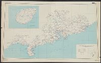
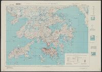
- Great Britain. War Office. General Staff. Geographical Section
- Published / Created:
- 1945
- Call Number:
- 5681 1945
- Container / Volume:
- BRBL_00300
- Image Count:
- 2
- Resource Type:
- Maps, Atlases & Globes
- Subject (Name):
- United States. Army Map Service
- Found in:
- Beinecke Rare Book and Manuscript Library > Hong Kong and New territory.
- Creator:
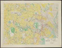
- United States. Far East Command
- Published / Created:
- 1947
- Call Number:
- 57 T578 1947
- Container / Volume:
- BRBL_00304
- Image Count:
- 2
- Resource Type:
- Maps, Atlases & Globes
- Subject (Name):
- United States. Army Map Service
- Found in:
- Beinecke Rare Book and Manuscript Library > Map of central Tokyo / prepared for the 64th Engineer Topographic Battalion for GHQ Visitors Bureau.
- Creator:
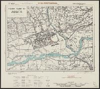
- Great Britain. War Office. General Staff. Geographical Section
- Published / Created:
- 1943
- Call Number:
- 40 Ao75 1943
- Container / Volume:
- BRBL_00204
- Image Count:
- 1
- Resource Type:
- Maps, Atlases & Globes
- Subject (Name):
- United States. Army Map Service
- Found in:
- Beinecke Rare Book and Manuscript Library > Town plan of Aosta [cartographic material].
- Creator:
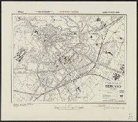
- Great Britain. War Office. General Staff. Geographical Section
- Published / Created:
- 1943
- Call Number:
- 40 B45 1943
- Container / Volume:
- BRBL_00205
- Image Count:
- 1
- Resource Type:
- Maps, Atlases & Globes
- Subject (Name):
- United States. Army Map Service
- Found in:
- Beinecke Rare Book and Manuscript Library > Town plan of Bergamo [cartographic material].
- Creator:
- Great Britain. War Office. General Staff. Geographical Section
- Published / Created:
- 1943
- Call Number:
- 3969 Ib4 1943
- Container / Volume:
- BRBL_00194
- Image Count:
- 1
- Resource Type:
- Maps, Atlases & Globes
- Subject (Name):
- United States. Army Map Service
- Found in:
- Beinecke Rare Book and Manuscript Library > Ibiza & Formentera [cartographic material].
- Creator:
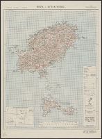
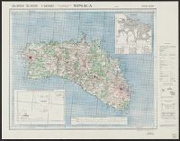
- Great Britain. War Office. General Staff. Geographical Section
- Published / Created:
- 1943
- Call Number:
- 3969 M52 1943
- Container / Volume:
- BRBL_00194
- Image Count:
- 1
- Resource Type:
- Maps, Atlases & Globes
- Subject (Name):
- United States. Army Map Service
- Found in:
- Beinecke Rare Book and Manuscript Library > Menorca [cartographic material].
- Creator:
- Great Britain. War Office. General Staff. Geographical Section
- Published / Created:
- 1943
- Call Number:
- 40 P67 1943
- Container / Volume:
- BRBL_00214
- Image Count:
- 1
- Resource Type:
- Maps, Atlases & Globes
- Subject (Name):
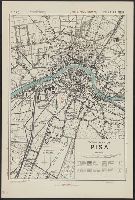
- United States. Army Map Service
- Found in:
- Beinecke Rare Book and Manuscript Library > Town plan of Pisa [cartographic material].
- Creator:
- Great Britain. War Office. General Staff. Geographical Section
- Published / Created:
- 1943
- Call Number:
- 40 P13 1943
- Container / Volume:
- BRBL_00213
- Image Count:
- 1
- Resource Type:
- Maps, Atlases & Globes
- Subject (Name):
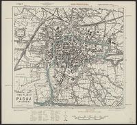
- United States. Army Map Service
- Found in:
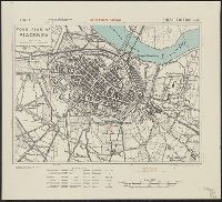
- Beinecke Rare Book and Manuscript Library > Town plan of Padua (Padova) [cartographic material].
- Creator:
- Great Britain. War Office. General Staff. Geographical Section
- Published / Created:
- 1943
- Call Number:
- 40 P19 1942
- Container / Volume:
- BRBL_00213
- Image Count:
- 1
- Resource Type:
- Maps, Atlases & Globes
- Subject (Name):
- United States. Army Map Service
- Found in:
- Beinecke Rare Book and Manuscript Library > Pantelleria [cartographic material] / drawn by GSGS, War Office 1940.
- Creator:
- Great Britain. War Office. General Staff. Geographical Section
- Published / Created:
- 1943
- Call Number:
- 40 P24 1943
- Container / Volume:
- BRBL_00213
- Image Count:
- 1
- Resource Type:
- Maps, Atlases & Globes
- Subject (Name):
- United States. Army Map Service
- Found in:
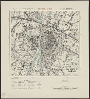
- Beinecke Rare Book and Manuscript Library > Town plan of Parma [cartographic material].
- Creator:
- Great Britain. War Office. General Staff. Geographical Section
- Published / Created:
- 1943
- Call Number:
- 40 P57 1943
- Container / Volume:
- BRBL_00214
- Image Count:
- 1
- Resource Type:
- Maps, Atlases & Globes
- Subject (Name):
- United States. Army Map Service
- Found in:
- Beinecke Rare Book and Manuscript Library > Town plan of Piacenza [cartographic material].
- Creator:
- Great Britain. War Office. General Staff. Geographical Section
- Published / Created:
- 1943
- Call Number:
- 40 R19 1943
- Container / Volume:
- BRBL_00215
- Image Count:
- 1
- Resource Type:
- Maps, Atlases & Globes
- Subject (Name):
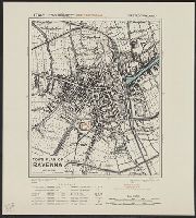
- United States. Army Map Service
- Found in:
- Beinecke Rare Book and Manuscript Library > Town plan of Ravenna [cartographic material].
- Creator:
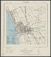
- United States. Army. Corps of Engineers
- Published / Created:
- 1943
- Call Number:
- 40 V65 1943
- Image Count:
- 1
- Resource Type:
- Maps, Atlases & Globes
- Subject (Name):
- United States. Army Map Service
- Found in:
- Beinecke Rare Book and Manuscript Library > Italy 1:10,000. Viareggio city plan / prepared under the direction of the Chief of Engineers, U.S. Army, Washington, D.C [cartographic material].
- Creator:
- Great Britain. War Office. General Staff. Geographical Section
- Published / Created:
- 1943
- Call Number:
- 40 V66 1943
- Image Count:
- 1
- Resource Type:
- Maps, Atlases & Globes
- Subject (Name):
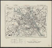
- United States. Army Map Service
- Found in:
- Beinecke Rare Book and Manuscript Library > Town plan of Vicenza [cartographic material].
- Creator:
- Great Britain. Inter-service Topographical Dept
- Published / Created:
- 1943
- Call Number:
- 40 V652 1943
- Image Count:
- 1
- Resource Type:
- Maps, Atlases & Globes
- Subject (Name):
- United States. Army Map Service
- Found in:
- Beinecke Rare Book and Manuscript Library > Town plan of Vibo Valentia Marina [cartographic material] / compiled and drawn by Inter-Service Topographical Department ; produced under the Superintendence of Vice-Admiral John Edgell, hydrographer.