Search
You Searched For
Search Results
- Published / Created:
- [191-?].
- Call Number:
- 11hcf 1919D-43
- Container / Volume:
- BRBL_00010X
- Image Count:
- 1
- Resource Type:
- Maps, Atlases & Globes
- Subject (Geographic):
- Lorraine (France)--Maps
- Found in:
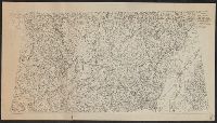
- Beinecke Rare Book and Manuscript Library > Block diagram showing terrain of Lorraine and adjacent districts.
- Published / Created:
- 1910
- Call Number:
- 38 B83 1910
- Container / Volume:
- BRBL_00156
- Image Count:
- 1
- Resource Type:
- Maps, Atlases & Globes
- Subject (Geographic):
- Lorraine (France)--Maps
- Found in:
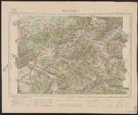
- Beinecke Rare Book and Manuscript Library > Bruyéres.
- Creator:
- Dépôt de la guerre (France)
- Published / Created:
- 1912
- Call Number:
- 38 1912
- Container / Volume:
- BRBL_00155
- Image Count:
- 1
- Resource Type:
- Maps, Atlases & Globes
- Subject (Geographic):
- Lorraine (France)--Maps
- Subject (Topic):
- Maps--France--Lorraine--1912
- Found in:
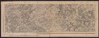
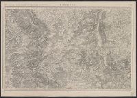
- Beinecke Rare Book and Manuscript Library > Commercy. Levée par les Officiers du Corps d'état-major et publiée par le Dépôt de la guerre en 1835.
- Published / Created:
- [191-?]
- Call Number:
- 11hcf 1919D-42
- Container / Volume:
- BRBL_00010X
- Image Count:
- 1
- Resource Type:
- Maps, Atlases & Globes
- Subject (Geographic):
- Lorraine (France)--Maps
- Found in:
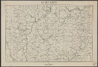
- Beinecke Rare Book and Manuscript Library > Lorraine.
- Published / Created:
- 1918
- Call Number:
- 38hc 1918A
- Container / Volume:
- BRBL_00172
- Image Count:
- 2
- Resource Type:
- Maps, Atlases & Globes
- Subject (Geographic):
- Lorraine (France)--Maps
- Found in:
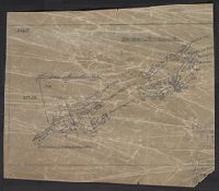
- Beinecke Rare Book and Manuscript Library > St. Mihiel offensive, map showing daily position of front line : Map Room G-3, G.H.Q., September 1918.
- Published / Created:
- 1918
- Call Number:
- 38hc 1918 Sep. folder
- Container / Volume:
- BRBL_00172
- Image Count:
- 1
- Resource Type:
- Maps, Atlases & Globes
- Subject (Geographic):
- Lorraine (France)--Maps
- Found in:
- Beinecke Rare Book and Manuscript Library > Verdun-Point-à-Mousson.
- Creator:
- France. Corps d'état-major
- Published / Created:
- 1916
- Call Number:
- 38315cbf C736 1912
- Container / Volume:
- BRBL_00177
- Image Count:
- 1
- Resource Type:
- Maps, Atlases & Globes
- Subject (Geographic):
- Lorraine (France)--Maps
- Found in:
- Beinecke Rare Book and Manuscript Library > Commercy / levée par les officiers du Corps d'état-major, et publiée par le Dépôt de la guerre en 1835 ; [gravée, le trait par Bonnet, la lettre par Hacq, le figuré du terrain par George].
- Published / Created:
- 1905?
- Call Number:
- 383 1900
- Container / Volume:
- BRBL_00177
- Image Count:
- 1
- Resource Type:
- Maps, Atlases & Globes
- Subject (Geographic):
- Lorraine (France)--Maps
- Found in:
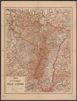
- Beinecke Rare Book and Manuscript Library > Karte der Reichs-Provinz Elsass-Lothringen.
- Published / Created:
- 1915?]
- Call Number:
- 38315gfc 1915
- Container / Volume:
- BRBL_00177
- Image Count:
- 1
- Resource Type:
- Maps, Atlases & Globes
- Subject (Geographic):
- Lorraine (France)--Maps
- Found in:
- Beinecke Rare Book and Manuscript Library > The Lorraine-Saar Minefield.
- Creator:
- France. Corps d'état-major
- Published / Created:
- 1917
- Call Number:
- 38315cbf V585 1913
- Container / Volume:
- BRBL_00177
- Image Count:
- 1
- Resource Type:
- Maps, Atlases & Globes
- Subject (Geographic):
- Lorraine (France)--Maps
- Found in:
- Beinecke Rare Book and Manuscript Library > Verdun.
- Published / Created:
- 1916?]
- Call Number:
- 38am V58 1916
- Container / Volume:
- BRBL_00168
- Image Count:
- 1
- Resource Type:
- Maps, Atlases & Globes
- Subject (Geographic):
- Lorraine (France)--Maps
- Found in:
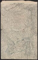
- Beinecke Rare Book and Manuscript Library > [Verdun and Environs].
- Published / Created:
- 1918?]
- Call Number:
- 38hc 1918A Sep. folder
- Container / Volume:
- BRBL_00172
- Image Count:
- 1
- Resource Type:
- Maps, Atlases & Globes
- Subject (Geographic):
- Lorraine (France)--Maps
- Found in:
- Beinecke Rare Book and Manuscript Library > Fernsprechleitungen der Schaltstellen.
- Creator:
- Bumstead, Albert H. (Albert Hoit), 1875-1940
National Geographic Society (U.S.). Cartographic Division
- Published / Created:
- 1918
- Call Number:
- 30 1918B
- Container / Volume:
- BRBL_00032A
- Image Count:
- 1
- Resource Type:
- Maps, Atlases & Globes
- Subject (Geographic):
- Lorraine (France)--Maps
- Found in:
- Beinecke Rare Book and Manuscript Library > Map of the Western Theatre of War / Prepared in the Map Dept. of the National Geographic Society for the National Geographic Magazine ; A. H. Bumstead, cartographer.
- Creator:
- Bumstead, Albert H. (Albert Hoit), 1875-1940
National Geographic Society (U.S.). Cartographic Division
- Published / Created:
- 1918
- Call Number:
- 11hc 1918C
- Container / Volume:
- BRBL_00010E
- Image Count:
- 1
- Resource Type:
- Maps, Atlases & Globes
- Subject (Geographic):
- Lorraine (France)--Maps
- Found in:
- Beinecke Rare Book and Manuscript Library > Map of the Western Theatre of War / Prepared in the Map Dept. of the National Geographic Society for the National Geographic Magazine ; A. H. Bumstead, cartographer.
- Published / Created:
- 1918?]
- Call Number:
- 38hc 1918C
- Container / Volume:
- BRBL_00172
- Image Count:
- 1
- Resource Type:
- Maps, Atlases & Globes
- Subject (Geographic):
- Lorraine (France)--Military maps
- Found in:
- Beinecke Rare Book and Manuscript Library > Grabenkarte.
- Published / Created:
- 1918?]
- Call Number:
- 38hc 1918B
- Container / Volume:
- BRBL_00172
- Image Count:
- 6
- Resource Type:
- Maps, Atlases & Globes
- Subject (Geographic):
- Lorraine (France)--Military maps
- Found in:
- Beinecke Rare Book and Manuscript Library > Grabenkarten.
- Published / Created:
- 1918?]
- Call Number:
- 38hc 1918E
- Container / Volume:
- BRBL_00172
- Image Count:
- 1
- Resource Type:
- Maps, Atlases & Globes
- Subject (Geographic):
- Lorraine (France)--Military maps
- Found in:
- Beinecke Rare Book and Manuscript Library > Minenwerfer-Karte, Div. "H".
- Published / Created:
- 1918?]
- Call Number:
- 38hc 1918D
- Container / Volume:
- BRBL_00172
- Image Count:
- 2
- Resource Type:
- Maps, Atlases & Globes
- Subject (Geographic):
- Lorraine (France)--Military maps
- Found in:
- Beinecke Rare Book and Manuscript Library > Gruppe Gorz, Ic/IId No. 62 geh. Artillerie-Wochenkarte mit Truppen und Fliegerbilderkundung.