Skip to search
Skip to main content
Skip to first result
Search
You Searched For
"Africa--Maps--Early works to 1800"
New Search
Search Results
Published / Created:
[1751]
Call Number:
BrSides Box 2019 32
Image Count:
1
Resource Type:
Maps, Atlases & Globes
Subject (Geographic):
--Early works to 1800 .
Subject (Topic):
Coasts--South Africa --Maps --Early works
Found in:
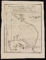
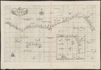
Beinecke Rare Book and Manuscript Library > Kort over Bayen St. Helena : udkaftet efter de Söfarendes Anmerkninger af N. Bellin.
Creator:
Published / Created:
1781
Call Number:
BrSides Folio 2017 19
Image Count:
1
Resource Type:
Maps, Atlases & Globes
Subject (Geographic):
Africa , West--Maps --Early works to 1800 .
Subject (Topic):
Coasts--Africa , West--Maps --Early works
Found in:
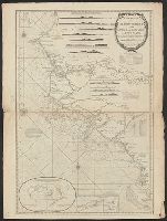
Beinecke Rare Book and Manuscript Library > Carta della bassa Guinea tra il capo tres puntas, e l'equatore / di Mr. d'Anville.
Creator:
Published / Created:
1670]
Call Number:
655 1670
Container / Volume:
BRBL_00345
Image Count:
1
Resource Type:
Maps, Atlases & Globes
Subject (Geographic):
Africa , West--Maps --Early works to 1800
Subject (Topic):
Coasts--Africa , West--Maps --Early works
Found in:
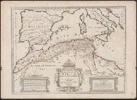
Beinecke Rare Book and Manuscript Library > Guinea.
Creator:
Published / Created:
1646 or 1647]
Call Number:
64 1646
Container / Volume:
BRBL_00338
Image Count:
1
Resource Type:
Maps, Atlases & Globes
Subject (Geographic):
Africa , Southern--Maps --Early works to
Subject (Topic):
Coasts--Africa , Eastern--Maps --Early
Found in:
Beinecke Rare Book and Manuscript Library > Carta seconda generale d'Affrica / AF: Lucini fece.
Published / Created:
[1751]
Call Number:
BrSides Box 2019 29
Image Count:
1
Resource Type:
Maps, Atlases & Globes
Subject (Geographic):
Table Bay (South Africa )--Maps --Early
Subject (Topic):
Coasts--South Africa --Maps --Early works
Found in:
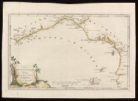
Beinecke Rare Book and Manuscript Library > Kort over Taffelbayen og Reden ved det Gode Haabs Forbierg efter adskillige Manuskripter udkastet af N. Bellin, Ing. de la Marine.
Creator:
Published / Created:
1766]
Call Number:
654 1766
Container / Volume:
BRBL_00344
Image Count:
1
Resource Type:
Maps, Atlases & Globes
Subject (Geographic):
Africa , West--Maps --Early works to 1800
Subject (Topic):
Coasts--Africa , West--Maps --Early works
Found in:
Beinecke Rare Book and Manuscript Library > A new and correct map of the coast of Africa, from Cape Blanco (lat. 20⁰40Ń) to the coast of Angola (lat. 11⁰S) : with explanatory notes of all the forts and settlements belonging to the several European powers / R.W. Seale, sculp.
Creator:
Published / Created:
1646-1647]
Call Number:
655 1646
Container / Volume:
BRBL_00345
Image Count:
1
Resource Type:
Maps, Atlases & Globes
Subject (Geographic):
Africa , West--Maps --Early works to 1800
Subject (Topic):
Coasts--Africa , West--Maps --Early works
Found in:
Beinecke Rare Book and Manuscript Library > Carta particolare che comincia con il fiume Iuntas nella Guinea è finisce con il capo di S. Dara è con l'Isola d'S:Tomaso / AF:Lucini fece.
Creator:
Published / Created:
1677
Call Number:
655 1677
Container / Volume:
BRBL_00345
Image Count:
1
Resource Type:
Maps, Atlases & Globes
Subject (Geographic):
Africa , West--Maps --Early works to 1800
Subject (Topic):
Coasts--Africa , West--Maps --Early works
Found in:
Beinecke Rare Book and Manuscript Library > Costes de Guińee avec les royaumes qui y sont connus des Européens, au dedans des terres : selon les relations les plus nouvelles / par P. Duval.
Creator:
Published / Created:
1596?]
Call Number:
63 1596
Container / Volume:
BRBL_00334
Image Count:
1
Resource Type:
Maps, Atlases & Globes
Subject (Geographic):
Africa , Eastern--Maps --Early works to
Subject (Topic):
Coasts--Africa , Eastern--Maps --Early
Found in:
Beinecke Rare Book and Manuscript Library > Delineatio orarum maritimarum, terrae vulgo indigetatae terra do Natal item Sofalae, Mozambicae & Melindae ... [cartographic material] = Affbeeldinghe der custen des landts genaempt terra do Natal, item van alle de custen van Coffala, Mozambique, Melinde
Creator:
Published / Created:
1789 January 1
Call Number:
1982 Folio 10
Image Count:
1
Subject (Geographic):
Africa , West --Maps --Early works to
Subject (Topic):
Coasts --Africa , West --Maps --Early
Found in:
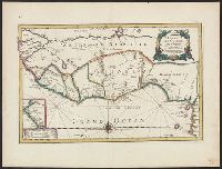
Beinecke Rare Book and Manuscript Library > The western coast of Africa, from Cape Blanco to Cape Virga, exhibiting Senegambia proper
Creator:
Published / Created:
1st January 1789.
Call Number:
655 1789
Container / Volume:
BRBL_00345
Image Count:
1
Resource Type:
Maps, Atlases & Globes
Subject (Geographic):
Africa , West--Maps --Early works to 1800
Subject (Topic):
Coasts--Africa , West--Maps --Early works
Found in:
Beinecke Rare Book and Manuscript Library > The western coast of Africa, from Cape Blanco to Cape Virga, exhibiting Senegambia proper / by T. Jefferys.
Creator:
Published / Created:
1596]
Call Number:
64 1596
Container / Volume:
BRBL_00337
Image Count:
1
Resource Type:
Maps, Atlases & Globes
Subject (Geographic):
Africa , Southern--Maps --Early works to
Subject (Topic):
Coasts--Africa , Southern--Maps --Early
Found in:
Beinecke Rare Book and Manuscript Library > Typus orarum maritimarum Guineae, Manicongo, & Angôlae ultra promontorium Bonae Spei ... [cartographic material] = Afheeldinghe der custen des landts Guinea, Manicongo, ende Angôla, ende voorts tot voorby de C. de boa esperança ... / Arnoldus F. á Lan
Creator:
Published / Created:
1720?]
Call Number:
49 1740
Container / Volume:
BRBL_00684
Image Count:
1
Resource Type:
Maps, Atlases & Globes
Subject (Topic):
--Maps --Early works to 1800
Found in:
Beinecke Rare Book and Manuscript Library > In notitiam ecclesiasticam Africae tabula geographica / auctore G. De L'Isle ...
Creator:
Published / Created:
1780
Call Number:
49 1780
Container / Volume:
BRBL_00267
Image Count:
1
Resource Type:
Maps, Atlases & Globes
Subject (Topic):
--Maps --Early works to 1800
Found in:
Beinecke Rare Book and Manuscript Library > In notitiam ecclesiasticam Africæ tabula geographica [cartographic material] / Auctore G. de l'Isle ; Joan. Bap. Liébaux inv. et sculp.
Published / Created:
1792
Call Number:
60cea 1792
Container / Volume:
BRBL_00329
Image Count:
1
Resource Type:
Maps, Atlases & Globes
Subject (Geographic):
Africa --Maps --Early works to 1800
Found in:
Beinecke Rare Book and Manuscript Library > A new Survey of the Coast of Africa from Senegal and Cape Verd to Cape St. Ann ...
Creator:
Published / Created:
1794?]
Call Number:
60 1794B
Container / Volume:
BRBL_00324
Image Count:
1
Resource Type:
Maps, Atlases & Globes
Subject (Geographic):
Africa --Maps --Early works to 1800
Found in:
Beinecke Rare Book and Manuscript Library > A new and accurate map of Africa, drawn from the best authorities / by Thos. Bowen.
Published / Created:
1794
Call Number:
60cea 1794
Container / Volume:
BRBL_00329
Image Count:
1
Resource Type:
Maps, Atlases & Globes
Subject (Geographic):
Africa --Maps --Early works to 1800
Found in:
Beinecke Rare Book and Manuscript Library > A new chart of the Coast of Africa from the Straits of Gibralter to Cape Blanco with Madeira & the Canary Islands ...
Creator:
Published / Created:
1721]
Call Number:
60 1721
Container / Volume:
BRBL_00322
Image Count:
1
Resource Type:
Maps, Atlases & Globes
Subject (Geographic):
Africa --Maps --Early works to 1800
Found in:
Beinecke Rare Book and Manuscript Library > A new map of Africa, from the latest observations.
Published / Created:
1700?]
Call Number:
60 1700
Container / Volume:
BRBL_00322
Image Count:
1
Resource Type:
Maps, Atlases & Globes
Subject (Geographic):
Africa --Maps --Early works to 1800
Found in:
Beinecke Rare Book and Manuscript Library > A new map of Africk : shewing its present general divisions, cheif cities or towns, rivers, mountains &c.
Creator:
Published / Created:
1700]
Call Number:
60 1700A
Container / Volume:
BRBL_00322
Image Count:
1
Resource Type:
Maps, Atlases & Globes
Subject (Geographic):
Africa --Maps --Early works to 1800
Found in:
Beinecke Rare Book and Manuscript Library > Accuratissima totius Africae tabula / in lucem producta per Iacobum de Sandrart ; Joann. Bapt. Homann, sculpsit.
Creator:
Published / Created:
1766?]
Call Number:
60 1766
Container / Volume:
BRBL_00323
Image Count:
4
Resource Type:
Maps, Atlases & Globes
Subject (Geographic):
Africa --Maps --Early works to 1800
Found in:
Beinecke Rare Book and Manuscript Library > Africa / performed by the Sr. Danville under the patronage of the Duke of Orleans ; revised and improved by Mr. Bolton ; E. Bowen sculpt.
Creator:
Published / Created:
1774?]
Call Number:
60 1774
Container / Volume:
BRBL_00323
Image Count:
4
Resource Type:
Maps, Atlases & Globes
Subject (Geographic):
Africa --Maps --Early works to 1800
Found in:
Beinecke Rare Book and Manuscript Library > Africa / performed by the Sr. Danville under the patronage of the Duke of Orleans ; revised and improved by Mr. Bolton ; E. Bowen sculpt.
Creator:
Published / Created:
[ca. 1760]
Call Number:
60 1760B
Container / Volume:
BRBL_00323
Image Count:
1
Resource Type:
Maps, Atlases & Globes
Subject (Geographic):
Africa --Maps --Early works to 1800
Found in:
Beinecke Rare Book and Manuscript Library > Africa : concinnata secundum observationes membror. acad. regal. scientiarum et non nullorum aliorum, et juxta recentissimas annotationes / per G. de l'Isle, geographum.
Creator:
Published / Created:
1680
Call Number:
1973 Folio 10
Image Count:
1
Resource Type:
Maps, Atlases & Globes
Subject (Geographic):
Africa --Maps --Early works to 1800
Found in:
Beinecke Rare Book and Manuscript Library > Africa : divided according to the extent of its principall parts in which are distinguished one from the other the empires, monarchies, kingdoms, states and peoples, which at this time inhabite Africa
Creator:
Published / Created:
[1748]
Call Number:
BrSides Folio 2017 11
Image Count:
1
Resource Type:
Maps, Atlases & Globes
Subject (Geographic):
Africa --Maps --Early works to 1800 .
Found in:
Beinecke Rare Book and Manuscript Library > Africa [cartographic material] / drawn from the best maps by T. Jefferys, Geographer to his Royal Highness the Prince of Wales.
Published / Created:
[1968]
Call Number:
60 1710
Container / Volume:
BRBL_00322
Image Count:
1
Resource Type:
Maps, Atlases & Globes
Subject (Geographic):
Africa --Maps --Early works to 1800
Found in:
Beinecke Rare Book and Manuscript Library > Africa according to H. Moll 1710.
Creator:
Published / Created:
1792
Call Number:
60 1795B
Container / Volume:
BRBL_00324
Image Count:
1
Resource Type:
Maps, Atlases & Globes
Subject (Geographic):
Africa --Maps --Early works to 1800
Found in:
Beinecke Rare Book and Manuscript Library > Africa according to the best authorities.
Creator:
Published / Created:
1795]
Call Number:
60 1795A
Container / Volume:
BRBL_00324
Image Count:
1
Resource Type:
Maps, Atlases & Globes
Subject (Geographic):
Africa --Maps --Early works to 1800
Found in:
Beinecke Rare Book and Manuscript Library > Africa according to the best authorities.
Creator:
Published / Created:
1794
Call Number:
60 1794C
Container / Volume:
BRBL_00324
Image Count:
1
Resource Type:
Maps, Atlases & Globes
Subject (Geographic):
Africa --Maps --Early works to 1800
Found in:
Beinecke Rare Book and Manuscript Library > Africa and it's several regions / by Samuel Dunn, mathematician.
Published / Created:
[1968]
Call Number:
60 1668
Container / Volume:
BRBL_00322
Image Count:
1
Resource Type:
Maps, Atlases & Globes
Subject (Geographic):
Africa --Maps --Early works to 1800
Found in:
Beinecke Rare Book and Manuscript Library > Africa by Jacob van Meurs 1668.
Creator:
Published / Created:
after 1741]
Call Number:
60 1735
Container / Volume:
BRBL_00323
Image Count:
1
Resource Type:
Maps, Atlases & Globes
Subject (Geographic):
Africa --Maps --Early works to 1800 .
Found in:
Beinecke Rare Book and Manuscript Library > Africa iuxta navigationes et observationaes recentissimas aucta, correcta et in sua regna et status divisa / in lucem edita a Matth. Seuttero, s. Caes. maj. geographo aug.
Creator:
Published / Created:
[1737?]
Call Number:
60 1737B
Container / Volume:
BRBL_00323
Image Count:
1
Resource Type:
Maps, Atlases & Globes
Subject (Geographic):
Africa --Maps --Early works to 1800
Found in:
Beinecke Rare Book and Manuscript Library > Africa secundum legitimas projectionis stereographicae regulas : et juxta recentissimas relationes et observationes in subsidium vocatis quoque veterum Leonis Africani ... / à Joh. Matthia Hasio, M.P.P.O. ...
Creator:
Published / Created:
[ca. 1737]
Call Number:
60 1737A
Container / Volume:
BRBL_00323
Image Count:
1
Resource Type:
Maps, Atlases & Globes
Subject (Geographic):
Africa --Maps --Early works to 1800
Found in:
Beinecke Rare Book and Manuscript Library > Africa secundum legitimas projectionis stereographicae regulas et juxta recentissimas relationes et observationes in subsidium vocatis quoque veterum Leonis Africani Nubiensis Geographi et aliorum monumentis et eleminatis fabulosis aliorum designationibus
Creator:
Published / Created:
1737
Call Number:
60 1737
Container / Volume:
BRBL_00323
Image Count:
1
Resource Type:
Maps, Atlases & Globes
Subject (Geographic):
Africa --Maps --Early works to 1800
Found in:
Beinecke Rare Book and Manuscript Library > Africa secundum legitimas projectionis stereographicae regulas et juxta recentissimas relationes et observationes in subsidium vocatis quoque veterum Leonis Africani Nubiensis Geographi et aliorum monumentis et eleminatis fabulosis aliorum designationibus
Creator:
Published / Created:
[ca. 1737]
Call Number:
1983 Folio 23
Collection Title:
[Atlas factice of 50 maps, primarily by Johann Baptist Homann and/or issued by the Homann Erben
Image Count:
1
Subject (Geographic):
Africa --Maps --Early works to 1800
Found in:
Beinecke Rare Book and Manuscript Library > Africa secundum legitimas projectionis stereographicae regulas et juxta recentissimas relationes et observationes in subsidium vocatis quoque veterum Leonis Africani Nubiensis Geographi et aliorum monumentis et eleminatis fabulosis aliorum designationibus
Creator:
Published / Created:
1737
Call Number:
1975 Folio 31
Collection Title:
[Atlas factice of 42 maps, produced by the Homann Erben firm]
Image Count:
1
Subject (Geographic):
Africa --Maps --Early works to 1800
Found in:
Beinecke Rare Book and Manuscript Library > Africa secundum legitimas projectionis stereographicae regulas et juxta recentissimas relationes et observationes in subsidium vocatis quoque veterum Leonis Africani Nubiensis Geographi et aliorum monumentis et eleminatis fabulosis aliorum designationibus
Creator:
Published / Created:
1737
Call Number:
1973 Folio 30
Collection Title:
[Atlas factice of 32 maps and 1 distance table, produced by the Homann Erben firm]
Image Count:
2
Subject (Geographic):
Africa --Maps --Early works to 1800
Found in:
Beinecke Rare Book and Manuscript Library > Africa secundum legitimas projectionis stereographicae regulas et juxta recentissimas relationes et observationes in subsidium vocatis quoque veterum Leonis Africani Nubiensis Geographi et aliorum monumentis et eleminatis fabulosis aliorum designationibus
Creator:
Published / Created:
1592]
Call Number:
60 1592
Container / Volume:
BRBL_00321
Image Count:
2
Resource Type:
Maps, Atlases & Globes
Subject (Geographic):
Africa --Maps --Early works to 1800
Found in:
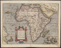
Beinecke Rare Book and Manuscript Library > Africa tertia pars terrae.
Creator:
Published / Created:
1792?]
Call Number:
60 1792
Container / Volume:
BRBL_00324
Image Count:
1
Resource Type:
Maps, Atlases & Globes
Subject (Geographic):
Africa --Maps --Early works to 1800
Found in:
Beinecke Rare Book and Manuscript Library > Africa, 1792 / Ferguson sculpsit.
Creator:
Published / Created:
ca. 1545]
Call Number:
60 1545
Container / Volume:
BRBL_00321
Image Count:
2
Resource Type:
Maps, Atlases & Globes
Subject (Geographic):
Africa --Maps --Early works to 1800
Found in:
Beinecke Rare Book and Manuscript Library > Africa, Lybia, Mörenlandt, mit allen Königreichen, so zü unsern Zeiten darin̄ gefunden werden.
Call Number:
1976 1233
Collection Title:
Forty-two new maps of Asia, Africa, and America ... : all engrav’d, according to the latest
Image Count:
1
Subject (Geographic):
Africa --Maps --Early works to 1800
Found in:
Beinecke Rare Book and Manuscript Library > Africa, according to ye newest and most exact observations
Creator:
Published / Created:
1595]
Call Number:
60 1595
Container / Volume:
BRBL_00321
Image Count:
2
Resource Type:
Maps, Atlases & Globes
Subject (Geographic):
Africa --Maps --Early works to 1800
Found in:
Beinecke Rare Book and Manuscript Library > Africa, ex magna orbis terre descriptione Gerardi Mercatoris / desumpta, studio & industria G.M. Iunioris.
Creator:
Published / Created:
1670]
Call Number:
60 1670
Container / Volume:
BRBL_00322
Image Count:
1
Resource Type:
Maps, Atlases & Globes
Subject (Geographic):
Africa --Maps --Early works to 1800
Found in:
Beinecke Rare Book and Manuscript Library > Africae accurata tabula / ex officina Iacobum Meursium.
Creator:
Published / Created:
anno 1652
Call Number:
1983 Folio 19
Collection Title:
[Atlas factice of 96 maps by Blaeu, Visscher, Jansson, Hondius and others]
Image Count:
1
Subject (Geographic):
Africa --Maps --Early works to 1800
Found in:
Beinecke Rare Book and Manuscript Library > Africae nova descr. / per Nicolaum Io[annem] Visscher
Creator:
Published / Created:
1641?]
Call Number:
60 1641
Container / Volume:
BRBL_00321
Image Count:
2
Resource Type:
Maps, Atlases & Globes
Subject (Geographic):
Africa --Maps --Early works to 1800
Found in:
Beinecke Rare Book and Manuscript Library > Africae nova descriptio / auct. Guiljelmo Blaeuw.
Creator:
Published / Created:
between 1639 and 1649?]
Call Number:
60 1639
Container / Volume:
BRBL_00321
Image Count:
2
Resource Type:
Maps, Atlases & Globes
Subject (Geographic):
Africa --Maps --Early works to 1800
Found in:
Beinecke Rare Book and Manuscript Library > Africae nova tabula / auct. Hen. Hondio, 1631.
Creator:
Published / Created:
1570
Call Number:
60 1570
Container / Volume:
BRBL_00321
Image Count:
2
Resource Type:
Maps, Atlases & Globes
Subject (Geographic):
Africa --Maps --Early works to 1800
Found in:
Beinecke Rare Book and Manuscript Library > Africae tabula nova.
Creator:
Published / Created:
1650
Call Number:
60 1650
Container / Volume:
BRBL_00321
Image Count:
1
Resource Type:
Maps, Atlases & Globes
Subject (Geographic):
Africa --Maps --Early works to 1800
Found in:
Beinecke Rare Book and Manuscript Library > Afrique / par N. Sanson d'Abbebille, geog. du Roy ; A. Peyrounin, sculp.
Branch:v1.60.98 ,Deployed:2024-04-17T09:54:29-04:00