Skip to search
Skip to main content
Skip to first result
Search
You Searched For
"Africa--Maps--Early works to 1800"
New Search
Search Results
Published / Created:
[1751]
Call Number:
BrSides Box 2019 32
Image Count:
1
Resource Type:
Maps, Atlases & Globes
Subject (Geographic):
--Early works to 1800 .
Subject (Topic):
Coasts--South Africa --Maps --Early works
Found in:
Beinecke Rare Book and Manuscript Library > Kort over Bayen St. Helena : udkaftet efter de Söfarendes Anmerkninger af N. Bellin.
Creator:
Published / Created:
1781
Call Number:
BrSides Folio 2017 19
Image Count:
1
Resource Type:
Maps, Atlases & Globes
Subject (Geographic):
Africa , West--Maps --Early works to 1800 .
Subject (Topic):
Coasts--Africa , West--Maps --Early works
Found in:
Beinecke Rare Book and Manuscript Library > Carta della bassa Guinea tra il capo tres puntas, e l'equatore / di Mr. d'Anville.
Creator:
Published / Created:
1670]
Call Number:
655 1670
Container / Volume:
BRBL_00345
Image Count:
1
Resource Type:
Maps, Atlases & Globes
Subject (Geographic):
Africa , West--Maps --Early works to 1800
Subject (Topic):
Coasts--Africa , West--Maps --Early works
Found in:
Beinecke Rare Book and Manuscript Library > Guinea.
Creator:
Published / Created:
1646 or 1647]
Call Number:
64 1646
Container / Volume:
BRBL_00338
Image Count:
1
Resource Type:
Maps, Atlases & Globes
Subject (Geographic):
Africa , Southern--Maps --Early works to
Subject (Topic):
Coasts--Africa , Eastern--Maps --Early
Found in:
Beinecke Rare Book and Manuscript Library > Carta seconda generale d'Affrica / AF: Lucini fece.
Published / Created:
[1751]
Call Number:
BrSides Box 2019 29
Image Count:
1
Resource Type:
Maps, Atlases & Globes
Subject (Geographic):
Table Bay (South Africa )--Maps --Early
Subject (Topic):
Coasts--South Africa --Maps --Early works
Found in:
Beinecke Rare Book and Manuscript Library > Kort over Taffelbayen og Reden ved det Gode Haabs Forbierg efter adskillige Manuskripter udkastet af N. Bellin, Ing. de la Marine.
Creator:
Published / Created:
1596?]
Call Number:
63 1596
Container / Volume:
BRBL_00334
Image Count:
1
Resource Type:
Maps, Atlases & Globes
Subject (Geographic):
Africa , Eastern--Maps --Early works to
Subject (Topic):
Coasts--Africa , Eastern--Maps --Early
Found in:
Beinecke Rare Book and Manuscript Library > Delineatio orarum maritimarum, terrae vulgo indigetatae terra do Natal item Sofalae, Mozambicae & Melindae ... [cartographic material] = Affbeeldinghe der custen des landts genaempt terra do Natal, item van alle de custen van Coffala, Mozambique, Melinde
Creator:
Published / Created:
1596]
Call Number:
64 1596
Container / Volume:
BRBL_00337
Image Count:
1
Resource Type:
Maps, Atlases & Globes
Subject (Geographic):
Africa , Southern--Maps --Early works to
Subject (Topic):
Coasts--Africa , Southern--Maps --Early
Found in:
Beinecke Rare Book and Manuscript Library > Typus orarum maritimarum Guineae, Manicongo, & Angôlae ultra promontorium Bonae Spei ... [cartographic material] = Afheeldinghe der custen des landts Guinea, Manicongo, ende Angôla, ende voorts tot voorby de C. de boa esperança ... / Arnoldus F. á Lan
Creator:
Published / Created:
1646-1647]
Call Number:
655 1646
Container / Volume:
BRBL_00345
Image Count:
1
Resource Type:
Maps, Atlases & Globes
Subject (Geographic):
Africa , West--Maps --Early works to 1800
Subject (Topic):
Coasts--Africa , West--Maps --Early works
Found in:
Beinecke Rare Book and Manuscript Library > Carta particolare che comincia con il fiume Iuntas nella Guinea è finisce con il capo di S. Dara è con l'Isola d'S:Tomaso / AF:Lucini fece.
Creator:
Published / Created:
1766]
Call Number:
654 1766
Container / Volume:
BRBL_00344
Image Count:
1
Resource Type:
Maps, Atlases & Globes
Subject (Geographic):
Africa , West--Maps --Early works to 1800
Subject (Topic):
Coasts--Africa , West--Maps --Early works
Found in:
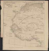
Beinecke Rare Book and Manuscript Library > A new and correct map of the coast of Africa, from Cape Blanco (lat. 20⁰40Ń) to the coast of Angola (lat. 11⁰S) : with explanatory notes of all the forts and settlements belonging to the several European powers / R.W. Seale, sculp.
Creator:
Published / Created:
1677
Call Number:
655 1677
Container / Volume:
BRBL_00345
Image Count:
1
Resource Type:
Maps, Atlases & Globes
Subject (Geographic):
Africa , West--Maps --Early works to 1800
Subject (Topic):
Coasts--Africa , West--Maps --Early works
Found in:
Beinecke Rare Book and Manuscript Library > Costes de Guińee avec les royaumes qui y sont connus des Européens, au dedans des terres : selon les relations les plus nouvelles / par P. Duval.
Creator:
Published / Created:
1st January 1789.
Call Number:
655 1789
Container / Volume:
BRBL_00345
Image Count:
1
Resource Type:
Maps, Atlases & Globes
Subject (Geographic):
Africa , West--Maps --Early works to 1800
Subject (Topic):
Coasts--Africa , West--Maps --Early works
Found in:
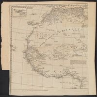
Beinecke Rare Book and Manuscript Library > The western coast of Africa, from Cape Blanco to Cape Virga, exhibiting Senegambia proper / by T. Jefferys.
Creator:
Published / Created:
1789 January 1
Call Number:
1982 Folio 10
Image Count:
1
Subject (Geographic):
Africa , West --Maps --Early works to
Subject (Topic):
Coasts --Africa , West --Maps --Early
Found in:
Beinecke Rare Book and Manuscript Library > The western coast of Africa, from Cape Blanco to Cape Virga, exhibiting Senegambia proper
Creator:
Published / Created:
1720?]
Call Number:
49 1740
Container / Volume:
BRBL_00684
Image Count:
1
Resource Type:
Maps, Atlases & Globes
Subject (Topic):
--Maps --Early works to 1800
Found in:
Beinecke Rare Book and Manuscript Library > In notitiam ecclesiasticam Africae tabula geographica / auctore G. De L'Isle ...
Creator:
Published / Created:
1780
Call Number:
49 1780
Container / Volume:
BRBL_00267
Image Count:
1
Resource Type:
Maps, Atlases & Globes
Subject (Topic):
--Maps --Early works to 1800
Found in:
Beinecke Rare Book and Manuscript Library > In notitiam ecclesiasticam Africæ tabula geographica [cartographic material] / Auctore G. de l'Isle ; Joan. Bap. Liébaux inv. et sculp.
Creator:
Published / Created:
[1748]
Call Number:
BrSides Folio 2017 11
Image Count:
1
Resource Type:
Maps, Atlases & Globes
Subject (Geographic):
Africa --Maps --Early works to 1800 .
Found in:
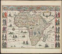
Beinecke Rare Book and Manuscript Library > Africa [cartographic material] / drawn from the best maps by T. Jefferys, Geographer to his Royal Highness the Prince of Wales.
Creator:
Published / Created:
1730
Call Number:
60 1730
Image Count:
1
Resource Type:
Maps, Atlases & Globes
Subject (Geographic):
Africa --Maps --Early works to 1800 .
Found in:
Beinecke Rare Book and Manuscript Library > Carte d'Afrique / dressée pour l'usage du Roy par Guillaume Delisle, premier geographe de sa Majesté, de l'aacademie [sic] royale des sciences.
Creator:
Published / Created:
[1688?]
Call Number:
BrSides Double Folio 2019 114
Image Count:
1
Resource Type:
Maps, Atlases & Globes
Subject (Geographic):
Africa --Maps --Early works to 1800 .
Found in:
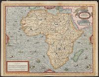
Beinecke Rare Book and Manuscript Library > Totius Africae accuratissima tabula [cartographic material] : denuo correcte revisa multis locis aucta, in partes tam maiores quam minores divisa / per F. de Witt.
Creator:
Published / Created:
1766?]
Call Number:
60 1766
Container / Volume:
BRBL_00323
Image Count:
4
Resource Type:
Maps, Atlases & Globes
Subject (Geographic):
Africa --Maps --Early works to 1800
Found in:
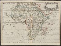
Beinecke Rare Book and Manuscript Library > Africa / performed by the Sr. Danville under the patronage of the Duke of Orleans ; revised and improved by Mr. Bolton ; E. Bowen sculpt.
Creator:
Published / Created:
1774?]
Call Number:
60 1774
Container / Volume:
BRBL_00323
Image Count:
4
Resource Type:
Maps, Atlases & Globes
Subject (Geographic):
Africa --Maps --Early works to 1800
Found in:
Beinecke Rare Book and Manuscript Library > Africa / performed by the Sr. Danville under the patronage of the Duke of Orleans ; revised and improved by Mr. Bolton ; E. Bowen sculpt.
Creator:
Published / Created:
1641?]
Call Number:
60 1641
Container / Volume:
BRBL_00321
Image Count:
2
Resource Type:
Maps, Atlases & Globes
Subject (Geographic):
Africa --Maps --Early works to 1800
Found in:
Beinecke Rare Book and Manuscript Library > Africae nova descriptio / auct. Guiljelmo Blaeuw.
Creator:
Published / Created:
155-?]
Call Number:
60 155X
Container / Volume:
BRBL_00321
Image Count:
2
Resource Type:
Maps, Atlases & Globes
Subject (Geographic):
Africa --Maps --Early works to 1800
Found in:
Beinecke Rare Book and Manuscript Library > [Map of Africa].
Creator:
Published / Created:
1535?]
Call Number:
60 1535
Container / Volume:
BRBL_00321
Image Count:
2
Resource Type:
Maps, Atlases & Globes
Subject (Geographic):
Africa --Maps --Early works to 1800
Found in:
Beinecke Rare Book and Manuscript Library > Aphricae tabula quarta continet Libyam & duas Aethiopias.
Creator:
Published / Created:
ca. 1545]
Call Number:
60 1545
Container / Volume:
BRBL_00321
Image Count:
2
Resource Type:
Maps, Atlases & Globes
Subject (Geographic):
Africa --Maps --Early works to 1800
Found in:
Beinecke Rare Book and Manuscript Library > Africa, Lybia, Mörenlandt, mit allen Königreichen, so zü unsern Zeiten darin̄ gefunden werden.
Creator:
Published / Created:
1570
Call Number:
60 1570
Container / Volume:
BRBL_00321
Image Count:
2
Resource Type:
Maps, Atlases & Globes
Subject (Geographic):
Africa --Maps --Early works to 1800
Found in:
Beinecke Rare Book and Manuscript Library > Africae tabula nova.
Creator:
Published / Created:
[1609]
Call Number:
60 1609
Container / Volume:
BRBL_00321
Image Count:
2
Resource Type:
Maps, Atlases & Globes
Subject (Geographic):
Africa --Maps --Early works to 1800
Found in:
Beinecke Rare Book and Manuscript Library > Nova Africae tabula / auctore Jodoco Hondio.
Creator:
Published / Created:
1595]
Call Number:
60 1595
Container / Volume:
BRBL_00321
Image Count:
2
Resource Type:
Maps, Atlases & Globes
Subject (Geographic):
Africa --Maps --Early works to 1800
Found in:
Beinecke Rare Book and Manuscript Library > Africa, ex magna orbis terre descriptione Gerardi Mercatoris / desumpta, studio & industria G.M. Iunioris.
Creator:
Published / Created:
1571?]
Call Number:
60 1571
Container / Volume:
BRBL_00321
Image Count:
2
Resource Type:
Maps, Atlases & Globes
Subject (Geographic):
Africa --Maps --Early works to 1800
Found in:
Beinecke Rare Book and Manuscript Library > Aphricae tabula IIII.
Creator:
Published / Created:
1592]
Call Number:
60 1592
Container / Volume:
BRBL_00321
Image Count:
2
Resource Type:
Maps, Atlases & Globes
Subject (Geographic):
Africa --Maps --Early works to 1800
Found in:
Beinecke Rare Book and Manuscript Library > Africa tertia pars terrae.
Creator:
Published / Created:
between 1639 and 1649?]
Call Number:
60 1639
Container / Volume:
BRBL_00321
Image Count:
2
Resource Type:
Maps, Atlases & Globes
Subject (Geographic):
Africa --Maps --Early works to 1800
Found in:
Beinecke Rare Book and Manuscript Library > Africae nova tabula / auct. Hen. Hondio, 1631.
Creator:
Published / Created:
1575]
Call Number:
60 1575
Container / Volume:
BRBL_00321
Image Count:
1
Resource Type:
Maps, Atlases & Globes
Subject (Geographic):
Africa --Maps --Early works to 1800
Found in:
Beinecke Rare Book and Manuscript Library > Table d'Afrique / A. Thevet.
Creator:
Published / Created:
1563]
Call Number:
60 1563
Container / Volume:
BRBL_00321
Image Count:
1
Resource Type:
Maps, Atlases & Globes
Subject (Geographic):
Africa --Maps --Early works to 1800
Found in:
Beinecke Rare Book and Manuscript Library > Prima tavola [Africa].
Creator:
Published / Created:
1650
Call Number:
60 1650
Container / Volume:
BRBL_00321
Image Count:
1
Resource Type:
Maps, Atlases & Globes
Subject (Geographic):
Africa --Maps --Early works to 1800
Found in:
Beinecke Rare Book and Manuscript Library > Afrique / par N. Sanson d'Abbebille, geog. du Roy ; A. Peyrounin, sculp.
Published / Created:
[1968]
Call Number:
60 1668
Container / Volume:
BRBL_00322
Image Count:
1
Resource Type:
Maps, Atlases & Globes
Subject (Geographic):
Africa --Maps --Early works to 1800
Found in:
Beinecke Rare Book and Manuscript Library > Africa by Jacob van Meurs 1668.
Creator:
Published / Created:
1598?]
Call Number:
60 1598
Container / Volume:
BRBL_00321
Image Count:
1
Resource Type:
Maps, Atlases & Globes
Subject (Geographic):
Africa --Maps --Early works to 1800
Found in:
Beinecke Rare Book and Manuscript Library > Tabulam hanc Aegypti, si aequus ac diligens lector ...
Creator:
Published / Created:
1689
Call Number:
60 1689
Container / Volume:
BRBL_00322
Image Count:
1
Resource Type:
Maps, Atlases & Globes
Subject (Geographic):
Africa --Maps --Early works to 1800
Found in:
Beinecke Rare Book and Manuscript Library > Afrique selon les relations les plus nouvelles / dressée et dediée par le P. Coronelli, cosmographe de la serenissime republique de Venise, a Monseigneur le duc de Brissac, pair de France ; H. Van Loon, sculp.
Creator:
Published / Created:
1670]
Call Number:
60 1670
Container / Volume:
BRBL_00322
Image Count:
1
Resource Type:
Maps, Atlases & Globes
Subject (Geographic):
Africa --Maps --Early works to 1800
Found in:
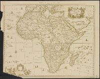
Beinecke Rare Book and Manuscript Library > Africae accurata tabula / ex officina Iacobum Meursium.
Creator:
Published / Created:
1690]
Call Number:
60 1690A
Container / Volume:
BRBL_00322
Image Count:
1
Resource Type:
Maps, Atlases & Globes
Subject (Geographic):
Africa --Maps --Early works to 1800
Found in:
Beinecke Rare Book and Manuscript Library > Novissima et perfectissima Africae descriptio / ex formis Caroli Allard ; Ph. Tideman, del. ; G. v. Gouwen, sculp.
Creator:
Published / Created:
ca. 1680]
Call Number:
60 1680
Container / Volume:
BRBL_00322
Image Count:
1
Resource Type:
Maps, Atlases & Globes
Subject (Geographic):
Africa --Maps --Early works to 1800
Found in:
Beinecke Rare Book and Manuscript Library > Novissima et perfectissima Africae descriptio / authore I. Danckerts.
Creator:
Published / Created:
Nov. 1707.
Call Number:
60 1707
Container / Volume:
BRBL_00322
Image Count:
1
Resource Type:
Maps, Atlases & Globes
Subject (Geographic):
Africa --Maps --Early works to 1800
Found in:
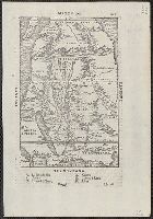
Beinecke Rare Book and Manuscript Library > Carte de l'Egypte, de la Nubie, de l'Abissinie &c. / par Guillaume Delisle de l'Academie R[oya]le des Sciences ; Desrosiers, sculp.
Creator:
Published / Created:
Nov. 1707.
Call Number:
60 1707
Container / Volume:
BRBL_00322
Image Count:
1
Resource Type:
Maps, Atlases & Globes
Subject (Geographic):
Africa --Maps --Early works to 1800
Found in:
Beinecke Rare Book and Manuscript Library > Carte de l'Egypte, de la Nubie, de l'Abissinie &c. / par Guillaume Delisle de l'Academie R[oya]le des Sciences ; Desrosiers, sculp.
Creator:
Published / Created:
[1730]
Call Number:
60 1730A
Container / Volume:
BRBL_00323
Image Count:
1
Resource Type:
Maps, Atlases & Globes
Subject (Geographic):
Africa --Maps --Early works to 1800
Found in:
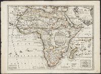
Beinecke Rare Book and Manuscript Library > L'Afrique dressée sur les observations de mrs. de l'Académie royale des sciences et quelques autres, and sur les memoires les plus recens [cartographic material] / par G. De L'Isle geographe.
Creator:
Published / Created:
1721]
Call Number:
60 1721
Container / Volume:
BRBL_00322
Image Count:
1
Resource Type:
Maps, Atlases & Globes
Subject (Geographic):
Africa --Maps --Early works to 1800
Found in:
Beinecke Rare Book and Manuscript Library > A new map of Africa, from the latest observations.
Creator:
Published / Created:
[1710]
Call Number:
60 1708
Container / Volume:
BRBL_00322
Image Count:
1
Resource Type:
Maps, Atlases & Globes
Subject (Geographic):
Africa --Maps --Early works to 1800
Found in:
Beinecke Rare Book and Manuscript Library > To the right honourable Charles, Earl of Peterborow and Monmouth, &c this map of Africa ... is most humbly dedicated / by your Lordship's humble servant H: Moll geographer.
Creator:
Published / Created:
1747
Call Number:
60 1747
Container / Volume:
BRBL_00323
Image Count:
1
Resource Type:
Maps, Atlases & Globes
Subject (Geographic):
Africa --Maps --Early works to 1800
Found in:
Beinecke Rare Book and Manuscript Library > L'Afrique / suivant les dernres. observations de Mr. Hass. et des R R.P.P. Jesuites ; par le Sr. le Rouge, ingr. geographe du Roi.
Published / Created:
1722
Call Number:
60 1722
Container / Volume:
BRBL_00323
Image Count:
1
Resource Type:
Maps, Atlases & Globes
Subject (Geographic):
Africa --Maps --Early works to 1800
Found in:
Beinecke Rare Book and Manuscript Library > [Map of Africa].
Creator:
Published / Created:
after 1741]
Call Number:
60 1735
Container / Volume:
BRBL_00323
Image Count:
1
Resource Type:
Maps, Atlases & Globes
Subject (Geographic):
Africa --Maps --Early works to 1800 .
Found in:
Beinecke Rare Book and Manuscript Library > Africa iuxta navigationes et observationaes recentissimas aucta, correcta et in sua regna et status divisa / in lucem edita a Matth. Seuttero, s. Caes. maj. geographo aug.
Creator:
Published / Created:
[1737?]
Call Number:
60 1737B
Container / Volume:
BRBL_00323
Image Count:
1
Resource Type:
Maps, Atlases & Globes
Subject (Geographic):
Africa --Maps --Early works to 1800
Found in:
Beinecke Rare Book and Manuscript Library > Africa secundum legitimas projectionis stereographicae regulas : et juxta recentissimas relationes et observationes in subsidium vocatis quoque veterum Leonis Africani ... / à Joh. Matthia Hasio, M.P.P.O. ...
Creator:
Published / Created:
[ca. 1737]
Call Number:
60 1737A
Container / Volume:
BRBL_00323
Image Count:
1
Resource Type:
Maps, Atlases & Globes
Subject (Geographic):
Africa --Maps --Early works to 1800
Found in:
Beinecke Rare Book and Manuscript Library > Africa secundum legitimas projectionis stereographicae regulas et juxta recentissimas relationes et observationes in subsidium vocatis quoque veterum Leonis Africani Nubiensis Geographi et aliorum monumentis et eleminatis fabulosis aliorum designationibus
Branch:v1.60.98 ,Deployed:2024-04-17T09:54:31-04:00