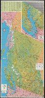
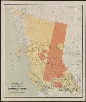
On recto: index and inset: Vancouver, Victoria and vicinity., On verso: text on points of interest, hunting and fishing information, and col. ill., Panel title., and Relief shown by shading and spot heights.
Publisher:
Grant-Mann Lithographers,
Subject (Geographic):
BritishColumbia--Maps
Subject (Name):
British Columbia. Dept. of Travel Industry and Grant-Mann Lithographers Limited
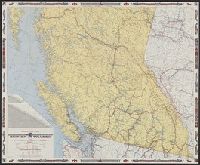
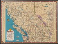
Includes mileage chart., Relief shown by spot heights., and Text, ill., location map, and maps of "Vancouver and lower Fraser Valley" and "Northern British Columbia" on verso.
Publisher:
British Columbia Government Travel Bureau, Dept. of Trade and Industry,
Subject (Geographic):
BritishColumbia--Maps
Subject (Name):
British Columbia. Dept. of Lands and Forests and Geological Survey of Canada
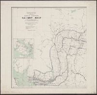
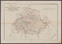
"Corrected to February 1st, 1908.", Indicates "lands disposed of, also timber berths.", Inset: Vancouver Island (Scale [ca. 1:1,267,200])., and Relief shown by spot heights.
"1939-1", "Above data in effect as of January 1, 1939", Also shows northern Washington, northern Idaho, and northwestern Montana., At head of title: Shell., Directory of radio stations in British Columbia, Alberta, and the western United States on verso., and Inde
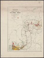
Accompanies: Annual report of the Topographical Surveys Branch, 1908-1909., Relief shown by hachures and spot heights., and Shows primary and secondary triangulations.
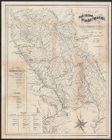
"Entered according to the Act of Congress in the year 1862 by Gustavus Epner in the Clerks Office of the District Court of the North Dist. of California." and Inset: Routes of comunication with the Cariboo Mines. -- Tables showing mileages along Douglas & Ft.