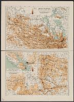
"100 M.84.", Includes indexes, mileage chart, col. ill., and 8 inset maps: Vancouver -- Edmonton -- Calgary -- Winnipeg -- Regina -- Saskatoon -- Alaska Highway -- Victoria., and Road map of Saskatchewan and Manitoba -- Road map of British Columbia and Alberta.
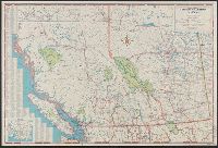
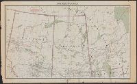
Alberta, British Columbia, Manitoba, Saskatchewan, Provinces of British Columbia and Alberta ; Provinces of Manitoba and Saskatchewan, and Provinces of Manitoba and Saskatchewan.
Description:
Includes mileage tables, indexes, text, and advertisements. and Insets: Map showing continuation of roads from Prince George to Prince Rupert -- Map showing continuation of roads from Edmonton to Peace River District.
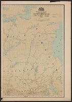
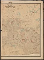
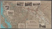
"Accompanying the Report of the Senate Committee appointed to inquire into the, Date inferred from Manitoba's northern boundary which is shown before its northern extension of 1912., and Shows natural resources, and developed and undeveloped agricultural areas.
Publisher:
Railway Lands Branch, Dept. of the Interior,
Subject (Geographic):
Canada, Western--Maps
Subject (Name):
Canada. Dept. of the Interior. Railway Lands Branch
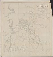
Mounted police stations in the North West Territories
Description:
Relief shown by spot heights and soundings., Shows railroads and Indian reserves., and Yale copy, Covers 74 1904C+, joined, mounted on linen, and folded to 27 x 18 cm.
Publisher:
By authority of Wilfred Laurier, President of the Privy Council,
Subject (Geographic):
Northwest Territories--Maps
Subject (Name):
Laurier, Wilfrid, Sir, 1841-1919, Royal Canadian Mounted Police--Maps, and White, James, 1863-1928
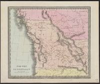
"48" at lower right corner in margin., "Entered according to act of Congress in the year 1836 by Illman & Pilbrow in the Clerk's office of the District Court for the Southern District of New-York.", Appears in Burr's A new universal atlas. 1835., and Prime meridians: Washington and Greenwich.
Publisher:
Illman & Pilbrow,
Subject (Geographic):
Canada, Western--Maps
Subject (Name):
Arnold, Robert M.--Ownership and Burr, David H., 1803-1875. New universal atlas. 1835
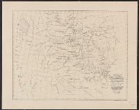
"This map made for the North West Company in 1813 and 1814 ....", Covers British Columbia, portions of Alberta, and U.S. Pacific Northwest., Includes text., Relief shown by hachures., and Reprint of 1814[?] map.
Alaska and the Yukon, Alaska, Yukon, Canadian Rockies, British Columbia, and Triangle tour of British Columbia, Jasper National Park, Mount Robson Park, Canadian Rockies, and the scenic seas of the North Pacific Coast
Description:
Date derived from history of national parks., Includes ill., text, and ancillary map - "Routes of Canadian National Steamships, Pacific Coast Service", Relief shown by shading and by spot heights., and Text and ancillary map - "Canadian National Railways, Grand