Skip to search
Skip to main content
Skip to first result
Search
You Searched For
"Canada--Maps"
New Search
Search Results
Creator:
Published / Created:
[1921].
Call Number:
73g 1921
Container / Volume:
BRBL_00376
Image Count:
1
Resource Type:
Maps, Atlases & Globes
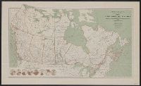
Description:
Includes "Comparative diagrams" of Canada's natural resources.
Publisher:
Dept. of the Interior,
Subject (Geographic):
Canada --Maps
Subject (Name):
Canada. Natural Resources Intelligence Branch
Subject (Topic):
Natural resources--Canada --Maps
Found in:
Beinecke Rare Book and Manuscript Library > Map of the Dominion of Canada : indicating natural resources, transportation and trade routes / prepared in the Natural Resources Intelligence Branch under the direction of F.C.C. Lynch, Superintendent.
Creator:
Published / Created:
1913]
Call Number:
73gc 1913
Container / Volume:
BRBL_00376
Image Count:
1
Resource Type:
Maps, Atlases & Globes
Alternative Title:
Paper trade journal.
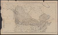
Description:
Date below scale: 1912., In lower margin: From the Proceedings of the Society of American Foresters, vol. 7, no. 2., and In upper margin: Supplement to the Paper Trade Journal, vol. LVI, no. 8, February 20, 1913 ....
Publisher:
Vance Pub. Corp.?,
Subject (Name):
Society of American Foresters. Proceedings of the Society of American Foresters
Subject (Topic):
Forests and forestry--Canada --Maps
Found in:
Beinecke Rare Book and Manuscript Library > Forest and land classification of Canada / by B.E. Fernow.
Creator:
Published / Created:
1886
Call Number:
74FBC 1886
Container / Volume:
BRBL_00394
Image Count:
1
Resource Type:
Maps, Atlases & Globes
Alternative Title:
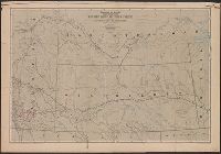
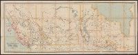
Map showing mounted police stations and patrols throughout the North-West Territories
Description:
"Photo. lith. by the Burland Litho. Co., Montreal." and Published by authority of the Right Hon. Sir John A. MacDonald, G.C.B.
Publisher:
Canada. Dept. of the Interior,
Subject (Geographic):
Assiniboia, District of (Sask. and Alta.)--Maps and Prairie Provinces--Historical geography--Maps
Subject (Name):
North West Mounted Police (Canada
Subject (Topic):
Mounted police--Prairie Provinces--Maps
Found in:
Beinecke Rare Book and Manuscript Library > Map shewing mounted police stations & patrols throughout the North-West Territories : during the year 1886 / compiled, drawn and published under the superintendence of J. Johnston, chief draftsman, Department of the Interior.
Creator:
Published / Created:
1889]
Call Number:
73gme 1889
Container / Volume:
BRBL_00376
Image Count:
2
Resource Type:
Maps, Atlases & Globes
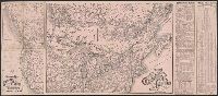
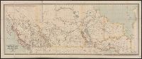
Alternative Title:
Canadian Pacific Railway
Description:
all of Canada , "Map of the Canadian
Publisher:
Canadian Pacific Railway?,
Subject (Name):
Canadian Pacific Railway Company--Maps
Subject (Topic):
Railroads--Canada --Maps
Found in:
Beinecke Rare Book and Manuscript Library > Map of the Canadian Pacific Railway and its connections.
Creator:
Published / Created:
1882
Call Number:
73 1882
Container / Volume:
BRBL_00375
Image Count:
1
Resource Type:
Maps, Atlases & Globes
Description:
In lower right: J. Bartholomew, Edinr. and Relief shown by hachures and spot heights.
Publisher:
Dawson Brothers,
Subject (Geographic):
Canada --Maps
Subject (Name):
Bartholomew, John, 1831-1893 and Canadian Pacific Railway Company--Maps
Subject (Topic):
Railroads--Canada --Maps
Found in:
Beinecke Rare Book and Manuscript Library > Map of Manitoba, Kewaydin, British Columbia and North West Territory : shewing the country traversed by the Canadian Pacific Railway.
Creator:
Published / Created:
1880
Call Number:
73 1880
Container / Volume:
BRBL_00375
Image Count:
1
Resource Type:
Maps, Atlases & Globes
Description:
In lower right: J. Bartholomew, Edinr. and Relief shown by hachures and spot heights.
Publisher:
Dawson Brothers,
Subject (Geographic):
Canada --Maps
Subject (Name):
Bartholomew, John, 1831-1893 and Canadian Pacific Railway Company--Maps
Subject (Topic):
Railroads--Canada --Maps
Found in:
Beinecke Rare Book and Manuscript Library > Map of Manitoba, Kewaydin, British Columbia and North West Territory : shewing the country traversed by the Canadian Pacific Railway.
Creator:
Published / Created:
[1908]
Call Number:
73 1908
Container / Volume:
BRBL_00375A
Image Count:
1
Resource Type:
Maps, Atlases & Globes
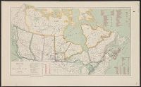
Description:
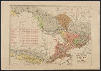
Includes distances from Montreal to other cities in Canada, costs of railways operations in 1907, mileage operated in 1907 and "Railway mileage by provinces, 1907." and Shows existing railroads.
Publisher:
Dept. of the Interior,
Subject (Geographic):
Canada --Maps
Subject (Name):
Canada. Dept. of the Interior
Subject (Topic):
Railroads--Canada --Maps
Found in:
Beinecke Rare Book and Manuscript Library > Map of the Dominion of Canada / James White, geographer.
Creator:
Published / Created:
1910
Call Number:
73 1910
Container / Volume:
BRBL_00375A
Image Count:
1
Resource Type:
Maps, Atlases & Globes
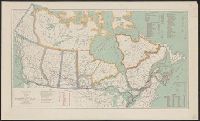
Description:
Includes distance tables and tables about railway mileage, construction, and costs.
Publisher:
Dept. of the Interior,
Subject (Geographic):
Canada --Maps
Subject (Name):
Canada. Dept. of the Interior
Subject (Topic):
Railroads--Canada --Maps
Found in:
Beinecke Rare Book and Manuscript Library > Map of the Dominion of Canada / R.E. Young, D.L.S., Chief Geographer.
Creator:
Published / Created:
1904
Call Number:
73cbf 1904
Container / Volume:
BRBL_00375A
Image Count:
1
Resource Type:
Maps, Atlases & Globes
Description:
Also shows railroads and connecting lines in the United States.
Publisher:
Dept. of the Interior,
Subject (Geographic):
Canada --Maps
Subject (Name):
Canada. Dept. of the Interior
Subject (Topic):
Railroads--Canada --Maps
Found in:
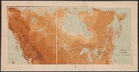
Beinecke Rare Book and Manuscript Library > Relief map of the Dominion of Canada / James White, geographer.
Creator:
Published / Created:
190-?]
Call Number:
73gme 1912A
Container / Volume:
BRBL_00376
Image Count:
2
Resource Type:
Maps, Atlases & Globes
Alternative Title:
Atlas of Canada no. 17, Atlas of Canada no. 18, Ontario and Quebec., Quebec and Maritime Provinces., and Railways :
Description:
At head of title: Department of the Interior, Atlas of Canada., Date inferred from 1905 data on Ontario map., Includes tables., and Quebec and Maritime Provinces -- Ontario and Quebec.
Publisher:
Dept. of the Interior?,
Subject (Name):
Canada. Dept. of the Interior. Atlas of Canada
Subject (Topic):
Railroads--Canada --Maps
Found in:
Beinecke Rare Book and Manuscript Library > Atlas of Canada : Railways.
Branch:v1.61.8 ,Deployed:2024-06-20T11:14:46-04:00