Skip to search
Skip to main content
Skip to first result
Search
You Searched For
"Lorraine (France)--Maps"
New Search
Search Results
Published / Created:
[191-?].
Call Number:
11hcf 1919D-43
Container / Volume:
BRBL_00010X
Image Count:
1
Resource Type:
Maps, Atlases & Globes
Description:
Includes index map. and Shows railroads and canals.
Publisher:
s.n.,
Subject (Geographic):
Lorraine (France )--Maps
Found in:
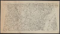
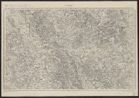
Beinecke Rare Book and Manuscript Library > Block diagram showing terrain of Lorraine and adjacent districts.
Published / Created:
1910
Call Number:
38 B83 1910
Container / Volume:
BRBL_00156
Image Count:
1
Resource Type:
Maps, Atlases & Globes
Description:
"Flle. XXXV-18".
Publisher:
Service Géographique de l'Armée,
Subject (Geographic):
Lorraine (France )--Maps
Found in:
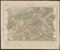
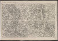
Beinecke Rare Book and Manuscript Library > Bruyéres.
Creator:
Published / Created:
1912
Call Number:
38 1912
Container / Volume:
BRBL_00155
Image Count:
1
Resource Type:
Maps, Atlases & Globes
Description:
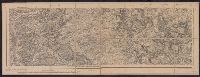
"Commercy S.O. ... 52" printed above upper left margin. "Commercy S.E. ... 52" printed above upper right margin., "Revisée en 1912.", and Dissected and mounted on linen. Ms note "A.B. Dayton" above upper right margin.
Publisher:
Dépôt de la Guerre
Subject (Geographic):
Lorraine (France )--Maps
Subject (Topic):
Maps --France --Lorraine --1912
Found in:
Beinecke Rare Book and Manuscript Library > Commercy. Levée par les Officiers du Corps d'état-major et publiée par le Dépôt de la guerre en 1835.
Published / Created:
[191-?]
Call Number:
11hcf 1919D-42
Container / Volume:
BRBL_00010X
Image Count:
1
Resource Type:
Maps, Atlases & Globes
Publisher:
s.n.,
Subject (Geographic):
Lorraine (France )--Maps
Found in:
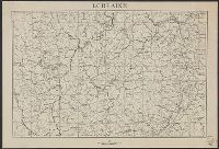
Beinecke Rare Book and Manuscript Library > Lorraine.
Published / Created:
1918
Call Number:
38hc 1918A
Container / Volume:
BRBL_00172
Image Count:
2
Resource Type:
Maps, Atlases & Globes
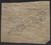
Description:
Base map: Extract of Metz-Commercy., Includes text., and Relief shown by hachures and spot heights.
Publisher:
s.n.],
Subject (Geographic):
Lorraine (France )--Maps
Found in:
Beinecke Rare Book and Manuscript Library > St. Mihiel offensive, map showing daily position of front line : Map Room G-3, G.H.Q., September 1918.
Published / Created:
1918
Call Number:
38hc 1918 Sep. folder
Container / Volume:
BRBL_00172
Image Count:
1
Resource Type:
Maps, Atlases & Globes
Description:
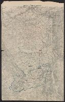
"Druck der Vermess. Abt. 2"., Legend indicates voltage, power lines, transformer stations, power switching stations, front line., Ms. annotations in German. Imperfect: cut around borders., and On verso: Ms. notes: "Komp.-Karte".
Publisher:
s.n.,]
Subject (Geographic):
Lorraine (France )--Maps
Subject (Topic):
Electric lines, World War, 1914-1918--France--Lorraine, and World War, 1914-1918--Maps
Found in:
Beinecke Rare Book and Manuscript Library > Verdun-Point-à-Mousson.
Creator:
Published / Created:
1916
Call Number:
38315cbf C736 1912
Container / Volume:
BRBL_00177
Image Count:
1
Resource Type:
Maps, Atlases & Globes
Description:
Lower right margin: R.14.7.16., Prime meridian: Paris., Relief shown by hachures and spot heights., and Upper right margin: 52.
Publisher:
Dépôt de la guerre],
Subject (Geographic):
Lorraine (France )--Maps
Subject (Name):
Dépôt de la guerre (France) and Hacq, J. M
Found in:
Beinecke Rare Book and Manuscript Library > Commercy / levée par les officiers du Corps d'état-major, et publiée par le Dépôt de la guerre en 1835 ; [gravée, le trait par Bonnet, la lettre par Hacq, le figuré du terrain par George].
Published / Created:
1905?
Call Number:
383 1900
Container / Volume:
BRBL_00177
Image Count:
1
Resource Type:
Maps, Atlases & Globes
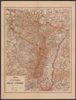
Publisher:
R. Schulz,
Subject (Geographic):
Lorraine (France )--Maps
Found in:
Beinecke Rare Book and Manuscript Library > Karte der Reichs-Provinz Elsass-Lothringen.
Published / Created:
1915?]
Call Number:
38315gfc 1915
Container / Volume:
BRBL_00177
Image Count:
1
Resource Type:
Maps, Atlases & Globes
Description:
In upper left corner: "7".
Publisher:
Naval Staff I.D.,
Subject (Geographic):
Lorraine (France )--Maps
Found in:
Beinecke Rare Book and Manuscript Library > The Lorraine-Saar Minefield.
Creator:
Published / Created:
1917
Call Number:
38315cbf V585 1913
Container / Volume:
BRBL_00177
Image Count:
1
Resource Type:
Maps, Atlases & Globes
Description:
"R.21.5.17.", "Revisée en 1913.", and Original publication details printed in lower margin: Levée par les Officiers du Corps d'Etat-Major, et publiée par le Dépôt de la Guerre en 1835. Gravée le trait par Thierry, la lettre par Hacq, le figure du terrain
Publisher:
Corps d'état major,
Subject (Geographic):
Lorraine (France )--Maps
Subject (Name):
Dépôt de la guerre (France)
Subject (Topic):
World War, 1914-1918--France--Lorraine
Found in:
Beinecke Rare Book and Manuscript Library > Verdun.
Branch:v1.61.8 ,Deployed:2024-06-20T11:15:02-04:00