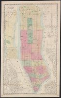
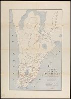
Cadastral map showing property lots with dimensions, names of owners, and year of grant (1642-1658), and early roads., Coordinates not present on map and are approximated., Imperfect: torn along folds, with upper left corner section missing., and Oriented with n
Publisher:
[Dunreath Pub. Co.],
Subject (Geographic):
Manhattan (NewYork, N.Y.)--Maps
Subject (Name):
Dunreath Publishing Co
Subject (Topic):
Land grants--New York (State)--New York--Maps and Real property--New York (State)--New York--Maps
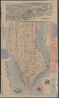
Coordinates not present on map and are approximated., Imperfect: mutilated in upper left corner., North oriented towards the upper right., Shows ferries., and Title devised by cataloger.
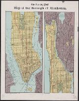
On verso: text, 2 smaller maps "Map of the of City of New York", showing density of population by wards, and a bird's-eye view of the Cotton States and International Exposition, Atlanta, Georgia; image of C.A. Collier, President and Director-General of th
Covers all of Manhattan, also the westernmost parts of Queens and Brooklyn in New York (N.Y.); also part of Jersey City and Hoboken in Hudson County (N.J.) New York (N.Y.) Map shows railroads, shows and names piers. and Hand col.
Publisher:
M. Dripps,
Subject (Geographic):
Manhattan (NewYork, N.Y.)--Maps
Subject (Topic):
Piers--New York (State)--New York--Maps and Railroads--New York (State)--New York--Maps
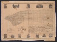
Below title: "A.W. Price, agent.", Inset illustrations of city, Inset map: "Map of New-York and its vicinity. 1850." Scale [ca. 1:63 360]., and Shows fire districts, wards, railroads, and lines designating "the end of the streets at which the numbers commence".
Citizens and travelers guide map into and from the City of New York and adjacent places and Guide map of New York City
Description:
Imperfect: mutilated, with some loss of text., Includes tourist information and inset map, Oriented with north to the upper left., Shows docks, local transit and ferry lines and radial distances from city hall., and Shows Manhattan south of 63rd St.
"Entered according to act of Congress, the 27th day of March 1824, by Wm. Hooker of the state of N. York.", Covers Manhattan south of 15th Street on the west side and south of 31st Street on the east side., and Includes lists of distributors, churches, markets,
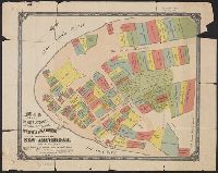
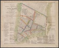
Amsterdam in New Netherland, Early New York., and New Amsterdam 1653-1664
Description:
"The personal names are those of the more prominent citizens of that period with the location of their homes.", "The principal points of interest for this period are in red.", Includes historical notes., Relief shown by hachures., and Shows the footprints of some historic buildings and names them; roads and wharves are also named.
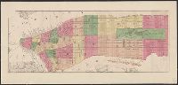
New York 1730 and New York, the English Colonial city
Description:
"The principal points of interest for this period are in red.", Includes historical notes., Relief shown by hachures., Shows the footprints of some historic buildings and of Fort George and names them; roads and wharves are also named., and This is one map from the set titled: Early New York.