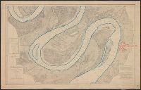
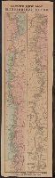
Backed with linen. River outline colored in blue; city of Greenville colored in red., Chart no. 39., Each sheet includes a list of authorities, note, and index chart.--Scale 1:360,000., Each sheet individually numbered, e.g.: Chart No.1, Chart No.2., Projected from a trigonometrical survey made in 1879-'80., and Relief shown by contours. Depths shown by soundings.
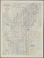
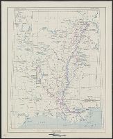
Description derived from published bibliography., Sheet no. 1: "No. 29"; Sheet no. 2: "No. 30." is printed in the upper left corner., and Sheet no. 1: Mississippi River, Rodney, St. Joseph, and Bruinsburg; - - Sheet no. 2: Mississippi River Grand Gulf, Turner's Pt., New Carthage.
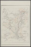
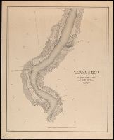
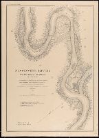
"F. H. Gerdes, Asst. Coast Survey, Chief of Party. A.T. Mosman, Sub asst. in charge of astronomical observations. T.C. Bowie, Sub Asst. in charge of topography. F.W. Perkins, Aid. J.B. Adamson, Aid & Draughtsman." and Description derived from published bibliography.