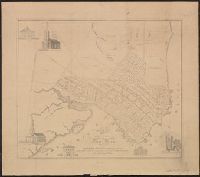
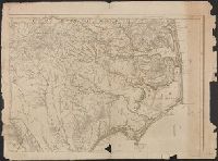
From Streeter Collection -cat. no. 1132., Legend: To his Most Excellent Majesty George the IIID King of Great Britain, &c. &c. &c. This map is most humbly dedicated by most humble obidient & dutiful subject, John Collet., and This large scale map locates the re
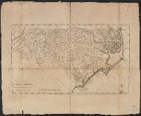
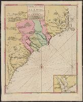
From The English pilot, The Fourth book. Dublin, Geo. Grierson, 1749 and later and perhaps earlier editions. Copied from the London wdition. and Inset: "A Large Draught of Ashly and Coopers River."
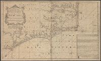
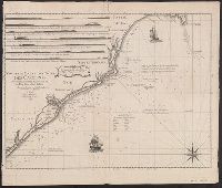
Insets are described in booklet, Printed for Robt. Sayer and J. Bennett ... 1775., See booklet 785.1966 filed in corridor: W.P. Cumming, "North Carolina in Maps" ( Raleigh: State Dept. of Archives and History, 1966), Plate VIII., and See Roll Map 7855 +1794 for
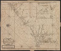
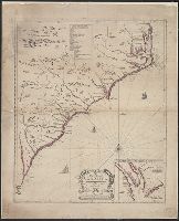
Backed with linen. Sheet measures 63.1 x 51.4 cm. 2nd copy shows different boundary for Colleton County., Bar scales given in "lieues de France et d'Angleterre," "lieues communes d'Allemagne," "lieues communes de Mer"., Prime meridian: Ferro., and Rel
Publisher:
Chez Pierre Mortier,
Subject (Geographic):
NorthCarolina--Maps--Earlyworksto
Subject (Name):
Mortier, Pierre. Atlas nouveau and Mortier, Pierre. Suite du Neptune François