Skip to search
Skip to main content
Skip to first result
Search
You Searched For
"Pacific Area--Maps"
New Search
Search Results
Creator:
Published / Created:
1900?]
Call Number:
23gh 1900A
Container / Volume:
BRBL_00021
Image Count:
1
Resource Type:
Maps, Atlases & Globes
Publisher:
U.S. Treasury Department, Bureau of Statistics,
Subject (Geographic):
Pacific Area --Maps
Found in:
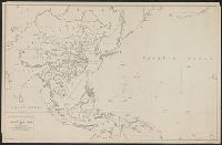
Beinecke Rare Book and Manuscript Library > Commerce and population of countries commercially adjacent to Manila / U.S. Treasury Department, Bureau of Statistics.
Creator:
Published / Created:
1900?]
Call Number:
23gmf 1900
Container / Volume:
BRBL_00021
Image Count:
1
Resource Type:
Maps, Atlases & Globes
Publisher:
U.S. Treasury Department, Bureau of Statistics,
Subject (Geographic):
Pacific Area --Maps
Found in:
Beinecke Rare Book and Manuscript Library > Commercial highways between United States and Asia and the islands of the Pacific / U.S. Treasury Department, Bureau of Statistics.
Creator:
Published / Created:
[1943?]
Call Number:
556ak 1943
Container / Volume:
BRBL_00293
Image Count:
1
Resource Type:
Maps, Atlases & Globes
Publisher:
Chinese News Service,
Subject (Geographic):
Pacific Area --Maps
Found in:
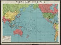
Beinecke Rare Book and Manuscript Library > Map of the Pacific war zone / Henry S. Evans, cartographer.
Creator:
Published / Created:
1945
Call Number:
23 1944
Container / Volume:
BRBL_00020
Image Count:
1
Resource Type:
Maps, Atlases & Globes
Description:
"CDE."
Publisher:
G. Philip & Son Limited,
Subject (Topic):
World War, 1939-1945--Pacific Area
Found in:
Beinecke Rare Book and Manuscript Library > Philips' war map of the Pacific.
Creator:
Published / Created:
[1680?]
Call Number:
23cea 1697
Container / Volume:
BRBL_00682
Image Count:
1
Resource Type:
Maps, Atlases & Globes
Description:
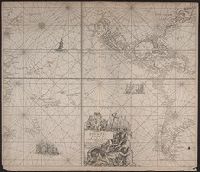
"Met Priviligie voor 15 Iaar.", From Keulen's Groote nieuwe vermeerderde zee-atlas ofte water-waereld / Johannes van Keulen., Map, State 1. Imperfect: small hole in lower right corner, with no loss of text. Cross Collection 69., and Title in cartouche.
Publisher:
By Ioannes van Keulen, aen de Nieuwe brugh in de Gekroonde Lootsman,
Subject (Geographic):
Pacific Area --Maps --Early works to 1800
Subject (Name):
Keulen, Johannes van, 1654-1715. Groote nieuwe vermeerderde zee-atlas ofte water-waereld
Found in:
Beinecke Rare Book and Manuscript Library > Pascaert vande Zuyd Zee en een gedeelte van Brasil van ilhas de Ladronos tot R. de la Plata.
Branch:v1.61.8 ,Deployed:2024-06-20T11:14:46-04:00