Skip to search
Skip to main content
Skip to first result
Search
You Searched For
"Rhode Island--Maps"
New Search
Search Results
Creator:
Published / Created:
©1898 & 1905.
Call Number:
765gmb 1905
Container / Volume:
BRBL_00464
Image Count:
1
Resource Type:
Maps, Atlases & Globes
Alternative Title:
Rhode Island :
Description:
Cover title. and Includes inset of Block Island.
Publisher:
Geo. H. Walker & Co.,
Subject (Geographic):
Rhode Island --Maps
Subject (Topic):
Cycling--Rhode Island --Maps
Found in:
Beinecke Rare Book and Manuscript Library > Road map of Rhode Island [cartographic material] : showing all the roads and points of interest, with the cycling roads distinguished by red lines.
Creator:
Published / Created:
1908
Call Number:
765gd N16 1908
Container / Volume:
BRBL_00464
Image Count:
1
Resource Type:
Maps, Atlases & Globes
Description:
Coordinates not present on map and area approximated. and Includes table of areas leased and lessees' names.
Publisher:
[publisher not identified],
Subject (Topic):
Leases--Rhode Island --Maps
Found in:
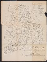
Beinecke Rare Book and Manuscript Library > Map of leased oyster ground / O. Perry Searle, engineer.
Creator:
Published / Created:
1908
Call Number:
765gme 1908
Container / Volume:
BRBL_00464
Image Count:
1
Resource Type:
Maps, Atlases & Globes
Description:
Coordinates not present on map and are approximated.
Publisher:
[publisher not identified],
Subject (Geographic):
Rhode Island --Maps
Subject (Name):
Rand McNally and Company, engravers and Rhode Island. Railroad Commissioner
Subject (Topic):
Railroads--Rhode Island --Maps
Found in:
Beinecke Rare Book and Manuscript Library > Railroad map of Rhode Island / prepared for Railroad Commissioner ; drawn by A.L. Bodwell, Providence, R.I. 1899.
Creator:
Published / Created:
1902
Call Number:
765gme 1902
Container / Volume:
BRBL_00464
Image Count:
1
Resource Type:
Maps, Atlases & Globes
Description:
Coordinates not present on map and are approximated.
Publisher:
[publisher not identified],
Subject (Geographic):
Rhode Island --Maps
Subject (Name):
Rand McNally and Company, engravers and Rhode Island. Railroad Commissioner
Subject (Topic):
Railroads--Rhode Island --Maps
Found in:
Beinecke Rare Book and Manuscript Library > Railroad map of Rhode Island / prepared for Railroad Commissioner ; drawn by A.L. Bodwell, Providence, R.I. 1899.
Creator:
Published / Created:
[1915?]
Call Number:
765 P94 1915
Container / Volume:
BRBL_00464
Image Count:
1
Resource Type:
Maps, Atlases & Globes
Description:
Shows street names and parks, civic institutions, etc.
Publisher:
Walker Lith. & Pub. Co.,
Subject (Geographic):
Providence (R.I.)--Maps
Subject (Topic):
Streets--Rhode Island --Maps
Found in:
Beinecke Rare Book and Manuscript Library > Map of Providence, Rhode Island.
Creator:
Published / Created:
c1898.
Call Number:
766 1898
Container / Volume:
BRBL_00467
Image Count:
3
Resource Type:
Maps, Atlases & Globes
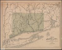
Alternative Title:
Connecticut and Rhode Island and Rand-McNally vest pocket map of Connecticut
Description:
Index on verso. and Prime meridian: Greenwich.
Publisher:
Rand, McNally & Co.,
Subject (Geographic):
Rhode Island --Maps
Subject (Topic):
Railroads--Rhode Island --Maps
Found in:
Beinecke Rare Book and Manuscript Library > Rand, McNally & Co.'s Connecticut and Rhode Island.
Creator:
Published / Created:
1903
Call Number:
765 1904
Container / Volume:
BRBL_00463
Image Count:
1
Resource Type:
Maps, Atlases & Globes
Alternative Title:
Indian map of the lands of Rhode Island. and Lands of Rhode Island as they were known to Canonicus and Miantinomi.
Description:
"Edition limited to 220 copies.", Also published as part of: Rider, S. S. The lands of Rhode Island as they were known to Canonicus and Miantinomi..., Covers attached to verso. Not digitized., and Title on folder: An Indian map of the lands of Rhode Island as they were known to Canonicus and Miantinomi when Roger Williams came here in 1636.
Publisher:
[s.n.]
Subject (Geographic):
Rhode Island--History--Colonial period, ca. 1600-1775--Maps
Subject (Topic):
Names, Geographical--Rhode Island --Maps
Found in:
Beinecke Rare Book and Manuscript Library > Map of the Colony of Rhode Island : giving the Indian names of locations and the locations of great events in Indian history with present political divisions indicated / by Sidney S. Rider.
Creator:
Published / Created:
1879
Call Number:
766 1879
Container / Volume:
BRBL_00467
Image Count:
1
Resource Type:
Maps, Atlases & Globes
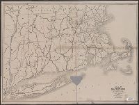
Description:
Includes Long Island, Rhode Island, and adjacent areas of Massachusetts and New York, with railroads shown. and Longitude east from Washington, D.C.; latitude north from equator.
Publisher:
Bingham, Dodd & Co.,
Subject (Topic):
Railroads--Rhode Island --Maps
Found in:
Beinecke Rare Book and Manuscript Library > Map of the railroads of Connecticut : to accompany the report of the railroad commissioners / prepared by S. D. Tilden.
Creator:
Published / Created:
1874
Call Number:
764gme 1874
Container / Volume:
BRBL_00462
Image Count:
1
Resource Type:
Maps, Atlases & Globes
Description:
"Scale, Six Miles to the Inch.", Imperfect. Mutilated with loss of text., and Names counties and shows their boundaries. Shows only those populated places which are on rail lines. Covers southern Vermont and New Hampshire, Connecticut, Rhode Island, Long Island
Publisher:
The Board,
Subject (Geographic):
Massachusetts--Maps
Subject (Topic):
Railroads--Rhode Island --Maps
Found in:
Beinecke Rare Book and Manuscript Library > Map of the railroads of the state of Massachusetts : accompanying the report of the railroad commissioners. 1874.
Creator:
Published / Created:
1921
Call Number:
766gfb 1921
Container / Volume:
BRBL_00475
Image Count:
1
Resource Type:
Maps, Atlases & Globes
Alternative Title:
States of Massachusetts, Rhode Island and Connecticut
Description:
"1919.", "Advance sheet. Subject to correction.", Includes index of power stations., and Shows power plants and transmission lines.
Publisher:
U.S. Geological Survey,
Subject (Name):
Thomas, G. D
Subject (Topic):
Electric lines--Rhode Island --Maps
Found in:
Beinecke Rare Book and Manuscript Library > Stations and transmission lines used in public service : [Massachusetts, Rhode Island and Connecticut] / Department of the Interior, U.S. Geological Survey ; compiled by G.D. Thomas.
Branch:v1.61.6 ,Deployed:2024-06-12T09:55:33-04:00