Search
You Searched For
Search Results
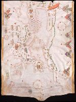
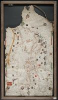
- Creator:
- Maggiolo, Giacomo.
- Published / Created:
- 1553
- Call Number:
- Manuscript 49cea 1553
- Image Count:
- 2
- Resource Type:
- Maps, Atlases & Globes
- Description:
- "Jacobo de Maiolo quondam vesconte ha conpito de ... questa charta in Genoa l'anno del Signore 1553 ha di 13 de aprilis."
- Subject (Geographic):
- Mediterranean Region--Maps--Early works to 1800.
- Found in:
- Beinecke Rare Book and Manuscript Library > [Portolano of the Mediterranean Sea and Europe].
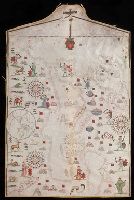
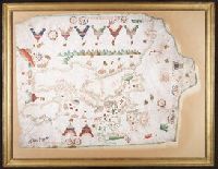
- Creator:
- Freducci, Conte di Ottomano, active 1497-1539, cartographer
- Published / Created:
- [1536?]
- Call Number:
- Covers 49 +1536
- Image Count:
- 6
- Resource Type:
- cartographic image
- Description:
- Four charts, each measuring 33 x 43 cm
- Publisher:
- Conte di Ottomano Freducci
- Subject (Geographic):
- Mediterranean Region, North Atlantic Ocean, and Baltic Sea
- Subject (Topic):
- Nautical charts
- Found in:
- Beinecke Rare Book and Manuscript Library > Composite atlas of portolan charts produced by Conte di Ottomano Freducci
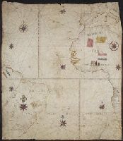
- Published / Created:
- 1590
- Call Number:
- 49cea 1590
- Image Count:
- 2
- Resource Type:
- Maps, Atlases & Globes
- Description:
- Colors: red, greens, and blues.
- Subject (Geographic):
- Europe--Maps--Early works to 1800 and Mediterranean Sea--Maps--Early works to 1800
- Found in:
- Beinecke Rare Book and Manuscript Library > [Portolan chart of the Mediterranean Sea and Europe].
- Creator:
- Volčić, Vicko Dimitrije, 1563-1607, cartographer
- Published / Created:
- [1601]
- Call Number:
- Manuscript 49cea 1601
- Image Count:
- 2
- Resource Type:
- cartographic image
- Description:
- Title devised by cataloger.
- Subject (Geographic):
- Mediterranean Sea
- Subject (Topic):
- Nautical charts
- Found in:
- Beinecke Rare Book and Manuscript Library > [Portolan chart of the Mediterranean Sea].
- Published / Created:
- 1619?]
- Call Number:
- 21cea 1619
- Container / Volume:
- BRBL_00700
- Image Count:
- 1
- Resource Type:
- Maps, Atlases & Globes
- Description:
- chart from Auktion XXXVIII, p. 72, published
- Subject (Geographic):
- Atlantic Ocean--Maps--Early works to 1800
- Found in:
- Beinecke Rare Book and Manuscript Library > [Anonymous ms. Portugese portolano of the Atlantic Ocean.]
- Published / Created:
- [between 1800 and 1899?]
- Call Number:
- GEN MSS FILE 601 (Oversize)
- Image Count:
- 2
- Resource Type:
- cartographic image
- Description:
- chart.
- Subject (Geographic):
- Europe and Mediterranean Sea
- Subject (Topic):
- Nautical charts
- Found in:
- Beinecke Rare Book and Manuscript Library > Portolan chart of western Europe and the Mediterranean Sea
- Call Number:
- 32cea 1550
- Container / Volume:
- BRBL_00701
- Image Count:
- 2
- Resource Type:
- Maps, Atlases & Globes
- Subject (Geographic):
- Europe--Maps--Early works to 1800 and Great Britain--Maps--Early works to 1800
- Found in:
- Beinecke Rare Book and Manuscript Library > [Section of a portolan chart spanning Great Britain in the west to the Adriatic Sea in the east.]
- Published / Created:
- [approximately 1600?]
- Call Number:
- Art Storage 986
- Image Count:
- 2
- Resource Type:
- Maps, Atlases & Globes
- Description:
- Portolan chart with seaport names given
- Subject (Geographic):
- Mediterranean Sea--Maps--Early works to 1800.
- Subject (Topic):
- Nautical charts--Mediterranean Sea
- Found in:
- Beinecke Rare Book and Manuscript Library > Portolan chart of the Mediterranean Sea.
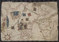
- Creator:
- Roselli, Petrus, active 1446-1468, cartographer
- Published / Created:
- [approximately 1450-1475]
- Call Number:
- Art Storage 49cea 1425
- Image Count:
- 2
- Resource Type:
- cartographic image
- Description:
- Portolan chart with seaport names given
- Publisher:
- Petrus Roselli?
- Subject (Geographic):
- Mediterranean Sea and Black Sea
- Subject (Topic):
- Nautical charts
- Found in:
- Beinecke Rare Book and Manuscript Library > Portolan chart of the Mediterranean Sea and the Black Sea
- Creator:
- Maggiolo, Vesconte, active 1504-1549.
- Call Number:
- Art Storage 1980 156
- Image Count:
- 2
- Resource Type:
- Maps, Atlases & Globes
- Description:
- Portolan chart with seaport names given
- Subject (Geographic):
- Baltic Sea--Maps--Early works to 1800., Mediterranean Sea--Maps--Early works to 1800., and North Atlantic Ocean--Maps--Early works to 1800.
- Subject (Topic):
- Manuscript maps --Mediterranean Region, Portolanos --Europe, and Portolanos --Mediterranean Region
- Found in:
- Beinecke Rare Book and Manuscript Library > [Portolan chart of the Mediterranean Sea, the North Atlantic Ocean, the Baltic Sea, and the West African coast].