Skip to search
Skip to main content
Skip to first result
Search
You Searched For
Extent of Digitization
Completely digitized
Publication Place
[London] :
Search Results
Creator:
Published / Created:
1746
Call Number:
2002 Folio 94
Image Count:
1
Resource Type:
Maps, Atlases & Globes
Alternative Title:
Contracted sketch of the plan of London &c. and Plan of the cities of London and Westminster and borough of Southwark.
Description:
"Published in October 1746 ... "
Publisher:
John Pine and John Tinney,
Subject (Geographic):
London (England)--Maps--Early works to 1800
Subject (Name):
Hodgson, Ralph,--1871-1962--Autograph
Found in:
Beinecke Rare Book and Manuscript Library > A contracted scetch of the plan of London &c. : printed on 24 sheets of imperial paper, to shew the general appearance of the whole : for the use of those who bind it in a book, and for the better comprehension of the divisions mentioned in the index.
Creator:
Published / Created:
[1625]
Call Number:
BrSides 2019 110
Image Count:
1
Resource Type:
Maps, Atlases & Globes
Description:
At upper right, the seal of the Great Mogul, with English transliteration.
Publisher:
[Printed by W. Stansby for H. Fetherstone],
Subject (Geographic):
South Asia--Maps--Early works to 1800.
Subject (Name):
Featherstone, Henry, -1647, Purchas, Samuel, 1577?-1626. Purchas his Pilgrimage., and Stansby, William, active 1597-1638
Found in:
Beinecke Rare Book and Manuscript Library > A description of East India : conteyning the Empire of the Great Mogoll / R. Elstracke sculpsit.
Published / Created:
1684
Call Number:
BrSides By6 1684
Image Count:
1
Description:
Begins: Come murthering Miles, where's your sedan?
Publisher:
Printed for J. Dean,
Subject (Name):
Prance, Miles,--fl. 1678-1689
Subject (Topic):
Brit tracts--1684
Found in:
Beinecke Rare Book and Manuscript Library > A dialogue between Bowman the Tory, and Prance the runagado : a new song.
Creator:
Published / Created:
[1778?]
Call Number:
BrSides 2017 62
Image Count:
1
Resource Type:
Maps, Atlases & Globes
Description:
Includes distance chart.
Publisher:
[publisher not identified],
Subject (Geographic):
North America--Maps--Early works to 1800
Subject (Name):
Jefferys, Thomas, -1771.
Found in:
Beinecke Rare Book and Manuscript Library > A general map of North America ; from the latest observations / engrav'd by Jno. Lodge from the late Mr. Jefferys, geographer to the King.
Creator:
Published / Created:
1758
Call Number:
755 1758
Container / Volume:
BRBL_00428
Image Count:
1
Resource Type:
Maps, Atlases & Globes
Alternative Title:
Middle British colonies
Description:
Hand colored.
Publisher:
Sold by T. Jefferys,
Subject (Geographic):
North America--Maps--Early works to 1800 and Northeastern States--Maps--Early works to 1800
Subject (Name):
Evans, Lewis, 1700?-1756, Jefferys, Thomas, d. 1771, and Mellon, Paul--Bookplate
Subject (Topic):
British--America--Maps--Early works to 1800
Found in:
Beinecke Rare Book and Manuscript Library > A general map of the middle British colonies in America : viz. Virginia, Maryland, Delaware, Pensilvania, New-Jersey, New-York, Connecticut and Rhode-Island : of Aquanishuonigy the country of the confederate Indians comprehending Aquanishuonigy proper, th
Creator:
Published / Created:
1775 June 15
Call Number:
755 1775D
Container / Volume:
BRBL_00429
Image Count:
1
Resource Type:
Maps, Atlases & Globes
Alternative Title:
Middle British colonies in America
Description:
Includes historical notes, text, 3 distance charts, and inset of "A sketch of the remaining part of Ohio R. &c."
Publisher:
Sold by R. Sayer in Fleet Street & T. Jefferys, Charing Cross,
Subject (Geographic):
Northeastern States--Maps--Early works to 1800
Subject (Name):
Evans, Lewis, 1700?-1756 and Sayer, Robert, 1725-1794
Found in:
Beinecke Rare Book and Manuscript Library > A general map of the middle British colonies in America : viz. Virginia, Maryland, Delaware, Pensilvania, New-Jersey, New-York, Connecticut, and Rhode-Island : of Aquanishuonîgy the country of the Confederate Indians comprehending Aquanishuonigy proper,
Published / Created:
1805
Call Number:
3238 1805
Container / Volume:
BRBL_00065
Image Count:
1
Resource Type:
Maps, Atlases & Globes
Description:
Preliminary record.
Publisher:
John Stockdale,
Subject (Geographic):
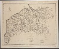
Cumberland (England)--Maps
Found in:
Beinecke Rare Book and Manuscript Library > A map of Cumberland ... Engraved by J. Cary.
Published / Created:
1798
Call Number:
3258 1798
Container / Volume:
BRBL_00069
Image Count:
1
Resource Type:
Maps, Atlases & Globes
Description:
Preliminary record.
Publisher:
J. Stockdale,
Subject (Geographic):
Hertfordshire (England)--Maps--Early works to 1800
Found in:
Beinecke Rare Book and Manuscript Library > A map of Hartfordshire.
Published / Created:
1805
Call Number:
3235 1805
Container / Volume:
BRBL_00064
Image Count:
1
Resource Type:
Maps, Atlases & Globes
Description:
Preliminary record.
Publisher:
John Stockdale,
Subject (Geographic):
Lancashire (England)--Maps
Found in:
Beinecke Rare Book and Manuscript Library > A map of Lancashire ... Engraved by J. Cary.
Creator:
Published / Created:
[1757]
Call Number:
777 1758
Container / Volume:
BRBL_00690
Image Count:
1
Resource Type:
Maps, Atlases & Globes
Description:
"For the Lond. Mag."
Publisher:
Printed for R. Baldwin in Pater Noster Row,
Subject (Geographic):
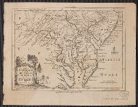
Chesapeake Bay Region (Md. and Va.)--Maps--Early works to 1800, Delaware--Maps--Early works to 1800, New Jersey--Maps--Early works to 1800, and Pennsylvania--Maps--Early works to 1800
Subject (Name):
Baldwin, R. (Robert), 1737-1810
Found in:
Beinecke Rare Book and Manuscript Library > A map of Maryland with the Delaware counties and the southern part of New Jersey &c / [cartographic material] / by T. Kitchin geogr.
Branch:v1.68.7 ,Deployed:2025-07-09T09:08:31-04:00