Skip to search
Skip to main content
Skip to first result
Search
You Searched For
Extent of Digitization
Completely digitized
Repository
Beinecke Rare Book and Manuscript Library
Creator
Geological Survey (U.S.)
Search Results
Creator:
Published / Created:
[1910]
Call Number:
844fcm Y83 1910
Container / Volume:
BRBL_00615
Image Count:
1
Resource Type:
Maps, Atlases & Globes
Description:
Relief shown by contours and spot heights.
Publisher:
Geological Survey,
Subject (Geographic):
Yosemite National Park (Calif.)--Administrative and political divisions--Maps and Yosemite National Park (Calif.)--Maps
Found in:
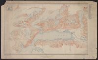
Beinecke Rare Book and Manuscript Library > Administrative map of Yosemite National Park, California / topography by R.E. Marshall and A.H. Sylvester ; surveyed in 1893-94, 1896, 1898-99 and 1905.
Creator:
Published / Created:
[1910]
Call Number:
844fcm Y83 1910
Container / Volume:
BRBL_00615
Image Count:
1
Resource Type:
Maps, Atlases & Globes
Description:
Relief shown by contours and spot heights.
Publisher:
Geological Survey,
Subject (Geographic):
Yosemite National Park (Calif.)--Administrative and political divisions--Maps and Yosemite National Park (Calif.)--Maps
Found in:
Beinecke Rare Book and Manuscript Library > Administrative map of Yosemite National Park, California / topography by R.E. Marshall and A.H. Sylvester ; surveyed in 1893-94, 1896, 1898-99 and 1905.
Creator:
Published / Created:
1898
Call Number:
848 C793 1898
Container / Volume:
BRBL_00632
Image Count:
1
Resource Type:
Maps, Atlases & Globes
Alternative Title:
Copper River and adjacent territory, Geological Survey (U.S.). Report, Public resolution ; no. 25, 55th Congress, 3d session., and Its Report, Public resolution ; no. 25, 55th Congress, 3d session
Description:
Contour interval approximately 250 feet.
Publisher:
The Survey,
Subject (Geographic):
Alaska--Maps, Chugach Mountains (Alaska)--Maps, and Copper River Region (Alaska)--Maps
Subject (Name):
Abercrombie, W. R.--(William Ralph),--b. 1857, Lowe, P. G, Mahlo, Emil, and Schrader, Frank C. (Frank Charles), 1860-1944
Found in:
Beinecke Rare Book and Manuscript Library > Alaska military expedition : in charge of Captain W.R. Abercrombie, U.S.A. Copper River and adjacent territory / topography by P.G. Lowe, F.C. Schrader, and Emil Mahlo.
Creator:
Published / Created:
1909
Call Number:
848 C26 1909
Container / Volume:
BRBL_00632
Image Count:
1
Resource Type:
Maps, Atlases & Globes
Alternative Title:
Casadepaga quadrangle and Topographic map of Casadepaga quadrangle, Alaska
Description:
Relief shown by contours and spot heights.
Publisher:
The Survey,
Subject (Geographic):
Casadepaga River (Alaska)--Maps
Found in:
Beinecke Rare Book and Manuscript Library > Alaska, Casadepaga quadrangle / U.S. Geological Survey.
Creator:
Published / Created:
[1908]
Call Number:
848 F15 1908
Container / Volume:
BRBL_00632
Image Count:
1
Resource Type:
Maps, Atlases & Globes
Alternative Title:
Alaska ; sheet no. 642 A and Fairbanks special map
Description:
"Surveyed in 1907."
Publisher:
The Survey,
Subject (Geographic):
Fairbanks Region (Alaska)--Maps
Found in:
Beinecke Rare Book and Manuscript Library > Alaska, Fairbanks special map / U.S. Geological Survey.
Creator:
Published / Created:
[1915]
Call Number:
848 V23 1915
Container / Volume:
BRBL_00634
Image Count:
1
Resource Type:
Maps, Atlases & Globes
Alternative Title:
Port Valdez District, Prince William Sound region, Port Valdez District, and Topography, Alaska, Prince William Sound region, Port Valdez District
Description:
"Alaska Sheet no. 602 B."
Publisher:
The Survey,
Subject (Geographic):
Port Valdez Region (Alaska)--Maps and Prince William Sound Region (Alaska)--Maps
Subject (Name):
Bagley, James Warren, 1881-1947 and Giffin, C. E
Found in:
Beinecke Rare Book and Manuscript Library > Alaska, Prince William Sound region, Port Valdez District [cartographic material] / U.S. Geological Survey, Alfred H. Brooks, Geologist in charge of division ; topography by J.W. Bagley and C.E. Giffin.
Creator:
Published / Created:
1906
Call Number:
771cbf Al13 1906
Image Count:
1
Resource Type:
Maps, Atlases & Globes
Description:
"Henry Gannet, Chief Geographer, H.M. Wilson, Geographer in charge; Topography by Frank Sutton and J.H. Jennings; surveyed in 1891-1892."
Publisher:
U.S. Geological Survey,
Subject (Geographic):
Albany Region (N.Y.)--Maps
Subject (Name):
Gannett, Henry, 1846-1914
Found in:
Beinecke Rare Book and Manuscript Library > Albany and vicinity, New York.
Creator:
Published / Created:
[1893]
Call Number:
831ca 1893
Container / Volume:
BRBL_00581
Image Count:
1
Resource Type:
Maps, Atlases & Globes
Description:
"Contour interval 200 feet."
Publisher:
Geological Survey,
Subject (Name):
Douglas, Edward Morehouse, 1855-1932, Gannett, Henry, 1846-1914, Hague, A. (Arnold), 1840-1917, Iddings, Joseph Paxson, 1857-1920, Leffingwell, W. H, Northern Transcontinental Survey, and Rensh
Subject (Topic):
Geology--Montana--Park County--Maps
Found in:
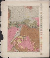
Beinecke Rare Book and Manuscript Library > Areal geology, Montana, Livingston sheet / U.S. Geological Survey, J.W. Powell, Director ; Henry Gannett, Chief Topographer ; A.H. Thompson, Geographer in charge ; triangulation by E.M. Douglas and J.H. Renshawe ; topography by Northern Transcontinental S
Creator:
Published / Created:
1917?]
Call Number:
38hc L337 1917
Container / Volume:
BRBL_00173
Image Count:
1
Resource Type:
Maps, Atlases & Globes
Description:
Shows "quadrille de Bonne en noir, quarillage Lambert en rouge."
Subject (Geographic):
Oise (France)--Maps
Subject (Topic):
World War, 1914-1918
Found in:
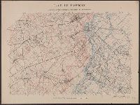
Beinecke Rare Book and Manuscript Library > Camp de Lassigny, Anciennes Organisations Francaises et Allemandes [cartographic material] / Engraved and printed by the U.S. Geological Survey.
Creator:
Published / Created:
1916?]
Call Number:
38hc L337 1916
Container / Volume:
BRBL_00173
Image Count:
1
Resource Type:
Maps, Atlases & Globes
Description:
Shows "quadrille de Bonne en noir, quarillage Lambert en rouge."
Subject (Geographic):
Oise (France)--Maps
Subject (Topic):
World War, 1914-1918 and World War, 1914-1918--Campaigns--France
Found in:
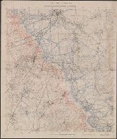
Beinecke Rare Book and Manuscript Library > Camp de Lassigny, Anciennes Organisations Francaises et Allemandes [cartographic material].
Branch:v1.68.6 ,Deployed:2025-07-02T08:09:21-04:00