Search
You Searched For
Search Results
- Creator:
- Ordnance Survey of Great Britain and Ireland
Royal Geographical Society (Great Britain). Geographical Section
- Published / Created:
- 1915
- Call Number:
- 11hcf 1919E-5
- Container / Volume:
- BRBL_00010ZA
- Image Count:
- 1
- Resource Type:
- Maps, Atlases & Globes
- Alternative Title:
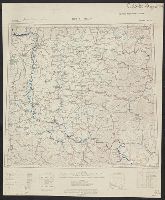
- Europe 1:1,000,000, G.S.G.S. ; no. 2758, and G.S.G.S. ; no. 2758.
- Description:
- Copy 2 ms. notes, hand col. spots on map.
- Publisher:
- Ordnance Survey,
- Subject (Geographic):
- Austria--Maps and Europe, Eastern--Maps
- Found in:
- Beinecke Rare Book and Manuscript Library > (Vienna) Wien : North M 33. / compiled at the Royal Geographical Society under the direction of the Geographical Section ; drawn and printed by Ordnance Survey.
- Creator:
- Ordnance Survey of Great Britain and Ireland
Royal Geographical Society (Great Britain). Geographical Section
- Published / Created:
- 1918
- Call Number:
- 11hcf 1919E-6
- Container / Volume:
- BRBL_00010ZA
- Image Count:
- 1
- Resource Type:
- Maps, Atlases & Globes
- Alternative Title:
- Europe 1:1,000,000, G.S.G.S. ; no. 2758, and G.S.G.S. ; no. 2758.
- Description:
- "Minor corrections December 1918."
- Publisher:
- Ordnance Survey,
- Subject (Geographic):
- Austria--Maps and Europe, Eastern--Maps
- Found in:
- Beinecke Rare Book and Manuscript Library > (Vienna) Wien : North M 33. / compiled at the Royal Geographical Society under the direction of the Geographical Section ; drawn and printed by Ordnance Survey.
- Creator:
- Ordnance Survey of Great Britain and Ireland
Royal Geographical Society (Great Britain). Geographical Section
- Published / Created:
- 1915
- Call Number:
- 11hcf 1919E-5
- Container / Volume:
- BRBL_00010ZA
- Image Count:
- 1
- Resource Type:
- Maps, Atlases & Globes
- Alternative Title:
- Europe 1:1,000,000, G.S.G.S. ; no. 2758, and G.S.G.S. ; no. 2758.
- Description:
- Includes index to adjoining sheets, index to boundaries, and pronunciation glossary.
- Publisher:
- Ordnance Survey,
- Subject (Geographic):
- Austria--Maps and Europe, Eastern--Maps
- Found in:
- Beinecke Rare Book and Manuscript Library > (Vienna) Wien : North M 33. / compiled at the Royal Geographical Society under the direction of the Geographical Section ; drawn and printed by Ordnance Survey.
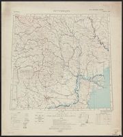
- Creator:
- Ordnance Survey of Great Britain and Ireland
Royal Geographical Society (Great Britain). Geographical Section
- Published / Created:
- 1915
- Call Number:
- 11hcf 1919E-12
- Image Count:
- 1
- Resource Type:
- Maps, Atlases & Globes
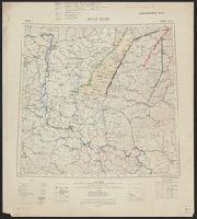
- Alternative Title:
- Europe 1:1,000,000, G.S.G.S. ; no. 2758, and GSGS (Series) ; no. 2758.
- Description:
- Includes index to adjoining sheets, index to boundaries, and pronunciation glossary.
- Publisher:
- Ordnance Survey,
- Subject (Geographic):
- Europe, Eastern--Maps
- Subject (Topic):
- World War, 1914-1918--Maps
- Found in:
- Beinecke Rare Book and Manuscript Library > (Warsaw) Varshava : North N. 34. / compiled at the Royal Geographical Society under the direction of the Geographical Section; drawn and printed by Ordnance Survey.
- Creator:
- Ordnance Survey of Great Britain and Ireland
Royal Geographical Society (Great Britain). Geographical Section
- Published / Created:
- 1918
- Call Number:
- 11hcf 1919E-14
- Image Count:
- 1
- Resource Type:
- Maps, Atlases & Globes
- Alternative Title:
- Europe 1:1,000,000, G.S.G.S. ; no. 2758, and GSGS (Series) ; no. 2758.
- Description:
- Includes index to adjoining sheets, index to boundaries, and pronunciation glossary.
- Publisher:
- Ordnance Survey,
- Subject (Geographic):
- Europe, Eastern--Maps
- Subject (Name):
- Seymour, Charles,--1885-1963--Autograph
- Subject (Topic):
- World War, 1914-1918--Maps
- Found in:
- Beinecke Rare Book and Manuscript Library > Bucuresti : North L 35. / compiled at the Royal Geographical Society under the direction of the Geographical Section; drawn and printed by Ordnance Survey.
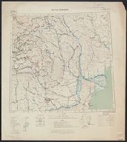
- Creator:
- Ordnance Survey of Great Britain and Ireland
Royal Geographical Society (Great Britain). Geographical Section
- Published / Created:
- 1918
- Call Number:
- 11hcf 1919E-15
- Image Count:
- 1
- Resource Type:
- Maps, Atlases & Globes
- Alternative Title:
- Europe 1:1,000,000, G.S.G.S. ; no. 2758, and GSGS (Series) ; no. 2758.
- Description:
- Elevation above sea level indicated by colored shading.
- Publisher:
- Ordnance Survey,
- Subject (Geographic):
- Europe, Eastern--Maps
- Subject (Name):
- Seymour, Charles,--1885-1963--Autograph
- Subject (Topic):
- World War, 1914-1918--Maps
- Found in:
- Beinecke Rare Book and Manuscript Library > Bucuresti : North L 35. / compiled at the Royal Geographical Society under the direction of the Geographical Section; drawn and printed by Ordnance Survey.
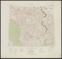
- Creator:
- Ordnance Survey of Great Britain and Ireland
Royal Geographical Society (Great Britain). Geographical Section
- Published / Created:
- 1915
- Call Number:
- 11hcf 1919E-13
- Image Count:
- 1
- Resource Type:
- Maps, Atlases & Globes
- Alternative Title:
- Europe 1:1,000,000, G.S.G.S. ; no. 2758, and GSGS (Series) ; no. 2758.
- Description:
- Includes index to adjoining sheets, index to boundaries, and pronunciation glossary.
- Publisher:
- Ordnance Survey,
- Subject (Geographic):
- Europe, Eastern--Maps
- Subject (Name):
- Seymour, Charles,--1885-1963--Autograph
- Subject (Topic):
- World War, 1914-1918--Maps
- Found in:
- Beinecke Rare Book and Manuscript Library > Bucuresti : North L 35. / compiled at the Royal Geographical Society under the direction of the Geographical Section; drawn and printed by Ordnance Survey.
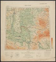
- Creator:
- Ordnance Survey of Great Britain and Ireland
Royal Geographical Society (Great Britain). Geographical Section
- Published / Created:
- 1918
- Call Number:
- 11hcf 1919E-20
- Container / Volume:
- BRBL_00010ZA
- Image Count:
- 1
- Resource Type:
- Maps, Atlases & Globes
- Alternative Title:
- Europe 1:1,000,000, G.S.G.S. ; no. 2758, and GSGS (Series) ; no. 2758.
- Description:
- Elevation above sea level indicated by colored shading.
- Publisher:
- Ordnance Survey,
- Subject (Geographic):
- Hungary--Maps
- Subject (Topic):
- World War, 1914-1918--Maps
- Found in:
- Beinecke Rare Book and Manuscript Library > Buda Pest : North L 34. / compiled at the Royal Geographical Society under the direction of the Geographical Section; drawn and printed by Ordnance Survey.
- Creator:
- Ordnance Survey of Great Britain and Ireland
Royal Geographical Society (Great Britain). Geographical Section
- Published / Created:
- 1915
- Call Number:
- 11hcf 1919E-19
- Container / Volume:
- BRBL_00010Z
- Image Count:
- 1
- Resource Type:
- Maps, Atlases & Globes
- Alternative Title:
- Europe 1:1,000,000, G.S.G.S. ; no. 2758, and GSGS (Series) ; no. 2758.
- Description:
- Copy 2: Col. ms. notes on map described as "Czechoslovakian Border". Inscription: Charles Seymour.
- Publisher:
- Ordnance Survey,
- Subject (Geographic):
- Hungary--Maps
- Subject (Name):
- Seymour, Charles,--1885-1963--Autograph
- Subject (Topic):
- World War, 1914-1918--Maps
- Found in:
- Beinecke Rare Book and Manuscript Library > Buda Pest : North L 34. / compiled at the Royal Geographical Society under the direction of the Geographical Section; drawn and printed by Ordnance Survey.
- Creator:
- Ordnance Survey of Great Britain and Ireland
Royal Geographical Society (Great Britain). Geographical Section
- Published / Created:
- 1915
- Call Number:
- 11hcf 1919E-19
- Container / Volume:
- BRBL_00010Z
- Image Count:
- 1
- Resource Type:
- Maps, Atlases & Globes
- Alternative Title:
- Europe 1:1,000,000, G.S.G.S. ; no. 2758, and GSGS (Series) ; no. 2758.
- Description:
- Copy 3: Ms. legend corresponding to col. ms. notes on map. On sheet 63 x 52 cm. Inscription: Charles Seymour.
- Publisher:
- Ordnance Survey,
- Subject (Geographic):
- Hungary--Maps
- Subject (Name):
- Seymour, Charles,--1885-1963--Autograph
- Subject (Topic):
- World War, 1914-1918--Maps
- Found in:
- Beinecke Rare Book and Manuscript Library > Buda Pest : North L 34. / compiled at the Royal Geographical Society under the direction of the Geographical Section; drawn and printed by Ordnance Survey.