Skip to search
Skip to main content
Skip to first result
Search
You Searched For
Extent of Digitization
Completely digitized
Format
cartographic
Creator
Wit, Frederik de
Search Results
Creator:
Published / Created:
[1690?]
Call Number:
335 1690
Container / Volume:
BRBL_00085
Image Count:
1
Resource Type:
Maps, Atlases & Globes
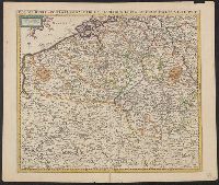
Description:
Map digitized.
Publisher:
Frederick de Wit inde Kalverstraet inde Witte Pascaert,
Subject (Geographic):
Belgium--Maps--Early works to 1800
Found in:
Beinecke Rare Book and Manuscript Library > Belgii regii accuratissima tabula pluribus locis / recens emen: A F. De Wit.
Creator:
Published / Created:
169-?]
Call Number:
3617 1730
Image Count:
1
Resource Type:
Maps, Atlases & Globes
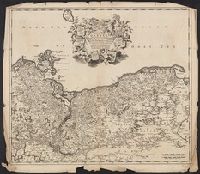
Description:
Imperfect: torn along folds and chipped at edges, with no loss of text. Sheet measures 54.0 x 61.9 cm.
Publisher:
Frederik de Wit?,
Subject (Geographic):
Pomerania (Poland and Germany)--Maps--Early works to 1800
Found in:
Beinecke Rare Book and Manuscript Library > Ducatus Pomeraniae tabula generalis, in qua sunt Ducatus Pomeraniae, Stettinensis, Cassubiae, Vandaliae, et Bardensis, Principatus Rugiae, ac Insulae, Comitatus Guskoviensis, et Dominia Louwenburgense, Wolgastense et Butoviense [cartographic material] / p
Creator:
Published / Created:
[1680?]
Call Number:
4894 1680
Container / Volume:
BRBL_00267
Image Count:
1
Resource Type:
Maps, Atlases & Globes
Description:
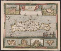
"23" in upper right corner.
Publisher:
Gedruckt tot Amsterdam by Frederick de Wit ...,
Subject (Geographic):
Crete (Greece)--Maps--Early works to 1800
Subject (Name):
Wit, Frederik de. Atlas
Found in:
Beinecke Rare Book and Manuscript Library > Insula Candia [cartographic material] : eiusque fortificatio / edita per F. de wit.
Creator:
Published / Created:
[1680?]
Call Number:
408 1680
Container / Volume:
BRBL_00238
Image Count:
1
Resource Type:
Maps, Atlases & Globes
Description:
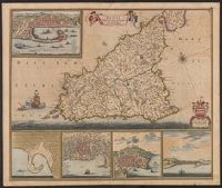
Appears in various editions of Wit's Atlas.
Publisher:
Gedruckt tot Amsterdam by Frederik de Wit inde Kalverstraet by den Dam inde Witte Paskaert,
Subject (Geographic):
Sicily (Italy)--Maps--Early works to 1800
Subject (Name):
Rodriguez, José M.--Bookplate, Uytenbogaart, J. W. H. (Johannes Wilhelmus Huybert), and Wit, Frederik de. Atlas
Found in:
Beinecke Rare Book and Manuscript Library > Insula sive regnum Siciliae / urbibus praecipuis exornatum et novissime editum per F. de Wit.
Creator:
Published / Created:
[1700?]
Call Number:
35 1700
Container / Volume:
BRBL_00100
Image Count:
1
Resource Type:
Maps, Atlases & Globes
Description:
Appears in various editions of Wit's Atlas.
Publisher:
Gedruckt t'Amsterdam by Frederick de Wit ...,
Subject (Geographic):
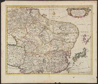
Asia--Maps--Early works to 1800
Found in:
Beinecke Rare Book and Manuscript Library > Magnae Tartariae: magni Mogolis imperii, Japoniae et Chinae, nova descriptio.
Creator:
Published / Created:
[1666?]
Call Number:
53 1690
Container / Volume:
BRBL_00283
Image Count:
1
Resource Type:
Maps, Atlases & Globes
Description:
"Gemeene Duytsche mylen van 15 in een graedt."
Publisher:
By Frederick de Wit in de Kalversbraet in de Witte Pascaert,
Subject (Geographic):
Middle East--Maps--Early works to 1800
Subject (Name):
Rodriguez, José M.--Bookplate and Wit, Frederik de. Atlas
Found in:
Beinecke Rare Book and Manuscript Library > Nova Persiae, Armeniae, Natoliae, et Arabiae descriptio / per F. de Wit.
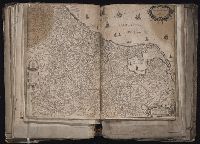
Creator:
Published / Created:
1652
Call Number:
1983 Folio 19
Collection Title:
[Atlas factice of 96 maps by Blaeu, Visscher, Jansson, Hondius and others]
Image Count:
1
Description:
Imperfect: torn and repaired along folds and in corners, with some loss of text. Sheet measures 38.8 x 54.8 cm. Reinforced along edges with manuscript waste. No. 50 of 92 maps bound together.
Publisher:
Apud Frederico de Widt
Subject (Geographic):
Netherlands --Maps --Early works to 1800
Found in:
Beinecke Rare Book and Manuscript Library > Nova XVII provinciarum discriptio / Baptista a Doetecum fecit
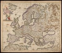
Creator:
Published / Created:
[170-?]
Call Number:
BrSides Double Folio 2019 113
Image Count:
1
Resource Type:
Maps, Atlases & Globes
Alternative Title:
Europae descriptio
Description:
"Amstelodami cum privilegio D.D. ordin. Hollandiae Westfrisiaeq[ue]."
Publisher:
Frederik de Wit,
Subject (Geographic):
Europe--Maps--Early works to 1800.
Found in:
Beinecke Rare Book and Manuscript Library > Nova et accurate divisa in regna et regiones praecipuas Europae descriptio / per F. de Witt ; F. de wit excudit.
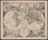
Creator:
Published / Created:
[1720?]
Call Number:
11 1720A
Container / Volume:
BRBL_00680
Image Count:
1
Resource Type:
Maps, Atlases & Globes
Alternative Title:
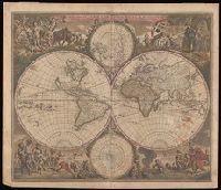
Nova orbis tabvla in lvcem edita
Description:
Allegorical vignettes of the four seasons.
Publisher:
Apud Ioannem Covens et Cornelium Mortier,
Subject (Name):
Cóvens, Jean and Mortier, Corneille
Subject (Topic):
World maps--Early works to 1800
Found in:
Beinecke Rare Book and Manuscript Library > Nova orbis tabula in lucem edita / a. F. de Wit.
Creator:
Call Number:
BrSides Double Folio 2019 116
Image Count:
1
Resource Type:
Maps, Atlases & Globes
Alternative Title:
Nova orbis tabula in lucem edita
Description:
Allegorical vignettes of the four seasons.
Subject (Geographic):
World--Maps--Early works to 1800.
Subject (Topic):
World maps--Early works to 1800.
Found in:
Beinecke Rare Book and Manuscript Library > Nova orbis tabvla in lvcem edita / a. F. de Wit.
Branch:v1.68.6 ,Deployed:2025-07-02T08:09:49-04:00