Skip to search
Skip to main content
Skip to first result
Search
You Searched For
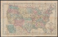
Extent of Digitization
Completely digitized
Format
cartographic
Subject (Topic)
Railroads--United States--Maps
Search Results
Published / Created:
[1874?]
Call Number:
796gme 1874
Container / Volume:
BRBL_00531
Image Count:
2
Resource Type:
Maps, Atlases & Globes
Alternative Title:
Proposed lines of the International R.R. of Mexico., Railroad map of Texas, Texas New Yorker., Texas New Yorker's map of the United States., and Travelers' and immigrants' guide, or railroad map to Texas
Description:
"Entered according to act of Congress in the year 1874 by Geo. H. Sweet in the office of the Librarian of Congress at Washington."
Publisher:
Geo. H. Sweet,
Subject (Name):
Streeter, Thomas W.--(Thomas Winthrop),--1883-1965--Ownership and Sweet, George H
Subject (Topic):
Railroads--Mexico--Maps, Railroads--Texas--Maps, and Railroads--United States--Maps
Found in:
Beinecke Rare Book and Manuscript Library > "Texas New Yorker's" railroad map of Texas : showing all completed and proposed routes, with principal rivers, county boundaries and county-seats, railroad stations and distances, congressional districts, United States military telegraph line, and frontie
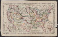
Creator:
Published / Created:
[1882]
Call Number:
75gme 1882B
Container / Volume:
BRBL_00413
Image Count:
2
Resource Type:
Maps, Atlases & Globes
Alternative Title:
Nature's Sanitarium: Las Vegas Hot Springs, Las Vegas, New Mexico on the line of the Atchison, Topeka and Santa Fe Railroad.
Description:
"R291-11-16-82".
Publisher:
Rand, McNally & Co.,
Subject (Name):
Atchison, Topeka, and Santa Fe Railroad Company and Atchison, Topeka, and Santa Fe Railroad Company--Maps
Subject (Topic):
Railroads--United States--Maps
Found in:
Beinecke Rare Book and Manuscript Library > A correct map of the United States of America showing the Atchison, Topeka and Santa Fe R.R. and connections.
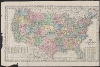
Creator:
Published / Created:
1857
Call Number:
75 1857
Container / Volume:
BRBL_00401
Image Count:
1
Resource Type:
Maps, Atlases & Globes
Description:
"Entered according to Act of Congress in the year 1856 by Charles Desilver in the clerks office of the District Court of the Eastern District
Publisher:
Charles Desilver,
Subject (Geographic):
United States--Maps
Subject (Name):
Desilver, Charles, Hazzard J. L, and Yeager, E. (Edward)
Subject (Topic):
Railroads--United States--Maps
Found in:
Beinecke Rare Book and Manuscript Library > A new map of the United States of America / by J.H. Young ; engraved by J.L. Hazzard & E. Yeager.
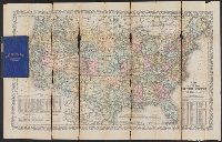
Creator:
Published / Created:
1860, c1859.
Call Number:
75 1859D
Container / Volume:
BRBL_00401
Image Count:
1
Resource Type:
Maps, Atlases & Globes
Description:
"Entered according to Act of Congress in the year 1859 by Charles Desilver in the clerks office of the District Court of
Publisher:
Charles Desilver,
Subject (Geographic):
United States--Maps
Subject (Name):
Charles Desilver (Firm), Hazzard, J. L, and Yeager, E. (Edward)
Subject (Topic):
Railroads--United States--Maps
Found in:
Beinecke Rare Book and Manuscript Library > A new map of the United States of America / by J.H. Young ; engraved by J.L. Hazzard & E. Yeager.
Creator:
Published / Created:
[1864]
Call Number:
75 1864B
Container / Volume:
BRBL_00403
Image Count:
1
Resource Type:
Maps, Atlases & Globes
Description:
"Entered according to Act of Congress in the year 186[4?] by Charles Desilver in the clerks office of the D
Publisher:
Charles Desilver,
Subject (Geographic):
United States--Maps
Subject (Name):
Desilver, Charles, Hazzard, J. L, and Yeager, E. (Edward)
Subject (Topic):
Railroads--United States--Maps
Found in:
Beinecke Rare Book and Manuscript Library > A new map of the United States of America [cartographic material] / by J.H. Young ; engraved by J.L. Hazzard & E. Yeager.
Creator:
Published / Created:
[1864]
Call Number:
75 1864B
Container / Volume:
BRBL_00403
Image Count:
2
Resource Type:
Maps, Atlases & Globes
Description:
"Entered according to Act of Congress in the year 186[4?] by Charles Desilver in the clerks office of the District Court of the Eastern District of Pe
Publisher:
Charles Desilver,
Subject (Geographic):
United States--Maps
Subject (Name):
Desilver, Charles, Hazzard, J. L, and Yeager, E. (Edward)
Subject (Topic):
Railroads--United States--Maps
Found in:
Beinecke Rare Book and Manuscript Library > A new map of the United States of America [cartographic material] / by J.H. Young ; engraved by J.L. Hazzard & E. Yeager.
Creator:
Published / Created:
[1864]
Call Number:
75gme 1864
Container / Volume:
BRBL_00412
Image Count:
2
Resource Type:
Maps, Atlases & Globes
Alternative Title:
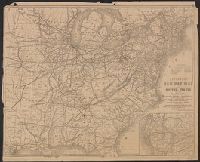
Railway map of the United States and the Canadas
Description:
Advertisements and ancillary map: Map of Illinois Central Railway and connections, on verso.
Publisher:
D. Appleton & Co.,
Subject (Name):
D. Appleton and Company
Subject (Topic):
Railroads--United States--Maps
Found in:
Beinecke Rare Book and Manuscript Library > Appletons' railway map of the United States and the Canadas : representing railways in actual operation, and those in course of construction, also map of the territories, showing the Pacific Railroad, gold regions, &c. / carefully compiled by G. F. Thomas
Creator:
Published / Created:
[1876]
Call Number:
754gme 1876
Container / Volume:
BRBL_00420
Image Count:
2
Resource Type:
Maps, Atlases & Globes
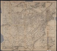
Alternative Title:
Railway map of the United States and the Canadas
Description:
"Engraved by Rae Smith, N.Y."
Publisher:
D. Appleton & Co.,
Subject (Name):
D. Appleton and Company
Subject (Topic):
Railroads--United States--Maps
Found in:
Beinecke Rare Book and Manuscript Library > Appletons' railway map of the United States and the Canadas : representing railways in actual operation, and those in course of construction, also map of the territories, showing the Pacific Railroad, gold regions, &c. / carefully compiled by G. F. Thomas
Creator:
Published / Created:
1864
Call Number:
75 1864
Container / Volume:
BRBL_00403
Image Count:
1
Resource Type:
Maps, Atlases & Globes
Alternative Title:
Railroad and military map of the United States, Mexico, the West Indies &c.
Description:
In upper left margin: No. 7.
Publisher:
J.H. Colton,
Subject (Geographic):
Central America--Maps, Mexico--Maps, United States--Maps, and West Indies--Maps
Subject (Topic):
Military bases--United States--Maps and Railroads--United States--Maps
Found in:
Beinecke Rare Book and Manuscript Library > Coltons' rail-road and military map of the United States, Mexico, the West Indies &c.
Creator:
Published / Created:
1854
Call Number:
75gme 1854
Container / Volume:
BRBL_00411
Image Count:
2
Resource Type:
Maps, Atlases & Globes
Abstract:
Outline map of the United States and Middle America showing proposed routes of the Pacific Rail Road and its branches in connection with the various systems of existing and unfinished rail roads from the Mississippi Valley to the Atlantic and Gulf coa...
Description:
A table of distances appears to the right of the map.
Publisher:
General Land Office,
Subject (Name):
Pacific Railroad and United States. General Land Office
Subject (Topic):
Railroads--North America--Maps and Railroads--United States--Maps
Found in:
Beinecke Rare Book and Manuscript Library > Diagram of the United States of America, Mexico, the West India Islands and Isthmus of Darien : showing proposed routes of the Pacific Rail Road ... / by W. T. Steiger, General Land Office ; Lith. by A. Hoen & Co. Baltimore.
Branch:v1.68.6 ,Deployed:2025-07-02T08:09:31-04:00