Skip to search
Skip to main content
Skip to first result
Search
You Searched For
Extent of Digitization
Completely digitized
Subject (Topic)
Military maps
Search Results
Creator:
Published / Created:
1944
Call Number:
50 1945O
Container / Volume:
BRBL_00273
Image Count:
2
Resource Type:
Maps, Atlases & Globes
Alternative Title:
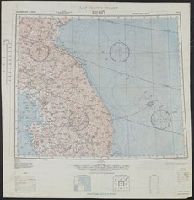
A.M.S. [Series] 5301, Eastern Asia, Keijō., and Vladivostok.
Description:
"For use by War and navy Department Agencies only, not for sale or distribution.
Publisher:
Army Map Service, U.S. Army,
Subject (Geographic):
East Asia--Maps
Subject (Name):
United States. Aeronautical Chart Service and United States. Army Air Forces
Subject (Topic):
Military maps
Found in:
Beinecke Rare Book and Manuscript Library > AAF cloth chart [cartographic material] : Eastern Asia / Army Map Service.
Published / Created:
1945
Call Number:
50 1945A
Container / Volume:
BRBL_00273
Image Count:
2
Resource Type:
Maps, Atlases & Globes
Alternative Title:
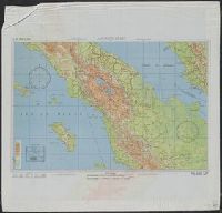
AAF cloth chart.
Description:
"5/45 SS"
Publisher:
Army Map Service,
Subject (Geographic):
Indonesia--Maps
Subject (Name):
United States. Aeronautical Chart Service and United States. Army Map Service
Subject (Topic):
Military maps
Found in:
Beinecke Rare Book and Manuscript Library > AAF cloth chart. C-800, We Island / Prepared at the direction of the Commanding General, Army Air Forces, by the Aeronautical Chart Service, Washington, D.C., from existing Aeronautical Charts, March 1945, Base No. 1.
Creator:
Published / Created:
1944
Call Number:
50 1945I
Container / Volume:
BRBL_00273
Image Count:
2
Resource Type:
Maps, Atlases & Globes
Description:
Cloth map.
Publisher:
Amy Map Service,
Subject (Geographic):
Kunming Region (China)--Maps
Subject (Name):
United States. Aeronautical Chart Service, United States. Army Air Forces, and United States. Army Map Service
Subject (Topic):
Military maps
Found in:
Beinecke Rare Book and Manuscript Library > AAF cloth chart. No. 133, Kun-Ming, Yunnan, China to Chabua, Assam, India Forces / prepared under the direction of the Commanding General, Army Air Forces, for the Aeronautical Chart Service, by the U.S. Coast and Geodetic Survey, Washington, D.C., Januar
Creator:
Published / Created:
1945
Call Number:
50 1945
Container / Volume:
BRBL_00273
Image Count:
2
Resource Type:
Maps, Atlases & Globes
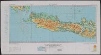
Alternative Title:
AAF cloth chart.
Description:
"3/45 SS" and "4/45 SS"
Publisher:
Army Map Service,
Subject (Geographic):
Indonesia--Maps
Subject (Name):
United States. Aeronautical Chart Service and United States. Army Map Service
Subject (Topic):
Military maps
Found in:
Beinecke Rare Book and Manuscript Library > AAF cloth chart. No. C-48 West Java / reproduced under the direction of the Commanding General, Army Air Forces for the Aeronautical Chart Service by the Army Map Service, Washington D.C. ; copied by Lake Survey Branch, A.M.S., Detroit, Michigan, July 194
Creator:
Published / Created:
1944
Call Number:
56gms 1944
Container / Volume:
BRBL_00299
Image Count:
2
Resource Type:
Maps, Atlases & Globes
Abstract:
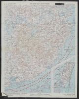
Shows roads, boundaries, railroads, power transmission lines, cities, towns, rivers, swamps, reefs and shoals.
Alternative Title:
AAF cloth map. and Asiatic series
Description:
"Officers using this chart will mark hereon corrections and addition
Publisher:
Army Map Service, U.S. Army,
Subject (Geographic):
China, Southeast--Maps and Southeast Asia--Maps
Subject (Name):
United States. Aeronautical Chart Service and United States. Army Air Forces
Subject (Topic):
Military maps, Ocean currents--China--Maps, and Winds--China--Maps
Found in:
Beinecke Rare Book and Manuscript Library > AAF cloth map [cartographic material] / prepared under the direction of the Commanding General, Army Air Forces, by the Aeronautical Chart Service.
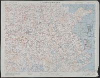
Creator:
Published / Created:
1944
Call Number:
50 1945E
Container / Volume:
BRBL_00273
Image Count:
2
Resource Type:
Maps, Atlases & Globes
Abstract:
Shows roads, boundaries, railroads, power transmission lines, cities, towns, rivers, swamps, reefs and shoals.
Alternative Title:
AAF cloth map. and Asiatic series
Description:
"Officers using this chart will mark hereon corrections and additions which come to their attention and mail dire
Publisher:
Army Map Service, U.S. Army,
Subject (Geographic):
China, Southeast--Maps and Southeast Asia--Maps
Subject (Name):
United States. Aeronautical Chart Service and United States. Army Air Forces
Subject (Topic):
Military maps, Ocean currents--China--Maps, and Winds--China--Maps
Found in:
Beinecke Rare Book and Manuscript Library > AAF cloth map [cartographic material] / prepared under the direction of the Commanding General, Army Air Forces, by the Aeronautical Chart Service.
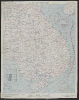
Creator:
Published / Created:
1944
Call Number:
50 1945E
Container / Volume:
BRBL_00273
Image Count:
2
Resource Type:
Maps, Atlases & Globes
Abstract:
Shows roads, boundaries, railroads, power transmission lines, cities, towns, rivers, swamps, reefs and shoals.
Alternative Title:
AAF cloth map. and Asiatic series
Description:
"Officers using this chart will mark hereon corrections and additions which come to their attention and mail direct to 'Aeronautical Chart Service, Headquarters Army Air Forces, Washington, D.C.'"--Lower
Publisher:
Army Map Service, U.S. Army,
Subject (Geographic):
China, Southeast--Maps and Southeast Asia--Maps
Subject (Name):
United States. Aeronautical Chart Service and United States. Army Air Forces
Subject (Topic):
Military maps, Ocean currents--China--Maps, and Winds--China--Maps
Found in:
Beinecke Rare Book and Manuscript Library > AAF cloth map [cartographic material] / prepared under the direction of the Commanding General, Army Air Forces, by the Aeronautical Chart Service.
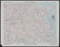
Creator:
Published / Created:
1944
Call Number:
50 1945F
Container / Volume:
BRBL_00273
Image Count:
2
Resource Type:
Maps, Atlases & Globes
Abstract:
Shows roads, boundaries, railroads, power transmission lines, cities, towns, rivers, marsh, open water areas.
Alternative Title:
AAF cloth map. and Asiatic series
Description:
"Officers using this chart will mark her
Publisher:
Army Map Service, U.S. Army,
Subject (Geographic):
China--Maps and Southeast Asia--Maps
Subject (Name):
United States. Aeronautical Chart Service and United States. Army Air Forces
Subject (Topic):
Military maps, Ocean currents--China--Maps, Ocean Currents--Southeast Asia--Maps, Winds--China--Maps, and Winds--Southeast Asia--Maps
Found in:
Beinecke Rare Book and Manuscript Library > AAF cloth map. Asiatic series. French Indo China / compiled for the U.S. Army Air Forces by the Army Map Service.
Branch:v1.68.6 ,Deployed:2025-07-02T08:09:31-04:00