Skip to search
Skip to main content
Skip to first result
Search
You Searched For
Repository
Beinecke Rare Book and Manuscript Library
Format
cartographic
Language
Portuguese
Search Results
Published / Created:
ca. 1880]
Call Number:
30 1880A
Container / Volume:
BRBL_00032
Image Count:
1
Resource Type:
Maps, Atlases & Globes
Description:
Ancillary text: A chave do enigma.
Subject (Geographic):
Europe--Maps
Subject (Topic):
Caricature--Europe--Maps and Russo-Turkish War, 1877-1878--Maps
Found in:
Beinecke Rare Book and Manuscript Library > A Europa em 1877 : mappa burlesco da guerra / por Abdul-Azis ; Livrarie Ferreira, editora ... ; Lith. Palhares ...
Published / Created:
MDCI [1601]
Call Number:
Taylor 193 3
Collection Title:
Tertia pars Indiae Orientalis ... / de Germanico in Latinum translata, & bono ordine disposita a
Image Count:
1
Description:
In pencil on verso: Part 3. p 40.
Subject (Geographic):
Angra dos Reis (Brazil)
Collection Created:
Francofurti : Excudebat Matthaeus Beckerus, anno MDCI [1601]
Found in:
Beinecke Rare Book and Manuscript Library > A cidade de Angra na ilhade ...
Published / Created:
[1598?]
Call Number:
Taylor 216A
Collection Title:
John Huighen van Linschoten, his Discours of Voyages into ye Easte & West Indies
Image Count:
1
Description:
[Scale ca. 1:14,000,000].
Subject (Geographic):
Africa, East --Maps, Egypt --Maps --Early works to 1800, Ethiopia --Maps --Early works to 1800, Mediterranean Sea --Maps --Early works to 1800, Nile River --Maps --Early works to 1800, and Tigris River Valley
Subject (Topic):
Voyages and travels --Early works to 1800
Collection Created:
[London] : Printed at London by [John Windet for] Iohn Wolfe, printer to ye Honorable Cittie of London, [1598]
Found in:
Beinecke Rare Book and Manuscript Library > A discripsion of Aegipt from Cair downeward
Creator:
Published / Created:
1595
Call Number:
Z3 017
Collection Title:
John Huighen van Linschoten, his Discours of Voyages into ye Easte & West Indies
Image Count:
1
Description:
Bound in following p. 52.
Subject (Geographic):
Goa (India : State) --Maps and Velha Goa (India)
Subject (Topic):
Voyages and travels --Early works to 1800
Collection Created:
[London] : Printed at London by [John Windet for] Iohn Wolfe, printer to ye Honorable Cittie of London, [1598]
Found in:
Beinecke Rare Book and Manuscript Library > A ilha e cidade de Goa metropolitana da India e partes orientais que esta en 15 graos da Banda do Norte
Published / Created:
MDCI [1601]
Call Number:
Taylor 193 3
Collection Title:
Tertia pars Indiae Orientalis ... / de Germanico in Latinum translata, & bono ordine disposita a
Image Count:
1
Description:
In pencil on verso: This map properly at page 73. Part 2.
Subject (Geographic):
Goa (India : State) --Maps and Goa --Description and travel
Collection Created:
Francofurti : Excudebat Matthaeus Beckerus, anno MDCI [1601]
Found in:
Beinecke Rare Book and Manuscript Library > A ilhae cidade de Goa metropolitana da Indiae partes orientais ...
Creator:
Published / Created:
[approximately 1900?]
Call Number:
BrSides 2019 6
Image Count:
1
Resource Type:
Maps, Atlases & Globes
Description:
"Atlas de geographia universal" in upper left corner.
Publisher:
[Empresa Editora do Atlas de Geographia Universal],
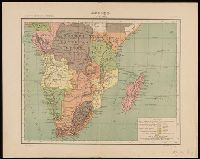
Subject (Geographic):
Africa, Southern--Maps
Subject (Name):
Costa, Julio Gaspar Ferreira da. Atlas de geographia universal.
Found in:
Beinecke Rare Book and Manuscript Library > Africa (3a parte) / Julio Gaspar des.
Creator:
Published / Created:
[approximately 1890?]
Call Number:
BrSides Folio 2019 7
Image Count:
1
Resource Type:
Maps, Atlases & Globes
Description:
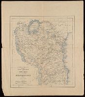
Relief shown by hachures.
Publisher:
Commissão de Cartographia,
Subject (Geographic):
Africa, East--Maps
Subject (Name):
Diniz, M.
Found in:
Beinecke Rare Book and Manuscript Library > Africa oriental desde porto Amelia até á frontiers da Africa oriental ingleza (esboço) / M. Diniz, des.
Creator:
Published / Created:
[1954]
Call Number:
BrSides Double Folio 2019 8
Image Count:
2
Resource Type:
Maps, Atlases & Globes
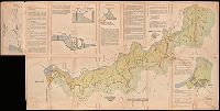
Description:
Includes three diagrams and two inset maps on recto and seven panels of photographs on verso.
Publisher:
[Ministério do Ultramar?]
Subject (Geographic):
Cunene River (Angola and Namibia)--Maps.
Subject (Topic):
Navigation--Cunene River (Angola and Namibia)--Maps.
Found in:
Beinecke Rare Book and Manuscript Library > Aproveitamentos do Cunene, 20 VI 54.
Creator:
Published / Created:
[1942]
Call Number:
212 1942A
Container / Volume:
BRBL_00014
Image Count:
1
Resource Type:
Maps, Atlases & Globes
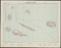
Description:
-- Azoren-Ost.
Publisher:
Gen St d H, Abt f Kr K u Verm Wes (II),
Subject (Geographic):
Azores--Maps, Topographic
Found in:
Beinecke Rare Book and Manuscript Library > Atlantische Inseln 1:200 000. [Azores] / bearbeitet und herausgegeben von der Heeresplankammer.
Creator:
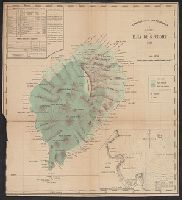
Call Number:
6514 1885
Container / Volume:
BRBL_00342
Image Count:
1
Resource Type:
Maps, Atlases & Globes
Description:
Imperfect: trimmed in lower left corner, with some loss of graticule.
Subject (Geographic):
São Tomé Island (Sao Tome and Principe)--Maps
Subject (Name):
Oliveira, A. A. de and Vasconcellos, Ernesto J. de C. e (Ernesto Julio de Carvalho), 1852-1930
Found in:
Beinecke Rare Book and Manuscript Library > Carta da Ilha de S. Thomé / Comissão de Cartographia ; coordenada por Ernesto de Vasconcellos ; desenhada por A. A. d' Oliveira.
Branch:v1.68.6 ,Deployed:2025-07-02T08:09:28-04:00