
Search


Limit your search
- Public29
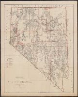
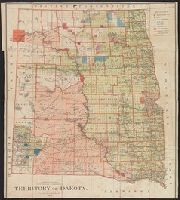
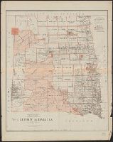
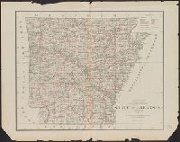
- Maps✖[remove]29
- English29
- Postal service--Arizona--Maps2
- Canals--United States--Maps1
- Counties--Florida--Maps1
- Indian reservations--United States--Maps1
- Military reservations--United States--Maps1
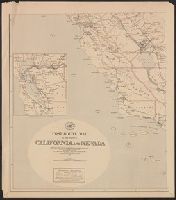
- Postal service--California--Maps1
- Postal service--Dakota Territory--Maps1
- Postal service--Idaho--Maps1
- Postal service--Montana--Maps1
- Postal service--Nevada--Maps1