Skip to search
Skip to main content
Skip to first result
Search
You Searched For
Genre
Maps
New Search
Search Results
Creator:
Published / Created:
[1857?]
Call Number:
825gmb F779 1857
Container / Volume:
BRBL_00576
Image Count:
1
Resource Type:
Maps, Atlases & Globes
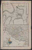
Description:
"Geo. A. Crawford, president of the company" and "Geo. W. Jones, secretary.", Date inferred from reference to Nov. 1857 in text., Includes text and inset of railroads in Kansas and Missouri., and Shows numbered lots.
Publisher:
L. Gast & Bro. lith.,
Subject (Geographic):
Fort Scott (Kan.)--Maps
Subject (Name):
Leopold Gast & Brother
Subject (Topic):
Real property--Kansas--Fort Scott--Maps
Found in:
Beinecke Rare Book and Manuscript Library > Fort Scott : county seat of Bourbon County, Kansas Territory / Orlando Darling, surveyor.
Creator:
Published / Created:
[ca. 1814]
Call Number:
Zc10 814Le
Collection Title:
History of the expedition under the command of Captains Lewis and Clark, to the sources of the
Image Count:
1
Resource Type:
Maps, Atlases & Globes
Subject (Geographic):
Missouri River. and West (U.S.)
Subject (Topic):
Lewis and Clark Expedition (1804-1806)
Collection Created:
Philadelphia : Bradford & Inskeep ; New York : A.H. Inskeep : J. Maxwell, Printer, 1814
Found in:
Beinecke Rare Book and Manuscript Library > Fortification
Creator:
Published / Created:
[ca. 1814]
Call Number:
Zc10 814Le
Collection Title:
History of the expedition under the command of Captains Lewis and Clark, to the sources of the
Image Count:
1
Resource Type:
Maps, Atlases & Globes
Description:
Between p. 62-63.
Subject (Geographic):
Missouri River. and West (U.S.)
Subject (Topic):
Lewis and Clark Expedition (1804-1806)
Collection Created:
Philadelphia : Bradford & Inskeep ; New York : A.H. Inskeep : J. Maxwell, Printer, 1814
Found in:
Beinecke Rare Book and Manuscript Library > Fortification
Published / Created:
[approximately 1800?]
Call Number:
400 1800A
Container / Volume:
BRBL_00233
Image Count:
1
Resource Type:
Maps, Atlases & Globes
Alternative Title:
Forum Romanum et circumiacentia. and Italia media lectioni autorum classicorum imprimis necessaria.
Description:
400 1800A: Hand colored. "5"--Manuscript note in unidentified hand. and Relief shown by hachures and pictorially.
Publisher:
[publisher not identified],
Subject (Geographic):
Italy, Central--Maps and Roman Forum (Rome, Italy)--Maps
Subject (Name):
Frentzel, engraver
Subject (Topic):
Geography, Ancient--Maps
Found in:
Beinecke Rare Book and Manuscript Library > Forum Romanum et circumiacentia ; Italia media lectioni autorum classicorum imprimis necessaria / Frentzel sc.
Published / Created:
1628
Call Number:
3615 1628
Container / Volume:
BRBL_00135
Image Count:
2
Resource Type:
Maps, Atlases & Globes
Description:
Text on Verso.
Publisher:
Henrici Hondij,
Subject (Geographic):
Rhine River--Maps--Early works to 1800
Found in:
Beinecke Rare Book and Manuscript Library > Fossa Engeniana quae a Rheno ad Mosam ...
Published / Created:
[1627?]
Call Number:
3615 1627
Container / Volume:
BRBL_00135
Image Count:
2
Resource Type:
Maps, Atlases & Globes
Description:
Note: Canal from the Rhine to the Maas.
Subject (Geographic):
Rhine River--Maps--Early works to 1800
Found in:
Beinecke Rare Book and Manuscript Library > Fossa Sanctae Mariae quae et Eugeniana dicitur Vulgo de Nieuwe Grist. Fossa haec a Rheno ad Mosam ... G. J. Blaeuw.
Creator:
Published / Created:
[1830?]
Call Number:
771 H864 1830
Container / Volume:
BRBL_00483
Image Count:
1
Resource Type:
Maps, Atlases & Globes
Alternative Title:
New map of the Hudson River
Description:
Includes descriptive text and mileage charts. and Relief shown by hachures.
Publisher:
George Fowler,
Subject (Geographic):
Hudson River (N.Y. and N.J.)--Maps and Hudson River Valley (N.Y. and N.J.)--Maps
Subject (Name):
Vance & Wendell (Firm)
Found in:
Beinecke Rare Book and Manuscript Library > Fowler's New map of the Hudson River : with a description of the adjoining country : the distances of the different towns, &c. on the Canal, from Albany to Buffalo, the distances of the different towns from Albany, by stage, to Niagara Falls, Lake George,
Published / Created:
1652
Call Number:
38 P21 1652A
Container / Volume:
BRBL_00159
Image Count:
1
Resource Type:
Maps, Atlases & Globes
Subject (Geographic):
Paris (France)--Maps--Early works to 1800
Found in:
Beinecke Rare Book and Manuscript Library > Fragment d'un Plan de Paris dressé par Jacques Gomboust en 1649 et publié en 1652 ...
Published / Created:
1792
Call Number:
38 1792
Container / Volume:
BRBL_00153
Image Count:
1
Resource Type:
Maps, Atlases & Globes
Publisher:
W. Faden,
Subject (Geographic):
France--Maps--Early works to 1800
Found in:
Beinecke Rare Book and Manuscript Library > France ... 1790.
Published / Created:
[1849?]
Call Number:
38 1849
Container / Volume:
BRBL_00154
Image Count:
1
Resource Type:
Maps, Atlases & Globes
Publisher:
John Murray,
Subject (Geographic):
France--Maps
Found in:
Beinecke Rare Book and Manuscript Library > France ... Edw. Weller.
Branch:v1.61.6 ,Deployed:2024-06-12T09:55:33-04:00