Skip to search
Skip to main content
Skip to first result
Search
You Searched For
Extent of Digitization
Partially digitized
Format
cartographic
Genre
Intaglio prints
New Search
Search Results
Published / Created:
1833
Call Number:
2002 Folio 97
Collection Title:
Tanner’s universal atlas : subscription price $1.00 a number, seperate [sic] numbers $1.50 each
Image Count:
1
Resource Type:
Maps, Atlases & Globes
Alternative Title:
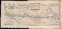
II.-Map of the state of Maine
Description:
Plate identified as "II" on atlas cover and "5" on map. and Verso blank.
Subject (Geographic):
Maine
Collection Created:
Philadelphia : Published by the author, 1833-1836
Found in:
Beinecke Rare Book and Manuscript Library > A new map of Maine
Creator:
Published / Created:
1631
Call Number:
Taylor 316
Image Count:
2
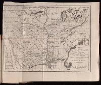
Alternative Title:
New England: the most remarqueable parts thus named by the high and mighty Prince Charles, nowe King of great Britaine [map] and Path-way to experience to erect a plantation.
Description:
Imperfect: damp-stained; added port. of Charles I., Map with portrait of Capt. Smith in corner: New England ... / observed and described by Captayn John Smith. 1614. Pendleton's Lithography, Boston. Drawn by J. Eddy. London, printed by Geor: Low., Signatures: A-F⁴., and Teaching resource: Professor John Mack Faragher, History 141: The American West.
Publisher:
Printed by I. Haviland, and are to be sold by R. Milbovrne,
Subject (Geographic):
Massachusetts--History--Colonial period, ca. 1600-1775, Massachusetts--Maps--Early works to 1800, New England--Description and travel, New England--History--Colonial period, ca. 1600-1775, and New England--Maps--Early works to 1800
Subject (Name):
Pasaeus, Simon and Reeve, James
Found in:
Beinecke Rare Book and Manuscript Library > Advertisements for the unexperienced planters of New-England, or anywhere, or, The path-way to experience to erect a plantation : With the yearely proceedings of this country in fishing and planting, since the yeare 1614. to the yeare 1630. and their present estate. Also how to prevent the greatest inconveniences, by their proceedings in Virginia, and other plantations, by approved examples. With the countries armes, a description of the coast, harbours, habitations, land-markes, latitude and longitude: with the map, allowed by our royall King Charles. By Captaine Iohn Smith, sometimes governour of Virginia, and admirall of Nevv-England.
Creator:
Published / Created:
1720]
Call Number:
Osborn pc227
Image Count:
1
Description:
At head of title: December, 1720., Author named in the work as William Stukeley., Beinecke copy was given to Maurice Johnson by the author and contains Johnson's ms. notes., Bound with: of the Roman amphitheater at Dorchester. [London : :s.n, 1723], Caption title., Map and engraving of inscriptions bound in before title page., and Page [1] at end blank.
Publisher:
s.n.,
Subject (Geographic):
Scotland--Antiquities, Roman
Subject (Name):
Johnson, Maurice, 1688-1755--Ms. notes
Found in:
Beinecke Rare Book and Manuscript Library > An account of a Roman temple and other antiquities : near Graham's Dike in Scotland
Call Number:
1978 +73
Collection Title:
The ecclesiastical history of New-England from its first planting in the year 1620 unto the year of
Image Count:
1
Resource Type:
Books, Journals & Pamphlets
Description:
Verso blank.
Subject (Geographic):
New England --Biography, New England --Church history, and New England --History --Colonial period, ca. 1600-1775
Collection Created:
London, Printed for Thomas Parkhurst, at the Bible and Three Crowns in Cheapside, 1702
Found in:
Beinecke Rare Book and Manuscript Library > An exact mapp of New England and New York
Call Number:
1983 Folio 44
Collection Title:
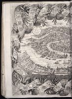
Isolario : descrittione geografico-historica, sacro-profana, antico-moderna, politica, naturale, e
Image Count:
2
Resource Type:
Books, Journals & Pamphlets
Description:
Border is garland containing heraldry of Veneto. and Three sheets conjoined.
Subject (Geographic):
Venice (Italy)--Maps, Pictorial--Early works to 1800
Subject (Topic):
Geography --Early works to 1800, Heraldry--Italy--Venice, and Islands
Collection Created:
In Venetia : A’ spese dell’autore, 1696 [i.e. 1697]
Found in:
Beinecke Rare Book and Manuscript Library > Citta di Venetia, descritta dal P. Coronelli, cosmografio della serenissima republica
Creator:
Published / Created:
1721-22.
Call Number:
Defoe 52 p721b
Image Count:
13
Resource Type:
Books, Journals & Pamphlets
Alternative Title:
Derde deel van Robinson Crusoe ...
Description:
Plates to face p. 28, 142, 429, 599, 624, and 649 of v. 3, misbound to face corresponding pages in v. 1, pt. 1-2. and Vol. 1 in two parts.
Publisher:
By de Jansoons van Waesborge,
Found in:
Beinecke Rare Book and Manuscript Library > Het leven en de wonderbaare gevallen van Robinson Crusoe : behelzende onder andere ongehoorde uitkomsten een verhaal van zyn agt en twintig jaarig verblyf op een onbewoond eiland, gelegen op de kust van America by de mond van de rivier Oronooque. Alles door liem zelfs beschreven, nu uit het engels vertaald, en met figuren benevens een nette kaart zyner zwerving verrykt : Eerste [-derde] deel.
Branch:v1.61.6 ,Deployed:2024-06-12T09:55:36-04:00