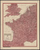
Great Britain. War Office. General Staff. Geographical Section
Published / Created:
1943
Call Number:
11hd 1942D-39
Container / Volume:
BRBL_00010ZD
Image Count:
1
Resource Type:
Maps, Atlases & Globes
Alternative Title:
G.S, G.S. (Series) ; 4249, Geographic Section, General Staff (Series) ; 4249, and Les Pieux-Guernsey
Description:
"50,000/12/43.C.K." print, "French 1:80,000 sheets 16 N.E. S.E.; 27 N.E.; 1:10,560 map of Alderney, 1:21,120 map of Guernsey and part of 1:31,680 map of Jersey.", and Copy 2 Imperfect: Torn, left half of map wanting. Fragment measures 66 x 51 cm.
Great Britain. War Office. General Staff. Geographical Section
Published / Created:
1943
Call Number:
11hd 1942D-41
Image Count:
1
Resource Type:
Maps, Atlases & Globes
Alternative Title:
G.S, G.S. (Series) ; 4249, Geographic Section, General Staff (Series) ; 4249, and St. Lo-Vire
Description:
"50,000/1/44 F.C.", "French 1:80,000 sheets 28 S.W., S.E.; 44 N.W., N.E., S.W., S.E.", and Includes glossary, reference table, index to adjoining sheets, incidence of grid letters, and reliability diagram.
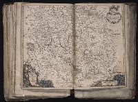
[Atlas factice of 96 maps by Blaeu, Visscher, Jansson, Hondius and others]
Image Count:
1
Description:
Imperfect: mutilated along edges, with some loss of cartouche and bar scale engravings, reproduced in ms. Reinforced along edges with manuscript and printed waste. Sheet measures 41.7 x 53.7 cm. No. 75 of 92 maps bound together. and Numbered 81 [76, cancelled] on verso.
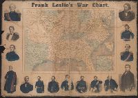
"Drawn on wood by G. W. Colton.", Insets: Vicinity of Washington City, D.C.; Southern portio, Mounted on linen. Imperfect: chewed, frayed, mutilated., and Shows locations of battles, positions of Rebel troops, U.S. troops, forts and fortified towns.
Publisher:
Frank Leslie,
Subject (Geographic):
United States--History--Civil War, 1861-1865--Maps and United States--History--Civil War, 1861-1865--Pictorial works
Subject (Name):
Colton, G. Woolworth (George Woolworth), 1827-1901 and Leslie, Frank, 1821-1880
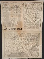
Frank Leslies illustrated newspaper. and War maps and companion to the newspaper
Description:
Map of Savannah, Georgia and its surroundings and Map of the Southern Coast of of the United States from Pensacola to New Orleans showing the strategic position of Ship Island, Mississippi, now occupied by Col. Phelps and the national troops with the approach
Publisher:
Frank Leslie,
Subject (Geographic):
United States--History--Civil War, 1861-1865--Maps and United States--History--Civil War, 1861-1865--Newspapers
Subject (Name):
Colton, G. Woolworth (George Woolworth), 1827-1901