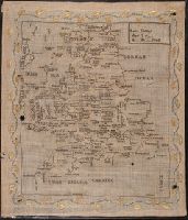
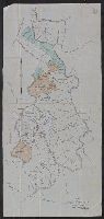
Embroidered map on linen depicting England, Wales, and a portion of Scotland made by Amelia Giddings. At its edges, the sampler depicts small parts of Ireland and France. It delineates and names every county in England and Wales. Where space allows, major
Description:
Coordinates not present on map and are approximated.
Subject (Geographic):
England--Maps. and Wales--Maps.
Subject (Topic):
Cartography--Study and teaching., Geography--Study and teaching., and Women--Education.
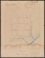
Accompanied by typed letter, "The Brown Map," from Sarah Cazneau Day Woodward., Coordinates not present on map and are approximated., Pen and ink with names of house-holders entered in longhand. Bodies of water colored blue., Possibly copied by Sarah Cazneau Day Woodward., and See A.P. Stokes, Historical prints of New Haven, number 2.
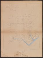
"This copy was made February 1881 by Mrs. Sarah Caznesu Day Woodward and by her presented to Sylvester Smith.", Coordinates not present on map and are approximated., Mounted on linen., Pen and ink with names of house-holders entered in longhand. Bodies of water colored blue., and See A.P. Stokes, Historical prints of New Haven, number 2.
Subject (Geographic):
New Haven (Conn.)--Maps
Subject (Name):
Smith, Sylvester, 1820-1911., Stiles, Ezra, 1727-1795, and Woodward, Sarah Day
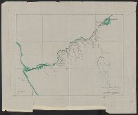
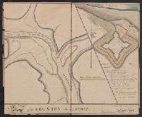
Coordinates not present on map and are approximated., Pen and ink; black an green., and Possibly based upon the D.W. Buckingham map with changes in shore line and new streets added.
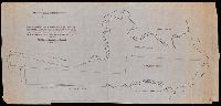
Inset: "Plan of Fort [Franklin]". and Original drawing of Fort Franklin, now the site of Franklin, Pa. At the time the drawing was executed the fort was unnamed, and a space was left in the caption for insertion of the name when it became known.
Subject (Geographic):
Franklin (Venango County, Pa.)--Maps--Early works to 1800