Search
You Searched For
Search Results
- Creator:
- Great Britain. War Office. General Staff. Geographical Section
- Published / Created:
- 1943
- Call Number:
- 11hd 1942D-39
- Container / Volume:
- BRBL_00010ZD
- Image Count:
- 1
- Resource Type:
- Maps, Atlases & Globes
- Found in:
- Beinecke Rare Book and Manuscript Library > France, scale 1:100,000: Les Pieux-Guernsey, sheet 5E. / published by War Office, 1942 ... drawn and reproduced at Ordnance Survey 1943.
- Creator:
- Great Britain. War Office. General Staff. Geographical Section
- Published / Created:
- 1943
- Call Number:
- 11hd 1942D-41
- Image Count:
- 1
- Resource Type:
- Maps, Atlases & Globes
- Found in:
- Beinecke Rare Book and Manuscript Library > France, scale 1:100,000: St. Lo-Vire, sheet 6F. / published by War Office, 1942, 2nd edition 1943.
- Published / Created:
- [1945?]
- Call Number:
- 50 1945J
- Container / Volume:
- BRBL_00273
- Image Count:
- 2
- Resource Type:
- Maps, Atlases & Globes
- Found in:
- Beinecke Rare Book and Manuscript Library > France.
- Published / Created:
- 1919]
- Call Number:
- 11hcf 1919B-21
- Container / Volume:
- BRBL_00010P
- Image Count:
- 1
- Resource Type:
- Maps, Atlases & Globes
- Found in:
- Beinecke Rare Book and Manuscript Library > France.
- Published / Created:
- 1944
- Call Number:
- 38 1944A
- Container / Volume:
- BRBL_00155
- Image Count:
- 1
- Resource Type:
- Maps, Atlases & Globes
- Found in:
- Beinecke Rare Book and Manuscript Library > France.
- Published / Created:
- 1795]
- Call Number:
- 38 1795A
- Container / Volume:
- BRBL_00153
- Image Count:
- 1
- Resource Type:
- Maps, Atlases & Globes
- Found in:
- Beinecke Rare Book and Manuscript Library > France. Divided into Circles and Departments.
- Published / Created:
- [1650?]
- Call Number:
- 3361 B833 1650
- Container / Volume:
- BRBL_00088
- Image Count:
- 2
- Resource Type:
- Maps, Atlases & Globes
- Found in:
- Beinecke Rare Book and Manuscript Library > Franconatus Vulgo Het Vrye.
- Creator:
- Jansson, Jan, 1588-1664
Rittershausen, Nicolaus, 1597-1670
- Published / Created:
- [ca. 1680?]
- Call Number:
- 1983 Folio 19
- Collection Title:
- [Atlas factice of 96 maps by Blaeu, Visscher, Jansson, Hondius and others]
- Image Count:
- 1
- Found in:
- Beinecke Rare Book and Manuscript Library > Franconiae nova descriptio
- Published / Created:
- [1864?]
- Call Number:
- 754hc 1864A
- Container / Volume:
- BRBL_00421
- Image Count:
- 1
- Resource Type:
- Maps, Atlases & Globes
- Found in:
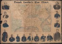
- Beinecke Rare Book and Manuscript Library > Frank Leslie's war chart : map of the southern and border states, showing the actual positions of the National and Rebel forces, and of the blockading fleets and vessels, the positions of the various fortifications that have been erected, and the localiti
- Creator:
- Leslie, Frank, 1821-1880
- Published / Created:
- [1862]
- Call Number:
- 754hc 1862A
- Container / Volume:
- BRBL_00421
- Image Count:
- 2
- Resource Type:
- Maps, Atlases & Globes
- Found in:
- Beinecke Rare Book and Manuscript Library > Frank Leslie's war maps and companion to the newspaper.