Search
You Searched For
Search Results
- Published / Created:
- [18--]
- Call Number:
- 11 1847A
- Image Count:
- 13
- Resource Type:
- Maps, Atlases & Globes
- Found in:
- Beinecke Rare Book and Manuscript Library > [Salisbury Collection of World Maps].
- Published / Created:
- ca. 1810]
- Call Number:
- 38 V61 1810
- Container / Volume:
- BRBL_00166
- Image Count:
- 13
- Resource Type:
- Maps, Atlases & Globes
- Found in:
- Beinecke Rare Book and Manuscript Library > [La carte des environs de Versailles dite des Chasses du Roi] / gravé par Doudan, Bouclet et Tardieu l'ainé ; ecrit par Herault, Delahaye.
- Published / Created:
- 1841
- Call Number:
- 36hc 1796
- Container / Volume:
- BRBL_00133
- Image Count:
- 13
- Resource Type:
- Maps, Atlases & Globes
- Found in:
- Beinecke Rare Book and Manuscript Library > Atlas Principes de la Strategie, par S.A.I. Le Prince Chartes, traduit de l'Allemand par le Général Jomini.
- Creator:
- Geo. W. Stadly & Co
- Published / Created:
- [186-?]
- Call Number:
- 754hc 1862C
- Container / Volume:
- BRBL_00421
- Image Count:
- 13
- Resource Type:
- Maps, Atlases & Globes
- Found in:
- Beinecke Rare Book and Manuscript Library > [13 maps showing positions of the Union and Confederate armies during the year 1862] / drawn and printed by Geo. W. Stadly & Co.
- Creator:
- Cartes Taride (Firm)
- Published / Created:
- 1901-
- Call Number:
- Series 38gmb 1920
- Container / Volume:
- BRBL_00038A
- Image Count:
- 20
- Resource Type:
- Maps, Atlases & Globes
- Found in:
- Beinecke Rare Book and Manuscript Library > Carte routière pour automobilistes & cyclistes [cartographic material] : [France].
- Published / Created:
- 1888
- Call Number:
- 32 Ox1 1768
- Container / Volume:
- BRBL_00052A
- Image Count:
- 20
- Resource Type:
- Maps, Atlases & Globes
- Found in:
- Beinecke Rare Book and Manuscript Library > Sixteen Old Maps of Properties in Oxfordshire (with one in Berkshire) ... Illustrating the open field system. 1605-1768.
- Creator:
- Assam (India). Survey Office
- Published / Created:
- [1943?]
- Call Number:
- 59gm As72 1943
- Container / Volume:
- BRBL_00319
- Image Count:
- 21
- Resource Type:
- Maps, Atlases & Globes
- Found in:
- Beinecke Rare Book and Manuscript Library > Map of Assam showing roads & railways
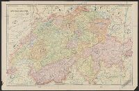
- Creator:
- Woerl, Joseph Edmund, creator
- Call Number:
- 37 1835
- Container / Volume:
- BRBL_00148
- Image Count:
- 19
- Resource Type:
- Maps, Atlases & Globes
- Found in:
- Beinecke Rare Book and Manuscript Library > Karte der Schweiz / von Dr. I. Woerl.
- Creator:
- King, Nicholas, d. 1812
- Published / Created:
- [1888]
- Call Number:
- 779 W27 1803
- Container / Volume:
- BRBL_00505
- Image Count:
- 19
- Resource Type:
- Maps, Atlases & Globes
- Found in:
- Beinecke Rare Book and Manuscript Library > The King plats of the city of Washington in the District of Columbia 1803.
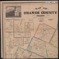
- Creator:
- Walling, Henry Francis, 1825-1888
- Published / Created:
- 1858, c1856.
- Call Number:
- 763 Or1 1858
- Container / Volume:
- BRBL_00452
- Image Count:
- 4
- Resource Type:
- Maps, Atlases & Globes
- Found in:
- Beinecke Rare Book and Manuscript Library > Map of Orange County, Vermont / from surveys under the direction of H.F. Walling ; engraved, printed, colored & mounted at H.F. Walling's map establishment.
- Creator:
- Geological Survey (U.S.)
- Published / Created:
- 193-?]
- Call Number:
- 71 1755Q
- Container / Volume:
- BRBL_00364
- Image Count:
- 4
- Resource Type:
- Maps, Atlases & Globes
- Found in:
- Beinecke Rare Book and Manuscript Library > The Mitchell map of the British and French dominions in North America, 1755.
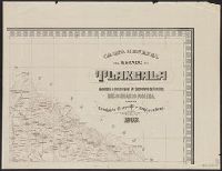
- Creator:
- Mexico. Comisión Geográfico-Exploradora
- Published / Created:
- 1920
- Call Number:
- 8861 1908
- Container / Volume:
- BRBL_00655
- Image Count:
- 4
- Resource Type:
- Maps, Atlases & Globes
- Found in:
- Beinecke Rare Book and Manuscript Library > Carta general del Estado de Tlaxcala / levantada á iniciativa del Sr. Secretario de Fomento, Lic. Olegario Molina, por la Comisión Geográfico-Exploradora.
- Published / Created:
- 1952
- Call Number:
- 281 1883
- Container / Volume:
- BRBL_00024
- Image Count:
- 4
- Resource Type:
- Maps, Atlases & Globes
- Found in:
- Beinecke Rare Book and Manuscript Library > Isla de Luzon y sus adjacentes / por D. Enrique d'Almonte y Muriel.
- Creator:
- Carvalho, Filipe Carlos Dias de
- Published / Created:
- 1914
- Call Number:
- 636 1914
- Container / Volume:
- BRBL_00337
- Image Count:
- 4
- Resource Type:
- Maps, Atlases & Globes
- Found in:
- Beinecke Rare Book and Manuscript Library > Carta do distrito de Quelimane (esboço) / elaborado pelo governador do distrito, Filipe Carlos Dias de Carvalho.
- Published / Created:
- 1870
- Call Number:
- 774 1870H
- Container / Volume:
- BRBL_00730
- Image Count:
- 4
- Resource Type:
- Maps, Atlases & Globes
- Found in:
- Beinecke Rare Book and Manuscript Library > A map of the province of Pennsilvania ... / by Thomas Holme ...
- Published / Created:
- [19--]
- Call Number:
- 30f 1914
- Container / Volume:
- BRBL_00037B
- Image Count:
- 4
- Resource Type:
- Maps, Atlases & Globes
- Found in:
- Beinecke Rare Book and Manuscript Library > [Europe in 1870-1914].
- Creator:
- Wood, M. O
- Published / Created:
- 1911
- Call Number:
- 771 Ad47 1911
- Container / Volume:
- BRBL_00480
- Image Count:
- 4
- Resource Type:
- Maps, Atlases & Globes
- Found in:
- Beinecke Rare Book and Manuscript Library > Map of the Adirondack Forest and adjoining territory / compiled from maps and field notes on file in the state departments at Albany, N.Y., and from the topographical sheets of the U.S. Geological Survey by M.O. Wood, C.E., and Glenn S. Smith, topographer
- Creator:
- Austro-Hungarian Monarchy. Militärgeographisches Institut
- Published / Created:
- 1882-1886.
- Call Number:
- 304 1886
- Container / Volume:
- Series Box 1
- Image Count:
- 4
- Resource Type:
- Maps, Atlases & Globes
- Found in:
- Beinecke Rare Book and Manuscript Library > Übersichts-Karte von Mittel-Europa, im Masse 1:750.000 der Natur / bearbeitet und herausgegeben vom K.K. Militär-geographischen Institute.
- Creator:
- Visscher, Claes Jansz., 1586 or 1587-1652
- Published / Created:
- 1616. and 1883-1885.
- Call Number:
- 32 L84 1616/1883
- Container / Volume:
- BRBL_00736
- Image Count:
- 4
- Resource Type:
- Maps, Atlases & Globes
- Found in:
- Beinecke Rare Book and Manuscript Library > London. Visscher delineavit.
- Creator:
- Lotter, Matthäus Albrecht, 1741-1810
- Published / Created:
- 1784
- Call Number:
- 71 1784L
- Container / Volume:
- BRBL_00726
- Image Count:
- 4
- Resource Type:
- Maps, Atlases & Globes
- Found in:
- Beinecke Rare Book and Manuscript Library > A new and correct map of North America with the West India Islands : divided according to the last Treaty of Peace, concluded at Paris the 20th of Jan. 1783, wherein are particularly distinguished the Thirteen Provinces wich [sic] compose the United State
- Creator:
- Bien, Joseph R
- Published / Created:
- 1902
- Call Number:
- 766 1902
- Container / Volume:
- BRBL_00467
- Image Count:
- 4
- Resource Type:
- Maps, Atlases & Globes
- Found in:
- Beinecke Rare Book and Manuscript Library > The standard map of Connecticut / prepared under the direction of Joseph R. Bien, E.M., from original surveys and the triangulations and surveys of the U.S. Geological Survey and U.S. Coast and Geodetic Survey.
- Published / Created:
- 1902
- Call Number:
- 771 Ad47 1902
- Container / Volume:
- BRBL_00480
- Image Count:
- 4
- Resource Type:
- Maps, Atlases & Globes
- Found in:
- Beinecke Rare Book and Manuscript Library > Map of the Adirondack Forest and adjoining territory / compiled from the official maps and field notes on file in the state departments at Albany, N.Y. ; by authority of the Forest, Fish, and Game Commission.
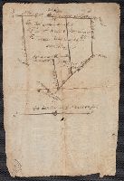
- Published / Created:
- 1919 Nov 18
- Call Number:
- WA MSS S-1326
- Collection Title:
- Ernest Howe papers
- Container / Volume:
- BSD | Folder 269
- Image Count:
- 4
- Resource Type:
- Maps, Atlases & Globes
- Found in:
- Beinecke Rare Book and Manuscript Library > Oriental Mine report by Robert Bedford, maps
- Creator:
- Tanner, Henry Schenck, 1786-1858
- Published / Created:
- [1822 or 1823]
- Call Number:
- 71 1822
- Container / Volume:
- BRBL_00369
- Image Count:
- 4
- Resource Type:
- Maps, Atlases & Globes
- Found in:
- Beinecke Rare Book and Manuscript Library > A map of North America : constructed according to the latest information / engraved & published by H.S. Tanner, Philadelphia 1822.
- Published / Created:
- [1911?]
- Call Number:
- 32 1911
- Container / Volume:
- BRBL_00045
- Image Count:
- 4
- Resource Type:
- Maps, Atlases & Globes
- Found in:
- Beinecke Rare Book and Manuscript Library > Michelin Map of Great Britain.
- Creator:
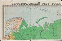
- Soviet Union. Glavnoe upravlenie geodezii i kartografii
Soviet Union. Главное управление геодезии и картографии
- Published / Created:
- [1962]
- Call Number:
- 35j 1914
- Container / Volume:
- BRBL_00103
- Image Count:
- 4
- Resource Type:
- Maps, Atlases & Globes
- Found in:
- Beinecke Rare Book and Manuscript Library > Territorialʹnyĭ rost Rossiĭskoĭ imperii s 1700 po 1914 g. / sostavleno Nauchno-redakt︠s︡ionnoĭ kartosostavitelʹskoĭ chastʹi︠u︡ GUGK ; otvetstvennyĭ redaktor--Kuchborskai︠a︡ E.P. ; tekhnicheskiĭ redaktor--Bukhanova N.I.
- Published / Created:
- [1813]
- Call Number:
- 774 M193 1813
- Container / Volume:
- BRBL_00714
- Image Count:
- 4
- Resource Type:
- Maps, Atlases & Globes
- Found in:
- Beinecke Rare Book and Manuscript Library > [Manuscript map of McKean County].
- Creator:
- Istituto geografico militare (Italy)
- Published / Created:
- 1912
- Call Number:
- 69 1912
- Container / Volume:
- BRBL_00352
- Image Count:
- 4
- Resource Type:
- Maps, Atlases & Globes
- Found in:
- Beinecke Rare Book and Manuscript Library > Levate topografiche al 25 000 dei dintorni di Tripoli [cartographic material] / rilievo eseguito dal personale dell'Istituto geografico militare messo a disposizione del Comando del Corpo d'occupazione.
- Published / Created:
- 1884]
- Call Number:
- 32ex Ab97 1884
- Container / Volume:
- BRBL_00075
- Image Count:
- 4
- Resource Type:
- Maps, Atlases & Globes
- Found in:
- Beinecke Rare Book and Manuscript Library > [Map of one hundred square miles round Abury; showing the British and Roman Stone and Earthworks of the Downs of North Wilts; by the Rev. A.C. Smith.
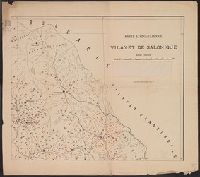
- Published / Created:
- 1901
- Call Number:
- 4828ed 1901
- Container / Volume:
- BRBL_00265
- Image Count:
- 4
- Resource Type:
- Maps, Atlases & Globes
- Found in:
- Beinecke Rare Book and Manuscript Library > Karte ethnographique du vilayet de Salonique.