BEIN 28 1852A: Covers removed and classed separately as 28 1852AA. Bookseller's label on inside front cover: Cellar Book Shop ... Detroit, Mich., BEIN 28 1852B: Covers removed and classed separately as 28 1852BA. Bookseller's label on inside front cover: Cellar Book Shop ... Detroit, Mich., BEIN 28 1852C: Covers removed and classed separately as 28 1852CA. Bookseller's label on inside front cover: Cellar Book Shop ... Detroit, Mich., Relief shown by hachures. Depths shown by soundings., Prime meridian: Madrid., In upper margin: Diccionario geográfico-estadístico-histórico ; Atlas de España y sus posesiones de ultramar., Cover title: Atlas de España y sus posesiones de ultramar / por D. Francisco Coello., Sheets titled: Posesiones de Oceania -- Primera hoja central -- Segunda hoja central., "Grabado en Madrid bajo la direccion de D. Juan Noguera. El contorno y la topografia por Desbuissons y Raynaud, la letra por Bacot"--Primera hoja., "Grabado en Madrid bajo la direccion del autor. El contorno por Leclercq, la topografia por Desbuissons, la letra por Bacot"--Segunda hoja and posesiones sheet., Includes text about demography and economy., and Price and subscription information on covers.
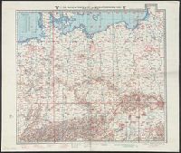
BEIN 319gmp 1942: Imperfect: Blatter 1-2 only. Stamp in upper right corner of Blatt 2: Nur für den Dienstgebraucht., Relief shown by contours, gradient tints, and spot heights; depths shown by contours and soundings., Maps individually titled and numbered, e.g. "Blatt 8 (Vorderasien).", Blätter 1-2, 4-5, 8-9, 10-11, and 12-13 are back to back on one sheet., and Includes sheet index.
Publisher:
Generalstab der Luftwaffe
Subject (Geographic):
Europe., Africa, North., Eurasia., Europe, Africa, North, Eurasia, and North Africa.
Subject (Topic):
Aeronautical charts, World War, 1939-1945, Aerial operations, German, Military operations, Aerial, and German
Imperfect: mutilated., Title devised by cataloger., North oriented towards the right., Color: green with blue and red detail., and Coordinates not present on map and are approximated.
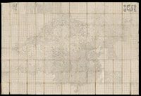
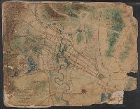
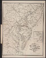
Map of Horse Railroad, Westville, and part of New Haven
Description:
Imperfect: mutilated., Map attributed to Donald Grant Mitchell., Backed with paper., Relief shown by hachures., "Scale of five inches to mile.", Color: green with blue and red detail., and Coordinates not present on map and are approximated.
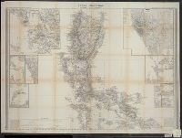
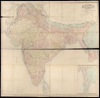
BEIN Covers 59 +1882: Dissected and mounted on linen., Relief shown by hachures., "Published by Wm. Allen & Co., April 3rd, 1870, corrections to 1882.", and Inset: Continuation of British Burmah.
Publisher:
W.H. Allen & Co.
Subject (Geographic):
South Asia, India, Nepal, Bhutan, Bangladesh, and Burma
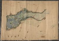
Imperfect: mutilated. Mounted on linen. Manuscript note on verso (partially trimmed): Map of old P[?]; D.G. Mitchell., Date of production precedes statement of responsibility., Oriented with north towards right., Relief shown by hachures., "Scale: 140 ft. to inch.", Coordinates not present on map and are approximated., Includes names of ownership., and Includes inset map of surrounding area in lower right corner.
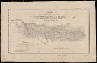
Goddard, George H. (George Henry), 1817-1906, cartographer
Published / Created:
[1855?]
Call Number:
BrSides Zc72 855gn
Image Count:
2
Resource Type:
cartographic image
Description:
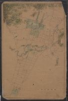
BEIN Broadsides Zc72 855gn: Mounted on linen. Autograph: H.W. Turner. Withdrawn stamp: Map Collection, University of California Library., Oriented with north toward upper right., Relief shown by hachures., Shows settlements, roads, ditches, flumes, etc., Includes table of distances., and Coordinates not present on map and are approximated.
Publisher:
Lith of Britton & Rey
Subject (Geographic):
California, Calaveras County, Calaveras County (Calif.), Mokelumne Hill Canal (Calif.), and Calaveras County.