Skip to search
Skip to main content
Skip to first result
Search
You Searched For
Subject (Topic)
World War, 1914-1918--Maps
Publication Place
London :
New Search
Search Results
Creator:
Published / Created:
1915
Call Number:
11hcf 1919E-12
Image Count:
1
Resource Type:
Maps, Atlases & Globes
Alternative Title:
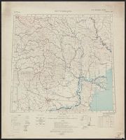
Europe 1:1,000,000, G.S.G.S. ; no. 2758, and GSGS (Series) ; no. 2758.
Description:
Includes index to adjoining sheets, index to boundaries, and pronunciation glossary.
Publisher:
Ordnance Survey,
Subject (Geographic):
Europe, Eastern--Maps
Subject (Topic):
World War, 1914-1918--Maps
Found in:
Beinecke Rare Book and Manuscript Library > (Warsaw) Varshava : North N. 34. / compiled at the Royal Geographical Society under the direction of the Geographical Section; drawn and printed by Ordnance Survey.
Creator:
Published / Created:
1918
Call Number:
11hcf 1919E-14
Image Count:
1
Resource Type:
Maps, Atlases & Globes
Alternative Title:
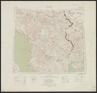
Europe 1:1,000,000, G.S.G.S. ; no. 2758, and GSGS (Series) ; no. 2758.
Description:
Includes index to adjoining sheets, index to boundaries, and pronunciation glossary. and Inscription: [Charles] Seymour.
Publisher:
Ordnance Survey,
Subject (Geographic):
Europe, Eastern--Maps
Subject (Name):
Seymour, Charles,--1885-1963--Autograph
Subject (Topic):
World War, 1914-1918--Maps
Found in:
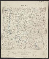
Beinecke Rare Book and Manuscript Library > Bucuresti : North L 35. / compiled at the Royal Geographical Society under the direction of the Geographical Section; drawn and printed by Ordnance Survey.
Creator:
Published / Created:
1918
Call Number:
11hcf 1919E-15
Image Count:
1
Resource Type:
Maps, Atlases & Globes
Alternative Title:
Europe 1:1,000,000, G.S.G.S. ; no. 2758, and GSGS (Series) ; no. 2758.
Description:
Elevation above sea level indicated by colored shading., Imperfect. Bled. Inscription: [Charles] Seymour., and Includes index to adjoining sheets, index to boundaries, and pronunciation glossary.
Publisher:
Ordnance Survey,
Subject (Geographic):
Europe, Eastern--Maps
Subject (Name):
Seymour, Charles,--1885-1963--Autograph
Subject (Topic):
World War, 1914-1918--Maps
Found in:
Beinecke Rare Book and Manuscript Library > Bucuresti : North L 35. / compiled at the Royal Geographical Society under the direction of the Geographical Section; drawn and printed by Ordnance Survey.
Creator:
Published / Created:
1915
Call Number:
11hcf 1919E-13
Image Count:
1
Resource Type:
Maps, Atlases & Globes
Alternative Title:
Europe 1:1,000,000, G.S.G.S. ; no. 2758, and GSGS (Series) ; no. 2758.
Description:
Includes index to adjoining sheets, index to boundaries, and pronunciation glossary. and Inscription: [Charles] Seymour.
Publisher:
Ordnance Survey,
Subject (Geographic):
Europe, Eastern--Maps
Subject (Name):
Seymour, Charles,--1885-1963--Autograph
Subject (Topic):
World War, 1914-1918--Maps
Found in:
Beinecke Rare Book and Manuscript Library > Bucuresti : North L 35. / compiled at the Royal Geographical Society under the direction of the Geographical Section; drawn and printed by Ordnance Survey.
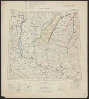
Creator:
Published / Created:
1918
Call Number:
11hcf 1919E-20
Container / Volume:
BRBL_00010ZA
Image Count:
1
Resource Type:
Maps, Atlases & Globes
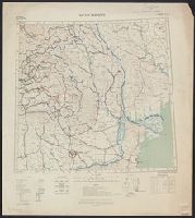
Alternative Title:
Europe 1:1,000,000, G.S.G.S. ; no. 2758, and GSGS (Series) ; no. 2758.
Description:
Elevation above sea level indicated by colored shading. and Includes index to adjoining sheets, index to boundaries, and pronunciation glossary.
Publisher:
Ordnance Survey,
Subject (Geographic):
Hungary--Maps
Subject (Topic):
World War, 1914-1918--Maps
Found in:
Beinecke Rare Book and Manuscript Library > Buda Pest : North L 34. / compiled at the Royal Geographical Society under the direction of the Geographical Section; drawn and printed by Ordnance Survey.
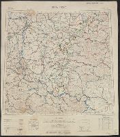
Creator:
Published / Created:
1915
Call Number:
11hcf 1919E-19
Container / Volume:
BRBL_00010Z
Image Count:
1
Resource Type:
Maps, Atlases & Globes
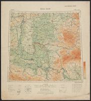
Alternative Title:
Europe 1:1,000,000, G.S.G.S. ; no. 2758, and GSGS (Series) ; no. 2758.
Description:
Copy 2: Col. ms. notes on map described as "Czechoslovakian Border". Inscription: Charles Seymour. and Includes index to adjoining sheets, index to boundaries, and pronunciation glossary.
Publisher:
Ordnance Survey,
Subject (Geographic):
Hungary--Maps
Subject (Name):
Seymour, Charles,--1885-1963--Autograph
Subject (Topic):
World War, 1914-1918--Maps
Found in:
Beinecke Rare Book and Manuscript Library > Buda Pest : North L 34. / compiled at the Royal Geographical Society under the direction of the Geographical Section; drawn and printed by Ordnance Survey.
Creator:
Published / Created:
1915
Call Number:
11hcf 1919E-19
Container / Volume:
BRBL_00010Z
Image Count:
1
Resource Type:
Maps, Atlases & Globes
Alternative Title:
Europe 1:1,000,000, G.S.G.S. ; no. 2758, and GSGS (Series) ; no. 2758.
Description:
Copy 3: Ms. legend corresponding to col. ms. notes on map. On sheet 63 x 52 cm. Inscription: Charles Seymour. and Includes index to adjoining sheets, index to boundaries, and pronunciation glossary.
Publisher:
Ordnance Survey,
Subject (Geographic):
Hungary--Maps
Subject (Name):
Seymour, Charles,--1885-1963--Autograph
Subject (Topic):
World War, 1914-1918--Maps
Found in:
Beinecke Rare Book and Manuscript Library > Buda Pest : North L 34. / compiled at the Royal Geographical Society under the direction of the Geographical Section; drawn and printed by Ordnance Survey.
Creator:
Published / Created:
1915
Call Number:
11hcf 1919E-19
Image Count:
1
Resource Type:
Maps, Atlases & Globes
Alternative Title:
Europe 1:1,000,000, G.S.G.S. ; no. 2758, and GSGS (Series) ; no. 2758.
Description:
Copy 1: Col. ms. notes on map. and Includes index to adjoining sheets, index to boundaries, and pronunciation glossary.
Publisher:
Ordnance Survey,
Subject (Geographic):
Hungary--Maps
Subject (Name):
Seymour, Charles,--1885-1963--Autograph
Subject (Topic):
World War, 1914-1918--Maps
Found in:
Beinecke Rare Book and Manuscript Library > Buda Pest : North L 34. / compiled at the Royal Geographical Society under the direction of the Geographical Section; drawn and printed by Ordnance Survey.
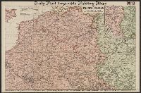
Creator:
Published / Created:
[1914.]
Call Number:
11hc 1915B
Image Count:
2
Resource Type:
Maps, Atlases & Globes
Alternative Title:
The Franco-Belgian Theatre of War
Description:
"The London Geographical Institute." printed outside lower right margin., Includes inset map "South East continuation of the Map on same scale.", and On verso: Key Map to the General European Situation, adv. and ill.
Publisher:
G. Philips & Son, Ltd.,
Subject (Geographic):
Belgium--Maps and France--Maps
Subject (Topic):
World War, 1914-1918--Maps
Found in:
Beinecke Rare Book and Manuscript Library > Daily Mail large-scale Military maps No. 3. : The Franco-Belgian Theatre of War / edited by George Philip, F.R.G.S., in conjunction with Military experts.
Creator:
Published / Created:
1914
Call Number:
30 1914E
Container / Volume:
BRBL_00032A
Image Count:
1
Resource Type:
Maps, Atlases & Globes
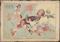
Description:
Caricature map. and Ill. of people and animals represent international relations.
Publisher:
"Geographia" Ltd.,
Subject (Geographic):
Europe--Maps
Subject (Topic):
International relations--20th century--Maps, World War, 1914-1918--Caricatures and cartoons, and World War, 1914-1918--Maps
Found in:
Beinecke Rare Book and Manuscript Library > European revue : kill that eagle / produced by "Geographia" Ltd. ; [drawn by] J.H.A.
Branch:v1.64.0 ,Deployed:2024-09-11T10:25:40-04:00