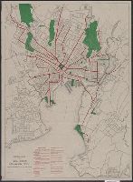
Distance from center of city up to 5 mi. indicated by concentric rings spaced at half mile intervals., Indexes: 1. Principal parks. 2.Car lines from center of city., and Lithographed map colored to show parks and car line; blocks in outline.
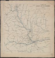
Includes table of "Astronomical determinations" and "Map of Central America showing the routes proposed for an interoceanic ship-canal." and Relief shown by hachures.
Publisher:
s.n.,
Subject (Geographic):
Atrato River Region (Colombia)--Maps and Truandó River Region (Colombia)--Maps
Subject (Name):
United States. Army. Corps of Topographical Engineers
Subject (Topic):
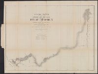
Hydrographic surveying--Colombia--Atrato River Region--Maps and Hydrographic surveying--Colombia--Truandó River Region--Maps
Insets: Vista de ma Mina de Corbou descubierta per F. Ferrer en Choutáles -- Plan y vista de las Minas Luigalpa en Choudales -- Plan de hatogrande en Choudales., Prime meridians: Washington - Greenwich., and Relief shown by hachures; depths shown by isolines.
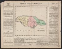
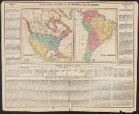
Appears in Carey's Complete historical chronological, and geographical American atlas. Philadelphia, Pa. : H.C. Carey & I. Lea, 1822., Historical and descriptive text in margin., North America -- South America., and Relief shown pictorially.
Publisher:
H.C. Carey & I. Lea,
Subject (Geographic):
North America--Maps and South America--Maps
Subject (Name):
Carey & Lea, Carey, Henry Charles, 1793-1879. A complete historical, chronological, and geographical American atlas, Lea, Isaac, 1792-1886, and Young & Delleker
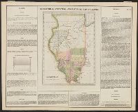
Complete historical, chronological and geographical American atlas. and Illinois
Description:
Detached from: Complete historical, chronological and geographical American atlas. Philadelphia: H.C. Carey & I. Lea, 1822. and Includes text in borders: Situation, boundaries, and extent; Face of the country, soil, and productions; Rivers; Climate; Civil Divisions and population, 1820; Chief towns; Canal; Public lands; Education; Government; Historical sketch; List of governors; Places remarkable for battles and sieges.