Skip to search
Skip to main content
Skip to first result
Search
You Searched For
Resource Type
Maps, Atlases & Globes
Language
Polish
New Search
Search Results
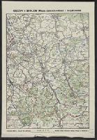
Published / Created:
[1930?]
Call Number:
356 1930
Container / Volume:
BRBL_00114
Image Count:
1
Resource Type:
Maps, Atlases & Globes
Publisher:
Drukarnia Grafia J. Nowak i Ska,
Subject (Geographic):
Cieszyn (Poland : Powiat)--Maps
Found in:
Beinecke Rare Book and Manuscript Library > Cieszyn i Zaolzie (mapa samochodowa i turystyczna) / rysował i wydał Bronisław Stlasny.
Creator:
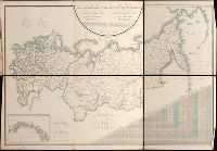
Published / Created:
1820-1827.
Call Number:
EEdb 828P
Image Count:
1
Resource Type:
Maps, Atlases & Globes
Alternative Title:
Atlas géographique de l'empire de Russie, du royaume de Pologne and du grand duché de Finlande and Географическій атлас Россійской Имперіи Царства Польскаго и Великаго Княжества Финляндскаго : расположенный по губерніям на 80 листах ... с генеральною картою ... / сочинен по новѣйшим и достовѣрным свѣденіям ... Пядышевым, начат 1820-го, окончен 1827-го года = Atlas géographique de l'empire de Russie, du royaume de Pologne et du grand duché de Finlande ; divisé en gouvernements ... ; avec une carte générale ... / composé ... par ... Pi︠a︡discheff ...
Description:
Captions and place names in Russian and Polish or in Russian and French., Relief shown by spot heights., and Some maps composed of two or more leaves hinged with cloth.
Publisher:
[publisher not identified],
Subject (Geographic):
Soviet Union.--(OCoLC)fst01210281 and Soviet Union--Maps.
Found in:
Beinecke Rare Book and Manuscript Library > Geograficheskīĭ atlas Rossīĭskoĭ Imperīi T︠s︡arstva Polʹskago i Velikago Kni︠a︡zhestva Finli︠a︡ndskago [cartographic material] : raspolozhennyĭ po gubernīi︠a︡m na 80 listakh ... s generalʹnoi︠u︡ kartoi︠u︡ ... / sochinen po novi︠e︡ĭshim i dostovi︠e︡rnym svi︠e︡denīi︠a︡m ... Pi︠a︡dyshevym, nachat 1820-go, okonchen 1827-go goda = Atlas géographique de l'empire de Russie, du royaume de Pologne et du grand duché de Finlande ; divisé en gouvernements ... ; avec une carte générale ... / composé ... par ... Pi︠a︡discheff ...
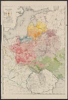
Published / Created:
[1919?].
Call Number:
11hcf 1919B-1
Image Count:
1
Resource Type:
Maps, Atlases & Globes
Description:
Legend indicates ethnic groups and political frontiers.
Publisher:
Wydawnictwo Biura Pracy Spolecznej,
Subject (Geographic):
Europe, Central--Maps
Subject (Topic):
Ethnology
Found in:
Beinecke Rare Book and Manuscript Library > Ludność Ziem Polskich / Lit. W. Główczewski.
Creator:
Published / Created:
1931
Call Number:
356cb L98 1931
Container / Volume:
BRBL_00115
Image Count:
1
Resource Type:
Maps, Atlases & Globes
Description:
Relief shown by contours and spot heights.
Publisher:
Ksi*a*znica-Atlas S.A.,
Subject (Geographic):
Lʹviv Region (Ukraine)--Maps
Found in:
Beinecke Rare Book and Manuscript Library > Mapa okolic Lwowa = [Map of the environs of Lwow] / Instytut kartograficzny Prof. E. Romera.
Published / Created:
1936
Call Number:
30gmm 1936
Container / Volume:
BRBL_00038
Image Count:
1
Resource Type:
Maps, Atlases & Globes
Description:
List of radio stations on border of map.
Publisher:
Wojskowego Inst. Geograficznego
Subject (Geographic):
Europe--Maps
Found in:
Beinecke Rare Book and Manuscript Library > Mapa radjokomunikacyjna Europy
Creator:
Published / Created:
c1923.
Call Number:
356 1923
Container / Volume:
BRBL_00114
Image Count:
1
Resource Type:
Maps, Atlases & Globes
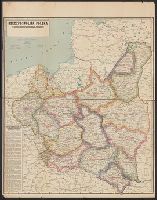
Description:
"Made in USA.", Sep. into two sheets., and Text: "Podział Administracyjny Rzeczypospolitej Polskiej na Województwa i Powiaty."
Publisher:
Geographical Pub. Co.,
Subject (Geographic):
Poland--Administrative and political divisions--Maps
Found in:
Beinecke Rare Book and Manuscript Library > Rzeczpospolita Polska : w granicach obecnych z Podziałem na Województwa i z Wyszczególnieniem Wszystkich miast Powiatowych.
Published / Created:
[1919?]
Call Number:
11hcf 1919B-23
Container / Volume:
BRBL_00010Q
Image Count:
1
Resource Type:
Maps, Atlases & Globes
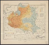
Description:
Indicates the percentages of Roman Catholics and Jews in the area covered by modern-day Poland, Belarus, and the Ukraine.
Publisher:
G. Freytag & Berndt,
Subject (Geographic):
Europe, Eastern--Maps
Subject (Topic):
Ethnology--Europe, Eastern--Maps and Religions--Europe, Eastern--Maps
Found in:
Beinecke Rare Book and Manuscript Library > Rzymsko-Katolicy = Römisch-Katholische = Catholiques Romains / Opracował E. Romer.
Creator:
Published / Created:
1945
Call Number:
3562 1945
Container / Volume:
BRBL_00115
Image Count:
1
Resource Type:
Maps, Atlases & Globes
Description:
Imperfect: mutilated on left side, with some loss of text. and Includes three inset maps.
Publisher:
Wydawnictwa Instytutu Śląskiego,
Subject (Geographic):
Silesia--Maps and Wrocław Region (Poland)--Maps
Found in:
Beinecke Rare Book and Manuscript Library > Śląsk : mapa fizyczna-administracyjna ... / opracowli Józef Szaflarski i Antoni Wrzosek.
Creator:
Published / Created:
c1931.
Call Number:
356 T18 1931
Container / Volume:
BRBL_00114
Image Count:
1
Resource Type:
Maps, Atlases & Globes
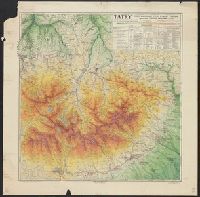
Alternative Title:
Tatry
Description:
"12.31"--Lower right margin., "Nakład i druk Ski Akc."--Lower right border., and Major towns/cities/resorts shown on the map include Zakopane, Jaworzyna, Podspady, Żar czyli Żdziar, Jaskinie Bielskie, Matlary, Lomnica Tatrazanska, Stary Smokowiec, Nowy Smokow
Publisher:
Ksia̜żnica-Atlas, Zjednoczone Zakłady Kartograficzne i Wydawnicze T.N.S.W.,
Subject (Geographic):
Tatra Mountains (Slovakia and Poland)--Maps
Subject (Topic):
Skis and skiing--Tatra Mountains (Slovakia and Poland)--Maps
Found in:
Beinecke Rare Book and Manuscript Library > Tatry Cze̜ść Wschodnia, Tatry Wysokie i Bielskie / opracowal Tadeusz Zwoliński w Zakopanem.
Creator:
Published / Created:
1993
Call Number:
356 W249 1993
Container / Volume:
BRBL_00114
Image Count:
2
Resource Type:
Maps, Atlases & Globes
Alternative Title:
Warszawa, city map, Warszawa, Plan de la ville, Warszawa, plan goroda, and Warszawa, Stadtplan
Description:
No. on panel: 33-192-03.
Subject (Geographic):
Warsaw (Poland)--Maps
Found in:
Beinecke Rare Book and Manuscript Library > Warszawa, plan miasta = Warszawa, city map = Warszawa, Stadtplan = Warszawa, Plan de la ville = Warszawa, plan goroda.
Branch:v1.61.6 ,Deployed:2024-06-12T09:55:33-04:00